
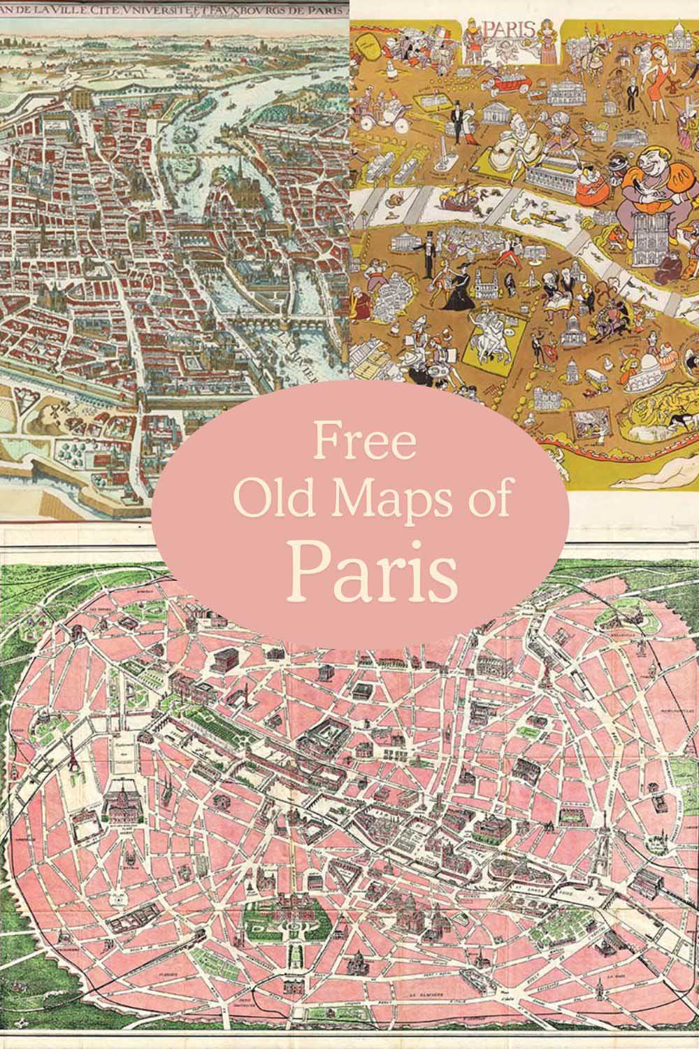
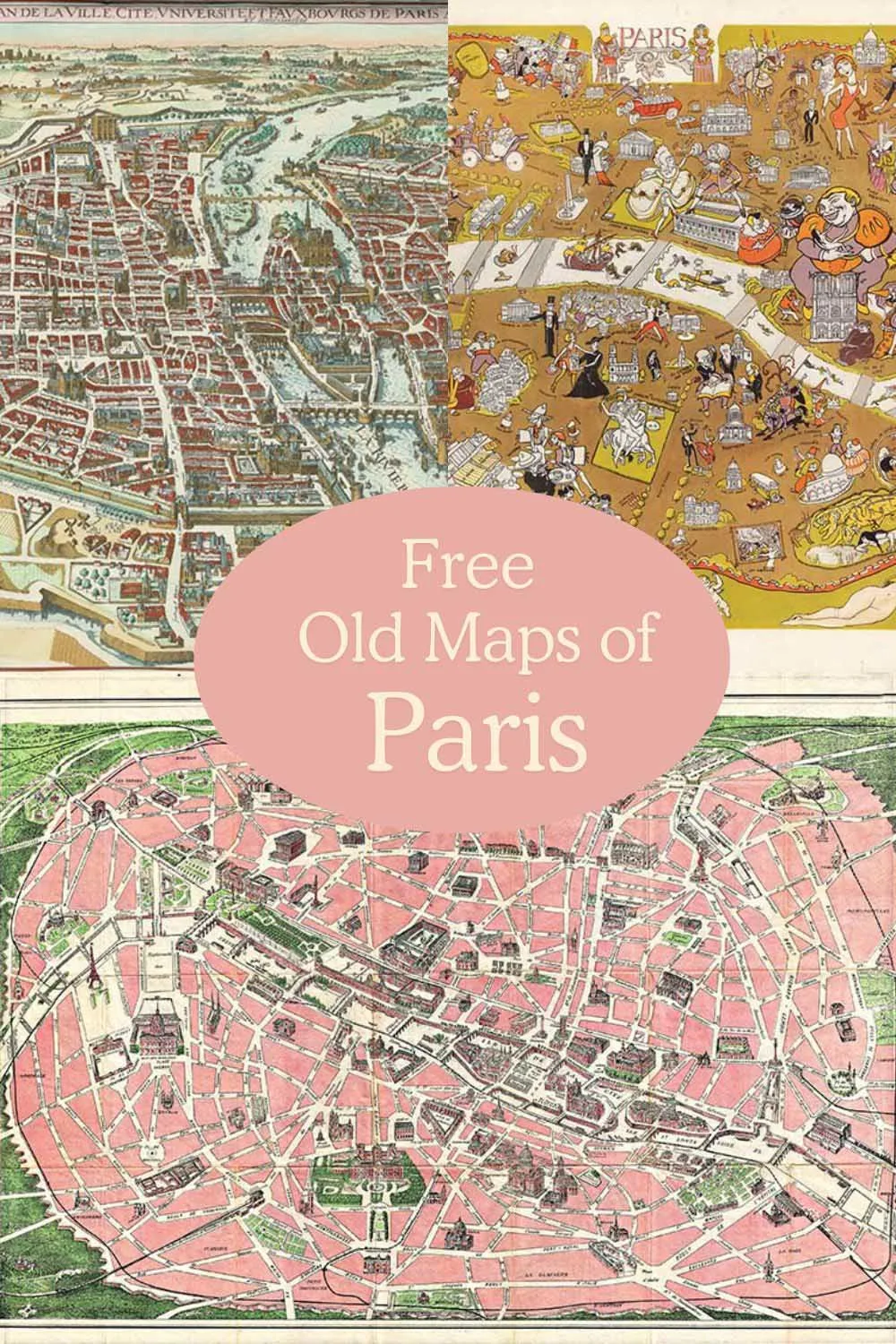
Dive into the rich history of Paris with our free collection of vintage maps. These maps are a valuable resource and a joy to explore, ideal for educators, researchers, and anyone interested in the city’s past.
Paris is associated with romance and love. As Valentine’s Day approaches, I thought it would be a good idea to assemble a collection of old maps of Paris.
Paris is one of my
These beautiful maps can be utilised in numerous ways. They would look fabulous decoupaged onto furniture like these personalised map chairs. If you prefer to have your maps hung on the wall, consider some great DIY frame ideas.
Copyright Free Vintage Maps Of Paris
To download the old maps of Paris, click on the Map title link. A higher-resolution map will open in a new tab; you can save or print this image. All the maps are in the public domain, allowing them to be used commercially.
Old Paris Maps 1-6
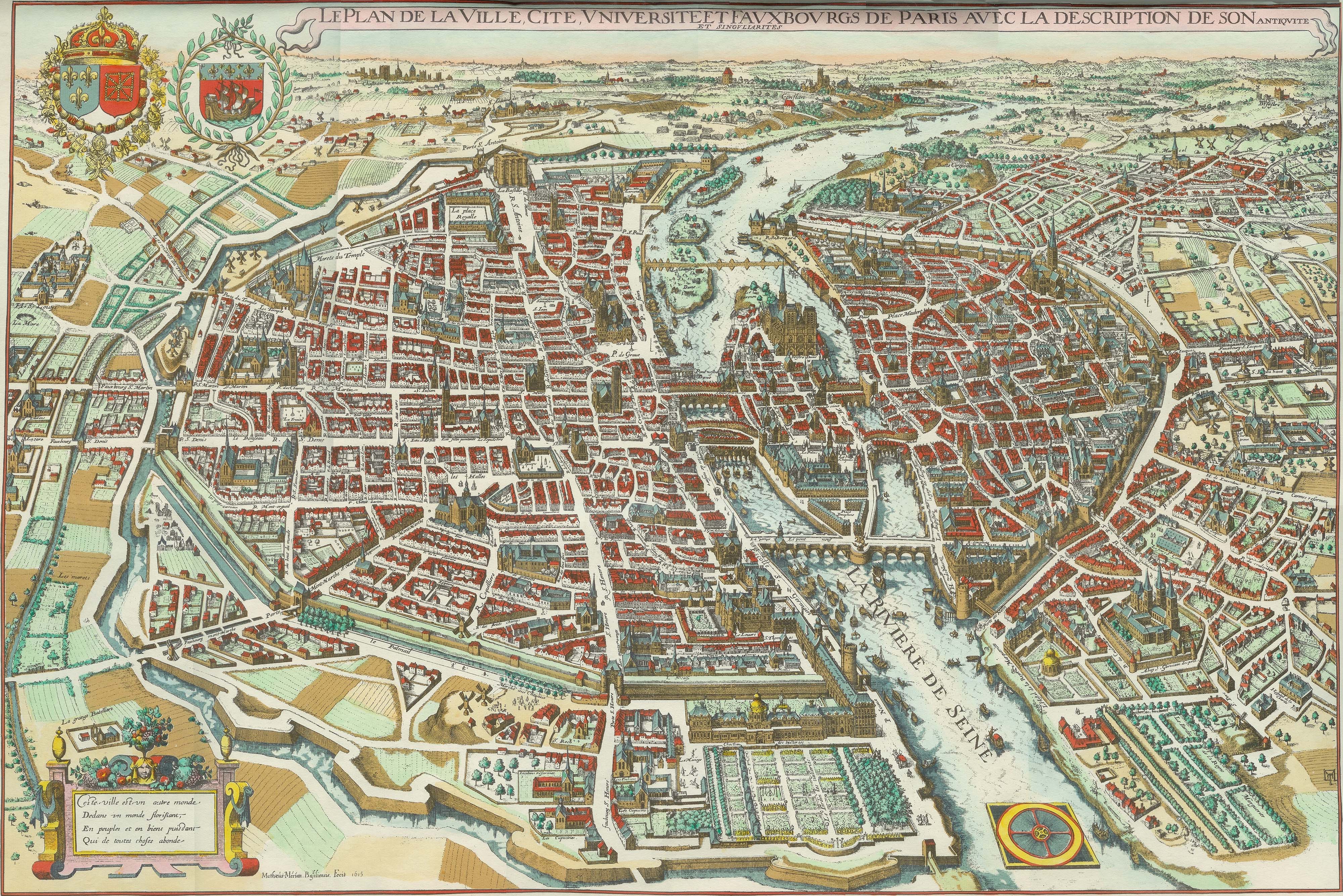
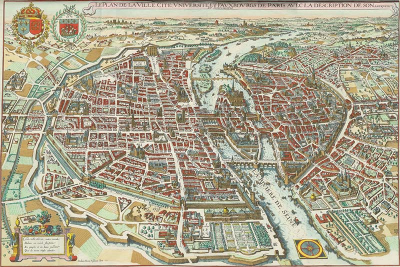
This is a gorgeous “vu d’oiseau” (bird’s-eye view) of Paris from 1615. I love that the buildings are 3D, and you can identify them easily on the map. The colours are gorgeous, too; however, because it’s so old, some major Parisian landmarks are missing, such as the Eiffel Tower, which had not yet been built.
Another lovely birds-eye view of Paris is in the vintage hot air balloon art collection. Check out these birds-eye maps of San Fransico.
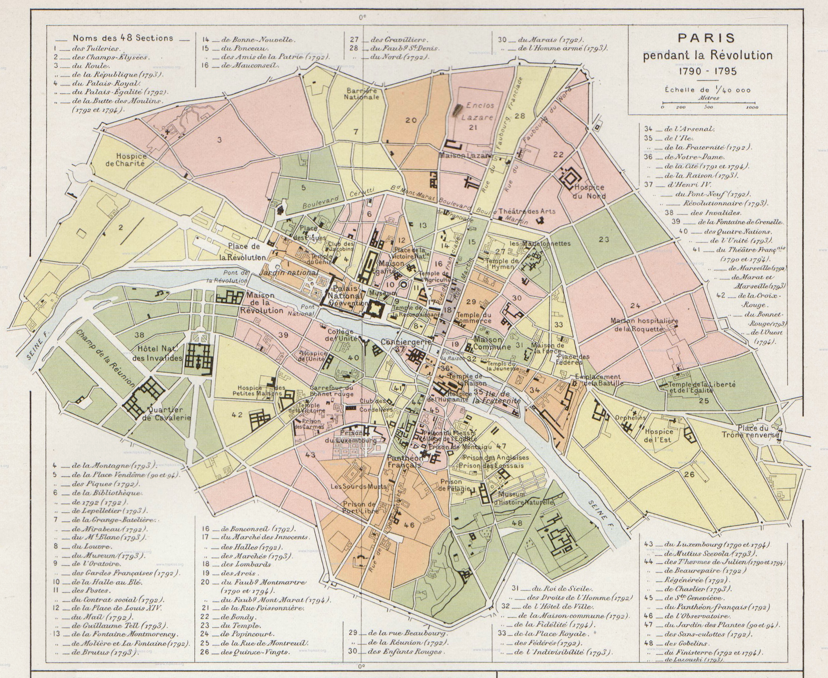
2. Old Map of Paris During The Revolution 1790-1795
Although this appears to be a map of Paris during the French Revolution (1790-1795), it doesn’t seem to be one. That is because the map was printed in 1912, which explains why some fonts don’t match the era.

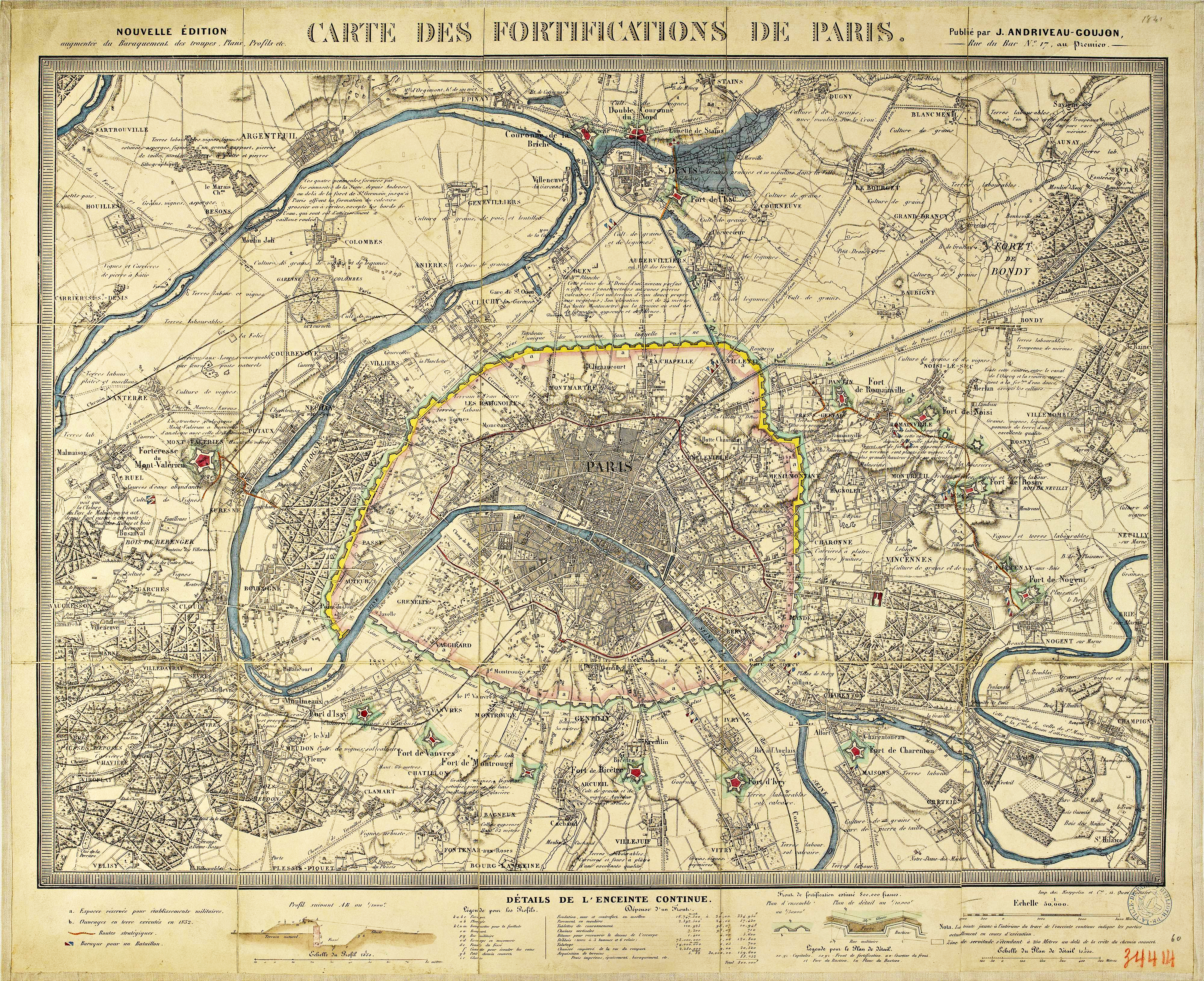
3. Fortifications Map of Paris 1841
A vintage map of the fortifications of Paris, showing the troops’ barracks. Printed in 1841.
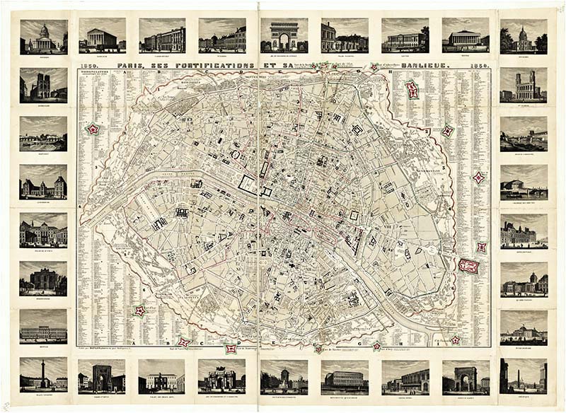
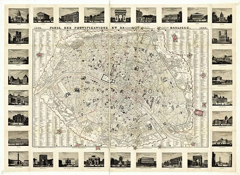
4. 1850 Old Map of Paris Showing Landmarks
This vintage map of Paris not only shows all the streets, but the map’s border is illustrated with all the major Paris landmarks. These illustrations feature the Hôtel de Ville, the Arc de Triomphe, Pont Neuf, and the Louvre.
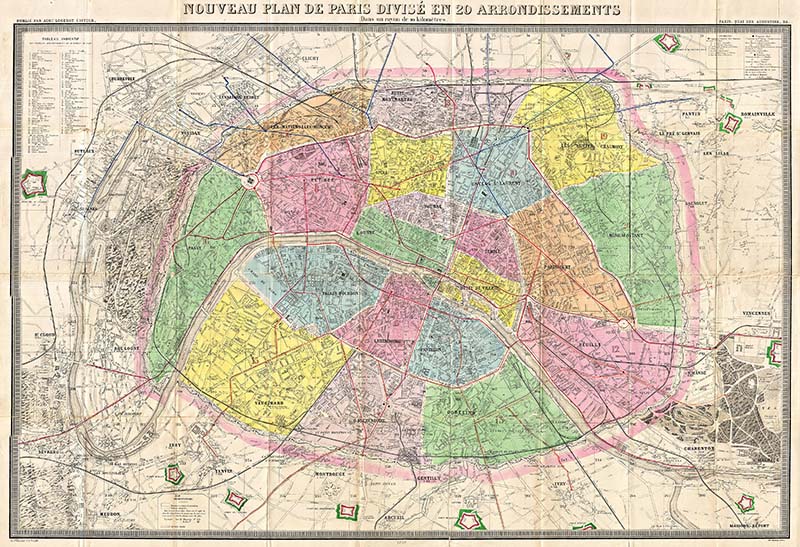
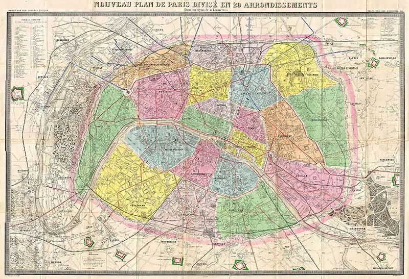
5. Colourful Map of Paris Showing the 20 Districts 1878
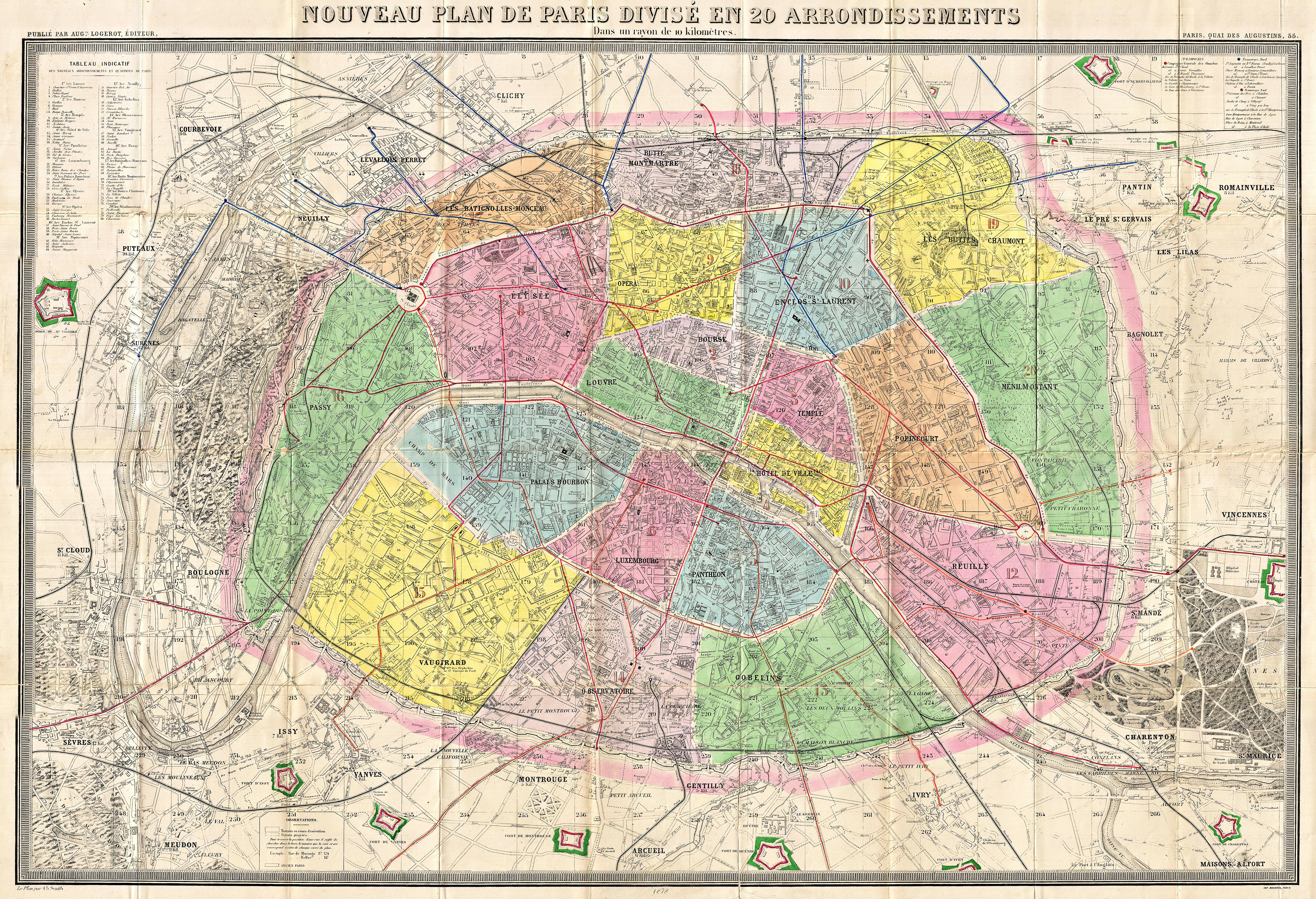
This is a lovely antique map of Paris. Each of the 20 districts is highlighted in a different colour. The map would look fabulous hung on any wall as a decoration.
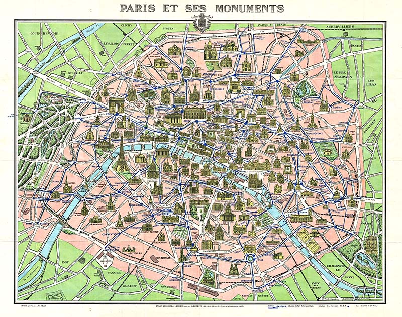
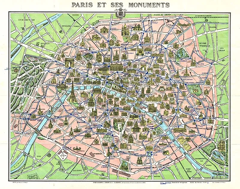
6. Tourist Map of Paris & Monuments 1925
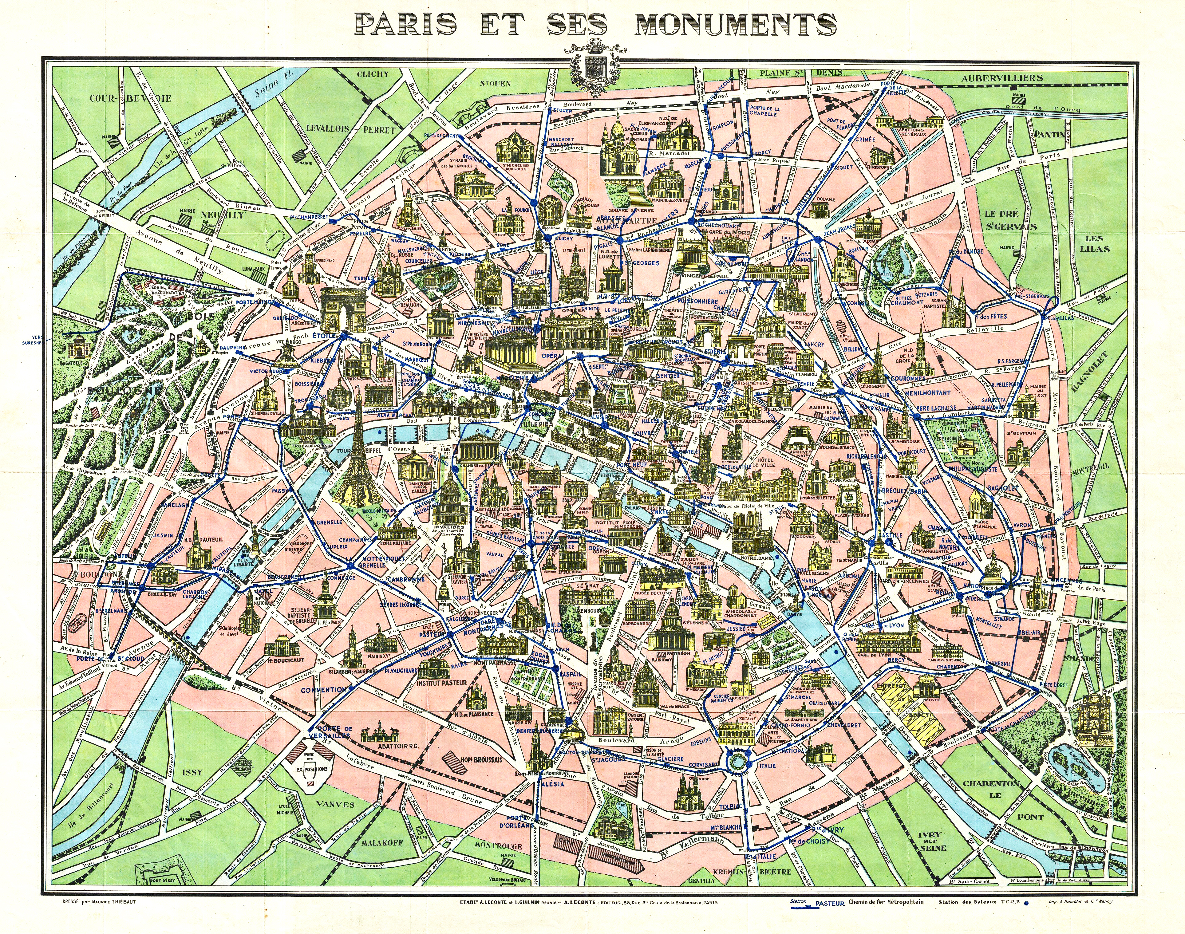
A delightful pocket map of Paris for tourists. The map is unique as the city’s major monuments are illustrated in 3d within the map.
Old Paris Maps 7-12
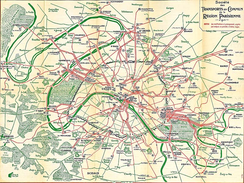
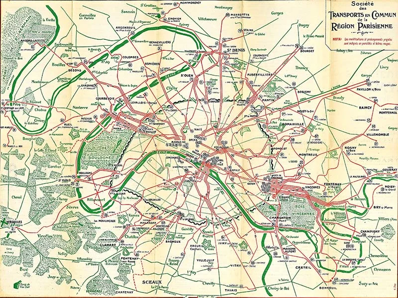
7. Transport Map of Paris 1921
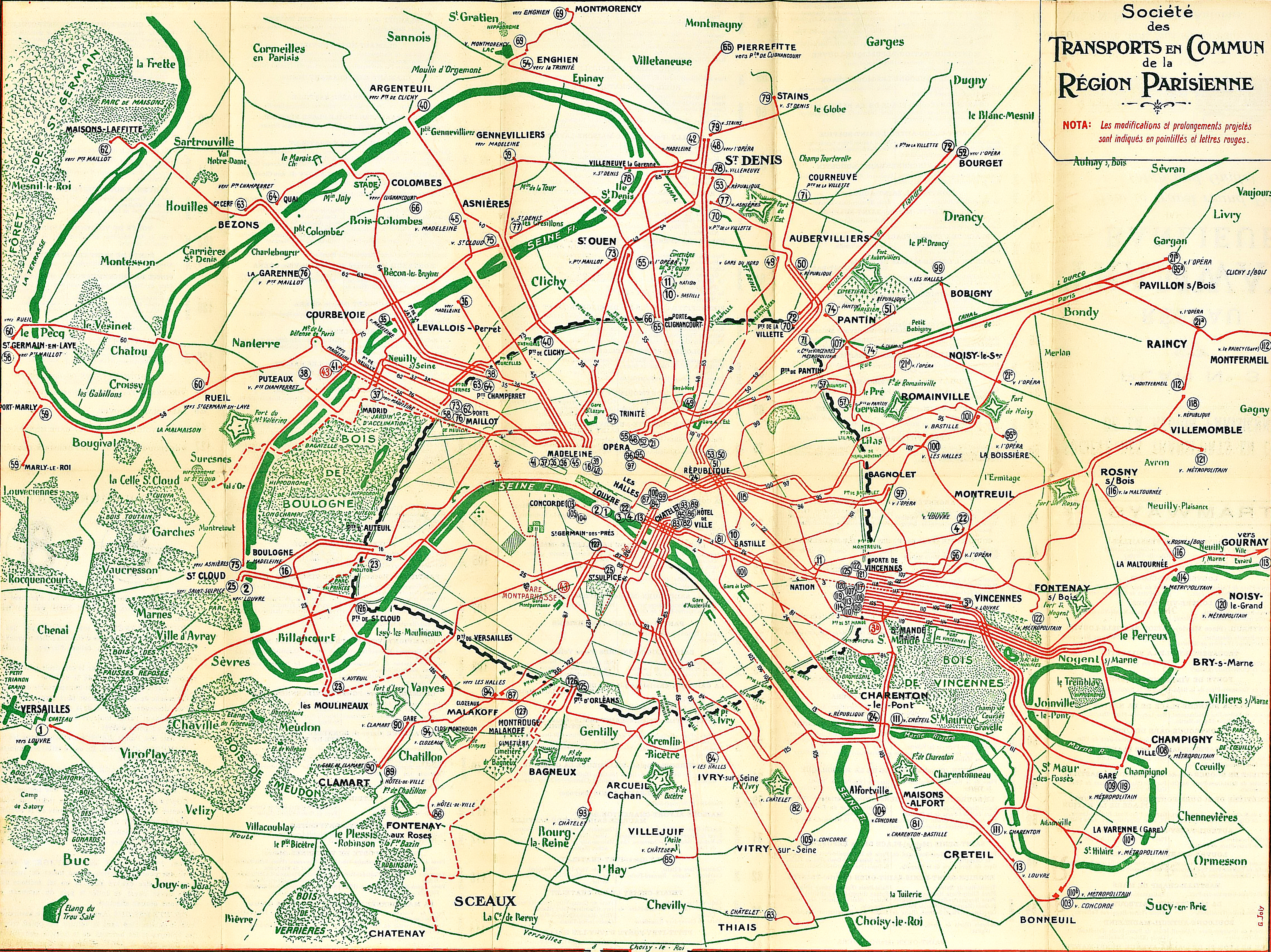
A transport map of Paris showing the tramway and train lines in 1921.
8. Old Maps of Paris Monuments 1926
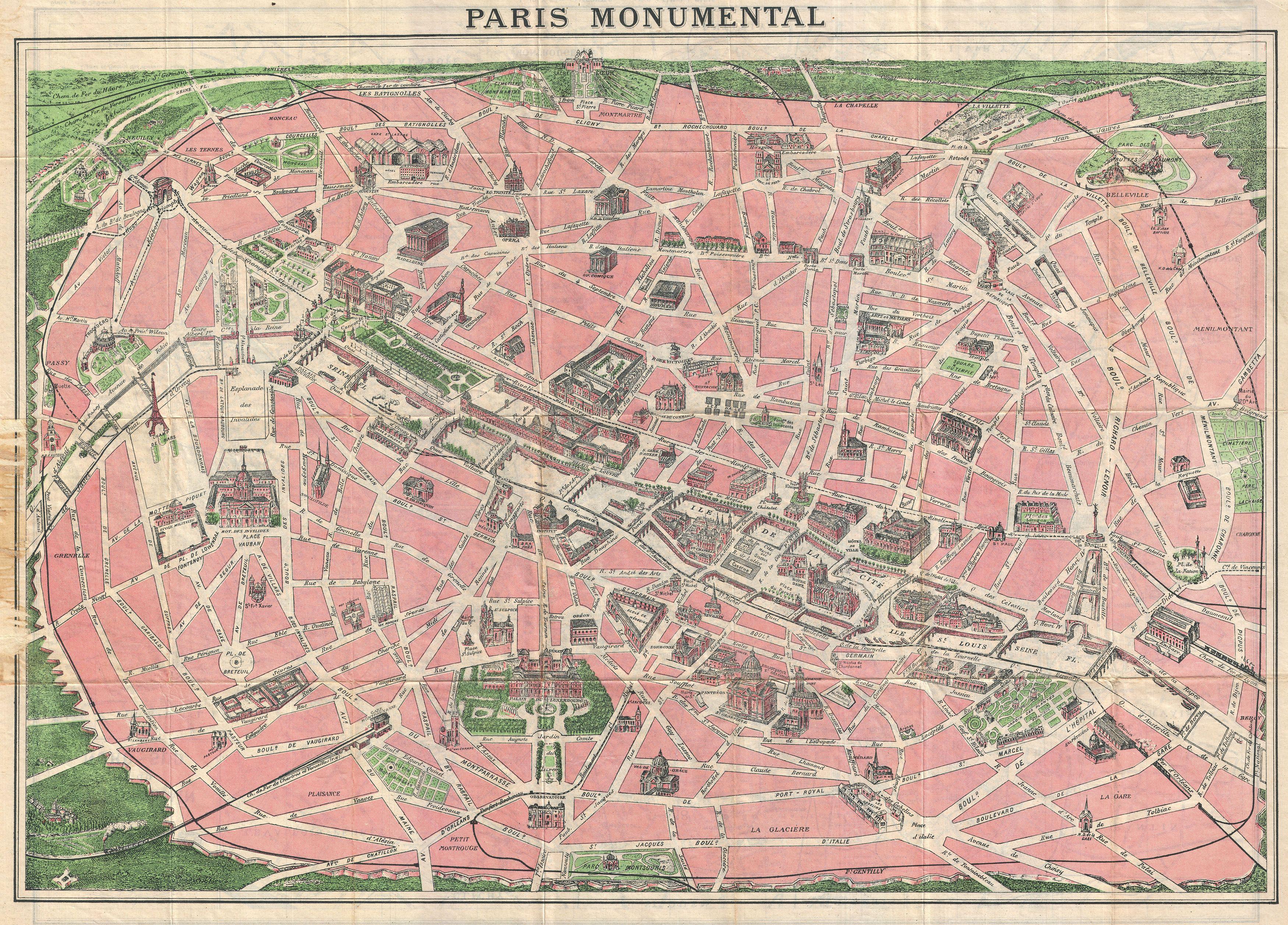
Another map of Parisian monuments from 1926. The map focuses on the historic walled city of Paris and its immediate surroundings.
Monumental buildings, including the Eiffel Tower, the Arc de Triomphe, Sacre-Coeur, and the Pantheon, are shown in profile on this tourist map. It also shows the Parisian train and Metro lines.
9. Map of The Palace of Versailles and Parks
This is another pocket tourist map of Paris, published in 1926. The map focuses on the Palace of Versailles and the surrounding area.

Map 10: Pictorial Map of Paris
This is a fun pictorial map of Paris by Arthur Zaidenberg, 1930.
You’ll find more wonderful vintage pictorial maps here.

Map 11: Paris and Its Surroundings
This stunning map of Paris was crafted by Robelin in Montrouge and vividly lithographed in colour. This tourist map is adorned with numerous vignettes depicting iconic landmarks of Paris, including the Eiffel Tower, the Arc de Triomphe, and Notre Dame. It extends beyond the city limits and the Thiers wall to illustrate neighbouring towns, represented by vignettes. Additionally, the map details the Metropolitan network. Although undated, it can be accurately dated to 1911, given the inclusion of specific lines and stations.


Maps 13-16
Architecture and Urban Planning Services, City of Paris. Easement Plan, 1948.

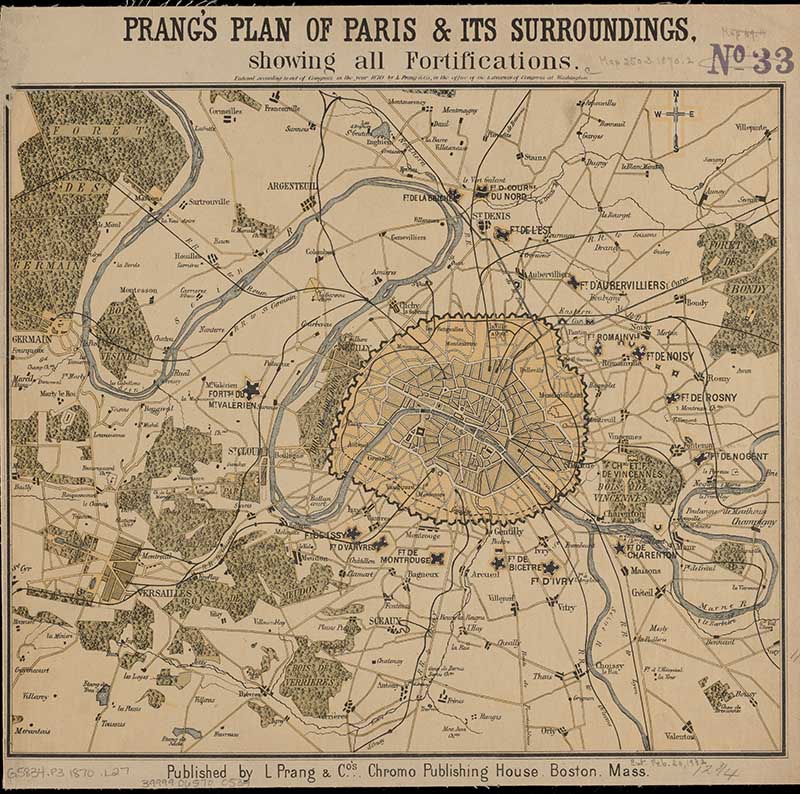
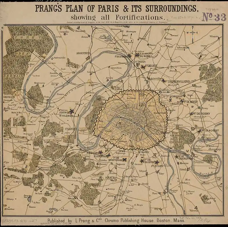
Prang’s plan of Paris & its surroundings, showing all fortifications 1870.
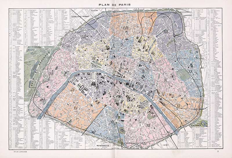
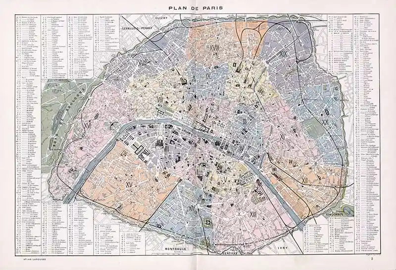
Map 15: Atlas Larousse Illustre.
Plan de Paris, 1900
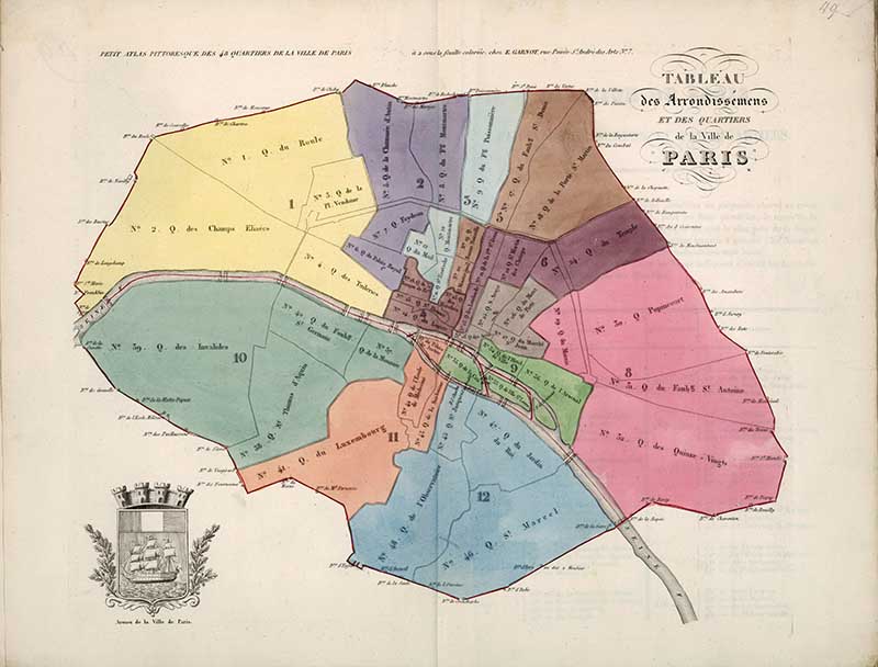
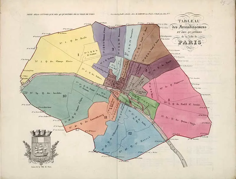
A colourful map of the 48 districts of Paris, 1834.
Other Related Posts
Don’t forget to download some of my other free printable vintage maps. Here are some you may like.
There is a wonderful collection of vintage bicycle posters on the site, most are French and from the Art Nouveau Era.
If you fancy, you can Buy Me A Coffee Here.
Michelle
Sunday 15th of August 2021
Thank you so much. The images are beautiful.
claire
Monday 16th of August 2021
Thank you, I'm really pleased you enjoyed the maps.
marie
Friday 22nd of February 2019
Thank you for sharing all those free prints. Its very kind.
claire
Sunday 24th of February 2019
Thank you, I’m glad you like them.
Eileen
Thursday 24th of January 2019
These are beautiful! I love old maps so much - and globes too. Something about them <3 Thanks for sharing at Sweet Inspiration!
claire
Friday 25th of January 2019
Thank you, I just love old maps.
sheri
Tuesday 22nd of January 2019
These could come in handy! Thanks for sharing at the To Grandma's House We Go DIY, Crafts, Recipes and More Link Party. I pinned this on Pinterest! Hope to see you next week.
claire
Friday 25th of January 2019
Thank you and thanks for sharing.
Cecilia
Sunday 20th of January 2019
Claire, you find the best maps! Thanks for sharing at Vintage Charm!
claire
Tuesday 22nd of January 2019
Thank you, Cecilia.