
London has always held a special place in my heart, so sharing some fabulous vintage original maps of this incredible city would be fun. From Edward Stanford’s detailed cartography to old London maps showcasing its rich history, there’s something magical about seeing the city through these original and antique lenses.
Growing up, my father often spoke fondly of his London roots. Though I was raised in Hong Kong, we visited my grandparents in London every few years. Those trips were filled with visits to Regent’s Park Zoo, explorations of Covent Garden, and afternoons spent in the free museums of South Kensington. Eventually, I attended university in London, and now, even though I live 50 miles north, I find myself drawn back to the city at least once a month.
London isn’t just my personal favourite—it’s a global treasure. As Wiki puts it, “London is often regarded as a world cultural capital. It is the world’s most-visited city, as measured by international arrivals, and has the world’s largest city airport system, measured by passenger traffic.”
In this post, you’ll find various historical and pictorial maps, including detailed city maps, old tube maps, and Ordnance Survey charts. Discover maps highlighting important buildings, Fleet Street’s bustling past, and even the detailed London Poverty maps. These maps of London offer a fascinating glimpse into the past, showcasing the evolution of the City of London and the broader United Kingdom. Whether you’re a history buff, a cartography enthusiast, or love London as much as I do, these historic maps will transport you back in time. Enjoy exploring these original and antique London maps!
The Free Printable London Maps
You can download and print these maps in high-resolution .jpg or downloadable PDF formats. Simply click on the title above the map you want, and a higher-resolution image will open in a new tab for you to print or save. All these old London maps are in the public domain, making them freely accessible to everyone.
London Map 1: Mogg Pocket or Case Map of London PDF
London Map 2: Bacons Pocket Map of the Environs of London
1895 Map that includes the London suburbs. The map runs from Rickmansworth in the northwest to Keveldon Hatch in the northeast. It then extends south to Whitewater Common and Ightham Common. There are details on the map, including manors, mills, roads, towns, forests, parks, castles, railways, cemeteries, and bridges.

London Map 3: 1920 Bacons Pocket Map of London Showing the Underground Railway
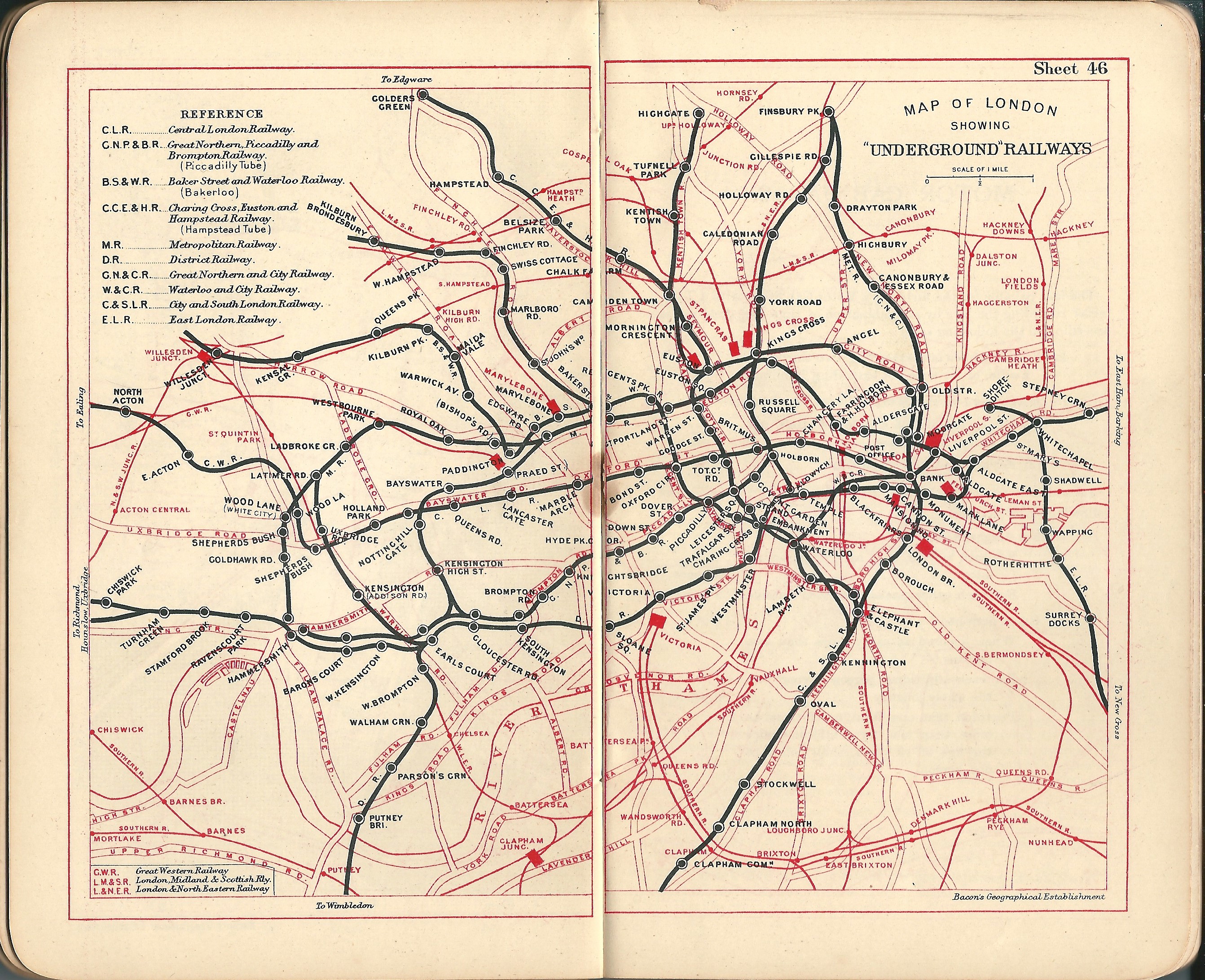

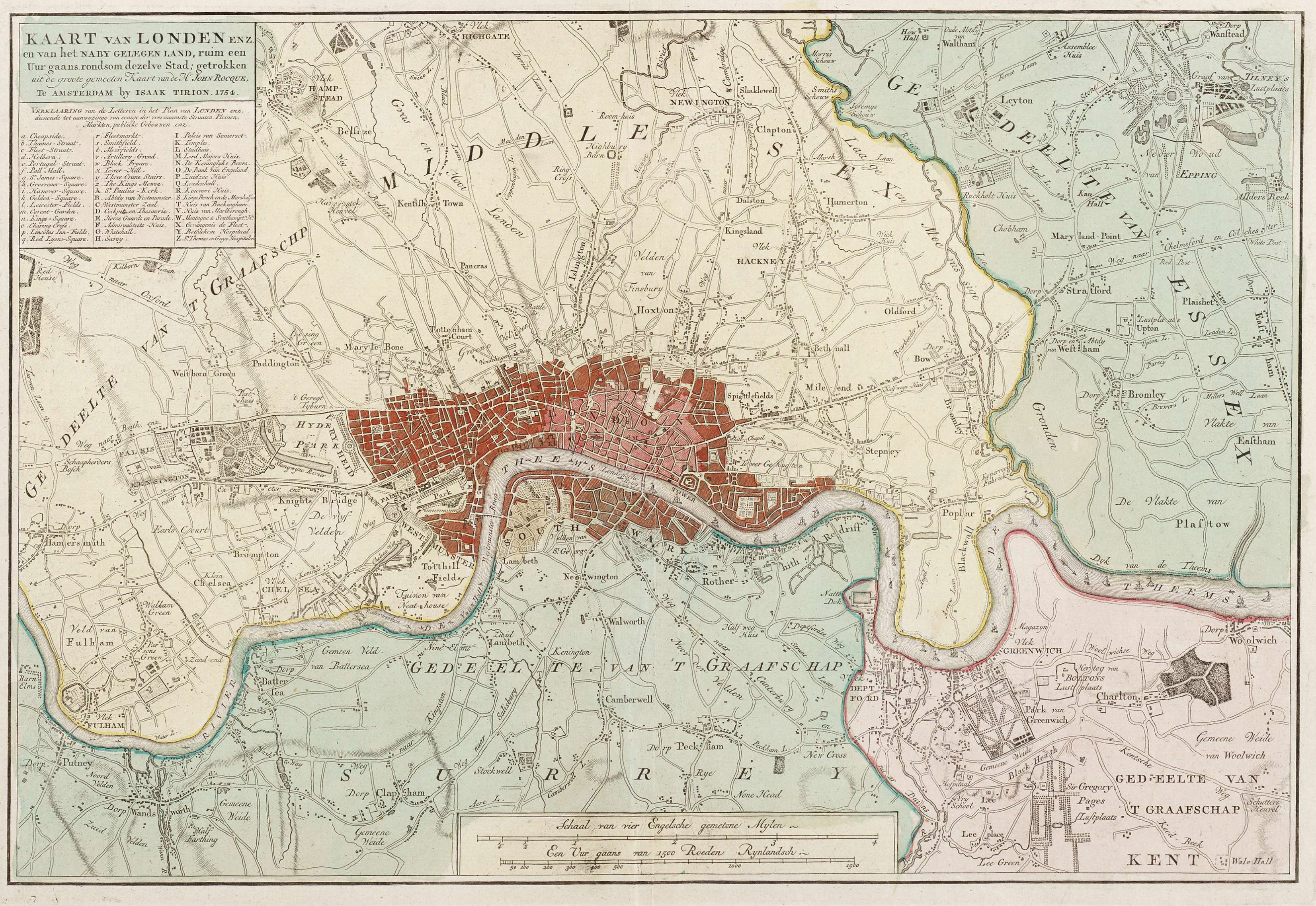
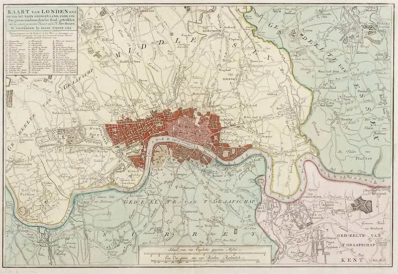
Map 4: 1754 Vintage London Map and Home Counties
.jpg Version of 1754 antique London Map
This map was drawn by the Dutch cartographer Isaak Tirion in 1754.
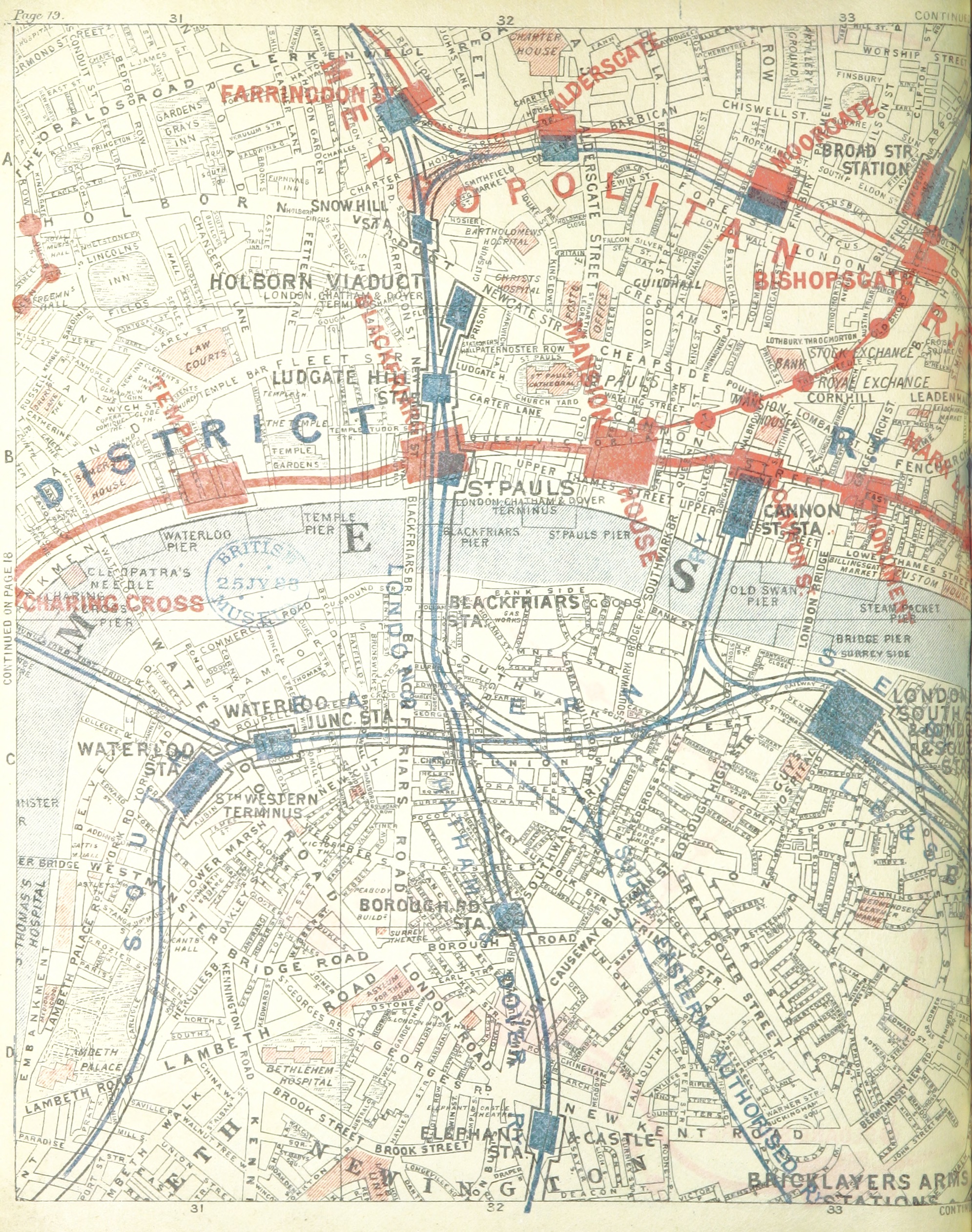
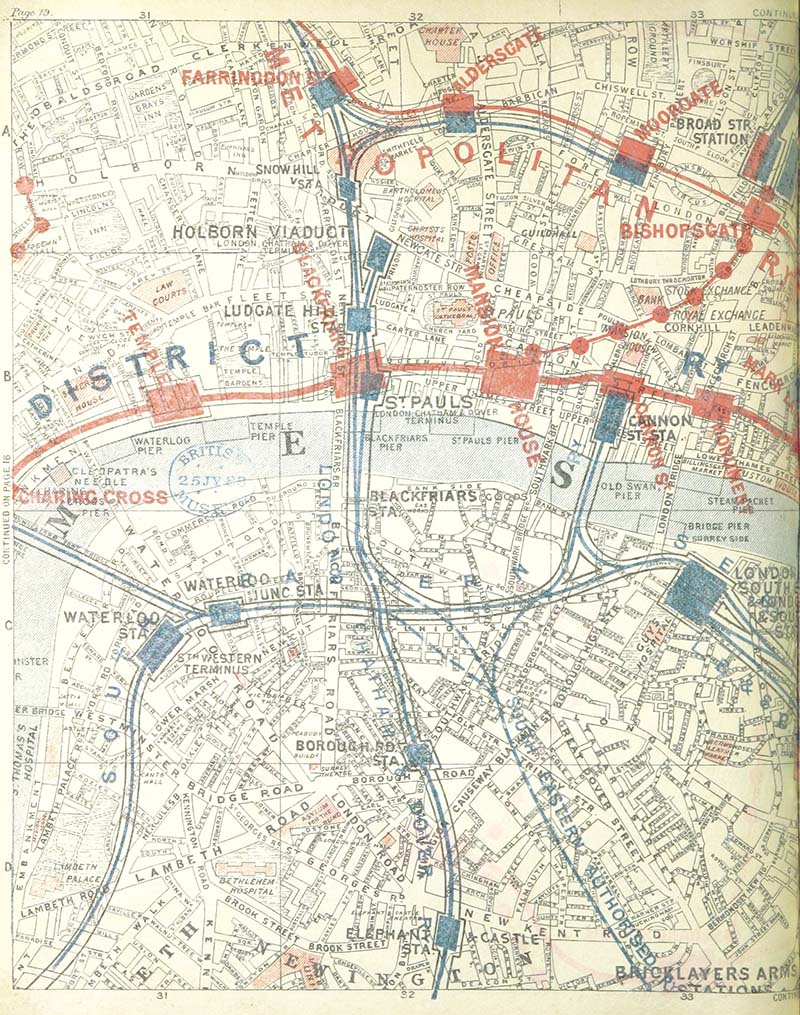
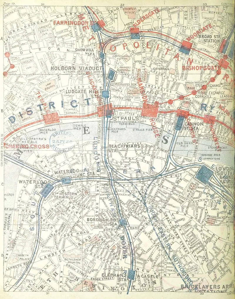
London Map 5: City of London & District Line
.jpg version of City of London map.
This map is from a page in a street atlas from 1888. It covers the square mile, the City of London, and the financial heart.
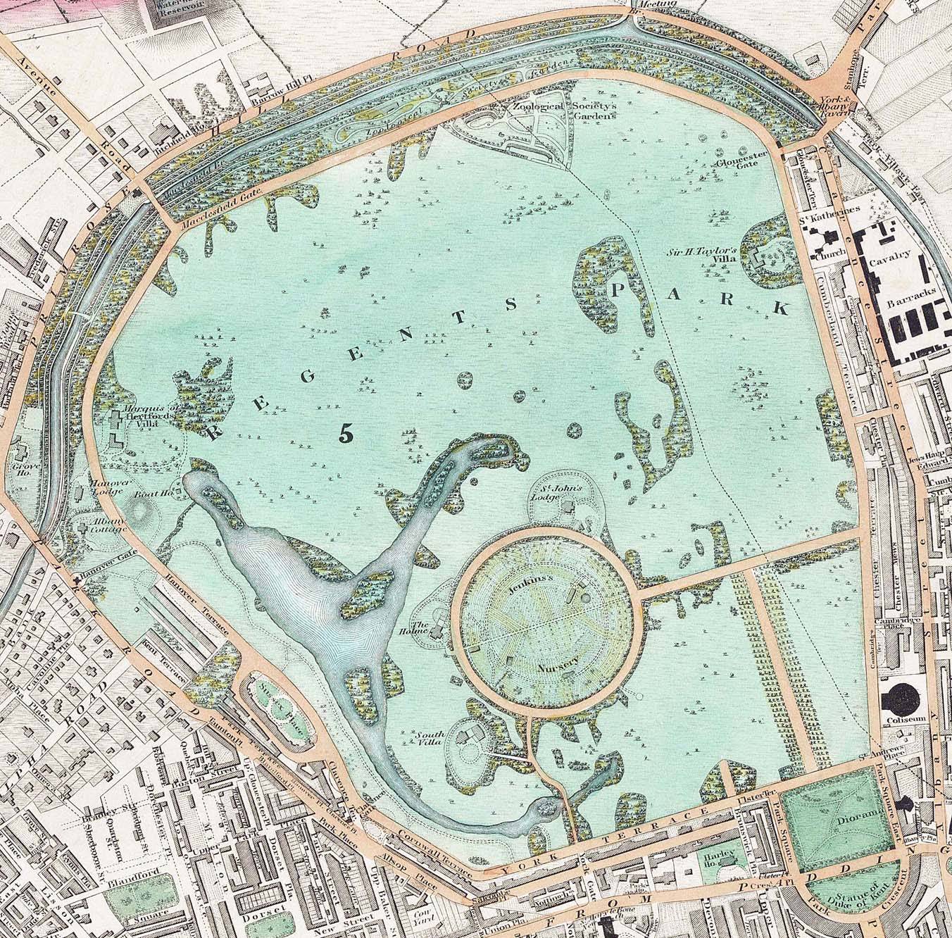
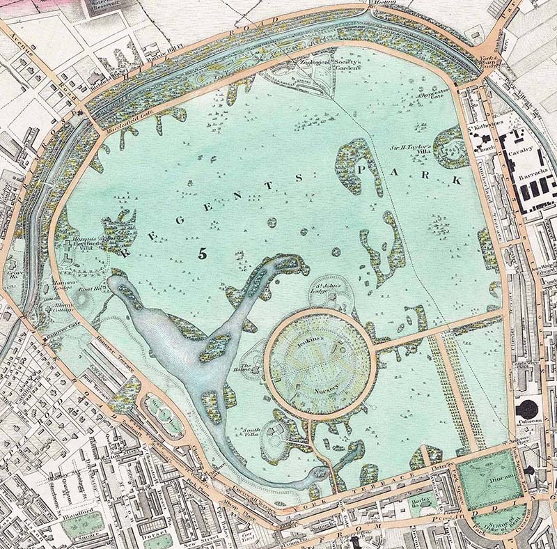
I love this map of Regents Park; the colours are lovely. It was made two years after Regents Park Zoo (London Zoo) opened in 1828.

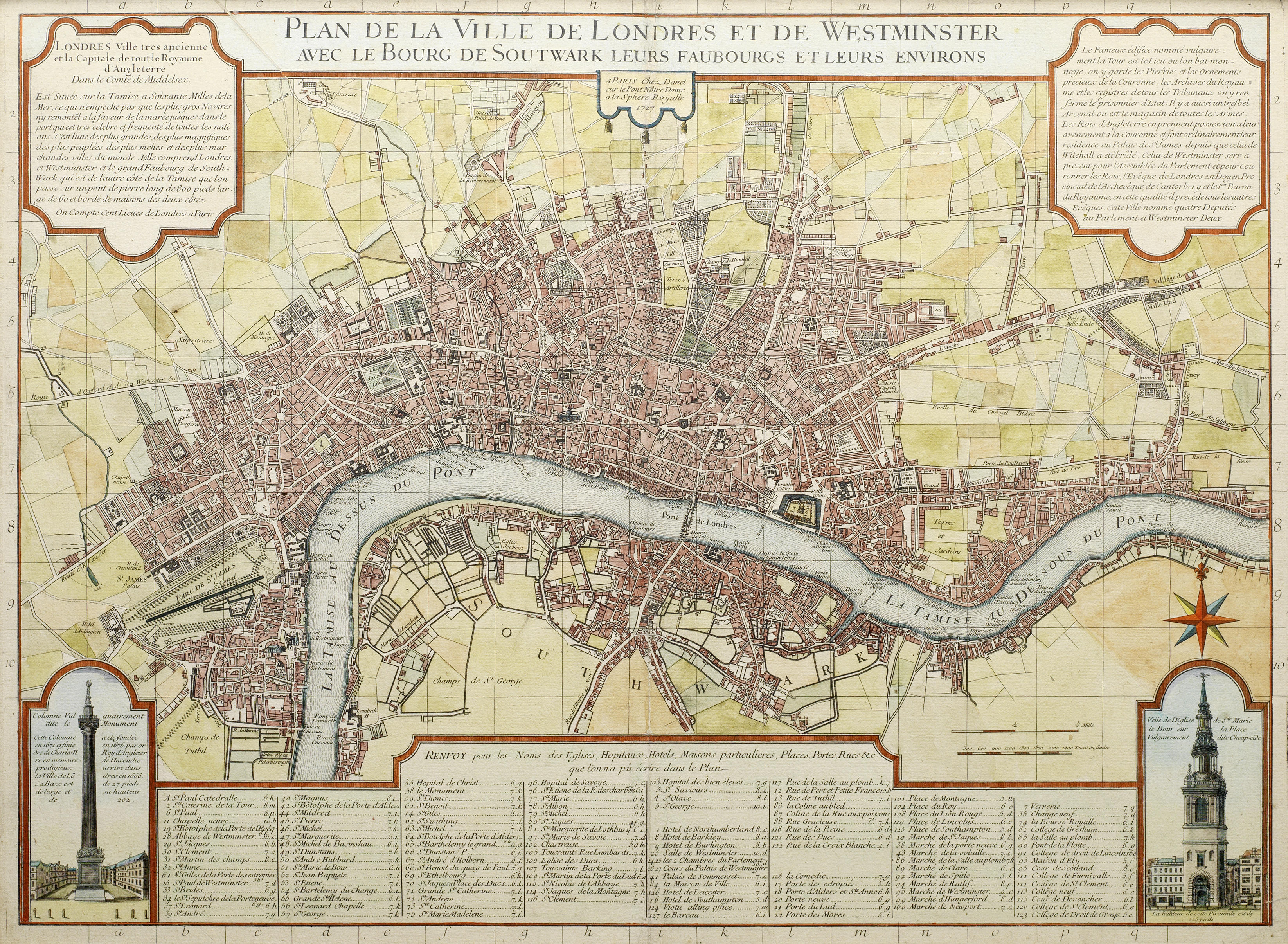
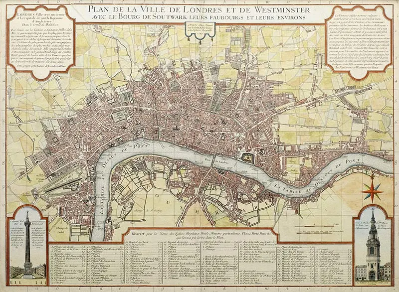
London Map 7: 1727 French Map of London PDF
.jpg version of French Old London map

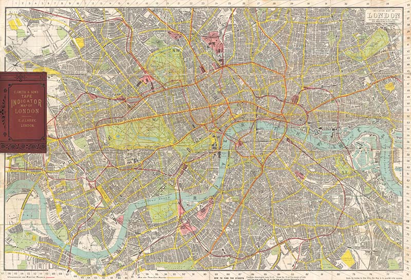
London Map 8: Smith & Sons 1910 Tape Indicator Map of London
.jpg version of Smith & Sons Antique London Map
This is an unusually large folding pocket map of London. Attached to this map of the City of London is a tape measure and street guide for identifying specific locations and distances. I think this would look fabulous framed and on the wall.

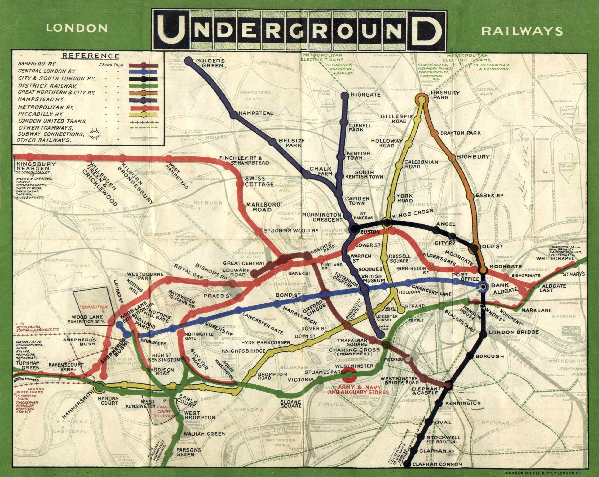
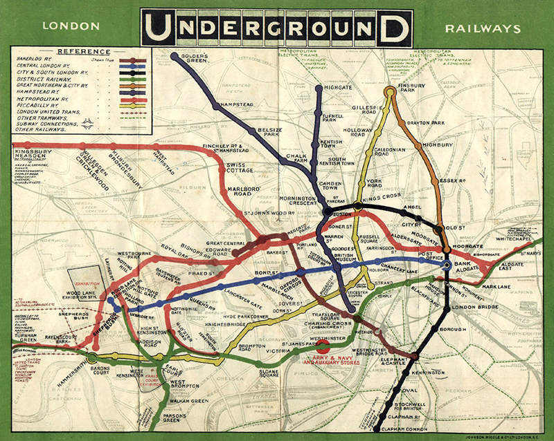
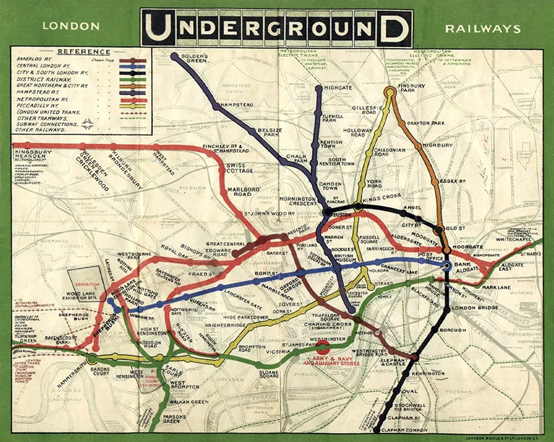
London Map 9: 1908 London Underground Map
This is a lovely, colourful map of the London Underground. The different tube lines are in colour, superimposed over a street map of London.
London Map 10: Pictorial Map of Whitehall jpg
This is a map of the historic administrative district of Whitehall, the heart of the Civil Service and government in the UK, drawn by John Pearson Sayer for the Strand Magazine. Estimated from 1948, this map includes vignette illustrations and detailed annotations of the area’s history, with numerous references to historic buildings, landmarks, and famous residents. It shows streets, shops, theatres, clubs, offices, and people engaged in various activities, capturing the vibrant life of Whitehall.
You’ll find more wonderful pictorial maps with this collection of Dudley Chase Maps.

London Map 11: Children’s Map of London
The 1938 Children’s Map of London, printed and published by John Bartholomew & Son Ltd. in Edinburgh, is a vibrant and educational map designed to engage young audiences. Known for their high-quality cartography, Bartholomew & Son created this map with playful illustrations, making it visually appealing and accessible for children. It features colourful drawings of major landmarks like Buckingham Palace, the Tower of London, and the Houses of Parliament, along with annotations and fun facts to help children learn about the city’s geography and history.

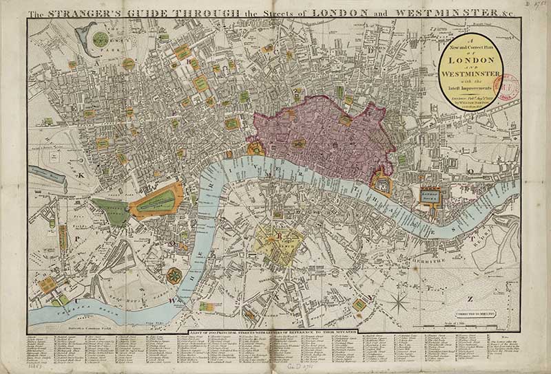
London Map 12: The Stranger’s Guide
1822 map titled The Stranger’s Guide through the streets of London and Westminster.

Other Free Downloadable Map Collections
Check out all the other wonderful free downloadable vintage Map collections on the site.
These include, among many other things, antique word maps, old maps of Europe, and maps of many countries, such as Great Britain.
Other city maps to check out are:
If you are looking for other ways to display and use these old maps, check out this fantastic collection of map craft ideas, including over 40 map decor ideas.
If you fancy, you can Buy Me A Coffee Here.
Helen
Thursday 3rd of October 2024
Thank you so much for these. A significant number of my family are Londoners, so good to look at old maps of the city.
claire
Thursday 3rd of October 2024
Thank you, you're welcome. London is my favourite city and I try to visit it a couple of times a month. I never get bored of it there are so many amazing places to see in London.
Keith Warren
Thursday 29th of June 2023
Thank you for the brilliant maps of London and the Thames. My mothers family were Watermen on the Thames from 1595 till the 1990's. Its been a fascinating journey noting the development and growth of London and the various Waterman Stairs that they were licensed to operate from.
claire
Sunday 2nd of July 2023
That's fascinating, I spend a lot of my spare time walking around London. And along the Thames where you will come across steps down to the water.
Mrs Janice Fisher
Thursday 20th of May 2021
Thank you so much for sharing these amazing vintage maps. I am compiling a pictorial collection for my personal Family tree and these are such a wonderful resource. Thank you so very much for all your hard work in putting these together.
claire
Thursday 20th of May 2021
Thank you, I'm glad you enjoyed them. Having lived in London myself I particularly enjoy these maps.
elif Hande bukum
Sunday 21st of March 2021
AMAZING!!!!
Thank you so much for sharing these!!
claire
Sunday 21st of March 2021
Thank you, I'm glad you have enjoyed them.
Trisha
Saturday 27th of February 2021
Thank you for these resources! May I ask what resolution the images are at?
claire
Saturday 27th of February 2021
Thank you, you need to check each map in Photoshop. These days I try to save the larger images at 300dpi but as I posted these maps a few years ago I'm not sure of the resolution. They are of the largest files I could find and they can easily be resized into 300dpi in a package like Photoshop if need be.