
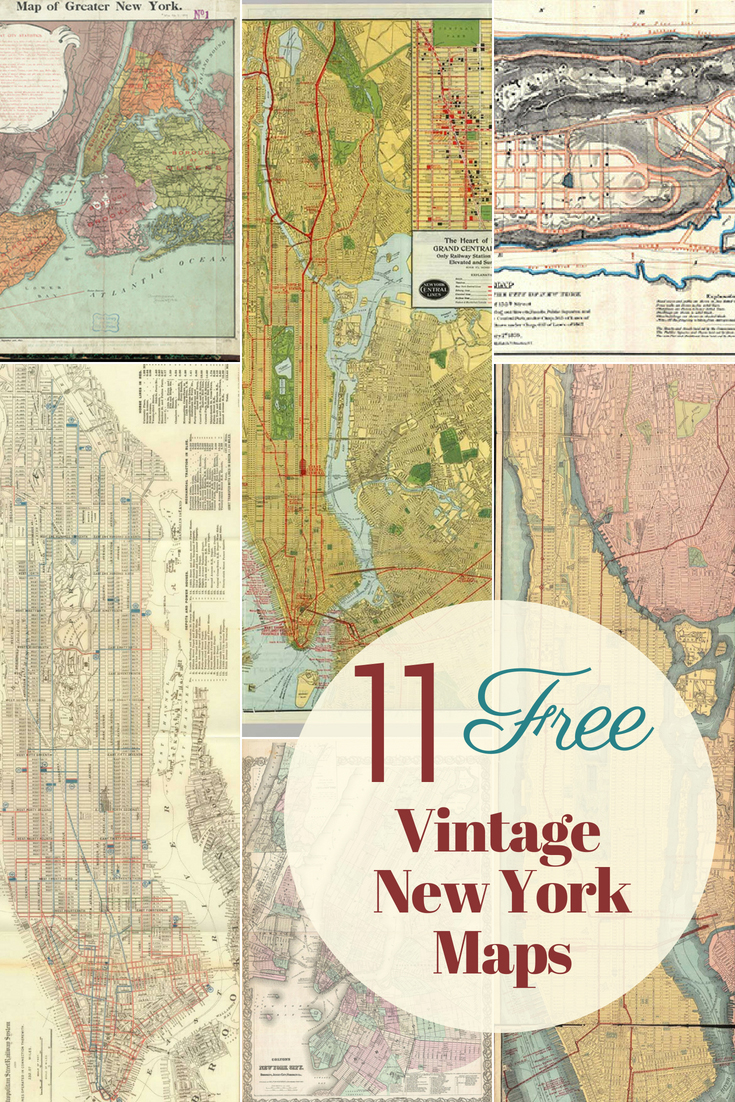
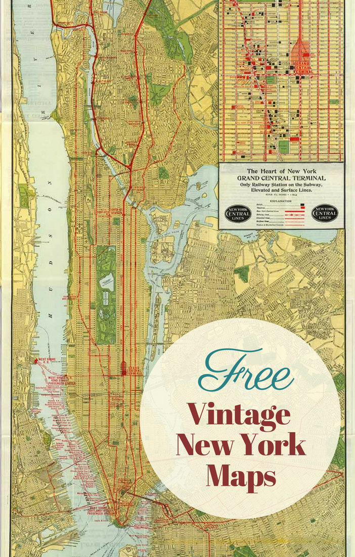
You can download and print antique maps of New York City for free. These vintage prints offer a glimpse into the city’s historic streets and landmarks.
Explore Vintage New York Maps
Have you ever dreamed of exploring the Big Apple through the eyes of history? Whether you’re a New Yorker at heart or just fascinated by the past, our collection of vintage New York maps is perfect for you. These antique maps offer a glimpse into the city’s rich history, from Wall Street to the Hudson River, and they’re all free to download and print. Imagine decorating your space with an antique wall map of New York City or using a vintage print for a unique DIY project.
I had the unforgettable experience of attending a wedding on top of the Empire State Building just days after the notorious Northeastern Seaboard blackout. It was a miracle that everyone made it, each guest with their adventurous tale. Despite the chaos, New York’s charm was undeniable. The city’s allure is unmistakable, even if you’ve only seen it on TV or in movies.
Dive into NYC’s Past
For all New York City enthusiasts, I’ve curated a collection of vintage maps highlighting everything from the Upper East Side to Ellis Island. These antique prints are more than just maps; they are pieces of history that capture the essence of the largest city in the United States. These maps make stunning decor for any space, perfect for framing or crafting.
Whether a detailed map of New York or a charming view of Long Island, these vintage maps provide a unique way to appreciate the city’s history. So, if you’re a history buff, a lover of all things vintage, or just looking for a unique piece to decorate your home, dive into our collection and let New York’s past come alive.

How To Download The NYC Vintage Maps
Click on the title above the map you want (PDF or JPG version. A higher-resolution antique print will open in a new tab. You can then save or print this map.
All the maps are in the Public Domain and thus copyright-free, so you can use them for all your projects, personal or commercial.
Free Antique New York Maps 1-6
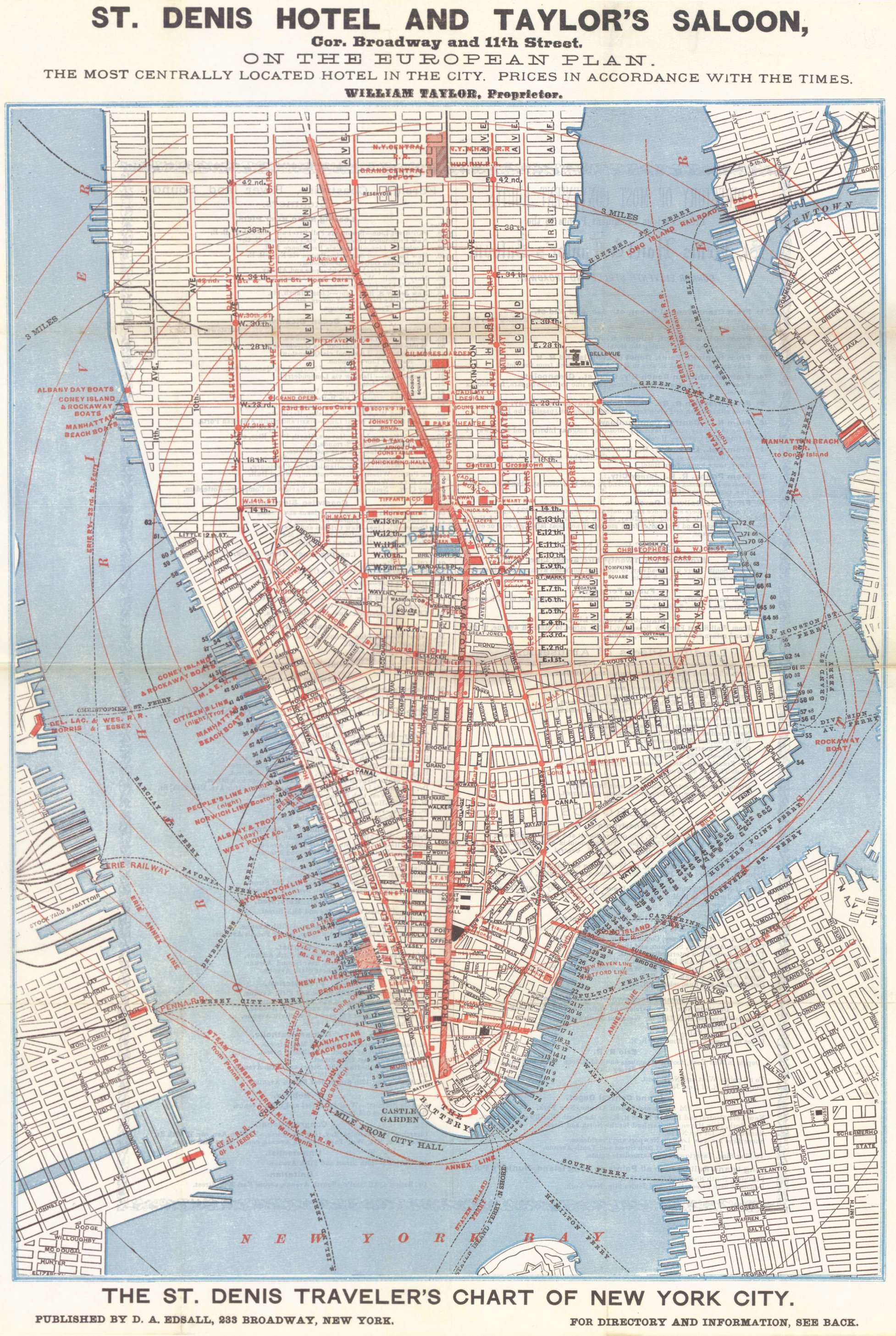
NYC Map 1: 1879 Tourist Map of Lower Manhattan (pdf).
This is a tourist map of lower Manhattan from the St Denis Hotel, showing its location in the centre of Manhattan.
The St. Denis Hotel, once a luxurious landmark at Broadway and 11th Street, hosted famous guests like Mark Twain and Alexander Graham Bell. Built in 1853, it was known for its opulent interiors and vibrant social scene, making it a cornerstone of New York City’s rich history.


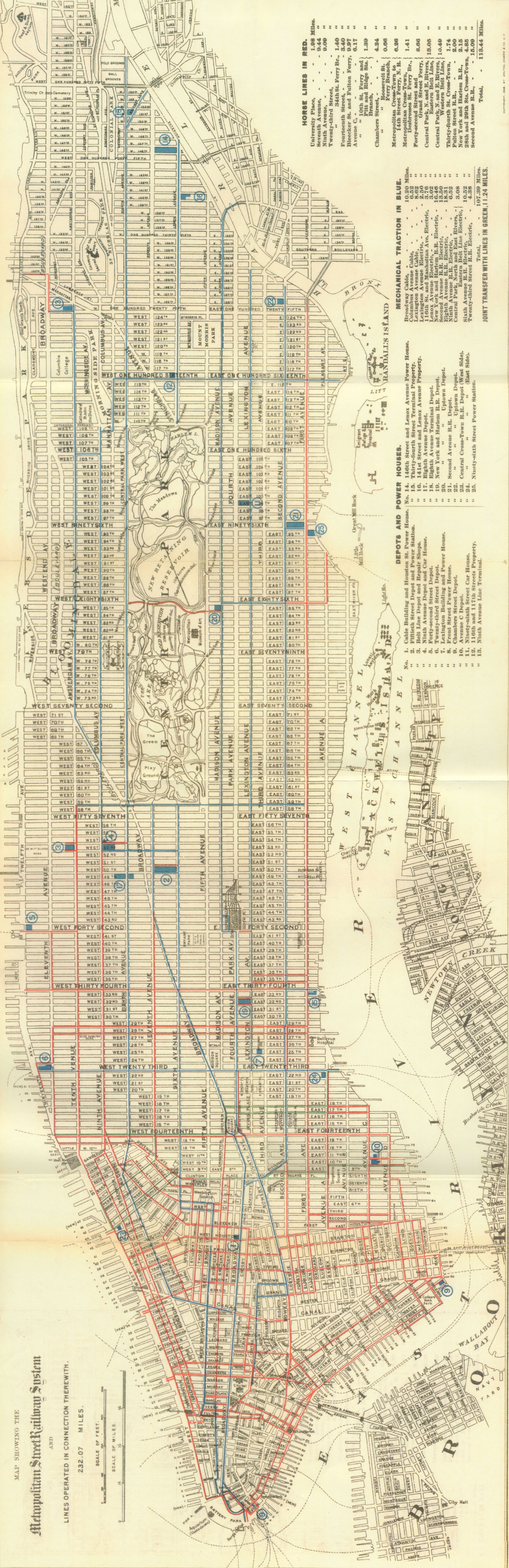
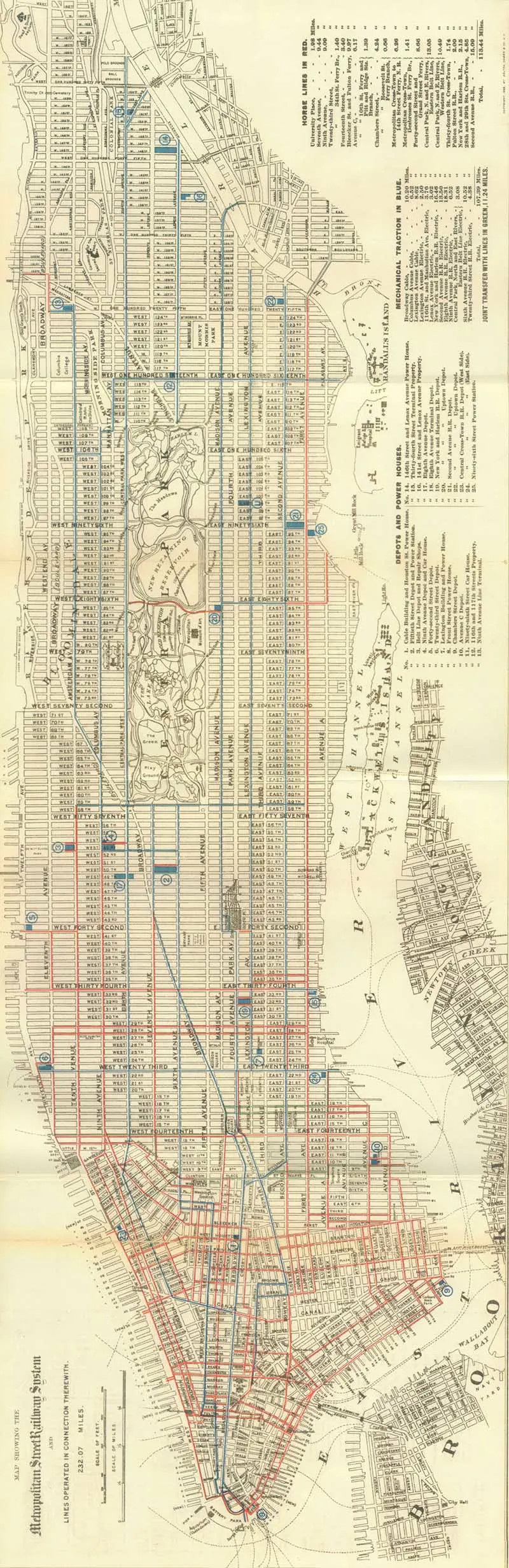
NYC Map 2: 1899 Map of Manhattan Railways
Manhattan Railways jpg version.
Once the lifeblood of city transit, New York’s streetcars clanged their way through bustling streets from the mid-19th century to the 1950s. These iconic trolleys connected neighbourhoods and carried millions, shaping the city’s growth before giving way to the modern subway system.

NYC Map 3: 1918 New York City Rail Road Map

NYC Map 4: Building Zone Map 14th -20th Street New York City 1920
It’s not strictly a map but a detailed diagram showing the building layouts from 14th Street to 20th Street. I decided to include it because I thought it was a very interesting, detailed close-up of a section of Manhattan Island.

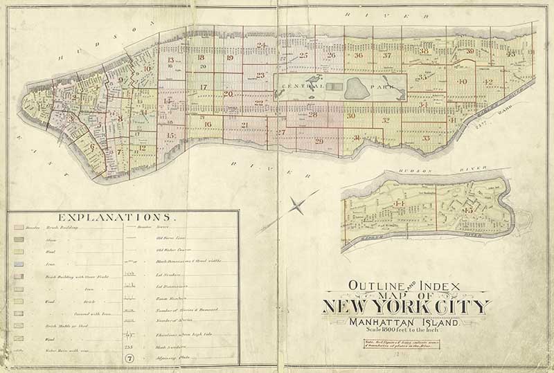
NYC Map 5: 1891 Outline Map of New York Manhattan Island
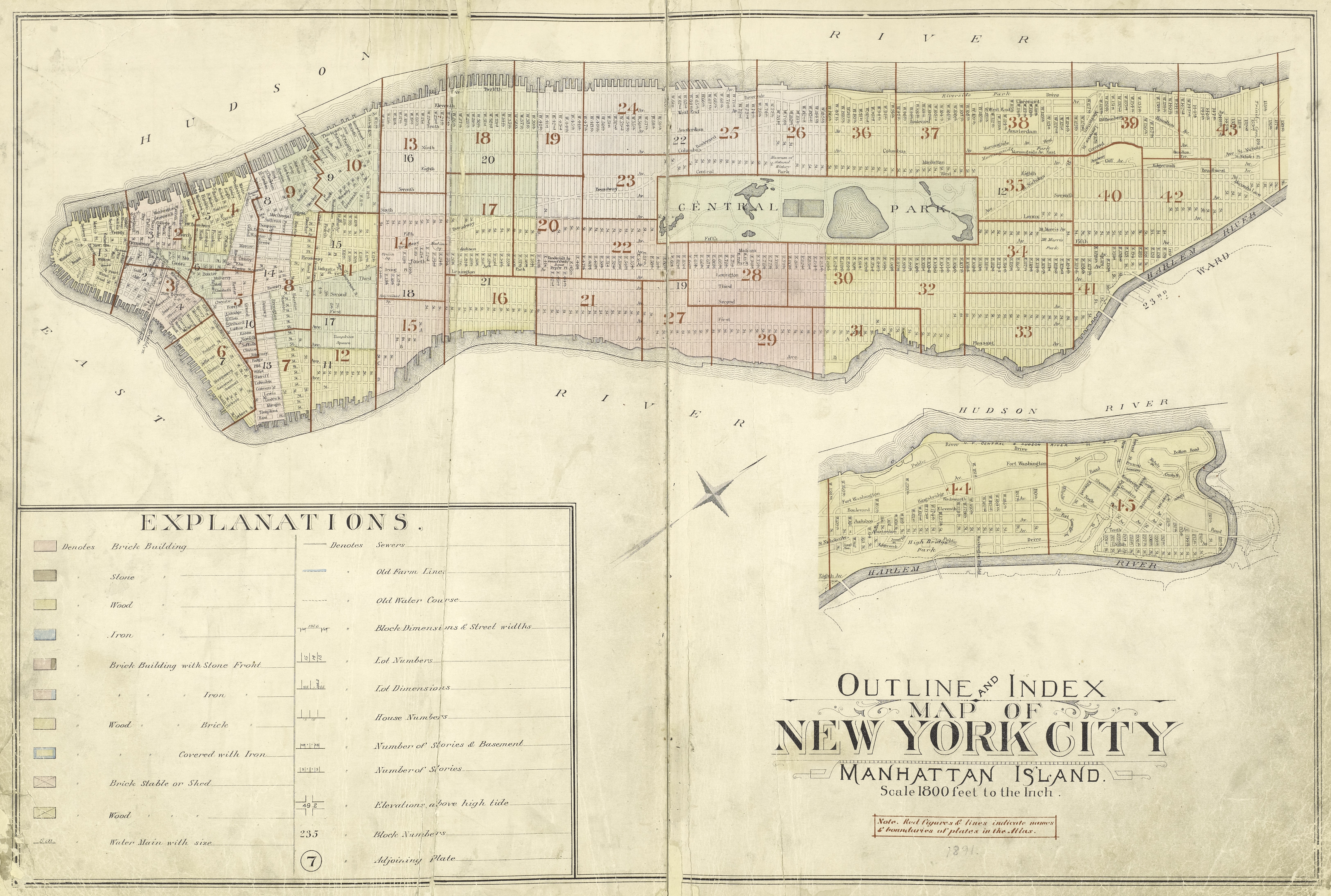
Manhattan Island’s history is as epic as the city itself! Originally bought by the Dutch from Native Americans for just $24 worth of beads and trinkets, it transformed from a colonial outpost into the vibrant heart of New York City. It’s seen it all—from the rise of Wall Street to the Statue of Liberty’s watchful gaze over Ellis Island.
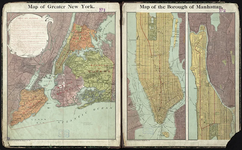
NYC Map 6: 1897 Map of Greater New York and Manhattan Island.
Greater New York is a sprawling metropolis that’s more than just the Big Apple—it’s a melting pot of vibrant neighbourhoods, each with its unique flavour. From the iconic skyscrapers of Manhattan to the bustling streets of Brooklyn, it’s the epicentre of culture, commerce, and nonstop energy!

Old New York Maps 7-13
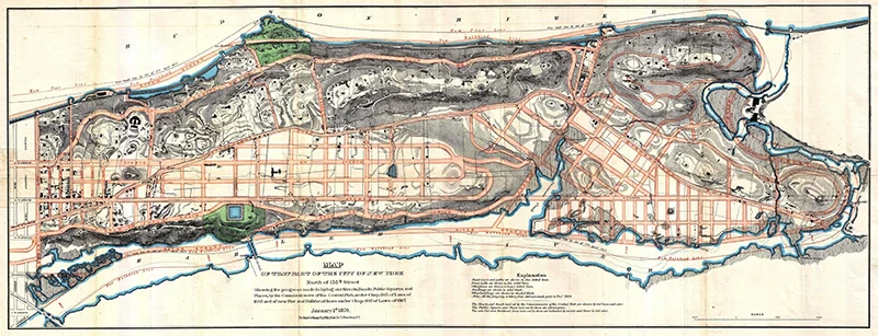
NYC Map 7: 1870 Map of Upper Manhattan
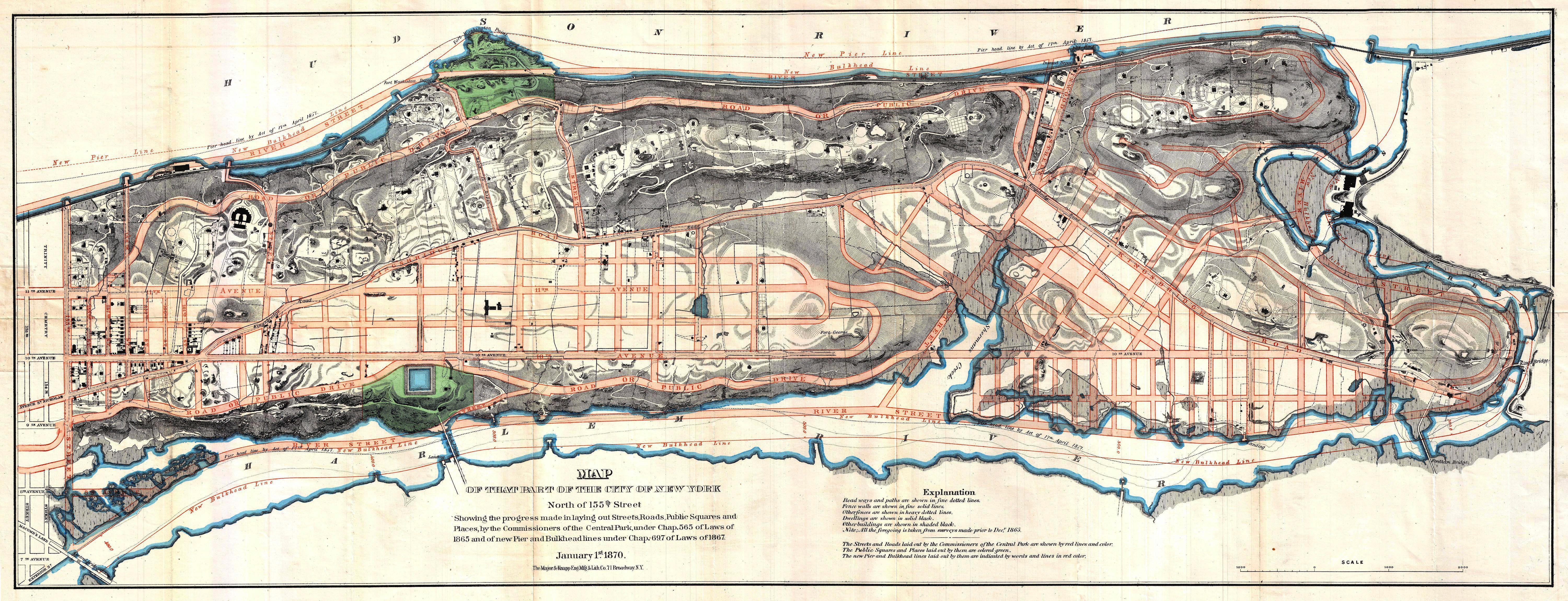

NYC Map 8 1865 Map including Brooklyn and Long Island City


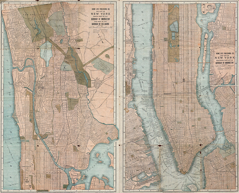
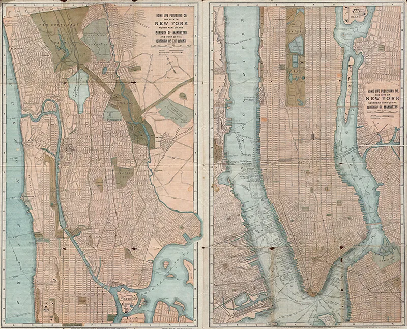
NYC Old Map 9: 1899 Map of New York City – Manhattan and the Bronx
Manhattan & Bronx .jpg version
The Bronx is the birthplace of hip-hop and home to Yankee Stadium, embodying the true spirit of New York. With its rich cultural tapestry, from the vibrant art scene to the lush green expanse of the Bronx Zoo and Botanical Garden, it’s a borough that pulses with life and history.
NYC Map 10: 1908 Map of the New York Borough of Queens
Borough of Queens .jpg version
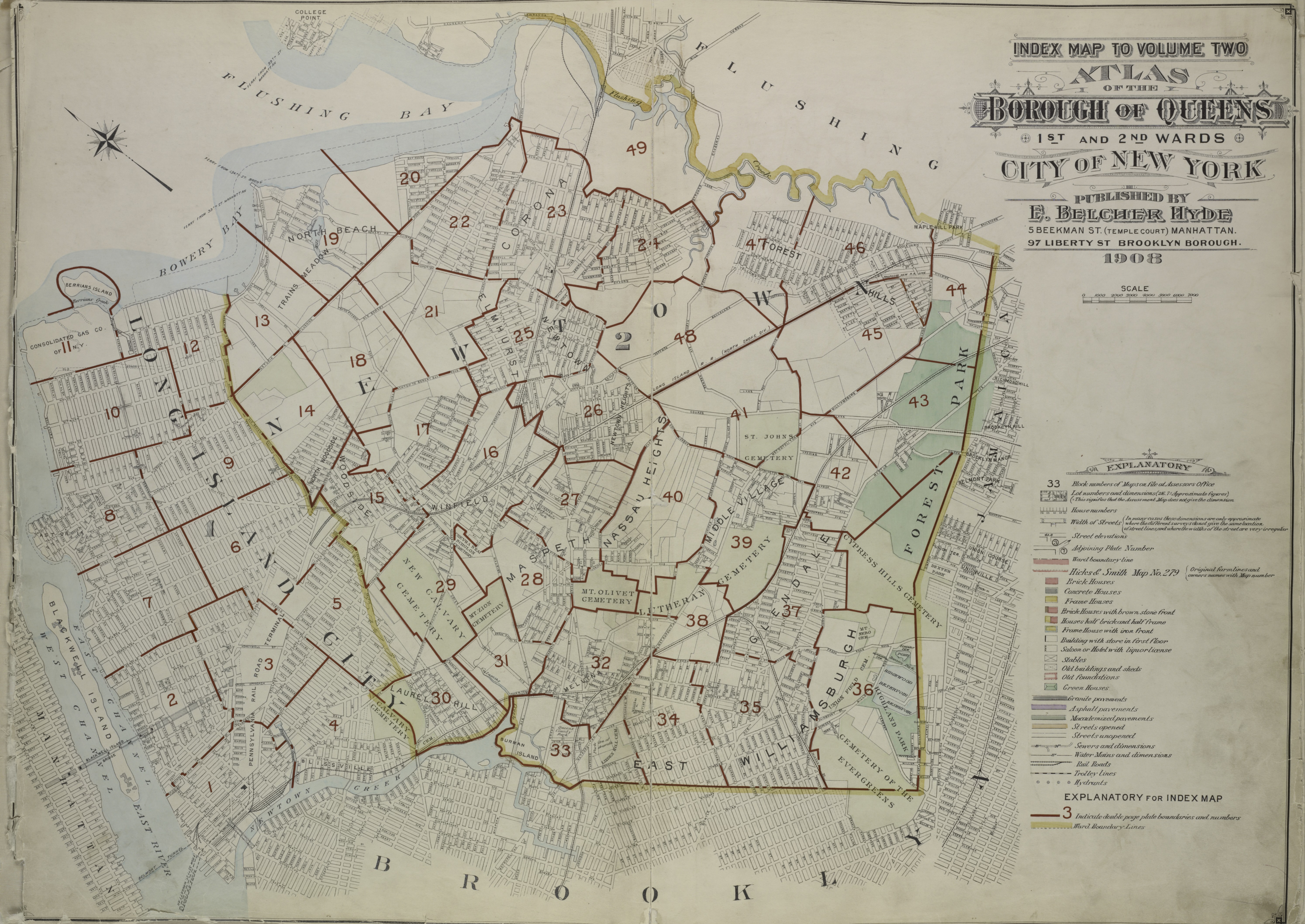
Queens is the most diverse borough in New York City, with a rich tapestry of cultures from around the globe. Historically a collection of small towns and farmland, it has grown into a vibrant urban hub known for landmarks like Flushing Meadows-Corona Park, the 1964 World’s Fair site, and the bustling neighbourhoods of Astoria and Long Island City.
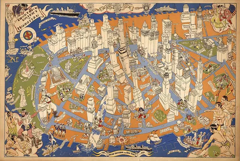
NYC Map 11: Pictorial Map of Manhattan
A pictorial map resembling a bird’s-eye view depicts lower Manhattan from an imaginary point above the Brooklyn shore. Shows buildings, monuments, tourist attractions, whimsical sea monsters, whales, and boats and ships in the water. Includes historical notes and pictorial vignettes, most reflecting events in the city’s colonial and Revolution-era history. Executed in a vibrant scheme dominated by blue, orange and green. On the upper centre of the map: Seal of New York City 1915, Seal of Amsterdam 1654 and Seal of Netherlands 1625. On the lower centre of the map: “1789- Nieuw Amsterdam and New York – 1939”.
For more pictorial maps, check out Ernest Dudley Chase’s.

NYC Map 12: 1873 Bird’s- eye Map of New York
The 1873 bird’ s-eye view map of New York by George Schlegel and George Degen is a detailed snapshot of the city during its rapid growth. It beautifully illustrates New York’s streets, buildings, and landmarks in an artistic and precise manner.
Don’t forget to check out the bird’s-eye view maps of San Francisco.
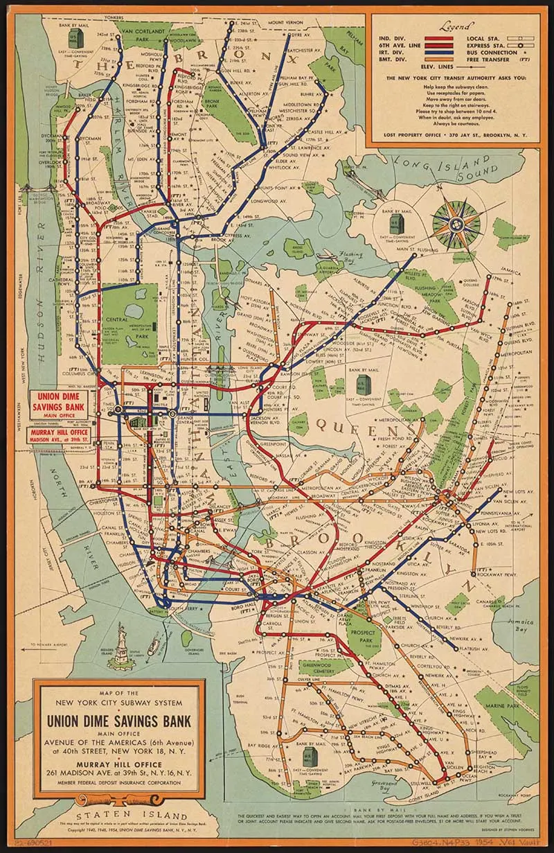
NYC Map 13: 1954 Map of New York City Subway
In 1954, New York’s subway system was already a vital lifeline for the city, boasting an extensive network that connected all five boroughs. That year marked the opening of the final segment of the IND Queens Boulevard Line, enhancing connectivity and solidifying the subway’s role as the backbone of New York City’s public transit.

Other Map Collections
Any of these maps would look fabulous as a wall decoration. Some of the larger maps you may want to send to a printer to get printed in a large format. A few of the maps are large enough for you to print custom wallpaper. If you look on the web, there are lots of sites that offer this service.
This vintage airline poster collection includes some wonderful New York posters. You can also see the collection of Maps of The United States here.
Check out the other City Maps on the site, including
I make map table mats out of the cities I have visited. This collection of vintage New York maps would make a lovely set of placemats, like these city map table mats. Check out all these other wonderful ways you can decorate with old maps.
Don’t forget to check out these free old maps of Texas and other US states . Also, there are some fantastic maps of the Mississippi river available.

If you fancy, you can Buy Me A Coffee Here.
Naomi Noeldner
Friday 1st of March 2019
Wow. Incredible, Thank you so much for compiling and sharing this treasure trove!
claire
Saturday 2nd of March 2019
You’re welcome their will be more to come.
Lovely Old Maps of Paris To Download - Picture Box Blue
Friday 11th of January 2019
[…] Vintage New York Maps […]
Shirley Wood
Thursday 9th of August 2018
Claire, congrats on the new blog! At first I thought someone was copying you when I saw the name, Picture Box Blue. I had to check around to be sure it was you! So glad you share with us at Merry Monday! Can't wait to see all of the great ideas you will be sharing with map projects!
claire
Saturday 11th of August 2018
Thank you, Shirley. This new blog will focus more on lovely vintage images, I will still be crafting at Pillarboxblue.
LINDA BOUFFARD
Wednesday 8th of August 2018
These are very cool, Claire. Thank you for the vintage maps. I like that. Coming from Thursday Favorite Things - cohostess, Linda @Crafts a la mode
claire
Saturday 11th of August 2018
Thank you, Linda glad you liked the images.
Cecilia MyThriftStoreAddiction
Monday 6th of August 2018
Thanks for sharing these great maps at Vintage Charm!
claire
Tuesday 7th of August 2018
Thank you, for hosting.