
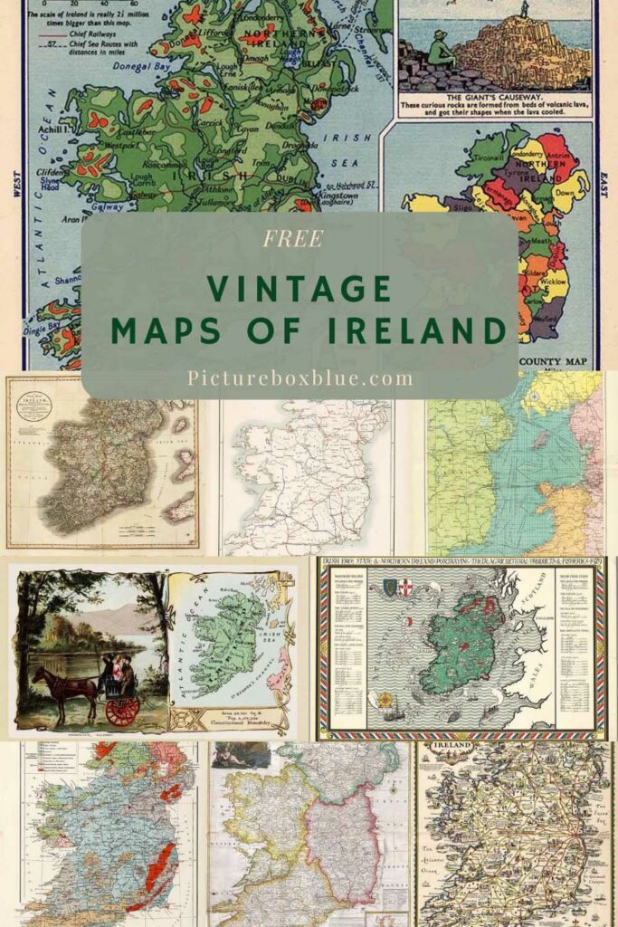
Here is a wonderful collection of vintage maps of Ireland. This complements the collection of printable old maps on Pictureboxblue.
There are already many vintage maps of Europe on the site and maps of Great Britain and Scotland. I thought it was time to add old maps of Ireland to the collection.
I actually got the idea when watching the Eurovision song contest. Even though Ireland didn’t make it to the final this year, I still associate the competition with the country. The Irish have won the competition more than any other European country. They have won it a total of 7 times.
I also have a vested interest in maps of Ireland, as I plan to visit the country to see friends as soon as the travel restrictions no longer exist. I have been to the country twice before, but only to Dublin. This time I plan to visit Galway.

10 Facts About Ireland
- Ireland sits in the North Atlantic Ocean and is the third-largest island in Europe after Great Britain and Iceland.
- Ireland is politically divided into the Republic of Ireland and Northern Ireland which is part of the United Kingdom.
- The Republic of Ireland makes up five-sixths of the Island.
- The population of Ireland has decreased over the centuries in 1841 it was about 8million whereas in 2011 it was 6.6 million (including Northern Ireland). This is due to mass emigration in the 19th Century. The number of Irish people living outside Ireland is far greater than those living inside the country.
- There are thought to be as many as 80 million people with Irish roots living outside Ireland. As of 2013, there were 40 million Irish-Americans, and a third of Australians are of Irish descent.
- Over 10% of the population in Ireland are red heads which is a higher proportion than any other nation.
- Ireland is the only country in the world with an instrument as a national symbol, the harp.
- Ireland is known as the Emerald Isle. It rains a lot in Ireland so the country is full of lush greenery and rolling hills.
- There are three World Heritage Sites on the island: the Brú na Bóinne, Skellig Michael, and the Giant’s Causeway
- There is a reason for the three colors on the flag of The Republic of Ireland. The green symbolizes Roman Catholics, the orange represents the minority Protestants who were supporters of William of Orange. The white in the center signifies a lasting peace and hope for union between Protestants and Catholics in Ireland.
The Vintage Maps of Ireland How To Download Them
This collection of vintage Irish maps range from traditional geographical maps from an old atlas to more fun pictorial maps of the countries, such as the Story Map of Ireland.
To download the vintage map of Ireland you want, click on the title above the map. A higher resolution map will open as a new window in your browser. If you right-click on that map with your mouse, you will have the option to save and print the map.
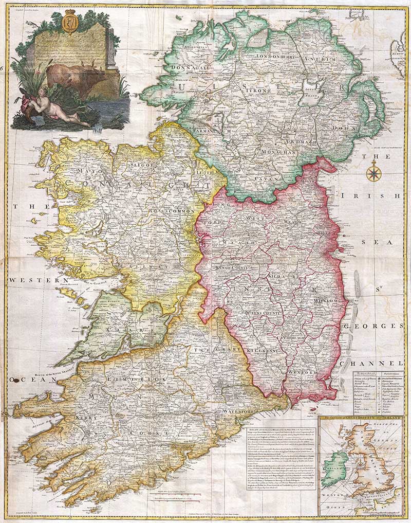
1. 1794 Rocque Map of Ireland
A stunning and important 1794 map of Ireland by Jean Rocque. It Covers Ireland in full with extraordinary detail throughout. Notes every town, hamlet, bishopric, country, forest, castle swam, and road.
The map even offers some offshore detail with regard to the shoals in Georges Channel. An inset map in the lower right quadrant shows Ireland in the context of the British Isles. An elaborate title cartouche in the upper left quadrant shows the Irish Harp over two pensive bovines and a demurely positioned unclothed maiden.

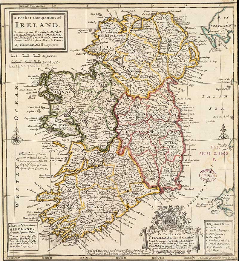
2. 1732 A pocket companion of Ireland
A pocket companion of Ireland, containing all the cities, market towns, boroughs, all ye great roads, and principal crossroads with the computed miles from town to town, by Herman Moll.

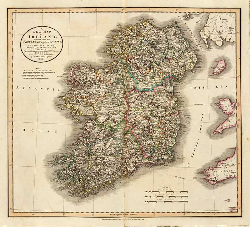
3. Cary’s Vintage Map of Ireland
This Map depicts the Emerald Isle in considerable detail with color-coding at the county and province level. Also includes parts of nearby Scotland and Wales. Figures above many of the town names denote distance along the roads from Dublin. Prepared in 1799 by John Car.y

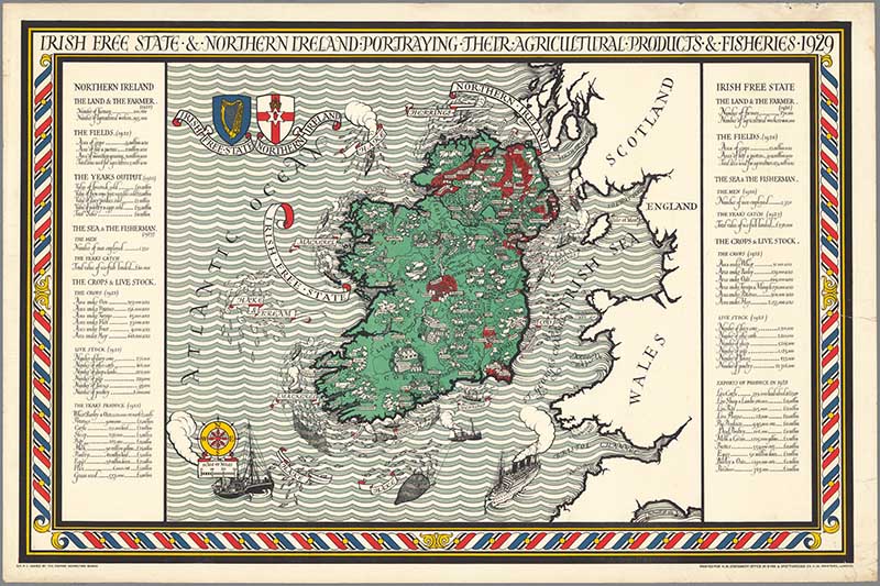
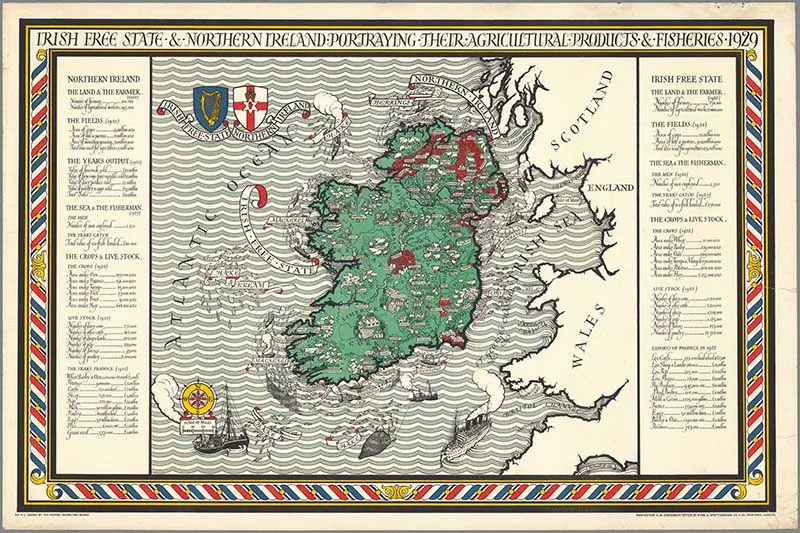
4. Irish Free State
A map of the Irish Free State & Northern Ireland Portraying Their Agricultural Products & Fisheries 1929. Published by Gill, Leslie MacDonald for the Empire Marketing Board.
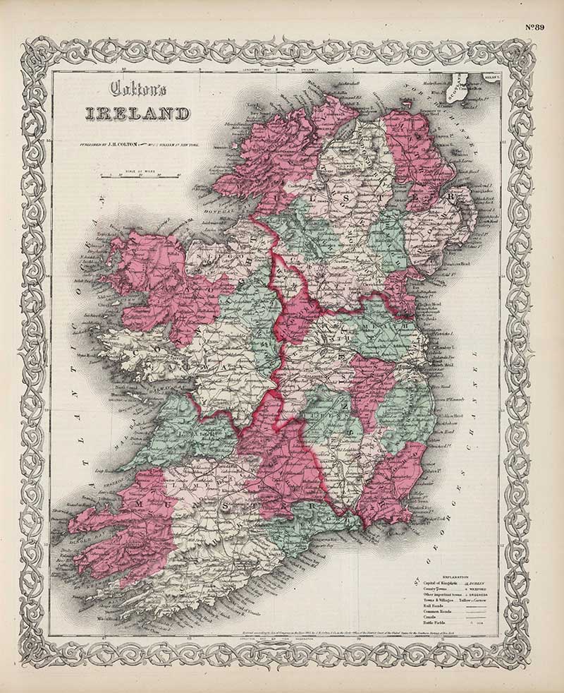
5. 1865 Colton Map of Ireland
Vintage Map of Ireland from Colton’s General Atlas.

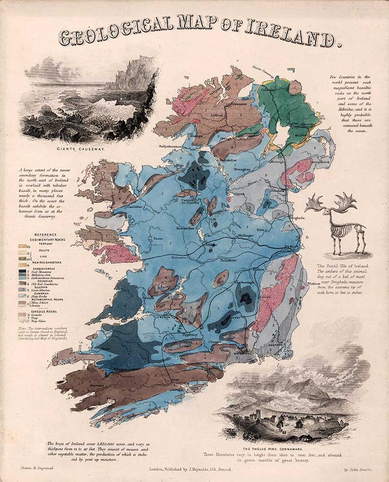
6. Geological Map
Hand color engraved map, showing areas of rock formations in Ireland. Includes color-coded reference identifying the geologic rock formation, and text (1849). Includes views of the Giant’s Causeway, (with) The Twelve Pins, Connamara. (with) Fosilelk of Ireland.

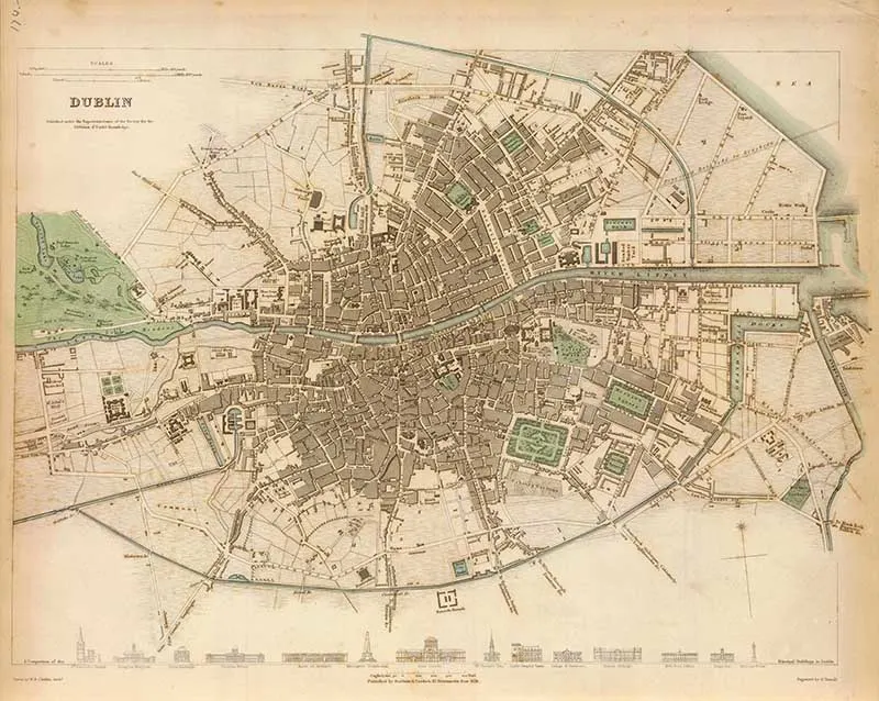
7. 1836 Map of Dublin
Engraved map of the capital city of the Republic of Ireland. A hand colored map, it Includes drawings of 14 structures “A comparison of the principal buildings in Dublin.”

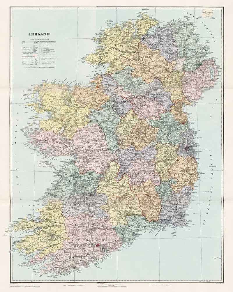
8. 1904 Stanford Map of Ireland
This vintage map of Ireland shows settlements, antiquities, parks, roads, railroads, canals, coast guard stations, lead and copper mines, lighthouses, etc.

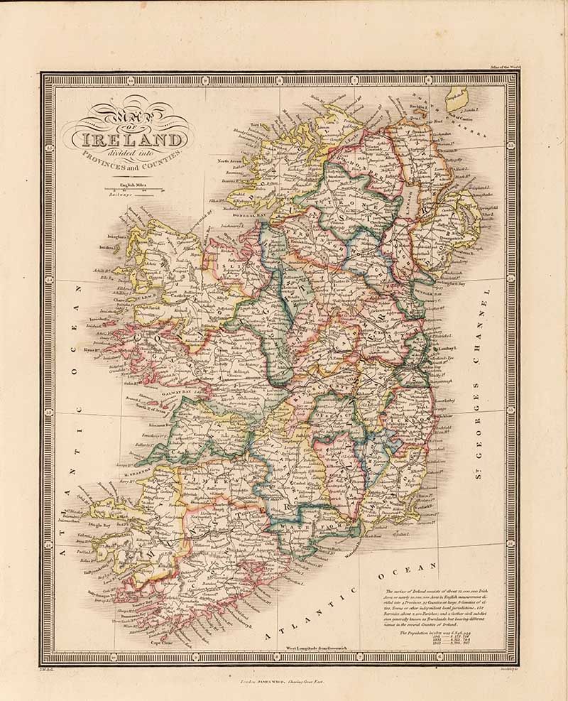
9. Map of Ireland Divided into Provinces and Counties
From the James Wyld 1864 “Atlas of the World”.

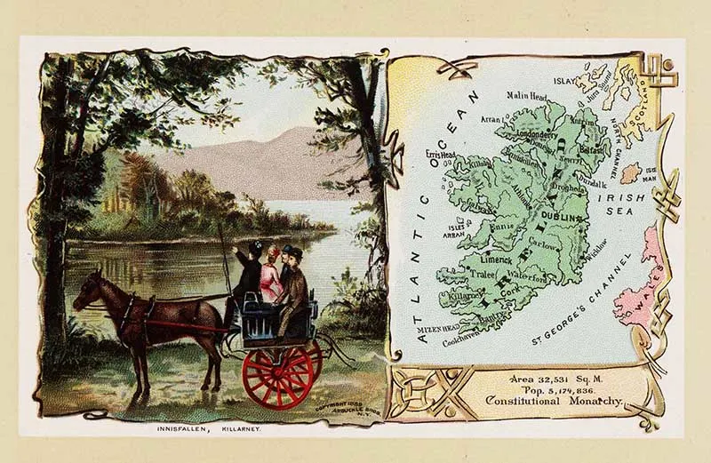
10. Pictorial Postcard Map
The constitutional monarchy of Ireland is depicted by a group of sightseers in a horse-drawn cart at Innisfallen, Killarney. From “Arbuckles’ Illustrated Atlas of Fifty Principal Nations of The World“, 1889, by Arbuckle Bros.

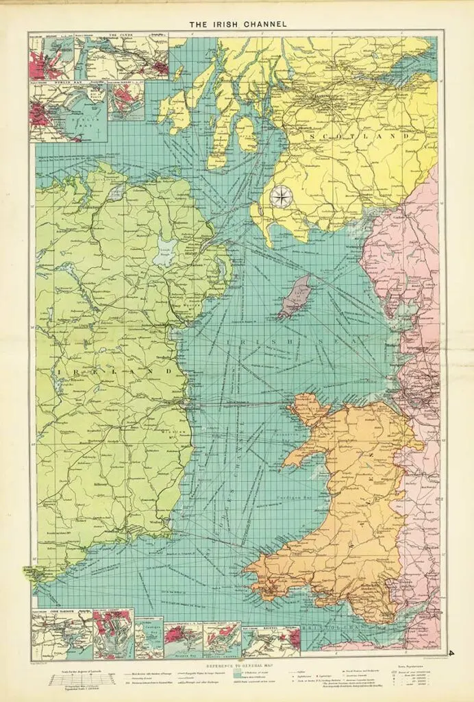
11. 1922 Map of The Irish Channel
A sea route map of the Irish Channel. Shows mail routes and duration, steamship routes, distances, navigable waters for large steamers, canals, principal railways, cables, lighthouses, lightships, docks, coaling stations, British and American consular offices, naval stations, dockyards, etc.

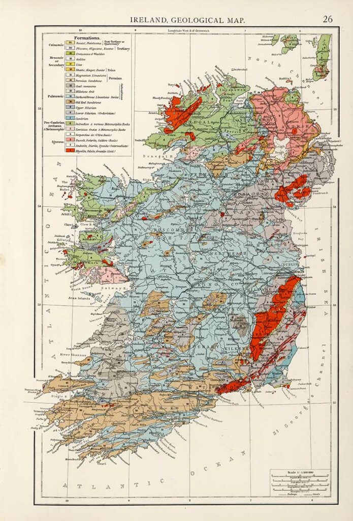
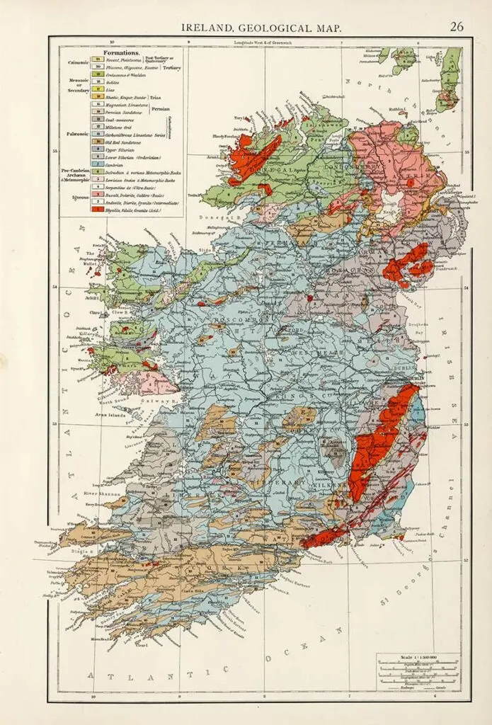
12. 1900 Geological Map of Ireland
This map is from the 1900 edition of the Times Atlas.
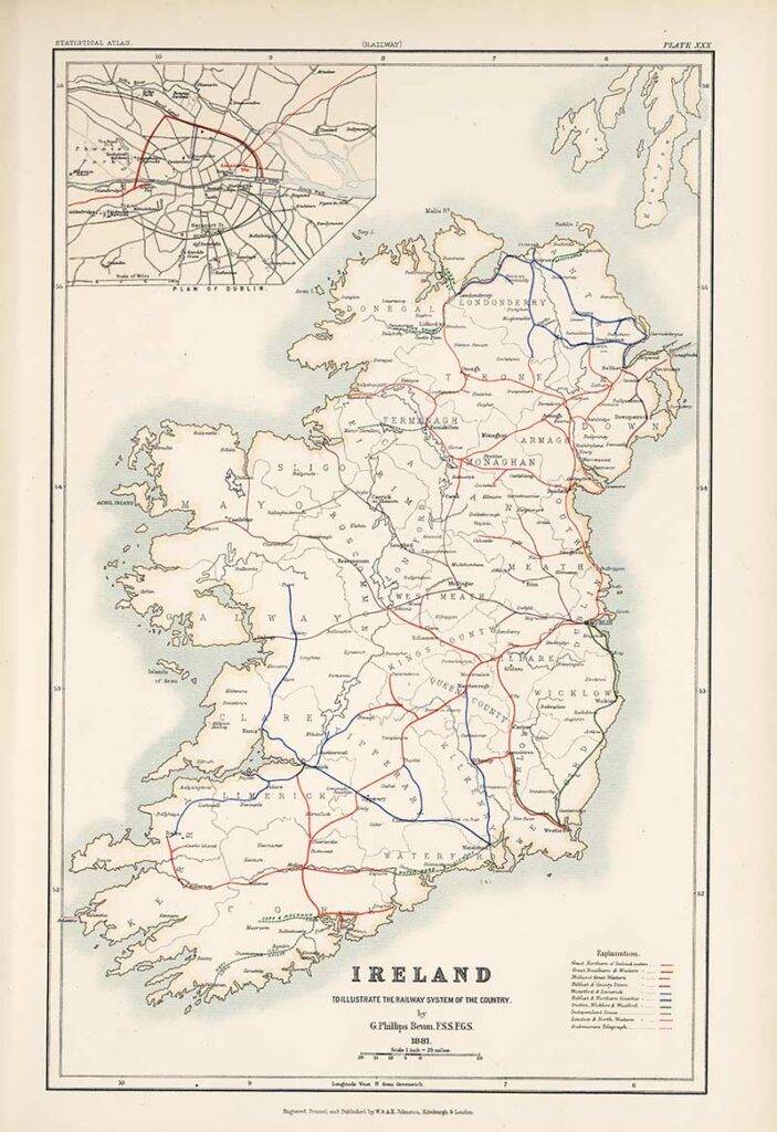
13. Railway Map Of Ireland
Ireland map to Illustrate the Railway System of the Country by G. Phillips 1881.

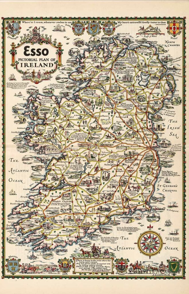
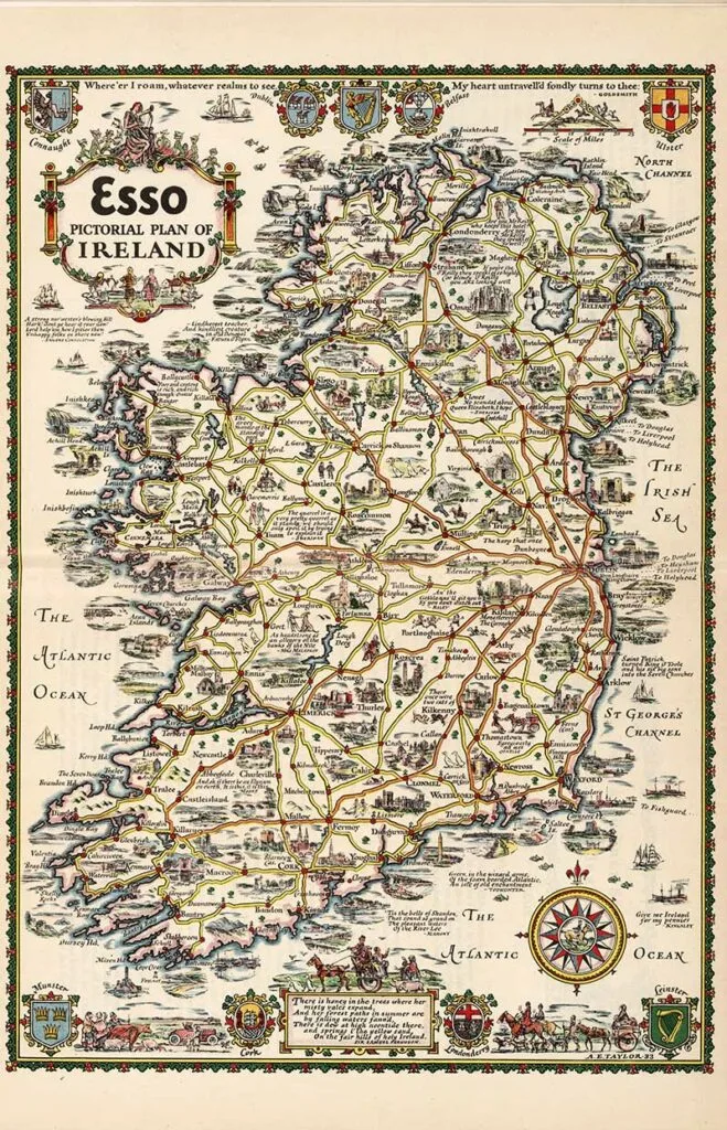
14. 1933 Esso Pictorial Plan of Ireland
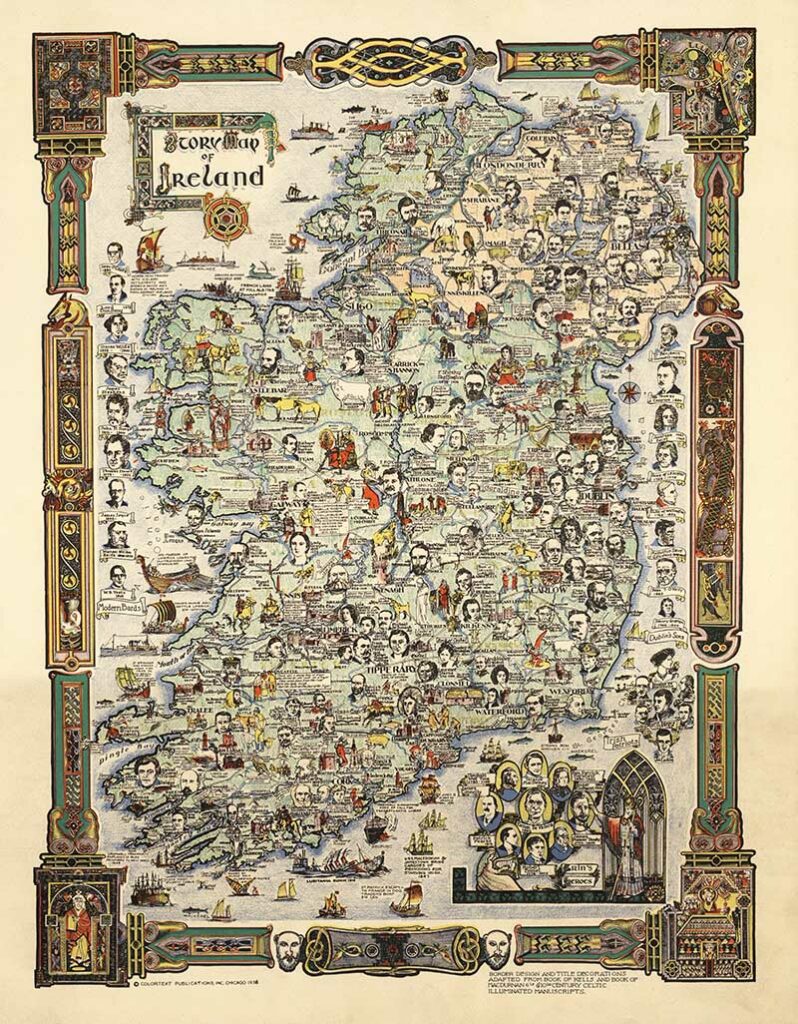
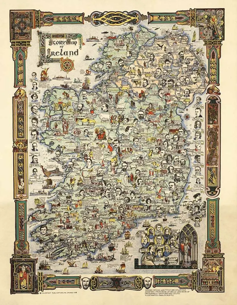
15. Story Map of Ireland
1936 Pictorial vintage maps of Ireland showing colorful map featuring portrait illustrations of historical figures and writers, buildings, literary figures, landscape features, ships and boats, animals, etc.
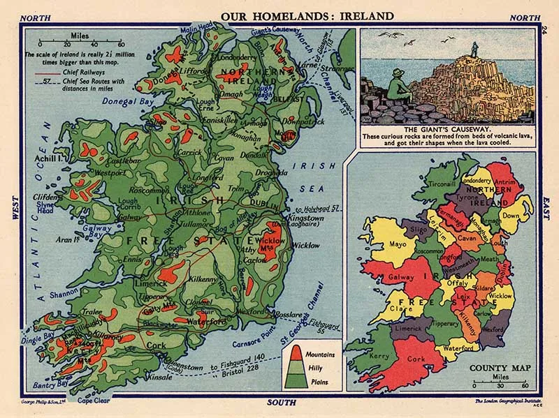
16. Our Homeland Ireland
Educational vintage map of Ireland from “Philips’ Pictorial Atlas of the World showing Where and How People Live” (1935).

I hope you enjoyed this colorful collection of vintage maps of Ireland. I think some of them would look fabulous on a vintage map pillow or just framed and hung on the wall.
There are many more vintage maps on the site of other European countries such as France and Norway. As well as some stunning antique world maps.
Rebecca Payne
Friday 11th of June 2021
Thank you so much for sharing. My family is from Kilkeeny, Ireland.
claire
Saturday 12th of June 2021
Thank you, I'm pleased you enjoyed them. Hope you have managed to visit Kilkenny or get to one day.