
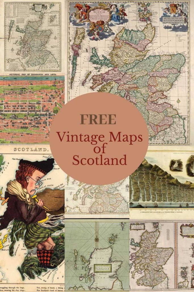
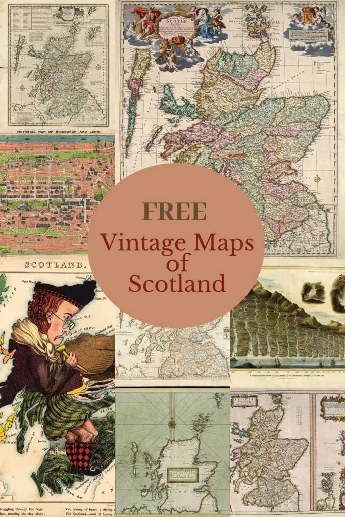
I have recently discovered the TV series Outlander, and I’m slowly working my way through all 5 seasons on Amazon Prime. The first season is set in Scotland which has given me the inspiration to compile this collection of free vintage maps of Scotland.
My mother is Scottish and as a child, we used to visit relatives regularly in Scotland. I have not been back to the country for many years. But after watching Outlander I have remembered how beautiful the country is. Hopefully, we will plan a trip there soon, especially with the current climate it easier to holiday within the British Isles than travel abroad.
Growing up we celebrated many Scottish traditions, and holidays such as Hogmanay (New Years) which was probably just as important (or more important) than Christmas for my Mother.
On Burns Night every year, we had haggis even though we were living in Hong Kong at the time and you couldn’t buy it there. My mum would make her own.
I have already compiled a wonderful collection of maps of Britain but this post focuses more closely on the vintage maps of Scotland. Interestingly some of the maps of Scotland are from the 18th Century which is the period the first series of Outlander is set.
Fun Facts About Scotland.
- Scotland’s national animal is a unicorn, which I think is pretty cool!
- Scotland has the highest proportion of redheads in the world. This becomes very apparent when you visit the country.
- Scots are most likely to have blue eyes than people in the rest of the UK.
- The Scots invented golf with St Andrews considered as the ‘home of golf’.
- Scotland has approximately 790 islands.
- There are as many people with Scots heritage living in the US as in Scotland.
- Like Rome, Edinburgh (the Scotlands capital city) was built on seven hills and has more listed (protected) buildings than anywhere in the world.
- 1707 was the Acts of Union which joined Scotland with England to form the United Kingdom of Great Britain.
The Vintage Maps of Scotland
All the following maps are in the Public Domain, which means you are free to print them and use them as you wish.
If you click the title above the map you want to download. A higher resolution image of that map will open in a new tab in your browser.
If you right-click with your mouse on that image you will have the option to save it to your device.
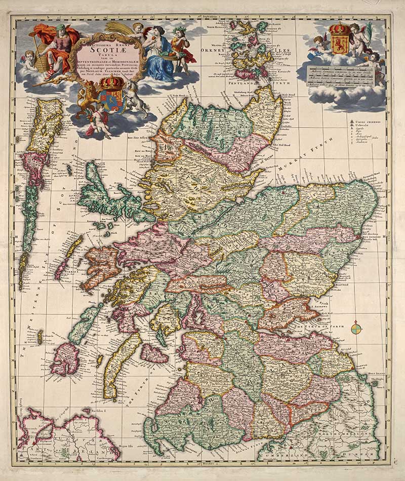
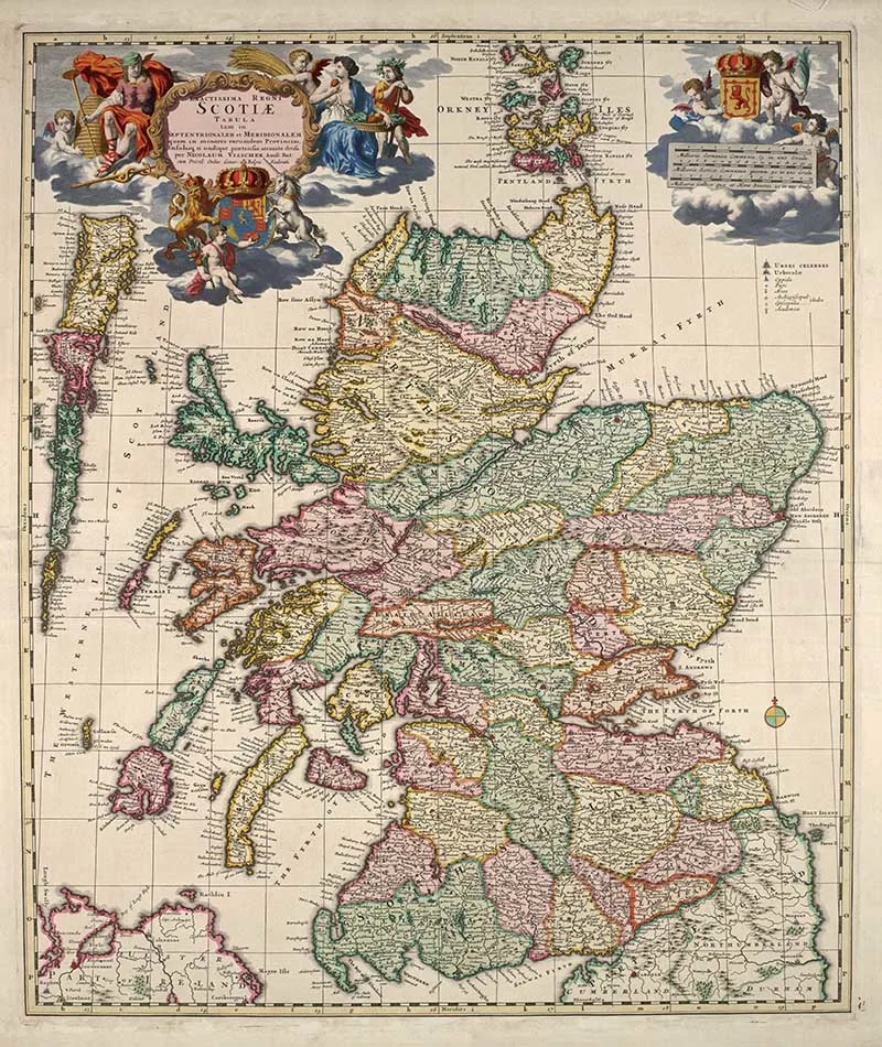
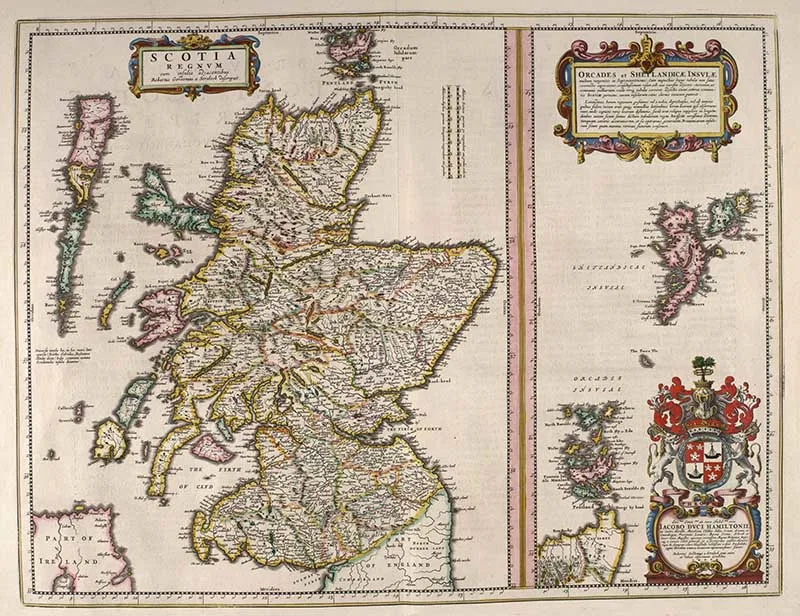
1. Vintage Map of Scotland 1689 map by Nicolaes Visscher
A beautiful colorful vintage map of Scotland by the Dutch Cartographer Nicholas Visscher II.
There are some lovely illustrations on the map showing the shield of Scotland, a unicorn the national anima. There are also several cherubs.
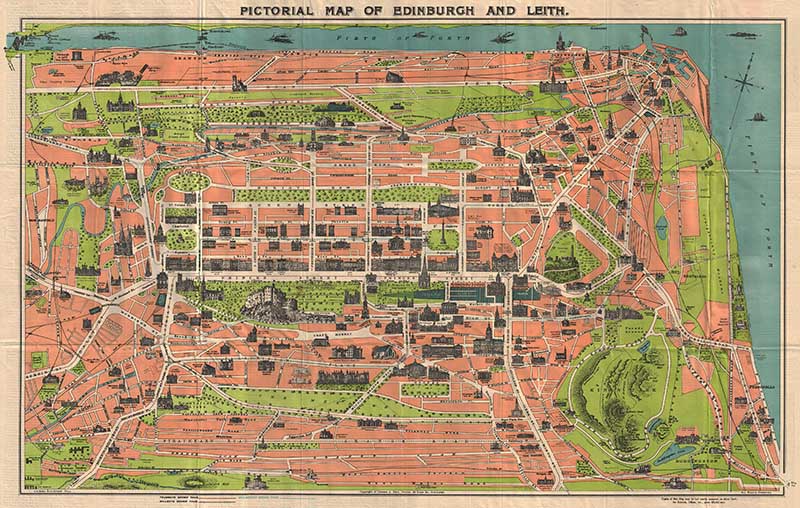
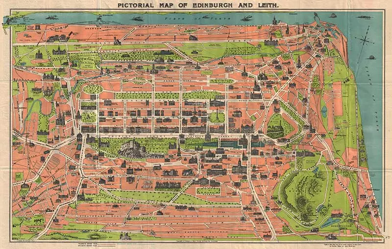
2. Pictorial Map of Edinburgh and Leith
I have included this 1935 pictorial map of the Scottish Capital as it is particularly beautiful. It reminds me of some of the lovely art deco Paris maps on Pictureboxblue.
This is an unusual art deco style plan of Edinburgh, Scotland by George A. Reid. Covers the whole of Edinburgh with important monuments and buildings represented in profile. Names various streets, parks, and business as well as railways, ferries, and trolleys.
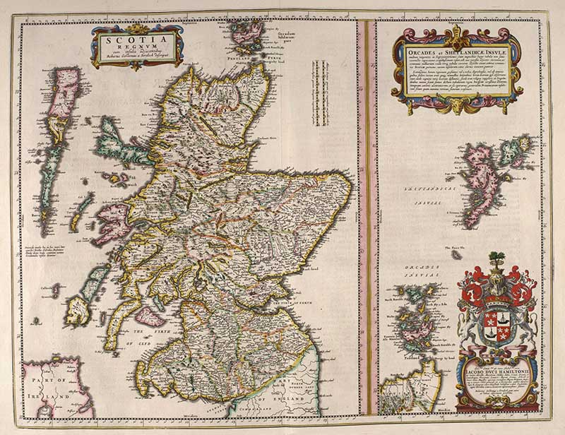
3. Blaeu – Atlas of Scotland 1654
This map of Scotland is from the Blaeu Atlas of Scotland. The first known Atlas of Scotland, compiled by Joan Blaeu, containing 49 engraved maps and 154 pages of descriptive text written in Latin and first published in 1654.
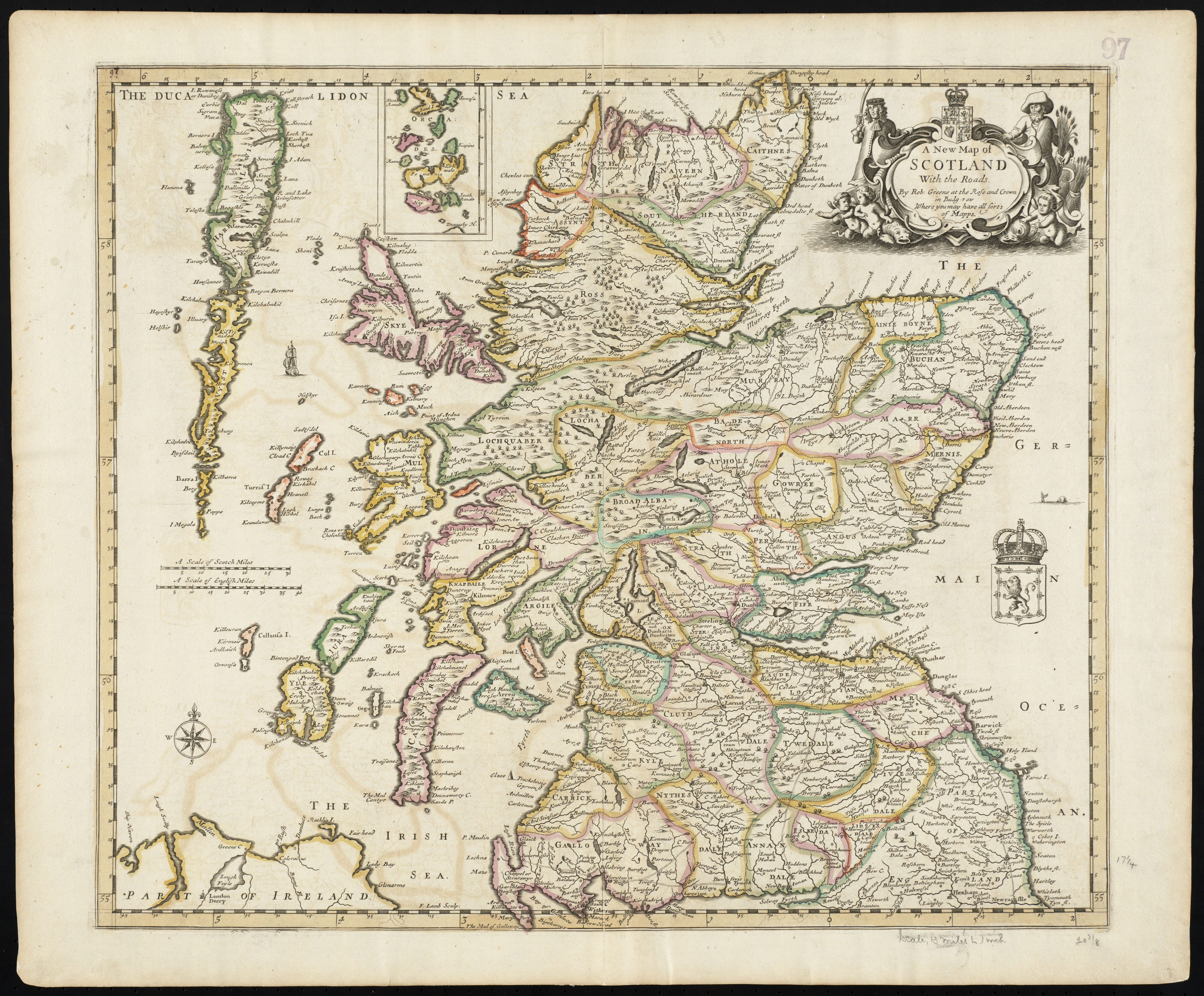
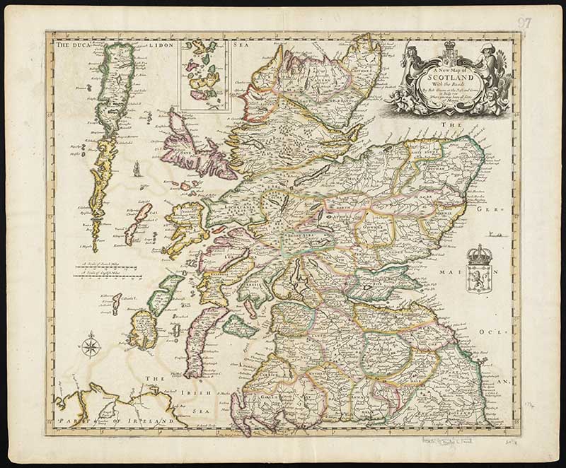
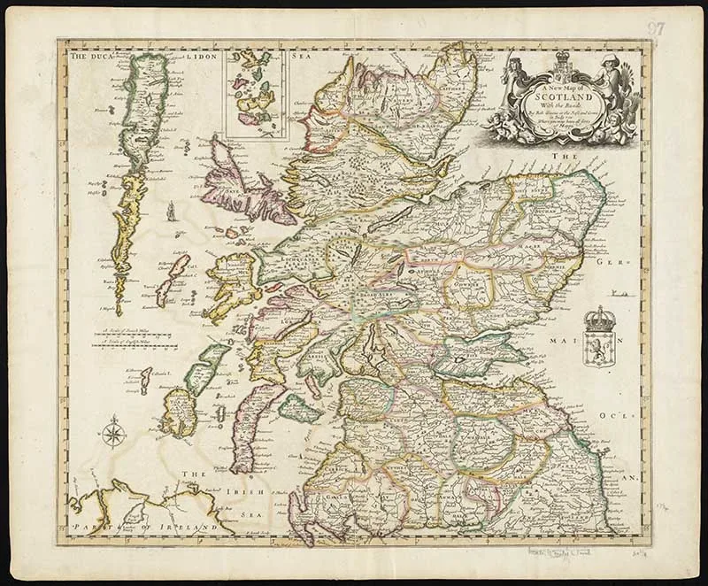
4. A New Map of Scotland with The Roads 1689
I don’t know much about this map in my collection of vintage maps of Scotland, other then what is printed on the map.
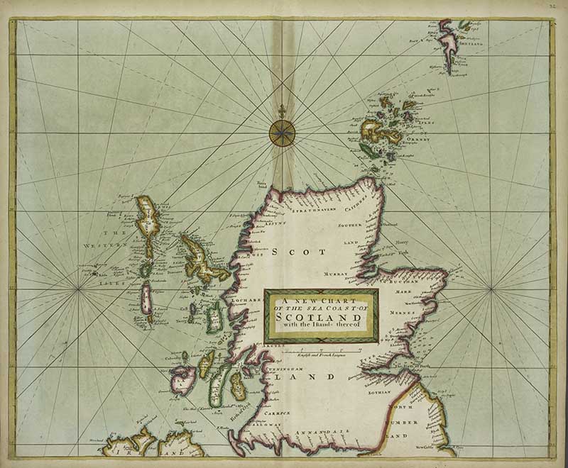
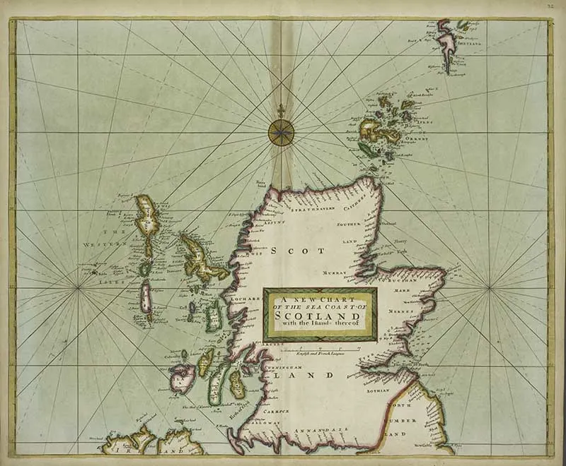
5. A Vintage Map of Scotland’s Coast
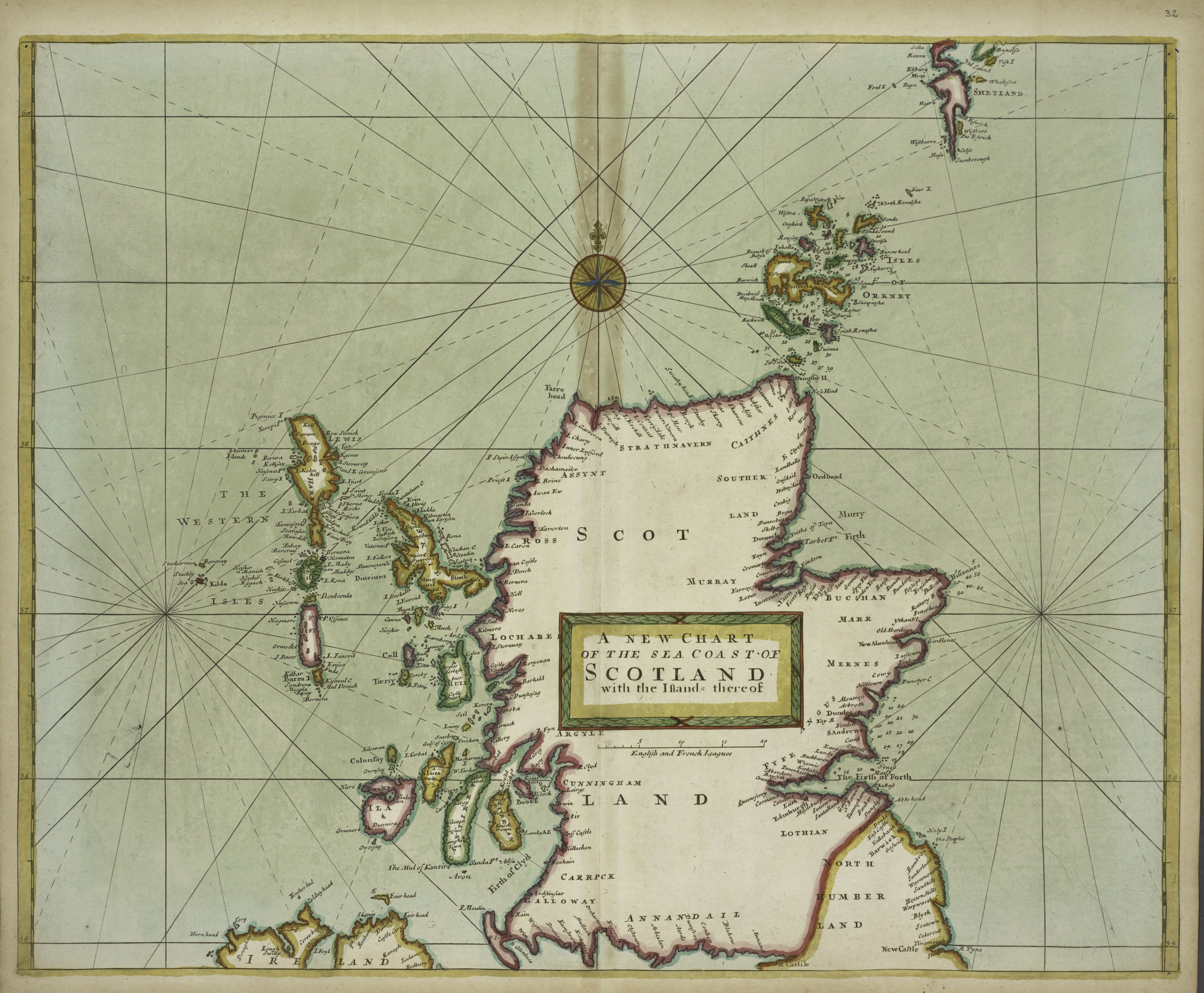
This map from 1707 is described as follows A new chart of the sea coast of Scotland with the Island thereof.
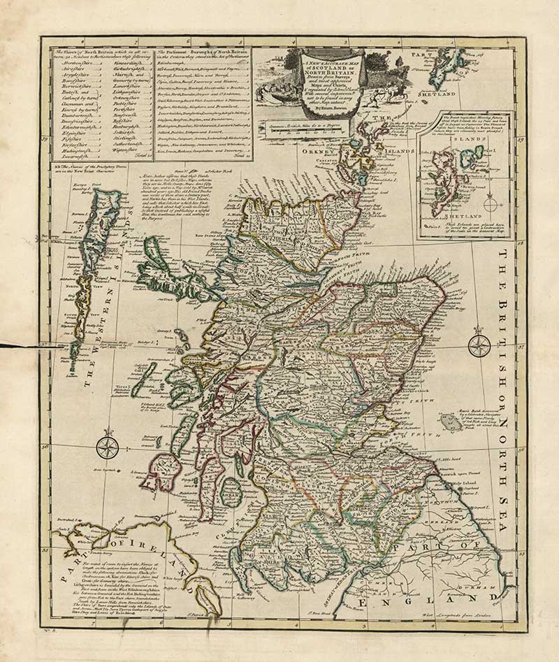
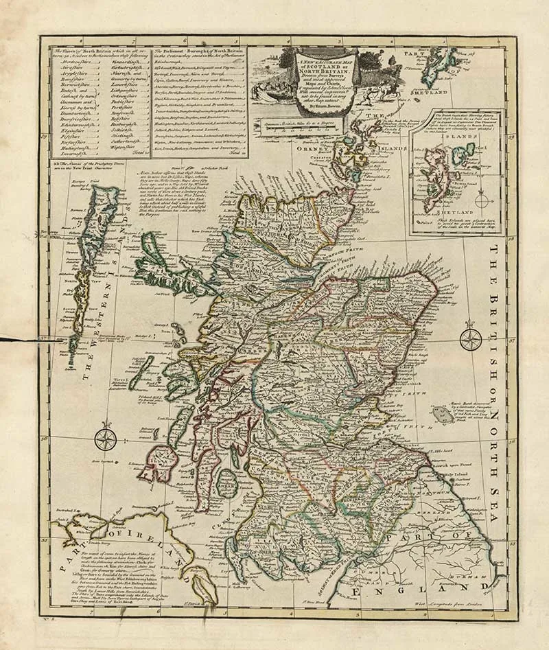
6. 1752 Map of Scotland
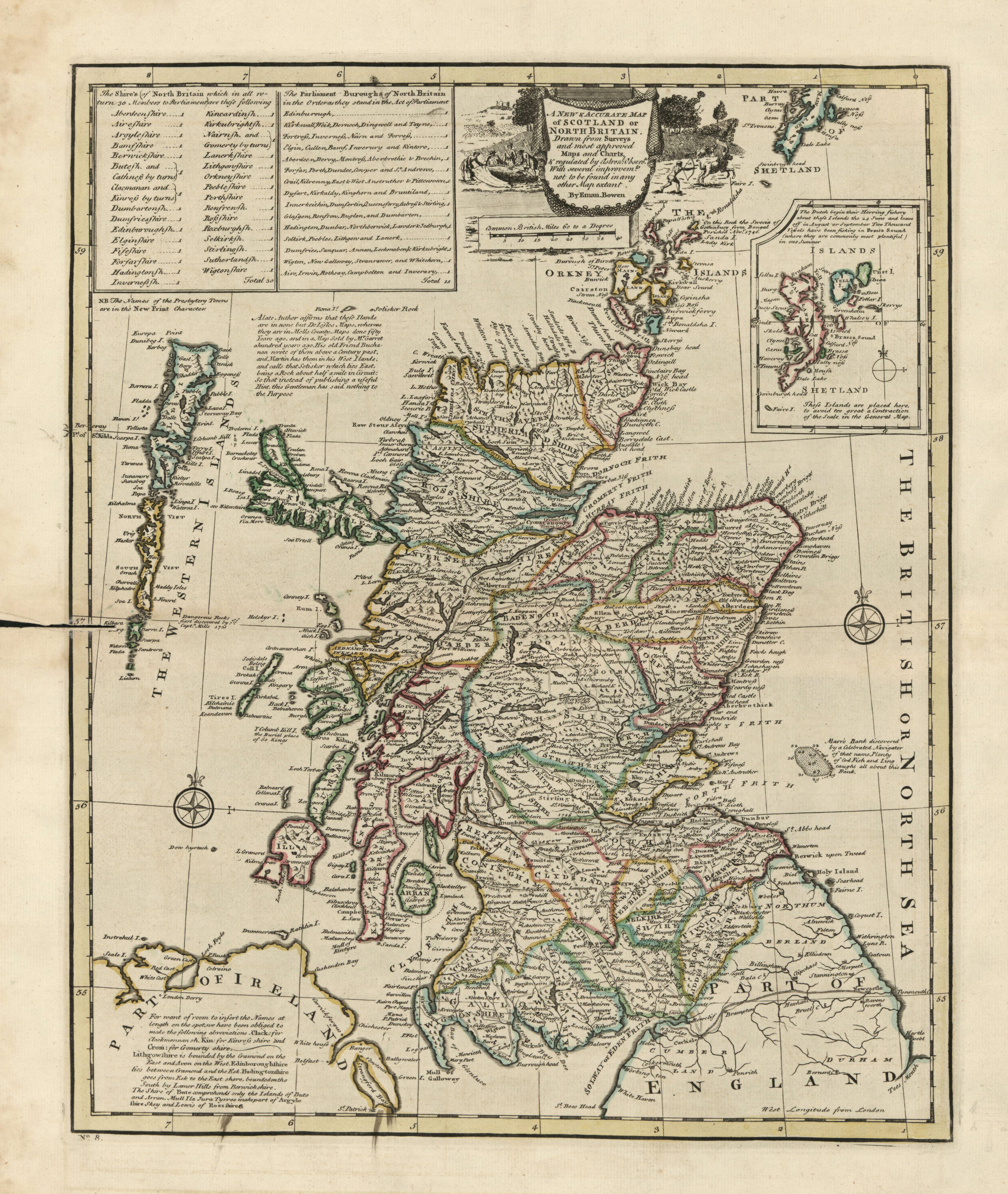
A new & accurate map of Scotland or North Britain: drawn from surveys and most approved maps and charts with several improvements not to be found in any other map extant. Relief is shown pictorially. Depths are shown by soundings in the local area. Hand-colored to emphasize shire boundaries.
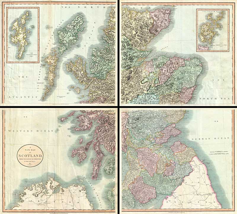
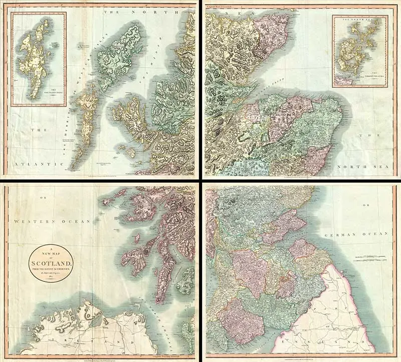
7. 1801 Cary Map of Scotland
A very attractive example of John Cary’s stupendous four sheet 1801 map of Scotland.
The map covers the entirety of Scotland as well as parts of neighboring England and Ireland. Inset maps detail the Orkney Islands and the Shetland Islands.
Overall the map offers extraordinary detail on the whole of Scotland with special attention to topography, historical notations, and roadways.
One of the largest and most highly detailed maps of Scotland to appear in the first years of the 19th century.
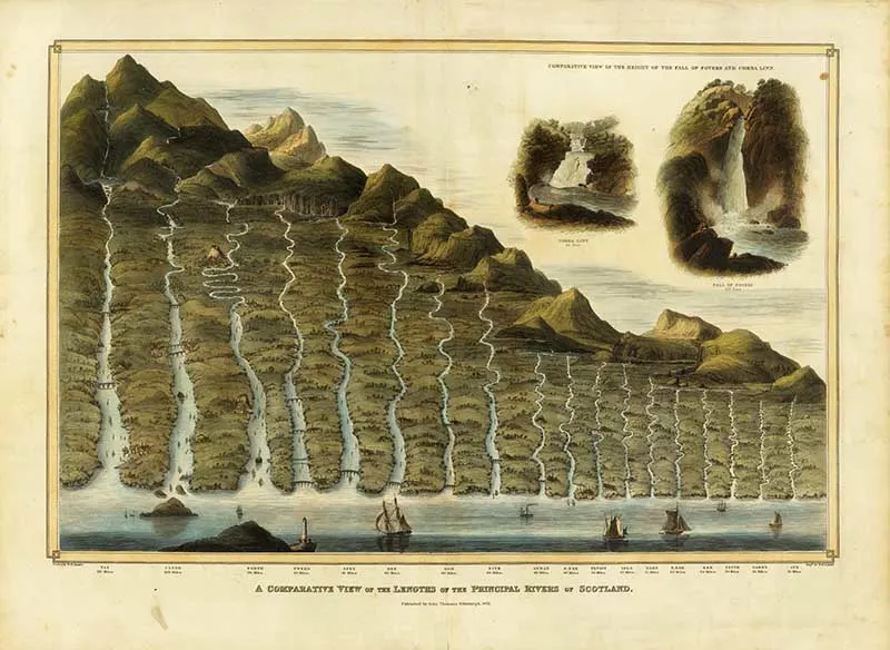
8. Comparative View of the Lengths of the Principal Rivers of Scotland
Comparison chart of the principal rivers of Scotland; published in the Atlas of Scotland, published by John Thomson, Edinburgh, 1822. This lovely river chart/map is very similar to the illustrated mountain charts/maps on Pictureboxblue.
This beautifully illustrated chart also shows the 2 major waterfalls in Scotland. From looking at the river map, the River Tay is identified as the longest river in Scotland.

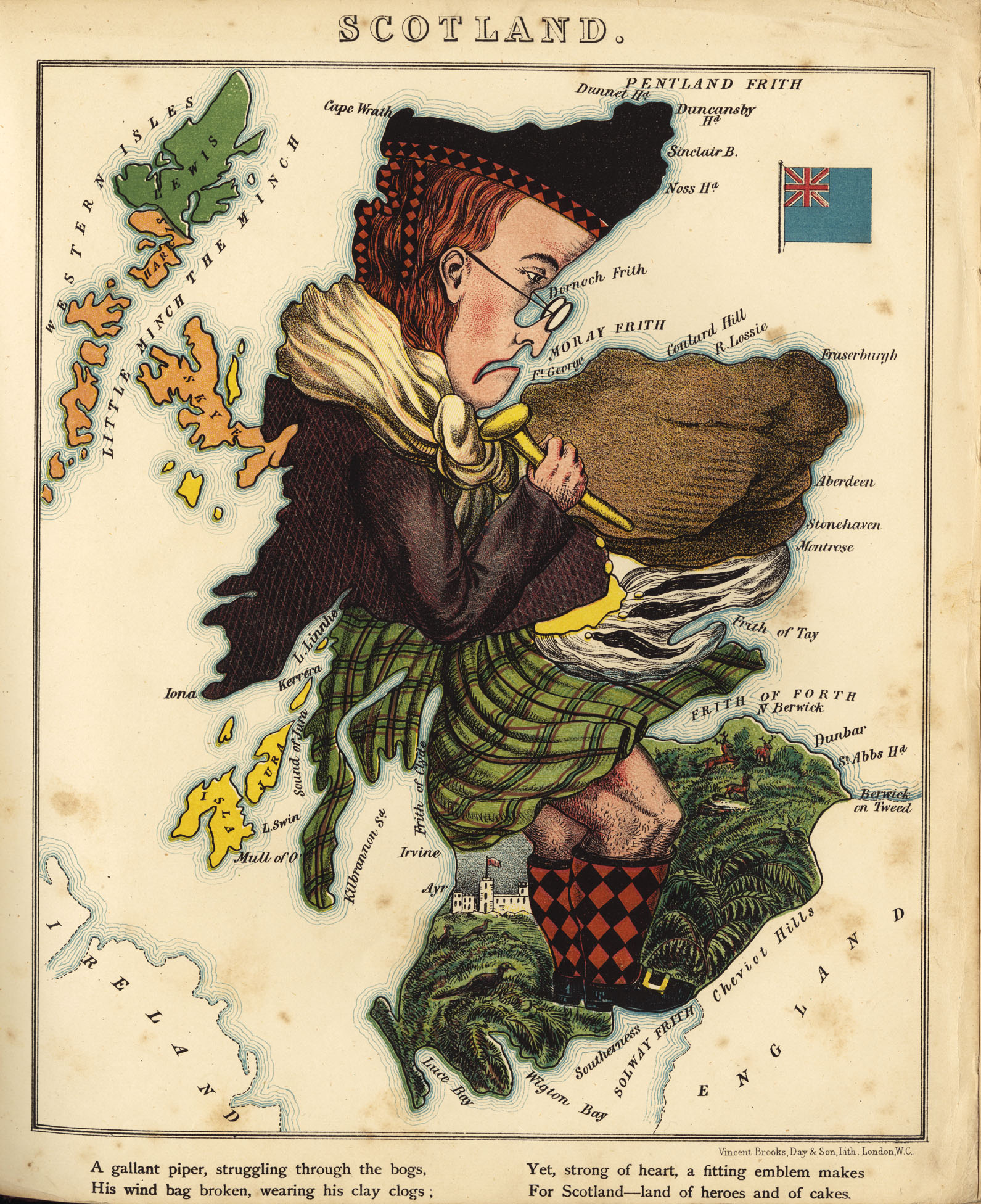
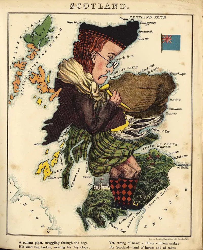
9. Cartoon Map 1868
This map of Scotland is shown illustrated as a caricature of a Scotsman.

There is a travel poster for Scotland in this vintage airline poster collection.
Also if you want to explore Scottish heritage more, check out these tartan craft ideas.
Hope you enjoyed these maps of Scotland don’t forget to check out my other country specific maps like the maps of Ireland and maps of Europe.
Julie A. Gunderson
Monday 12th of December 2022
Claire, Thank you for sharing these wonderful maps of Scotland! Like you, I fell in love with Outlander towards the beginning of the series and can't get enough of reading the books by Diana Gabaldon. The books are definitely the best, but I do love watching the actors portray the characters on screen. Brings them alive. It is my hope and dream to be able to visit Scotland someday. Maybe find where my own ancestors lived at one time. Find out if there are still family members there I'm not aware of. It's too much to hope for at this point, but I'm keeping my fingers crossed. Isn't it amazing the number of islands surrounding Scotland?! Some that are even inhabited!! I LOVE reading about it when I can get reliable information. If you haven't read his new book yet, Sam Hueghan has written a new book about growing up Scottish. In fact, he and Graham McTavish both have released two books recently about Scotland. Very informative.
claire
Tuesday 13th of December 2022
Thank you so much; it's nice to hear you enjoyed them. I will check out the new Same Hueghan book; thanks for the recommendation.
Naush Samama
Monday 12th of October 2020
Claire, Thank you so much for sharing information about Scotland ! 790 Islands ! Wow ! The vintage maps are fascinating. Its amazing how they must have devised ways to draw maps when they did not have any aerial system to capture land, mountains, rivers etc Thank you for sharing it with us at Meraki Link Party. Naush
claire
Tuesday 13th of October 2020
Thank you, yes it amazes me how they managed to draw maps without today's technological advantages.
Anita Holland
Tuesday 6th of October 2020
Thanks for sharing you maps, I loved the cartoon one. Pinned
claire
Wednesday 7th of October 2020
Thank you, that is a fun map.
Rachael
Friday 2nd of October 2020
I love these so much! I was born in Scotland, but moved away at 9 months old so I have no memories of it. We were fortunate enough to visit a few times when I got older, but I always had this draw to it! These maps are so beautiful and I'd love to frame one to put up in my house. Thank you for sharing!
claire
Monday 5th of October 2020
Thank you, glad you enjoyed them. I too have a draw to Scotland and hope to visit again soon. It is a beautiful country.
NATALIE SKILLER
Thursday 1st of October 2020
I want to thank you for collating creative commons into categories. I printed out some from the collection of flamingos at my local officeworks and got some cheap frames from a Charlie cheap shop. The prints look amazing. The staff member who printed my A3 colour prints asked where I found such beautiful images and I showed her your site on my phone.
Now in white A3 frames and some trimmed for square frames they look like $100 prints from Ikea or Freedom Furniture.
They are the highlight of my 10 year old's new bedroom. They really look sublime. Thank you for making it easy to find what I needed.
claire
Thursday 1st of October 2020
Thank you that is awesome to hear. There are so many lovely prints out there that are free and I just want to share them with people. I bet they look fabulous in your son's room. My 11year old nephew printed out some of the parrots and framed them for his room. Maybe they are both budding ornithologists!