
Love vintage illustrations and printable wall art? In this post, I’ve curated a collection of beautiful vintage mountain sketches and mountain diagrams. All are free to download and are in the public domain. These high-resolution scientific charts and historic landscape prints showcase mountain ranges, elevations, and classic geographical studies, making them perfect for framing, classroom resources, gallery walls, or creative projects.
Inspired by an upcoming trip to Switzerland and a long-standing love of mountainous landscapes, I gathered these antique mountain illustrations to share their timeless appeal. From detailed comparative diagrams to elegant sketch-style drawings, each print offers a fascinating glimpse into how mountains were studied and illustrated in the past.
I also love decorating my home with vintage scientific artwork, and these mountain prints are ideal for adding character to hallways, offices, or living spaces. Whether you’re a teacher, nature lover, designer, or simply enjoy unique wall art, this collection of printable mountain diagrams is a lovely way to bring classic natural history into your home.
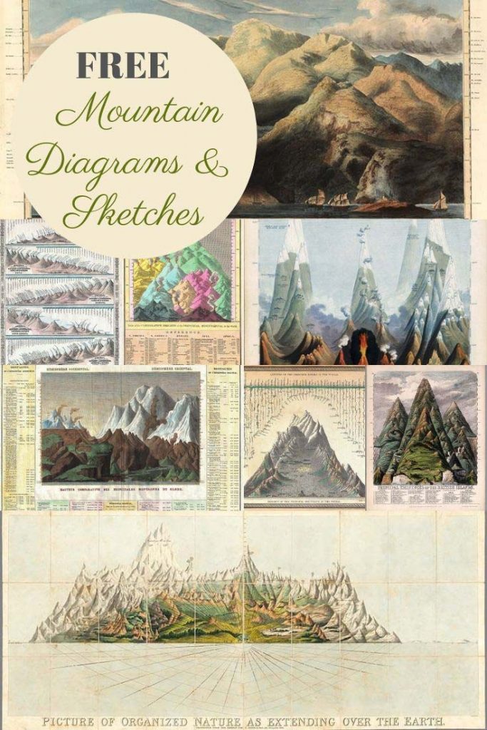

The Free Vintage Mountain Diagrams
To download the vintage mountain diagram or art you want, click on the title above that image. A higher resolution mountain picture will open in a new window, you can then print or save that image.
1. Comparative Chart of the World’s Mountains and Rivers -1850
An excellent map of the principal mountains and rivers of the world. The hills are at the bottom of the map, with important cities and geological formations noted at their appropriate elevation.
This mountain diagram also has the bonus of showing the world’s major rivers. The rivers are shown along the top of the mountain, descending from the seas to their sources – where known.
The Missouri and Mississippi River systems, at 4100 miles, are listed as the world’s greatest rivers and Dhaulagiri, at 26262 ft., is the world’s tallest mountain. The mythical Mountains of the Moon are noted as the source of the Nile.
This map diagram is by the American geographer Samuel Augustus Mitchell from the 1850 edition of Mitchell’s New Universal Atlas.
If you are looking for some amazing river maps check out the colorful Mississippi River Maps of Harold Fisk.
1. Comparative Chart of the World’s Mountains and Rivers -1850
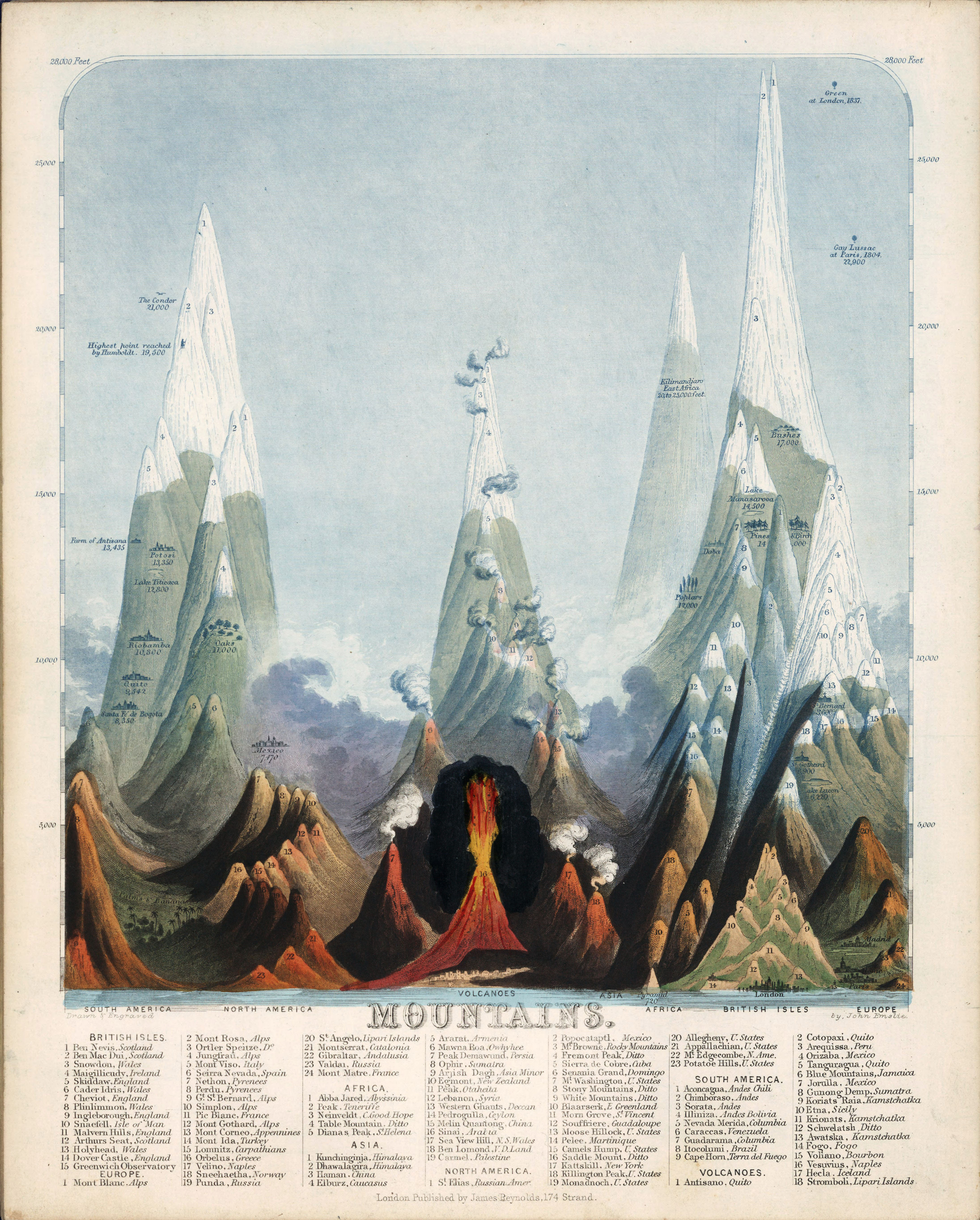
2. 1851 Sketch of The Mountains of The World
A beautiful sketch of the world’s major mountains. The mountain diagram has an excellent key, labelling the significant mountains. The legend includes the main peaks of the British Isles and each continent. The major volcanoes of the world are also on the mountain diagram.
The mountains are drawn to scale, which is what I love about this mountain sketch. This makes it so easy to compare the heights of the significant mountains by just looking at the diagram.
Also, a wealth of information is contained within this illustration. Wonderfully detailed drawings of some of the world’s major cities and landmarks showing their elevation above sea level are included. The mountain diagram also indicates the maximum height for various tree species.
James Reynolds and John Emslie drew this mountain sketch for the book “Mountains” published in 1851.
2. 1851 Sketch of The Mountains of The World

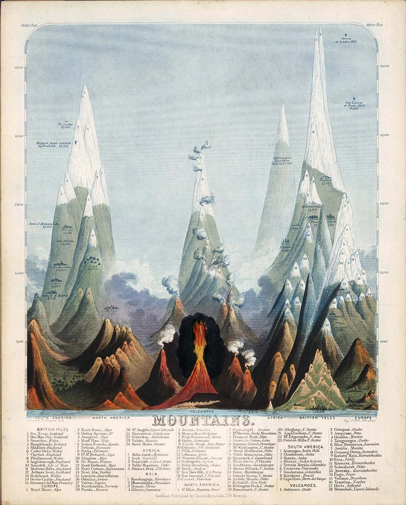
3. Scotland Mountains Sketch 1831
This mountain diagram shows the significant mountains of Scotland. My mother’s side of the family is Scottish, and they would love this beautiful mountain painting.
My husband and sons all went on a trip a few years ago to climb Ben Nevis. Ben Nevis is the highest mountain in the British Isles. It is 1,345 meters high and in the Scottish Grampian Mountains.
The mountain painting is by D. McKenzie & W.H. Lizars from the book “A Comparative View of the Heights of the Principal Mountains of Scotland” in 1831.
3. Scotland Mountains Sketch 1831

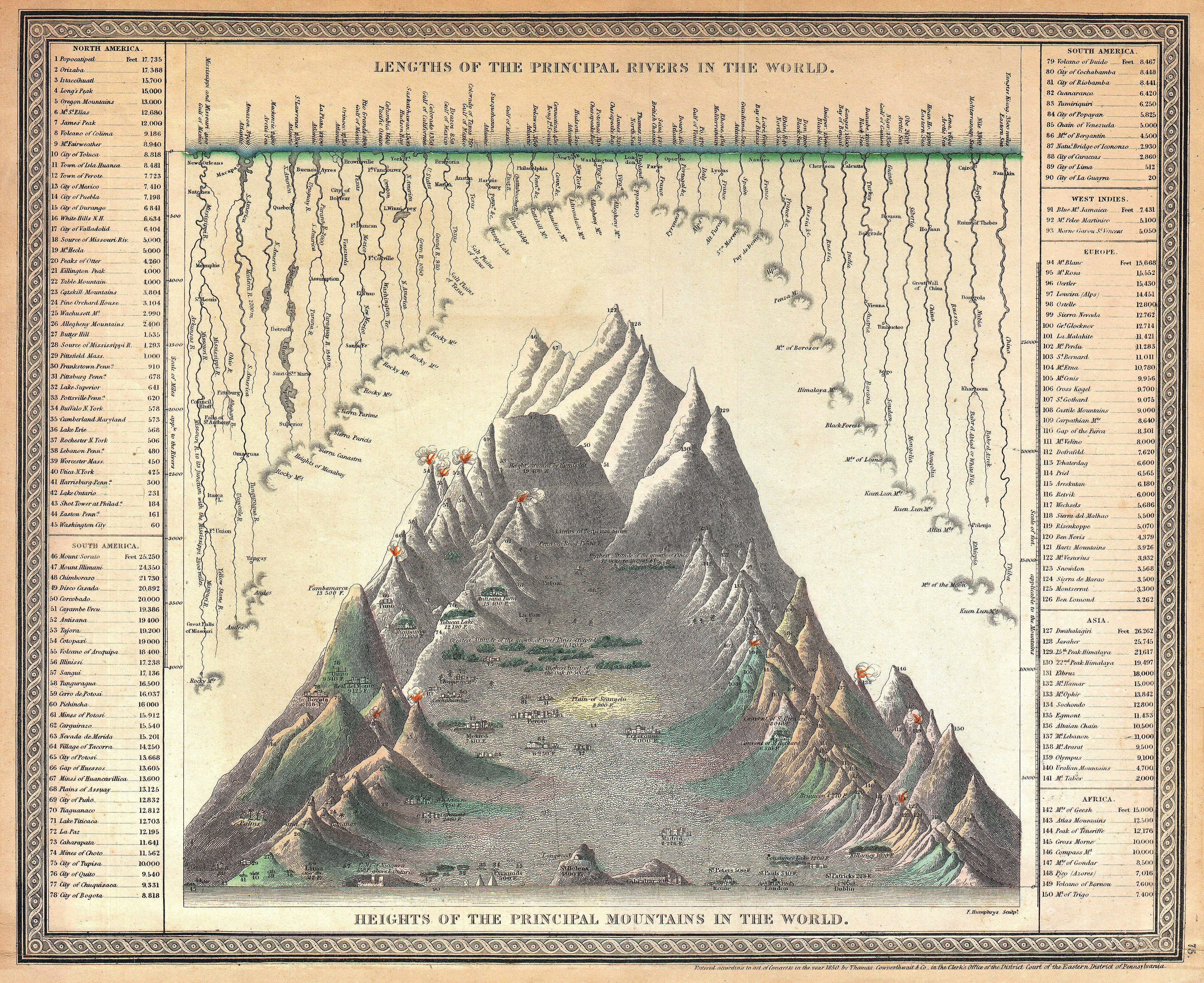
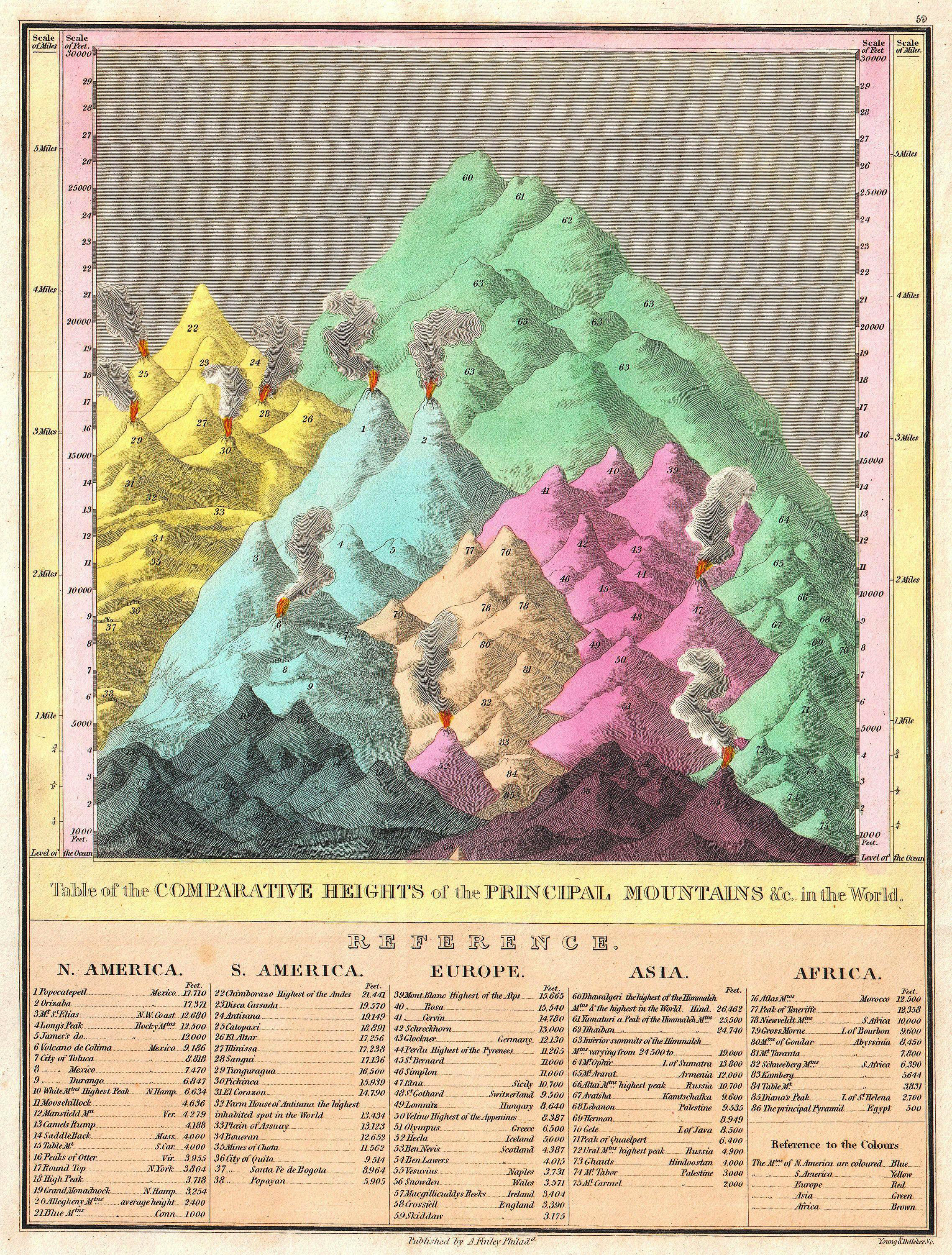
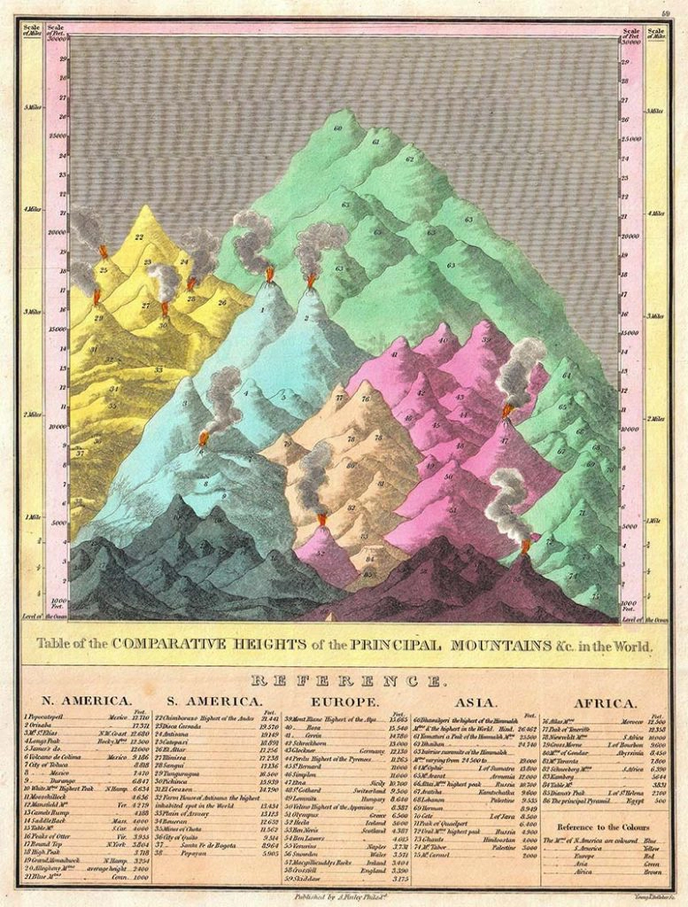
4. Principle Mountains of The World – 1826
This mountain diagram details the world’s great mountains in relative proximity to one another and divided by continent.
Each mountain is numbered and links to a reference list below the chart proper, naming each mountain and its elevation. The key also notes important cities, mines, volcanoes and geographical locations, including the Great Pyramid.
The highest mountain in North America is Mexico’s Popocatepetl; in South America, it is Chimborazo; in Europe, Mont Blanc; in Asia, Dhaulagiri; and in Africa, the Atlas Mountains of Morocco.
As this mountain map is from 1826, it is before the discovery of Everest, Kilimanjaro, Mt. Kenya, and Mt. McKinley (Denali), hence their omission. The colourful mountain sketch is from the 1826 edition of Finley’s New General Atlas.
4. Principle Mountains of The World – 1826

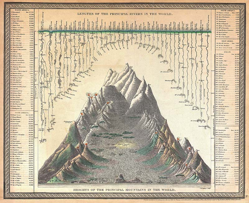
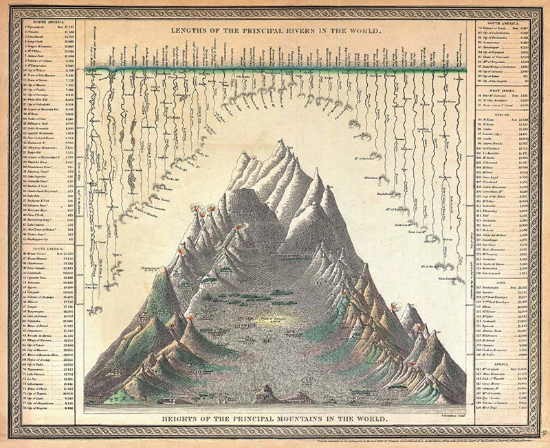
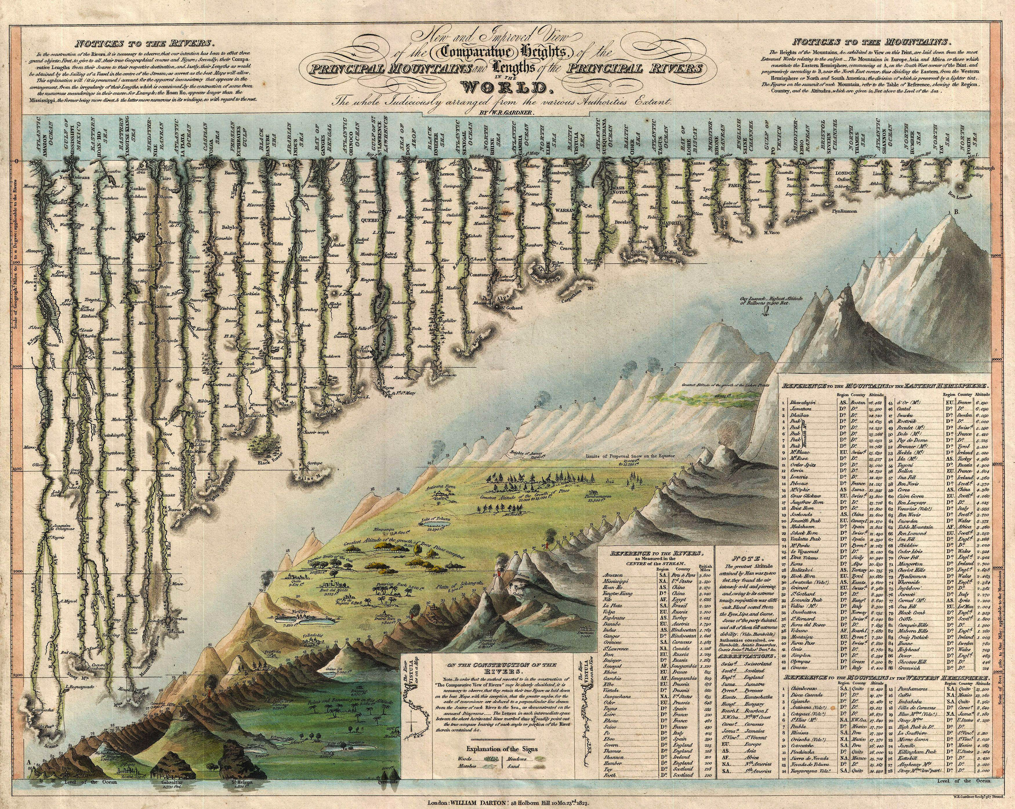
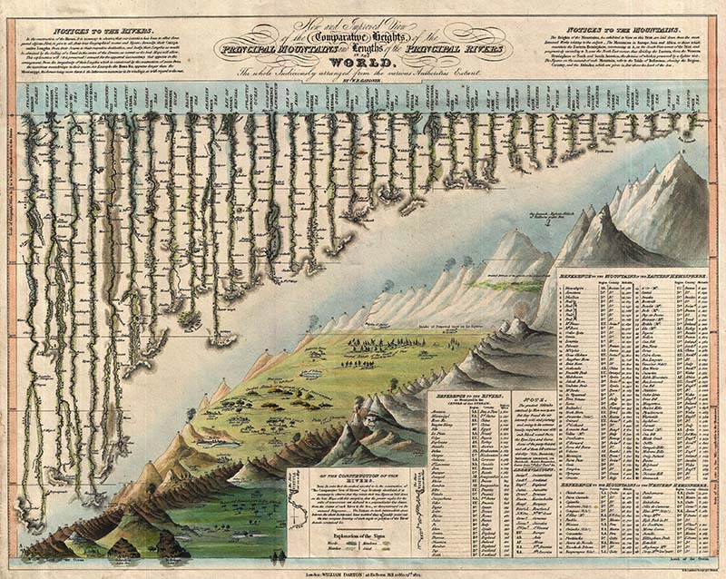
5. 1823 Map of World Mountains & Rivers
Another comparative mountain diagram shows the world’s greatest rivers as of 1823. This comparative chart is supposedly the first example to depict mountains and rivers on the same diagram.
It is by William Darton and W. R. Gardner’s 1823 “New and Improved View of the Comparative Heights, of the Principal Mountains and Lengths of the Principal Rivers in the World“.
The mountains sketch occupies the lower right half of this chart. The details of the principal mountains of the world are noted. The Himalayan peak Dhaulagiri is identified as the world’s greatest mountain.
The world’s mountain ranges are colour coded on the chart to show different vegetation types. The elevations of several important cities, including Paris, Rome, London, Geneva, Mexico, Bogota, and Quito, among others, are also noted.
In the upper-left portion of this chart, the lengths of the rivers are given along with their course and sources. Further details along each river, such as essential lakes, cities, directions, and distance measurements, are noted.
At 3600 miles long, the Amazon is identified as the world’s greatest river, followed by the Mississippi at 3530 miles. As its full length had yet to be explored, the Nile came fifth on the list.
5. 1823 Map of World Mountains & Rivers

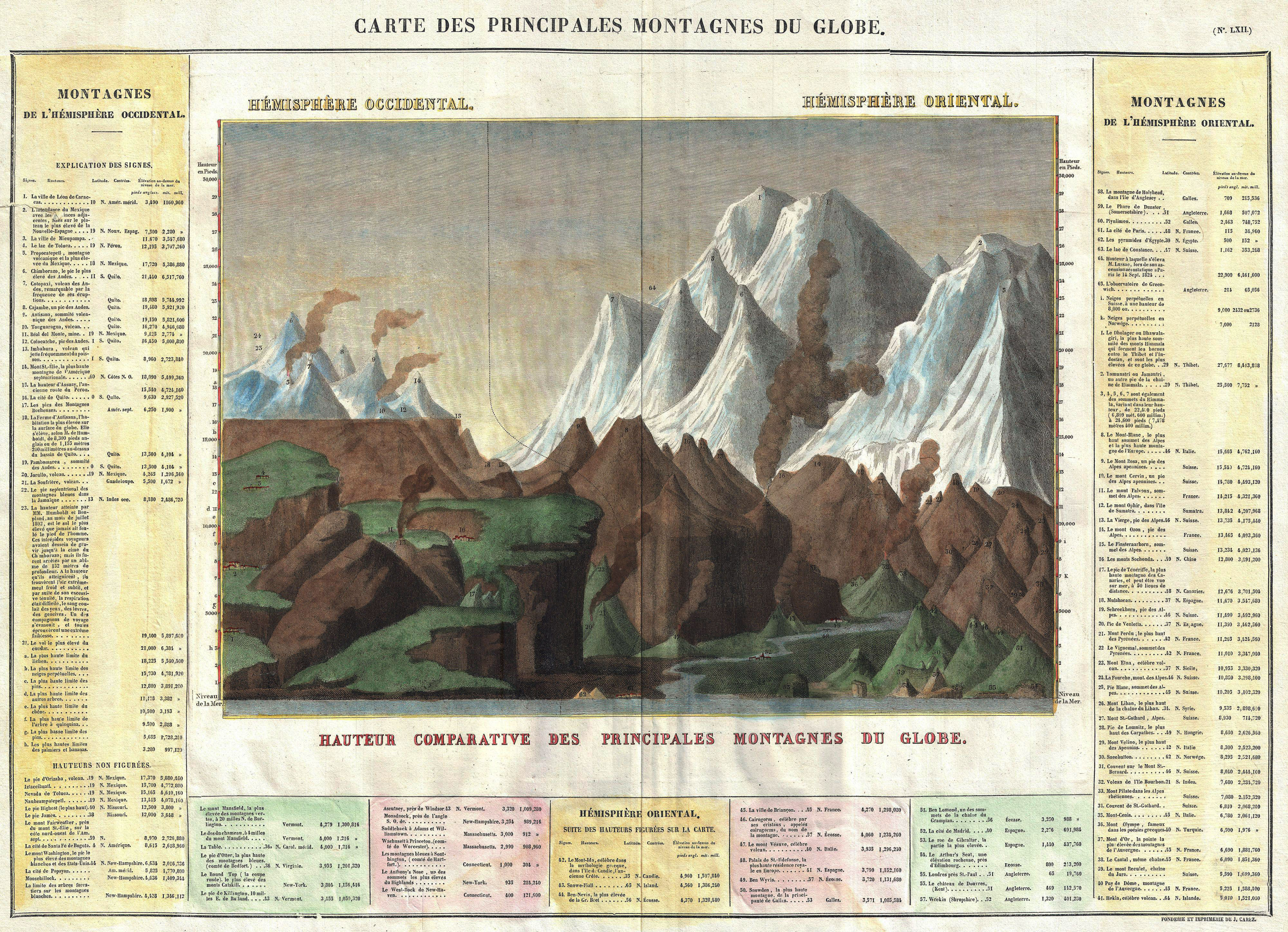
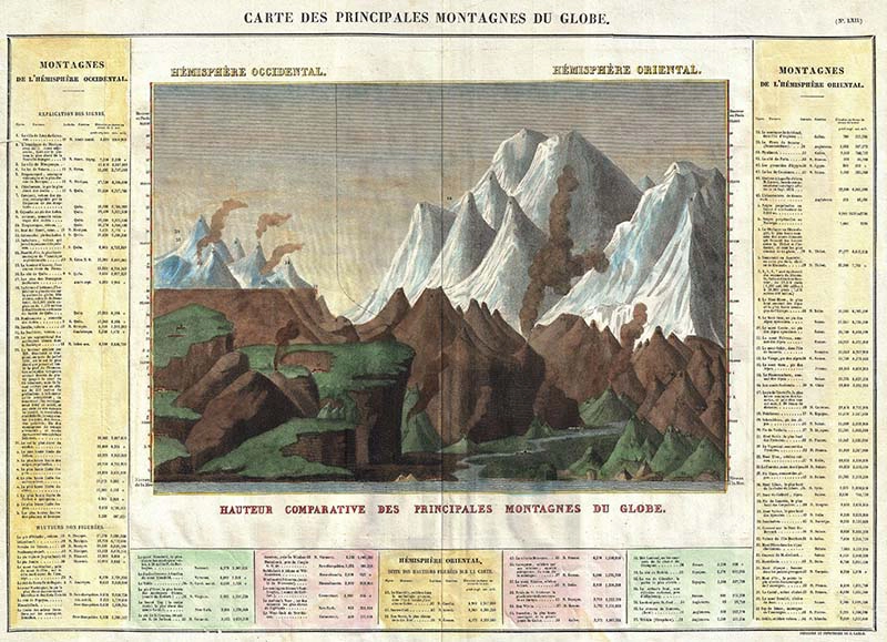
6. 1825 French Mountains of The World Diagram
This is an 1825 map “Carte des Principales Montagnes du Globe“.
On this chart, the mountains are divided into the Western Hemisphere mountains ( on the left ) and the mountains of the Eastern Hemisphere ( on the right ).
It also includes the relative elevations of essential cities, monuments, etc. Unlike most comparative charts issued in the mid-19th century, this chart consists of a reference table as part of the map.
6. 1825 French Mountains of The World Diagram

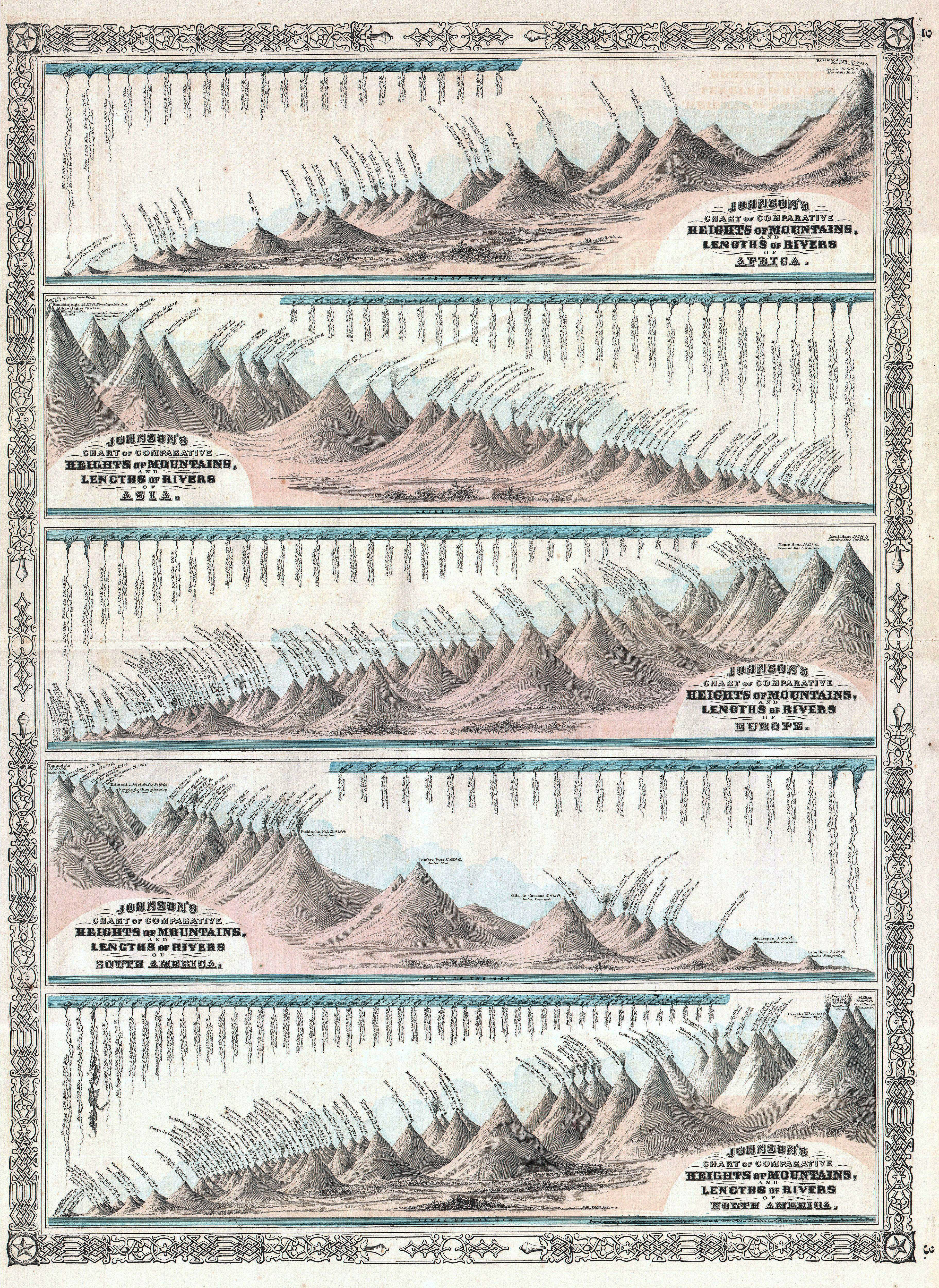
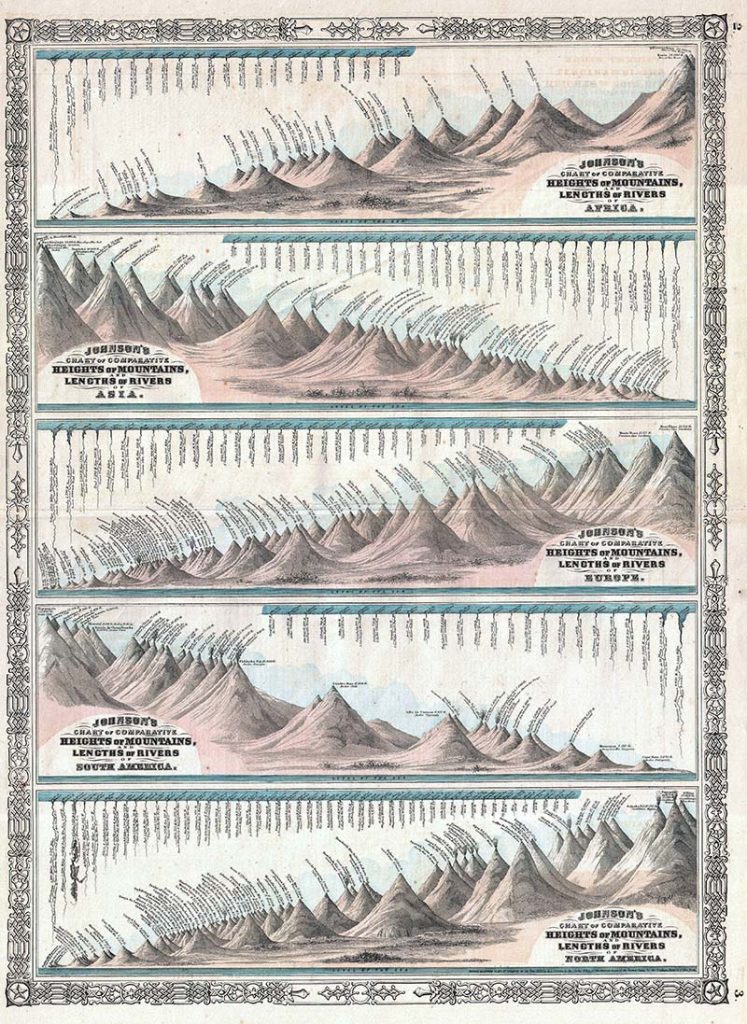
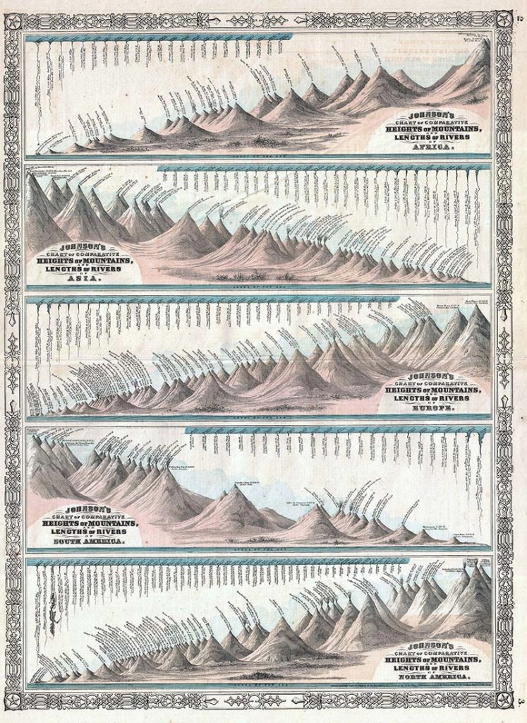
7. 1864 Mountain Sketches By Continent
This is the 1864 edition of Johnson’s mountain diagrams and rivers chart. The world’s great mountains and rivers are divided by continent.
Kilimanjaro is identified as the highest mountain, and the Nile is the longest river in the Africa section. The Great Pyramid is drawn to scale along with the mountains as a lovely little touch.
Everest, at 29,000 feet is recognized as the highest mountain in Asia and the Yangtze as the longest river.
Mont Blanc is Europe’s highest mountain, and the Volga is recognized as the longest river. In South America, Tupungato, at 22,450 feet, is identified as the highest mountain, and the Amazon is the most significant river.
North America was still not fully explored when this map was published. The mountain chart lists Mt. St. Elias, of the Canadian Yukon, as the highest mountain, followed by the Popocatepetl and Orizaba volcanoes of Mexico. This is somewhat reversed from actuality, with Orizaba being the highest at 18,504 feet, followed by Elias at 18,009 feet, and Popocatepetl at 17,930.
At this time, neither Mount McKinley (Denali) nor Mount Logan, the actual highest peaks of North America, had been measured. Even so, Johnson correctly recognized the Mississippi as the continent’s longest river.
7. 1864 Mountain Sketches By Continent
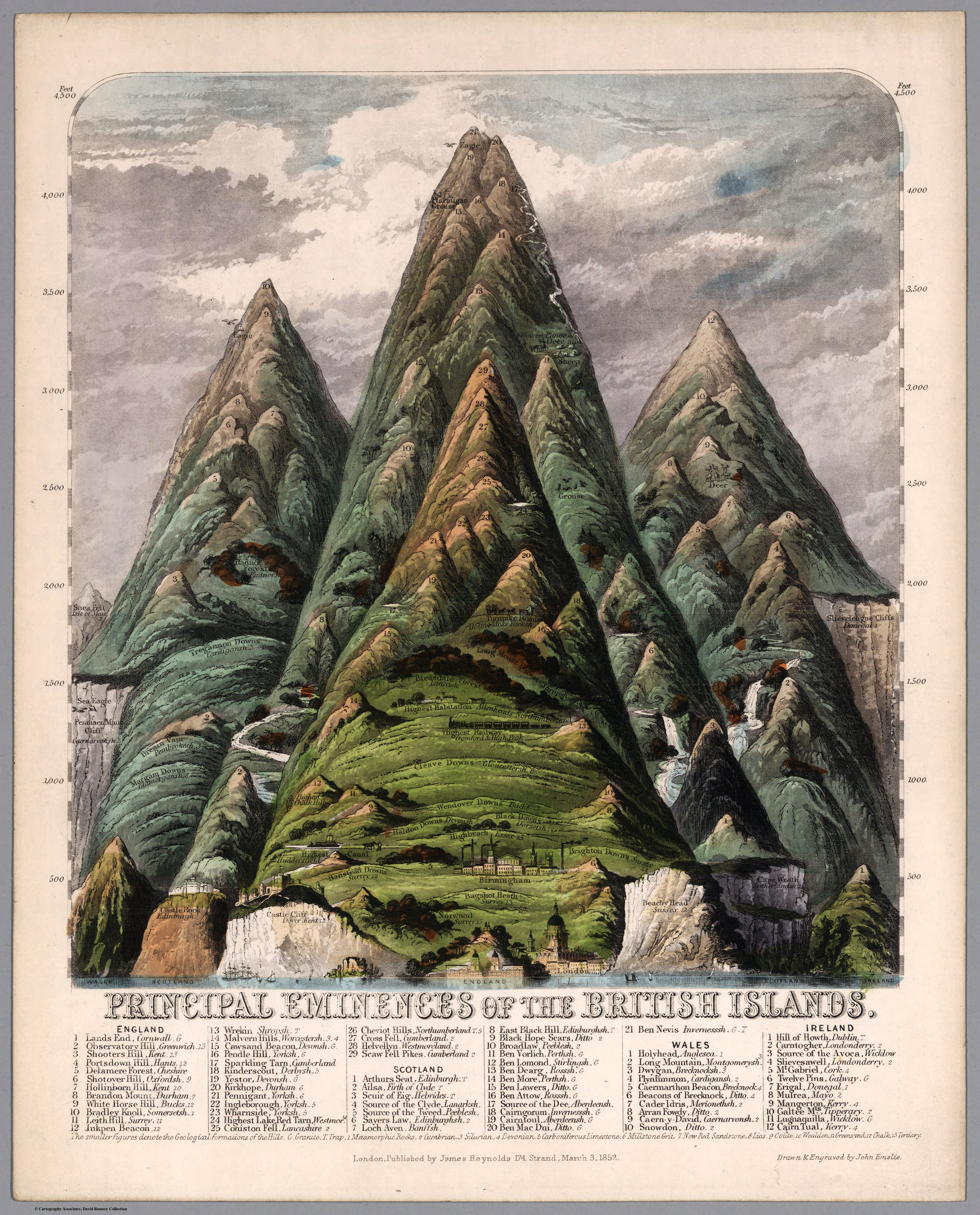
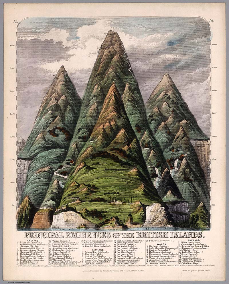
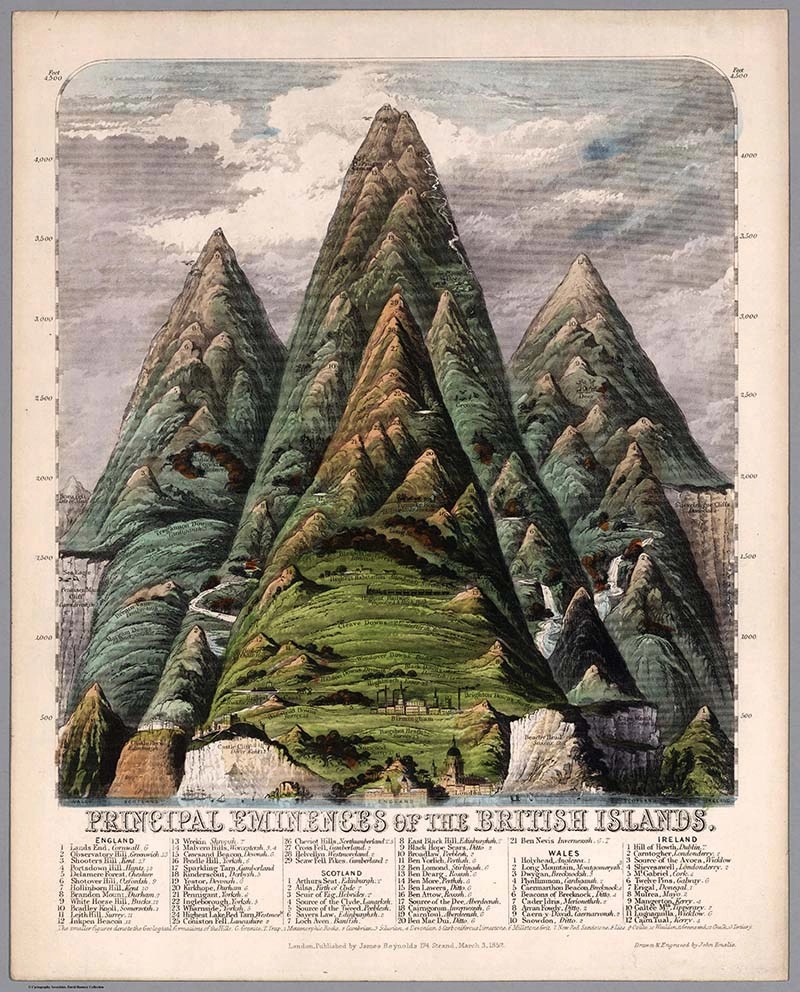
8. Principal Eminences of the British Islands -1852
When I came across this mountain diagram of the British Islands, I had to look up the word eminence. It’s defined as a position of prominence and a natural elevation.
Therefore, this mountain diagram is a sketch of natural elevations within the British Islands, such as hills and mountains.
8. Principal Eminences of the British Islands -1852
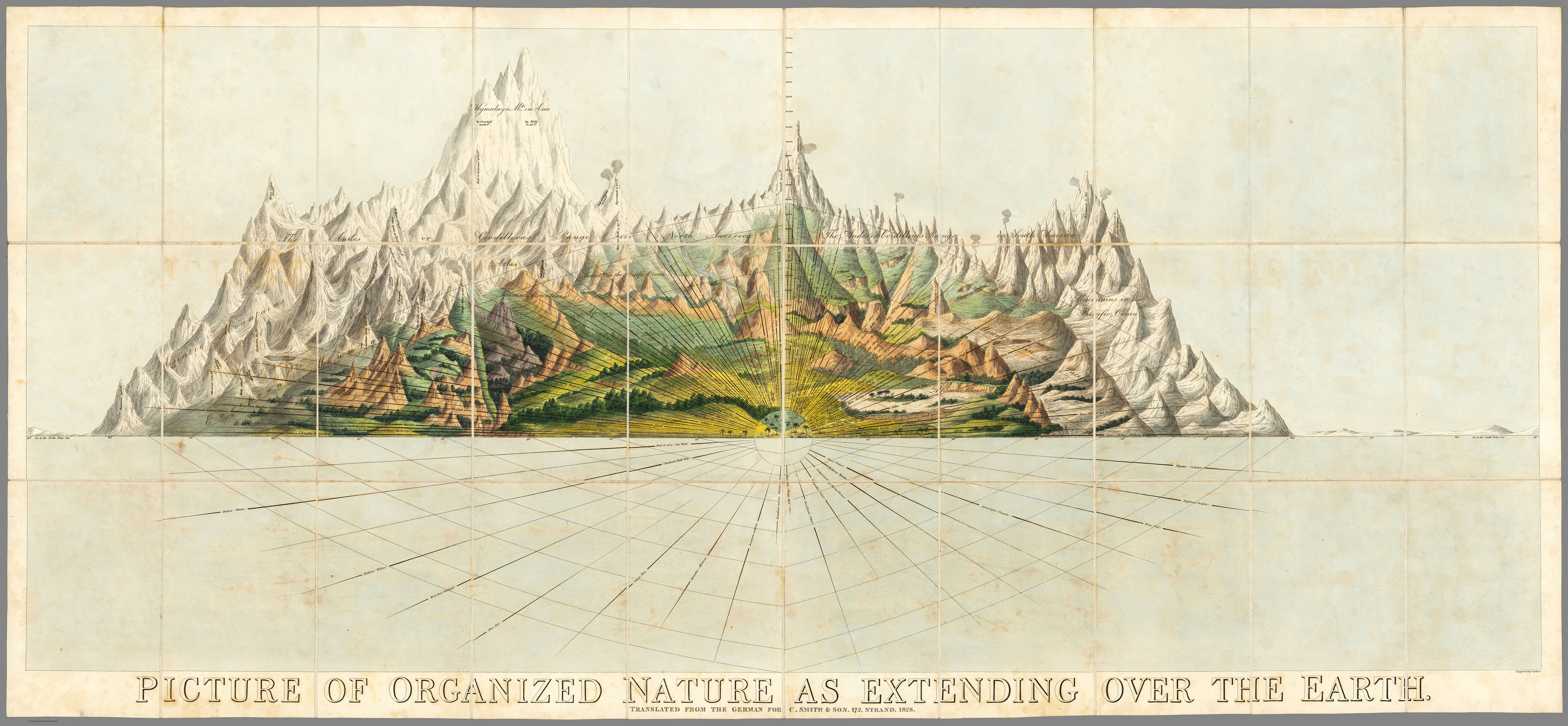
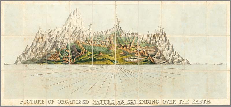
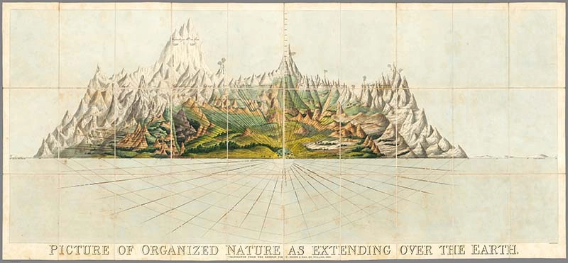
9. 1828 Mountain Diagrams of The World
This is an amazing illustration of the World’s mountains. I warn you it is a large file but it would look fabulous on a gallery wall of mountain sketches.
It’s titled “Picture of Organized Nature as Extending over the Earth” by Charles Smith.
9. 1828 Mountain Diagrams of The World
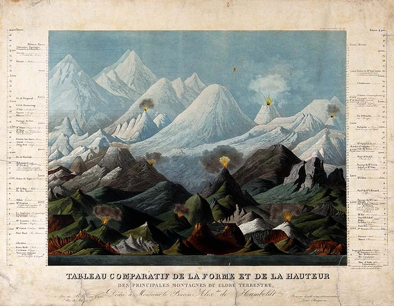
10. Comparative Shape And Heights of Mountains – 1850
This is a beautifully coloured sketch of the world’s mountains, comparing their heights and shapes. It’s a French illustration by Ambroise Tardieu.
10. Comparative Shape And Heights of Mountains – 1850

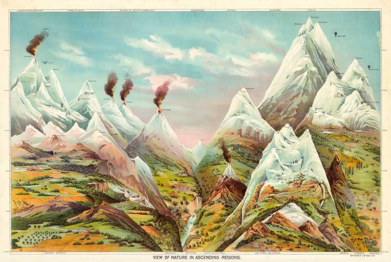
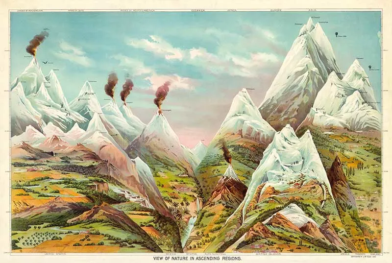
11. View of Nature in Ascending Order – Geography Chart
Educational geography poster illustrating the world’s mountains and volcanoes.
The major mountains are shown for each of the world’s continents (except Antarctica). The chart includes other exciting details, such as when certain 19th Century explorers climbed the mountains.
Major Mountain Cities are also named, including Denver, Leadville, Animas Forks, Mexico City, Toluca, St. Bernhard, St. Gothard, Birmingham, London, Chambury, Cashmere, Darjeeling, Dangoutre and Pamachun.
11. View of Nature in Ascending Order – Geography Chart
Other Related Collections
If you liked these fabulous mountain diagrams and sketches, you might want to check out these vintage geology prints and other wonderful copyright-free pictures.
- Antique World Maps to download
- Vintage Nautical Prints
- Vintage North Pole Maps
- Constellation Map Posters
- Ernst Haeckel Prints of Fabulous Nature Art

If you fancy, you can Buy Me A Coffee Here.
Deborah Dallyn
Thursday 30th of March 2023
Thank you for sourcing these wonderful maps and diagrams, please can you tellme how to print them? I am very old and live remotely.
claire
Saturday 1st of April 2023
Thank you. If you click on the title above the map, then a higher-resolution image should open in a new window in your browser. If you then right-click on that new image with your mouse, you should have the menu option to print and save the maps.
Louisa
Saturday 20th of June 2020
Thank you for sharing all these wonderful pictures/maps, especially the Scottish ones. Scotland is very dear to me even though I no longer live there. I will go back one day. I am currently living on the Isle of Wight, so unlike you, I am surrounded by the sea :-) xx
claire
Monday 22nd of June 2020
Thank you, Louisa I'm glad you enjoyed them. Scotland is a fabulous country, my mother is Scottish so I visited it many times when younger to see relatives.
Rebecca
Wednesday 20th of May 2020
Thanks for opening my eyes to how beautiful maps could be!
claire
Wednesday 20th of May 2020
Thank you, Rebecca. I'm fascinated with the beauty of old maps this is part of the reason I started this blog so that I could share their beauty with others.
Cecilia
Sunday 18th of August 2019
These are so unusual! Thanks for sharing at Vintage Charm!
claire
Sunday 18th of August 2019
Thank you 😊