
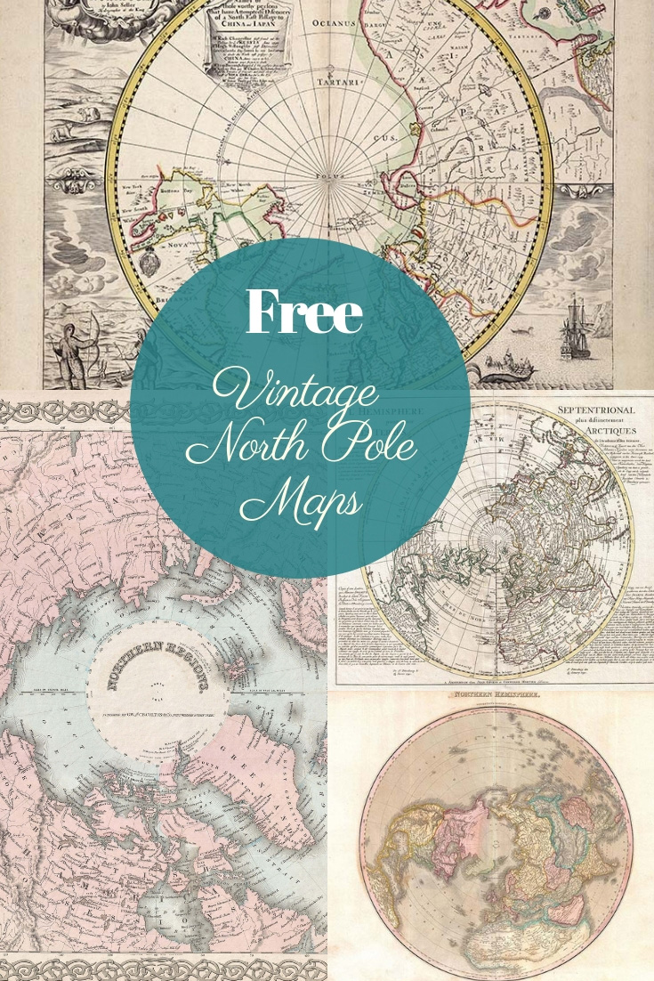
Explore a unique collection of vintage North Pole maps, which are free to download and print. Perfect for decor, DIY projects, and historical exploration with a nostalgic touch!
I decided to curate these vintage North Pole maps to incorporate them into my Christmas crafts and decorations this year. While searching for unique maps, I found so many beautiful and historically fascinating images that I wanted to share some of the best ones with you. Each map in this collection is free to download, so you can easily use it in your festive projects or winter-themed decor.
There’s something undeniably romantic and mysterious about the North Pole. It’s a place steeped in both magic and history. It’s famously home to Santa Claus, making these maps perfect for Christmas-themed crafts, gift tags, or holiday decor. Beyond that, the North Pole was one of Earth’s final frontiers—one of the last great geographical challenges for explorers to conquer. In the late 19th and early 20th centuries, the Arctic captivated adventurers, with each expedition bringing stories of harsh climates, immense landscapes, and the pursuit of the unknown.
One of the most famous figures associated with the North Pole is Robert Peary, who claimed to be the first person to reach it in 1909, supposedly using dog sledges. Yet, this claim has been the subject of intense debate. Modern explorers and historians question whether Peary’s journey was achievable when he reported, casting a shadow of mystery over his adventure.
If you’d like to use these vintage North Pole maps, click the map title link. This will open a high-resolution version in a new tab, which you can save or print for your projects. Whether you’re adding a touch of nostalgia to Christmas decor or exploring the stories of Arctic explorers, these maps offer a timeless glimpse into the wonders of the North.

THE VINTAGE NORTH POLE MAPS
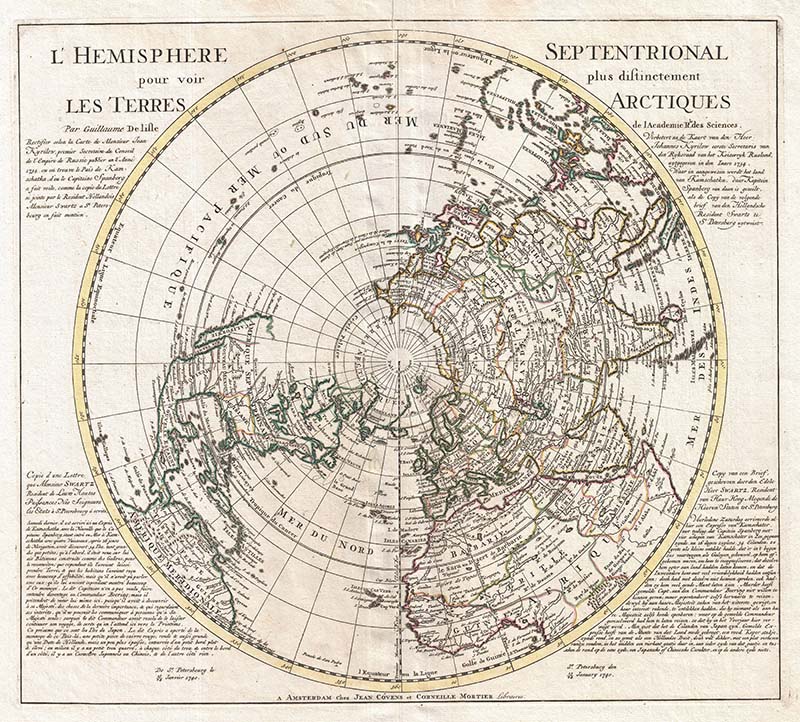
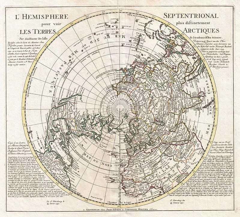
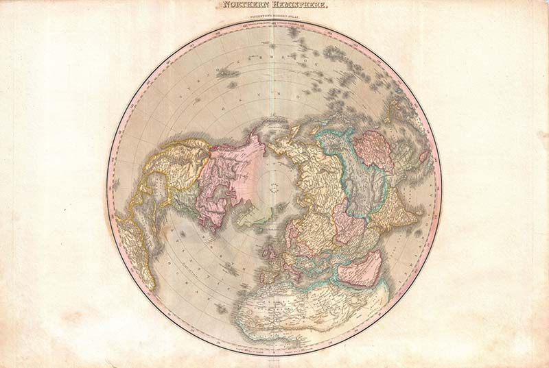
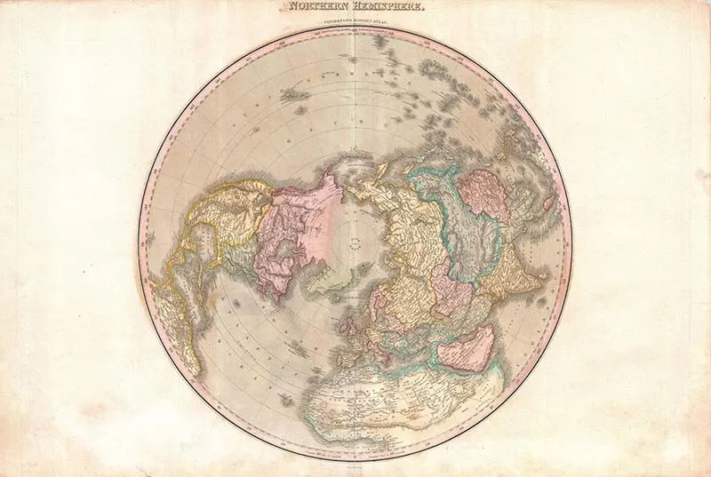
Map 1: 1741 Covens and Mortier Map of the Northern Hemisphere
This stunning map shows the Northern Hemisphere from the perspective of the Arctic. The writing on both sides of the map (in French on the left and in Dutch on the right) is a letter written by Monsieur Swartz, a Danish explorer, regarding his c. 1734 – 1740 explorations near Japan and the Kamchatka Peninsula.
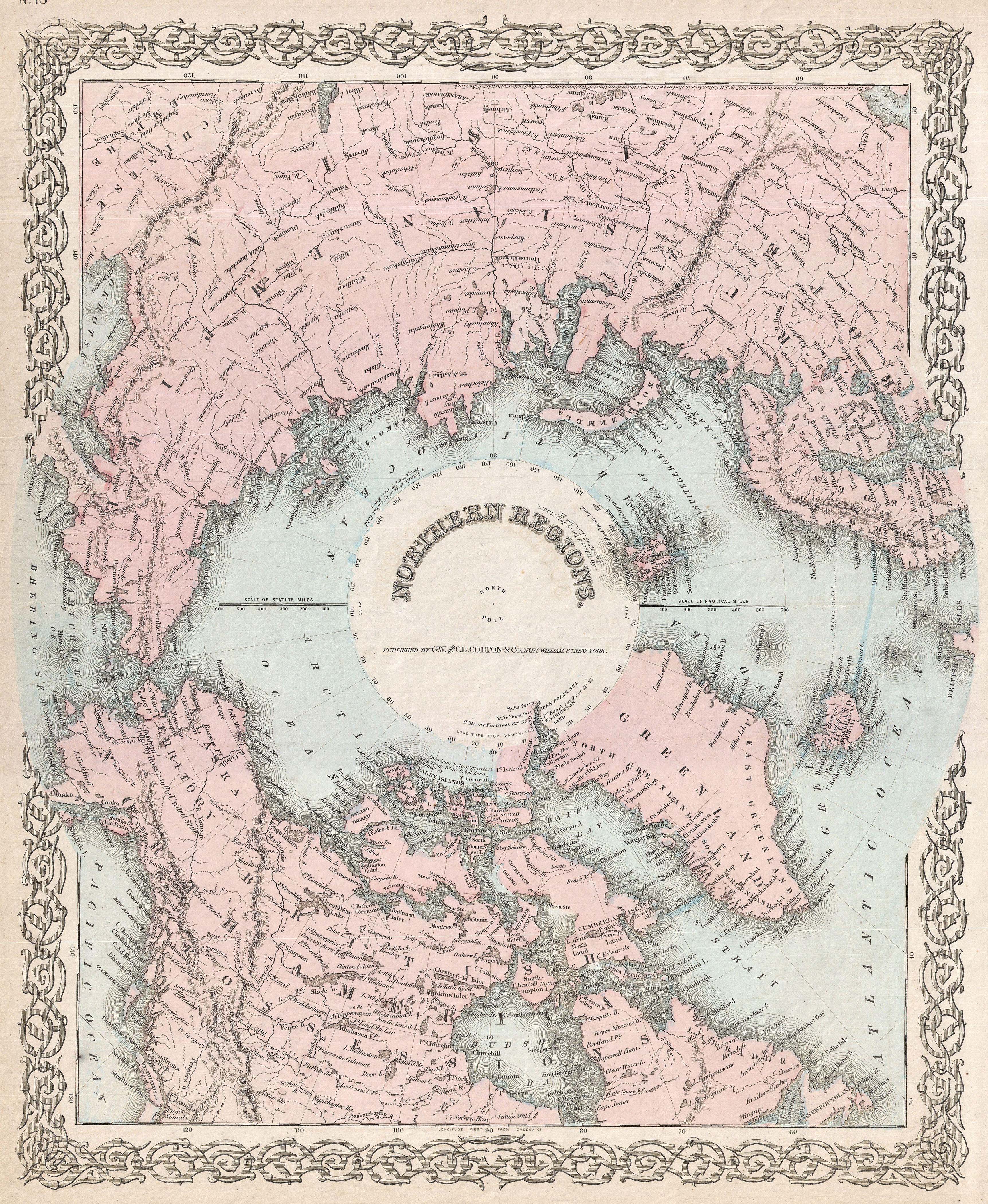
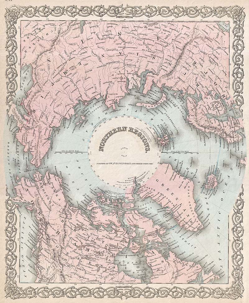
Map 2: 1855 Colton Map of the North Pole or the Arctic
This is a rarely seen version of Colton’s map of the North Pole or Arctic. It covers Lake Baikal, Hudson Bay, the British Isles, and Kamchatka from north to the Pole. This map provides an excellent overview of Arctic exploration and discovery up to about 1855.

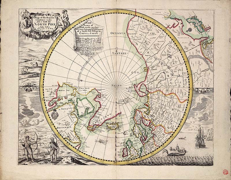
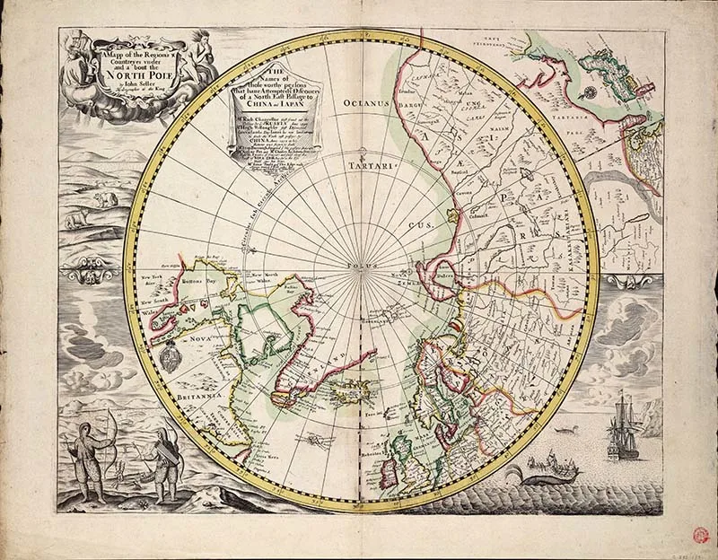
Map 4: 1680 North Pole Map by John Seller hydrographer to the King
This is a gorgeous hand-coloured engraving. It is a polar projection, with the Arctic Circle marked. At the top right, there are inset maps of Japan and China. The borders are decorated with beautifully illustrated Inuit hunting and European whaling scenes.
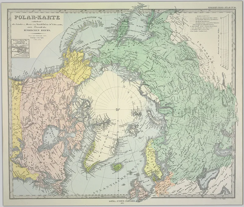
Map 5: 1855 North Pole Map by Captain John Ross
Captain John was a British naval officer and Arctic explorer. He was the uncle of Captain Sir James Clark Ross, RN, who explored the Arctic with him and later led expeditions to Antarctica. He was in his 70s and on his third Arctic expedition when he made this map.

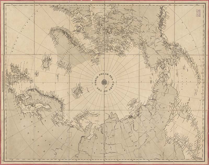
Map 6: 1855 Chart of The North Polar Sea

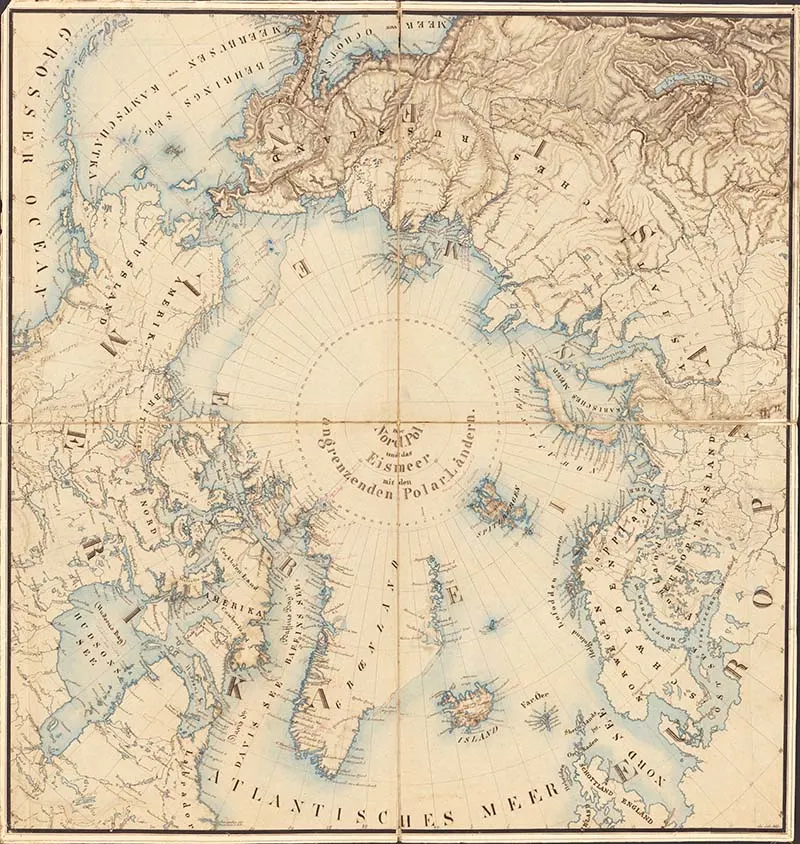
Map 7: 1875 German Map of the North Pole
The German Polar map contains the countries and oceans from the North Pole to 50 degrees North, and it also provides an overview of the Russian Empire.

Map 8: 1606 Mercator Hondius Map of the Arctic
This 1606 colourful vintage North Pole map is considered to be the world’s first specific map of the Arctic region.

Map 9: 1799 Map of the Countries Thirty Degrees Round the North Pole
This is a lovely 1799 map of the northern polar regions by the English map publisher Clement Cruttwell. The region hasn’t been fully explored yet, so some geographical coastlines are vague.
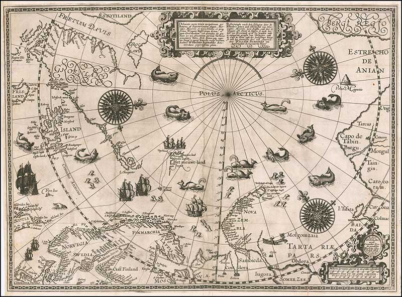
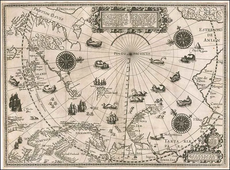
Map 10: 1598 Map of the Polar Regions by Willem Barentsz
Description of the three passages made by the Dutch through the North side of Norway, Moscovia, Nova Sembla, and through the Weygats or Strate de Nassou, as well as the part of Greenland at 80 degrees and the surrounding borders of Tartary and the Capo de Tabin and the landscape of Bargi, as well as the Eastern part of America.
Other Map Collections
This collection of classroom geography charts features a wonderful Arctic scene featuring Eskimos, polar bears, and the Northern Lights.
You might also like these maps of old maps of Antarctica or old maps of Europe.
If you are looking for some illustrations of the inhabitants of the North Pole, then check out these vintage reindeer drawings and polar bear art prints.
The poles are very snowy, so you might like to check out these vintage snowflake prints.
Hannah
Wednesday 13th of May 2020
Thank you for these! I'm doing a daily creativity boost class where we're creating our own maps using pieces of others, and these are perfect!
claire
Thursday 14th of May 2020
That sounds like a lovely project. Glad you found the maps useful, there are many more on the site to choose from.
Pam
Thursday 12th of December 2019
These are so cool! I'm featuring them today at Thursday Favorite Things. Thanks for sharing them!
claire
Friday 13th of December 2019
Thank you so much, I look forward to seeing them.
Alice
Friday 6th of December 2019
This is so cool! Pinning it for later.
claire
Friday 6th of December 2019
Thank you, they are lovely.
claire
Friday 6th of December 2019
Thank you, they are lovely.
Christine
Thursday 5th of December 2019
Wow, these are gorgeous! Thanks for sharing.
claire
Friday 6th of December 2019
Thank you, glad you like them I just love maps.
Make Your Own Christmas Crackers With Old Maps - Pillar Box Blue
Wednesday 12th of December 2018
[…] green and white. You can also use printouts of old maps from vintage atlas’s. There are some cool vintage North Pole maps on Pictureboxblue, which I think would make great handmade Christmas […]