
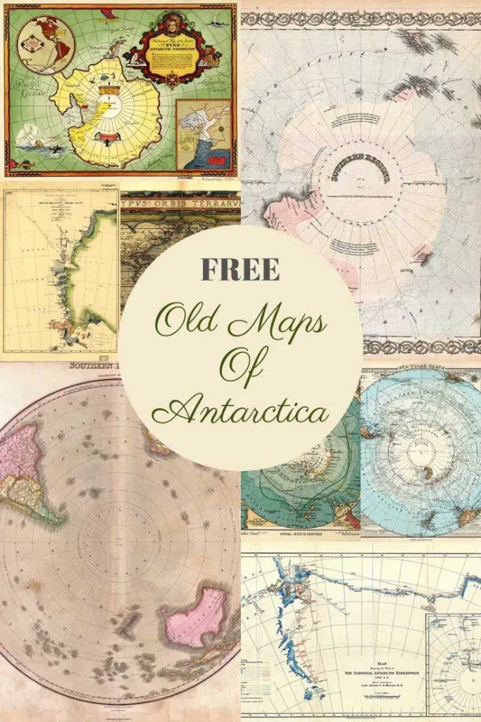
Over the last few weeks as a family, we have been sitting down on Sunday nights to watch the latest David Attenborough wildlife series “Seven Worlds On Planet”. As usual they series has been mesmerizing and the filmography stunning. After watching the Antarctica episode I feel inspired to curate a collection of old maps of Antarctica.
Antarctica is the fifth-largest of the world’s seven continents. It is the southernmost continent and site of the South Pole. Antarctica is by far the most hostile, coldest, driest, windiest and least populated of all the continents. 98% of the continent is covered in ice.
There are no native inhabitants of Antarctica. However, there is a population of research scientists of about 4000-5000 in the summer and 1000 in the winter. The continent was the last frontier on the earth to be discovered.
Even though the Antarctic continent wasn’t seen by humans until the late 18th century there had been speculation about its existence since the Greek and Roman times. It was not until 1820 that a confirmed sighting of Antarctica did occur.
Before sharing the old maps of Antarctica, I will share some fun facts about the content.
Fun Facts About Antarctica
- The Antarctic holds the record for the coldest temperature ever recorded on Earth. The temperature was minus 128.56 degrees Fahrenheit (minus 89.2 degrees Celsius), registered on July 21, 1983, at Antarctica’s Vostok station.
- The Dry Valleys of Antarctica are the driest place on Earth, with low humidity and almost no snow or ice cover.
- The Antarctic Ice Sheet is the largest single mass of ice on Earth.
- An incredible 60-90% of the world’s freshwater is held in Antarctica’s vast ice sheet
- The Antarctic ice is about 1 mile thick and if it melted it would raise the sea levels by about 5 meters
- Norwegian explorer Roald Amundsen was the first human to reach the South Pole.
- There are no Polar bears on the Antarctic continent. They are found only in the arctic regions. However, there are penguins in the Antarctic. Hence you will never see polar bears and penguins in the same place except for zoos and Christmas cards.

To download a higher resolution map, just click on the title above the map. The map should just then automatically download to your desktop. You can then save the map to your hard drive or print it.
The Old Maps Of The Antarctic
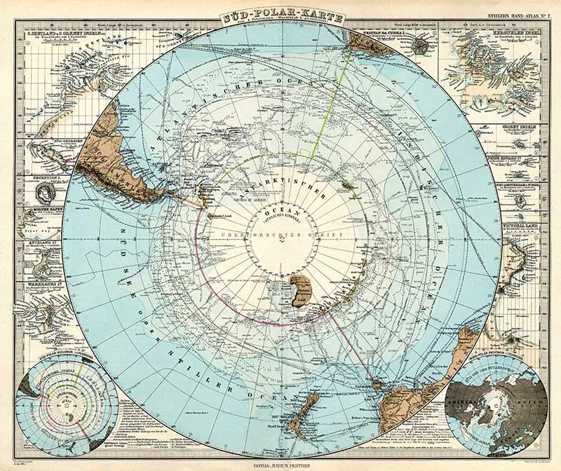
1.1891 Stielers Handatlas South Pole Map
This old map of the Antarctic is from the 1891 edition of Stielers Handatlas and is titled South Polar Map.

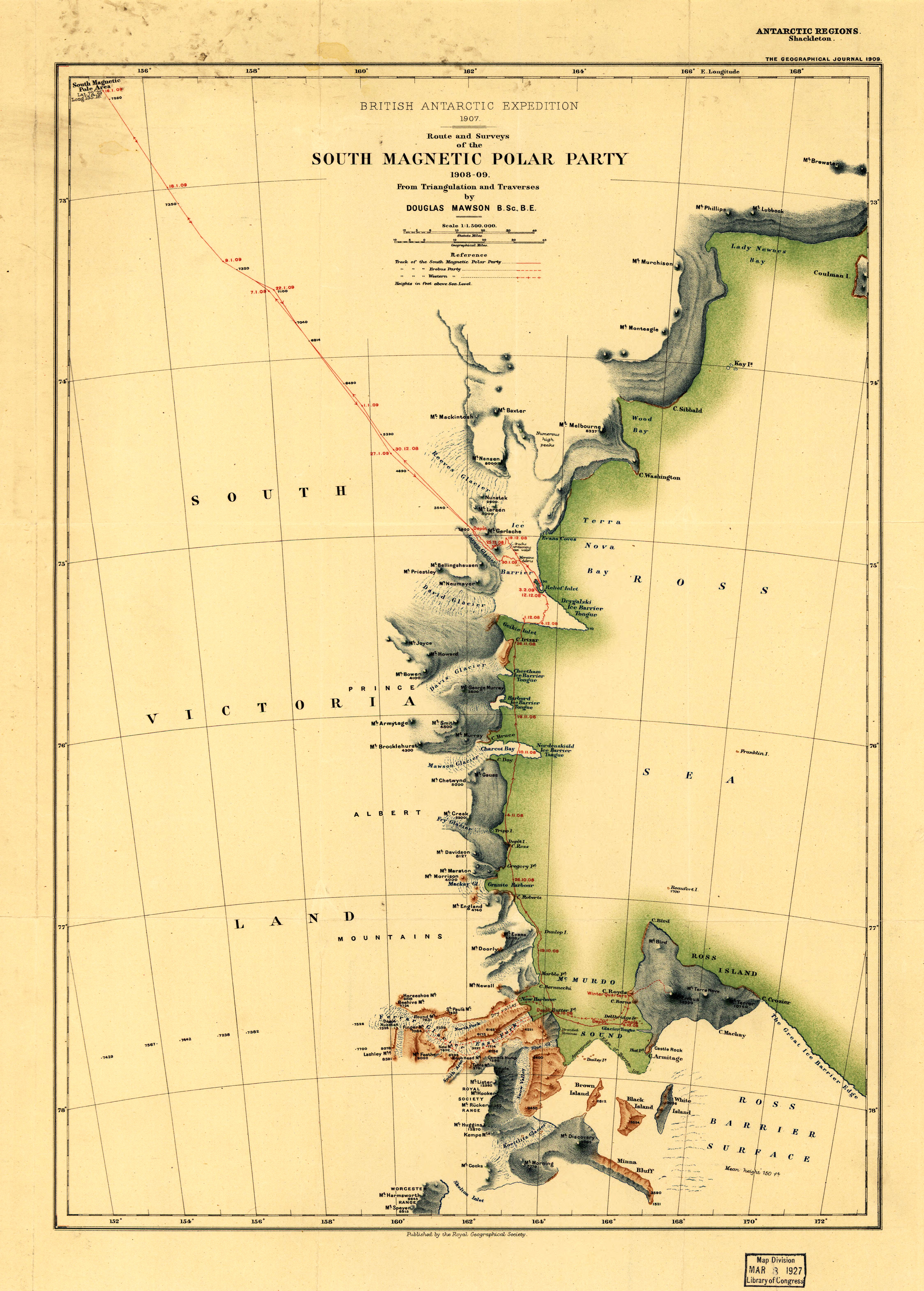
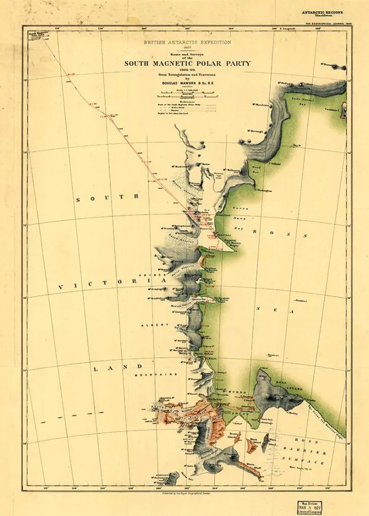
2. Route and Surveys of the South Magnetic Polar Party 1908-1909
Old maps of Antarctica showing the Route and Surveys of the South Magnetic Polar Party, 1908-09 published in England by the Royal Geographic Society in 1909.
The primary contributors to this map are Douglas Mawson and Sir Ernest Henry Shackleton. They were members of a scientific team that made a journey to the Magnetic South Pole as a part of Ernest Shackleton’s 1907-09 British Antarctic Expedition (Nimrod Expedition).
Ernest Shackleton was a British polar explorer of Antarctic Exploration he led three British expeditions to the Antarctic. Mawson was an Australian geologist and explorer who received worldwide acclaim for his explorations in the Antarctic that enabled Australia to claim numerous square miles of the Antarctic continent.

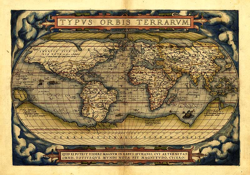
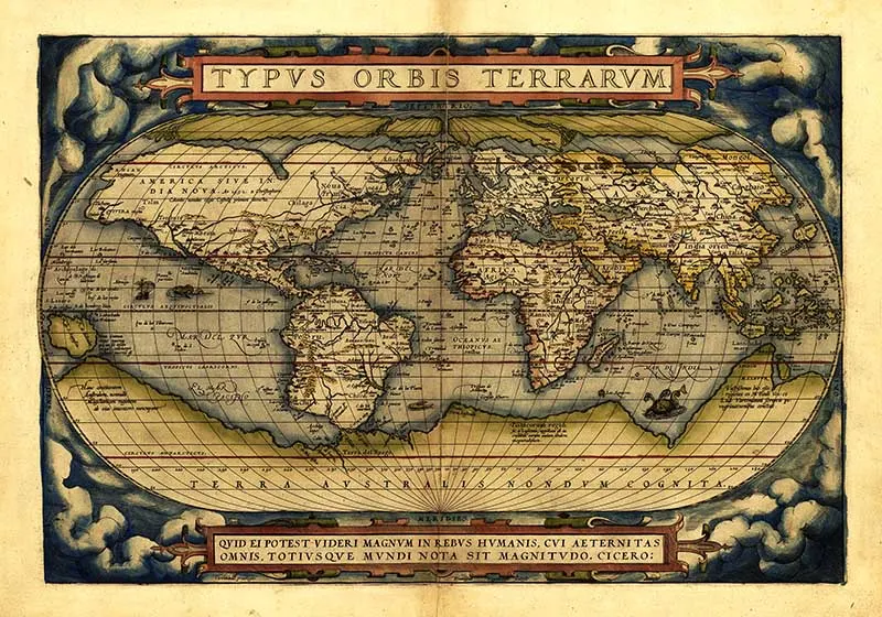
3. 1570 Typus Ortelius
This old map of Antarctica was drawn before the continent had been officially discovered.
This is one of the most famous maps on which Terra Australis (Antarctica) first appears. Ortelius was among the most famed mapmakers of the Dutch golden age of cartography. This map of his is a world map that depicts Terra Australis as being by far the largest landmass in the known world.
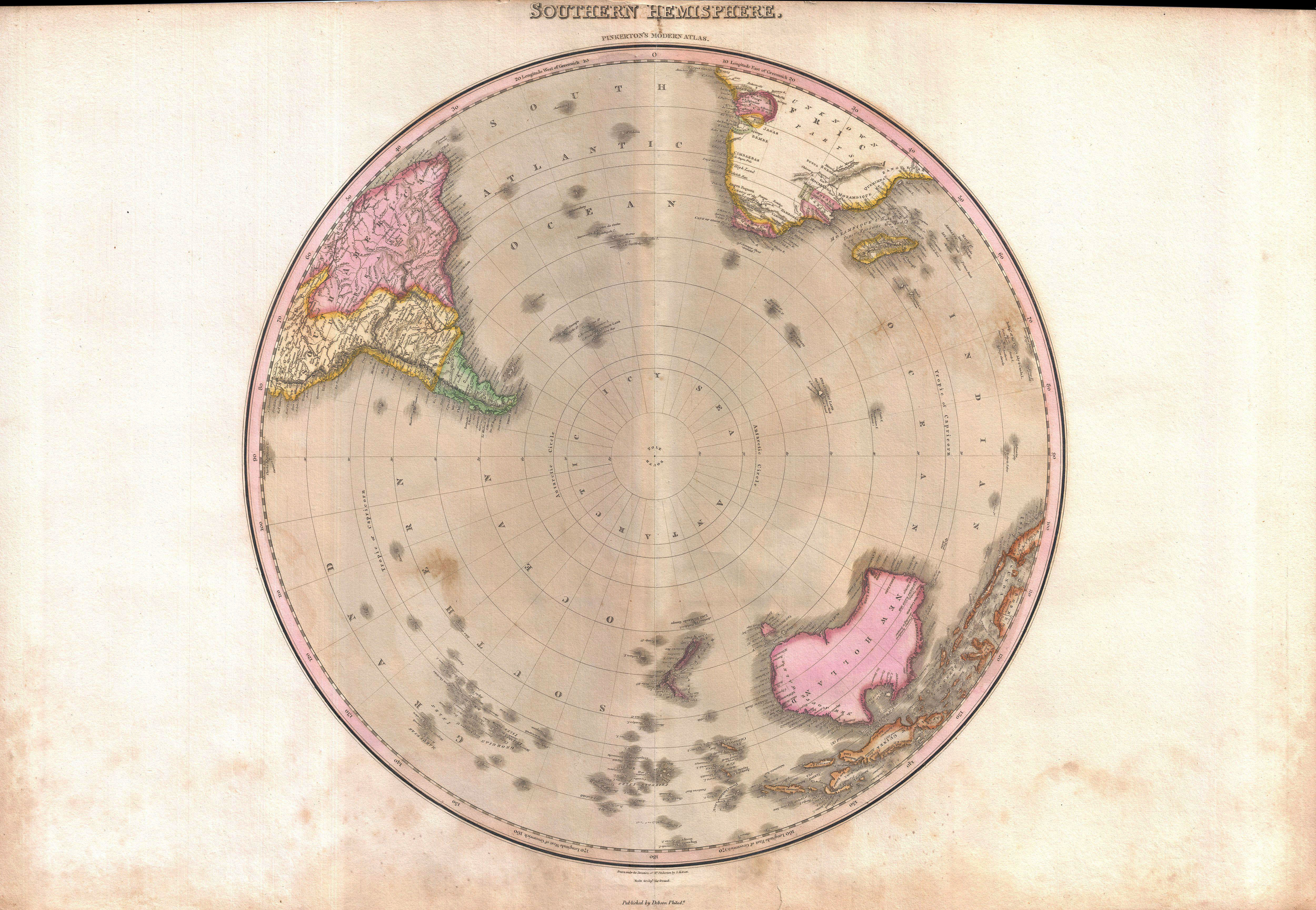
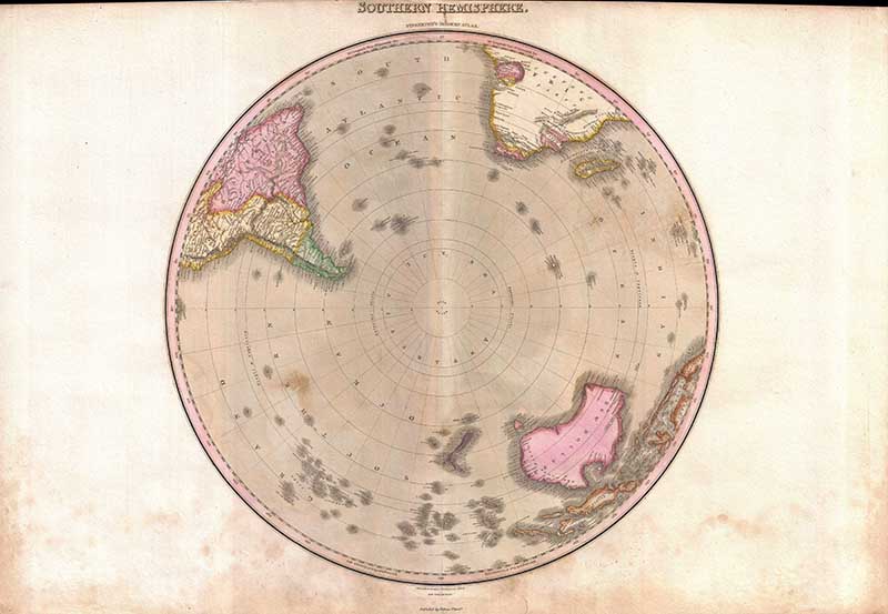
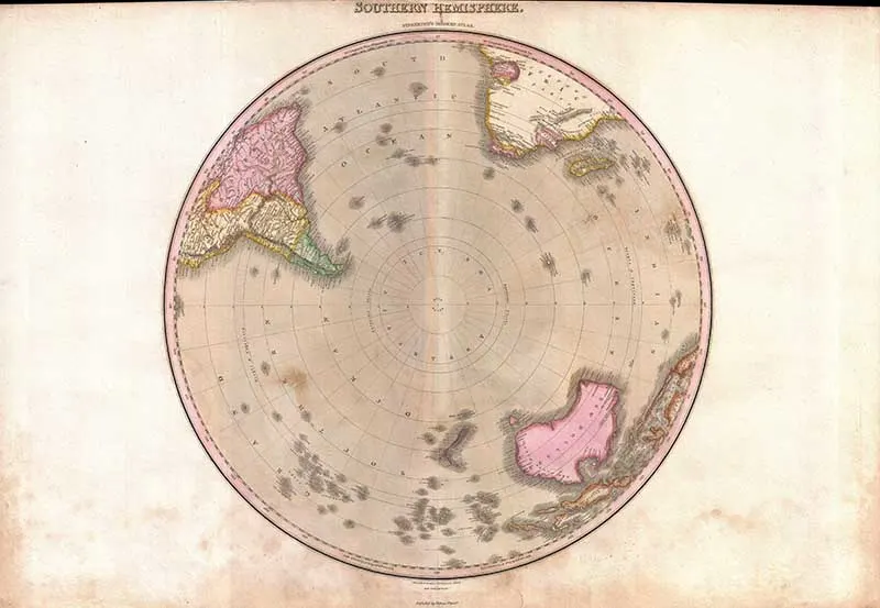
4. 1818 Pinkerton Map of the Southern Hemisphere ( South Pole, Antarctic )
A rare and important 1818 map of the Southern Hemisphere by John Pinkerton. On a Polar projection, this map depicts Australia, Polynesia, and the parts of South America and Africa.
This map was issued after the search for Terra Australis, or the Great Southern Continent, had been abandoned, but prior to the discovery of Antarctica – consequently, the South Pole is depicted as a vast ocean called the Icy Sea.
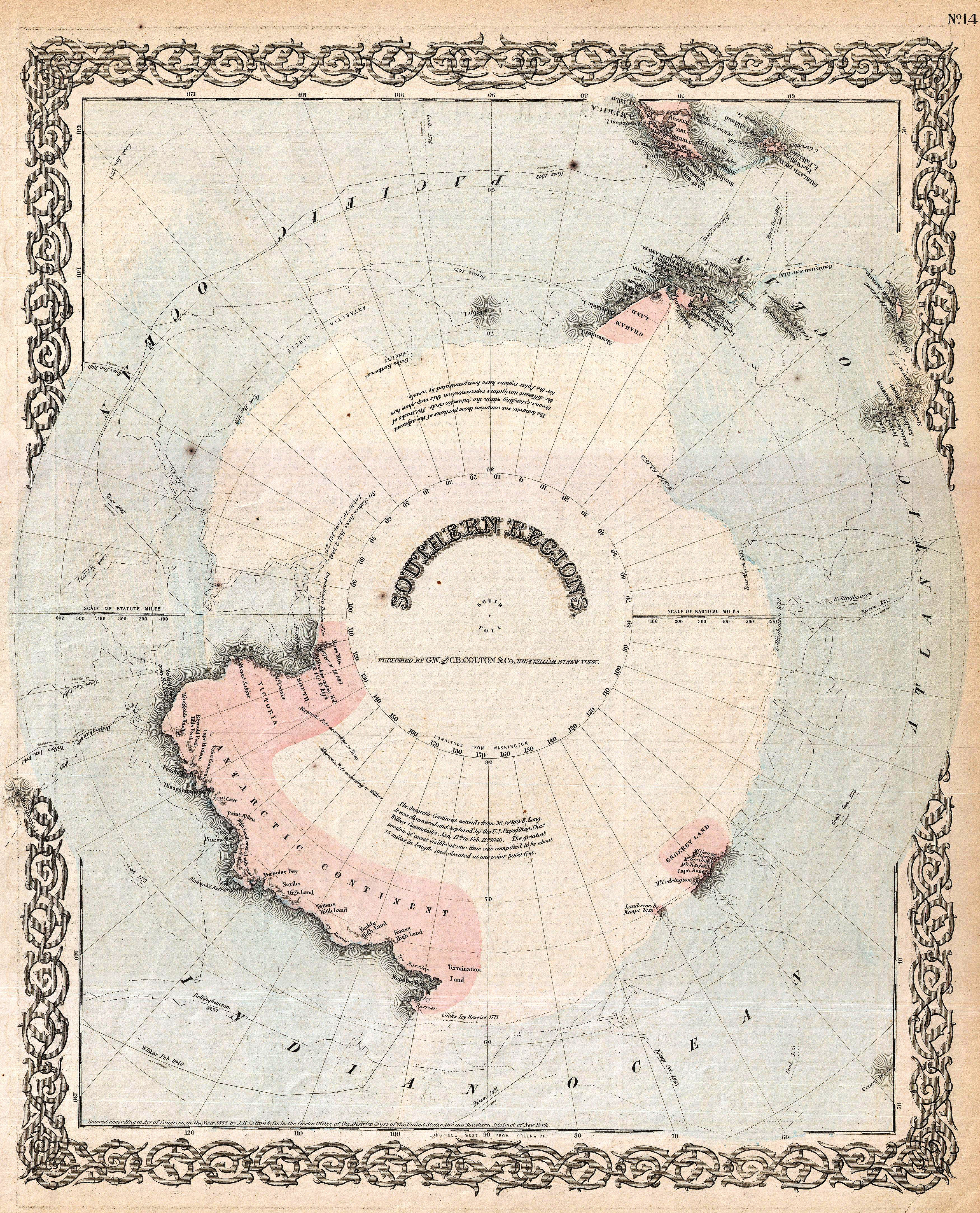
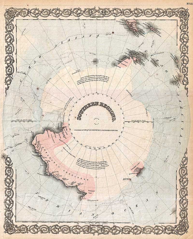
5. 1872 Colton Old Maps of Antarctica
Colton’s map of the South Pole, Antarctica, or the Southern Polar Regions. This old map of Antarctica shows the great southern continent with both solid and tentatively sketched in borders.
The map notes the travels of important Antarctic explorers of the previous 20 years or so, including Wilkes (1840), Bellinghausen (1820), Ross (1840 – 1843), KIempt (1833), Cook (1773 – 1774 ) and Biscoe (1831). The map generally gives an excellent overview of the state Antarctic exploration and discovery to about 1855.

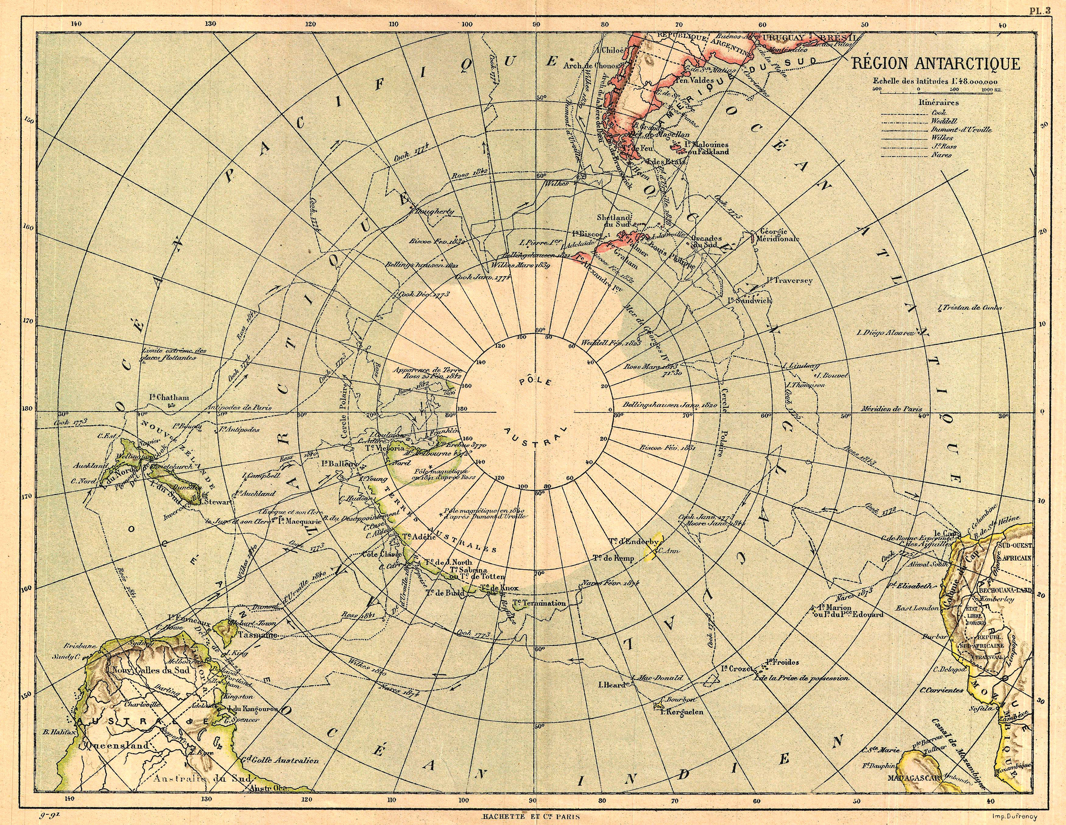
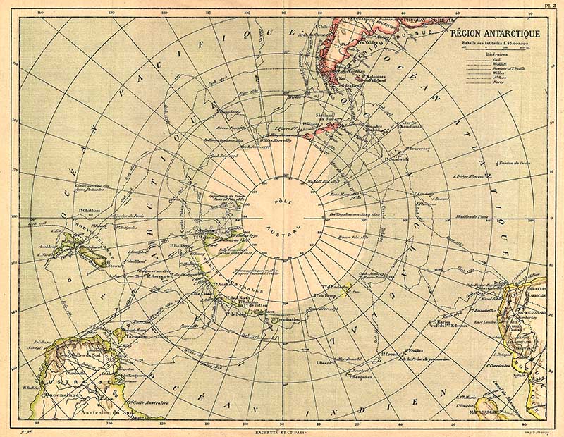
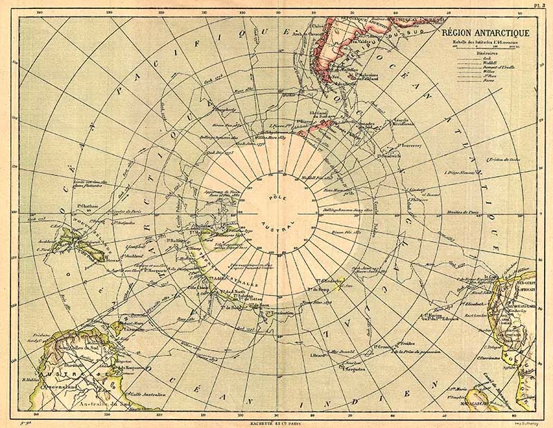
6. 1890 Hachette Old Maps of Antarctica
An old French map of Antarctica reflects the relatively primitive state of exploration in the region through a number of exploratory routes mapped out.
A key in the upper left quadrant lists the explorers who explored the Antarctic: Cook, Weddell, Dumont-d’Urville, Wilkes, Ross, and Nares. Countries and territories labeled, along with rivers and other minimal topographical detail.
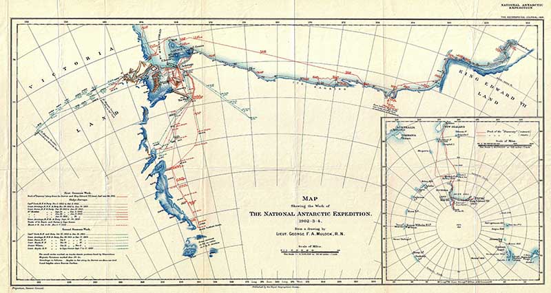
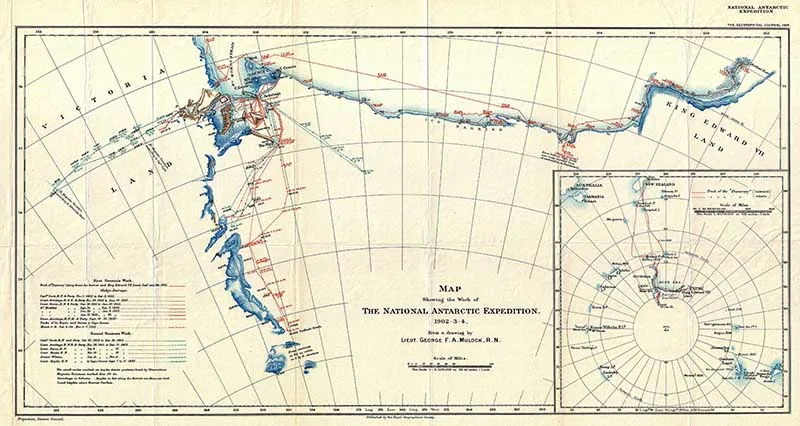
7. Map Showing the Work of The National Antarctic Expedition 1904
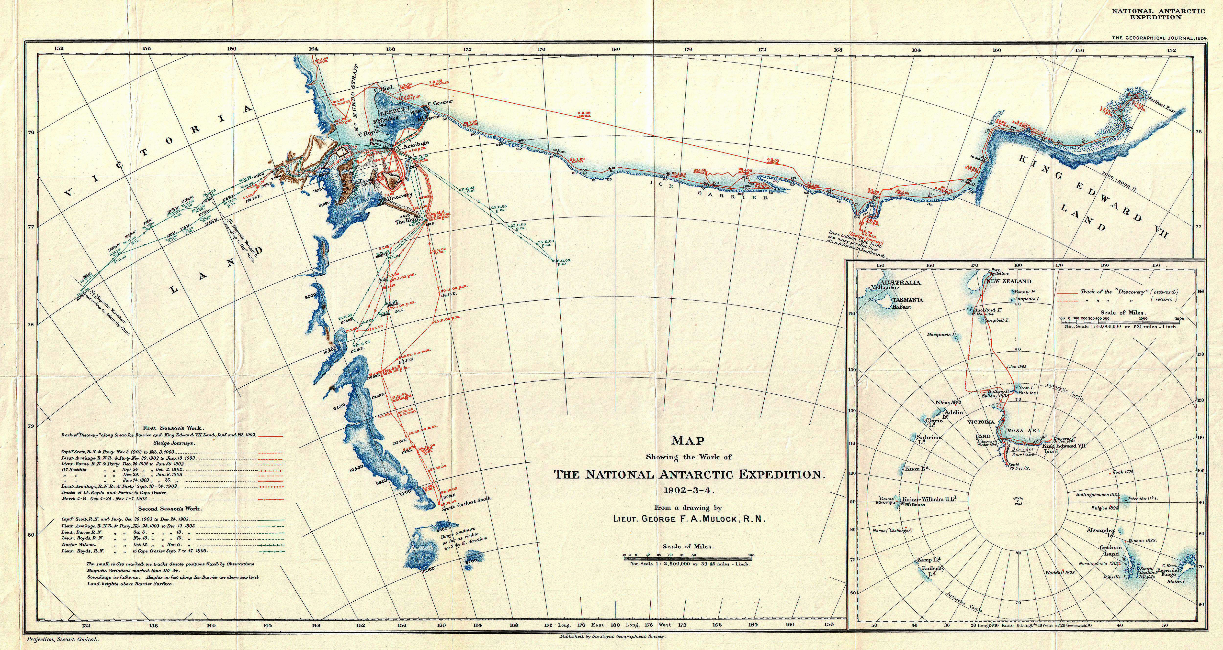
This old South Pole map details the explorations of the British National Antarctic Expedition 1904. This British Exploration of the Antarctic was designed to collect scientific and geographical data regarding the largely unexplored landmass.
Considered one of the most important voyages of exploration in the early 20th century, this landmark expedition launched the careers of several important Antarctic explorers including Robert Falcon Scott who led the expedition, Ernest Shackleton, Edward Wilson, Frank Wild, Tom Crean and William Lashly.
This map itself follows the coast of Antarctica from Victoria Land, eastward along the Ross Ice Shelf, to King Edward VII Land. It shows the tracks of several important explorers on the expedition as they probed inland toward the South Pole. From a map drawn by Lieutenant George F. A. Mulock, Scott’s second in command.
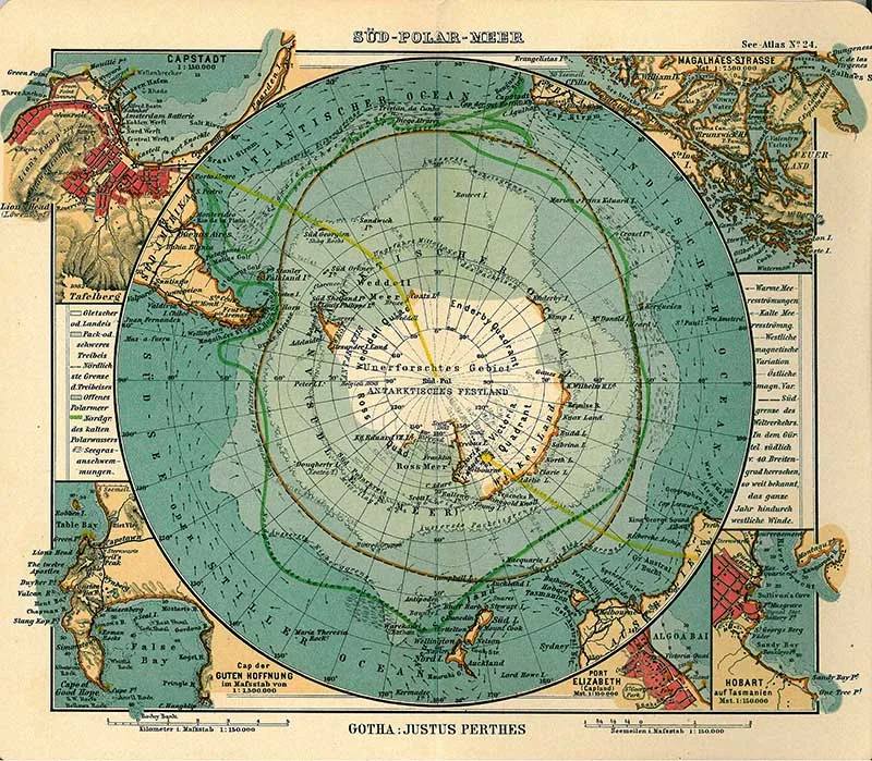
8. 1906 German Antarctica Map
A lovely colourful German map of Antarctica published in 1906.

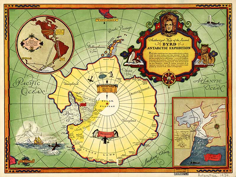
9. Map of Byrd Second Antarctic Expedition 1934
Rear Admiral Richard Byrd was an American naval officer and explorer. On his second expedition in 1934, Byrd spent five winter months alone operating a meteorological station, Advance Base.
This expedition is described by Byrd in his autobiography Alone. It is also commemorated in a U.S. postage stamp issued at the time, and a considerable amount of mail using it was sent from Byrd’s base at Little America.
This is a beautifully illustrated map of the region and that particular Antarctic expedition.
Australasia borders Antarctica, there is a wonderful collection of vintage maps of Australasia here.
If you liked these old maps of Antarctica then you will probably love these other map collections.
Julie Briones
Sunday 5th of January 2020
Love your printables, and the DIYs that go with them, Claire! Thanks for sharing at Tuesday Turn About... the party returns from the Christmas break this Tuesday, 1/7. Hope to see you there, and Happy New Year!
claire
Monday 6th of January 2020
Thank you Julie, there will be plenty more to come over the next year.
Cecilia
Monday 16th of December 2019
Thanks for sharing your charming maps at Vintage Charm!
claire
Wednesday 18th of December 2019
Thank you 😊