
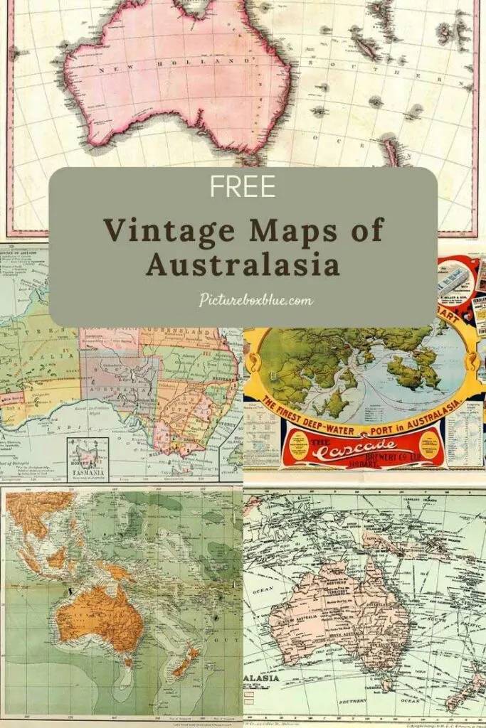
The other day whilst looking at the collections of vintage maps on Pictureboxblue, I realized that there were no maps of Australasia. This collection is to remedy that omission.
Strictly speaking, Australasia is not a continent. The Australian continent is distinguished from the country of Australia, by the landmasses, which sit on Australia’s continental plate. These are mainland Australia, Tasmania and the island of New Guinea.
However, the term Australasia also includes the Islands of New Zealand. Which are included in this collection of maps of Australasia.
New Zealanders feel they sometimes get missed off world maps. I once made a world map pillow out of denim and in the comments, many New Zealanders, thanked me for making sure that their Islands were included in the design.
Australasia is part of Oceania. Oceania is a geographic region that spans the Eastern and Western Hemispheres. It also includes Melanesia, Micronesia, and Polynesia.

Facts About Australasia
- Australasia is the smallest continental region in the world and the second least populated after Antarctica.
- According to the Britannica Encyclopedia, Australia is not considered an Island because it’s already a continent. Apparently, it can’t be both!
- The highest point in Australasia is Mount Wilhelm (4509 m) in Papua New Guinea.
- The longest river is the Darling River (2,739 km) in Australia.
- Australasia is the flattest continent, with much of Australia being desert.
- The plant life of Australasia is wide and varied, and in some cases unique to the continent. The tropical island regions are home to dense forests, with coconut palms and mangroves growing nearer the shorelines.
- The continent is home to the world’s largest coral reef, the Great Barrier Reef in Australia. At 2000km, the coral reef is the largest ecosystem in the world.
The Vintage Maps of Australasia
All the maps of Australasia in this collection are in the Public Domain. To download the map that you want, click on the title above that map. A higher resolution map will open as a new window in your browser.
If you right-click on that map with your mouse, you will have the menu option to save that Australasian map to your hard drive.
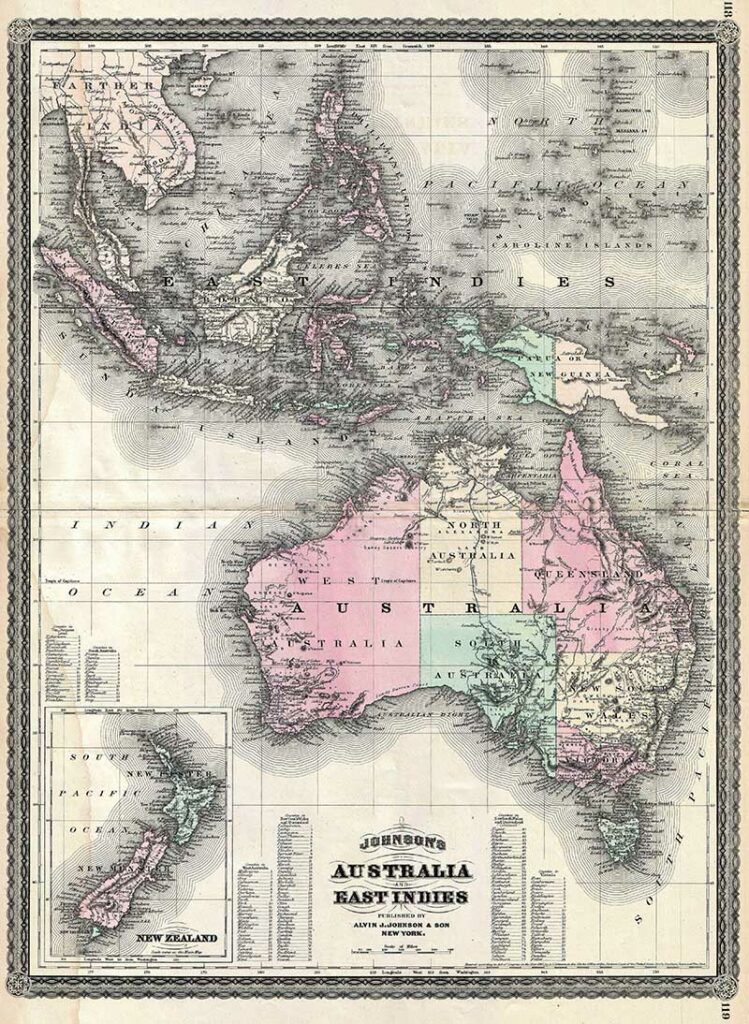
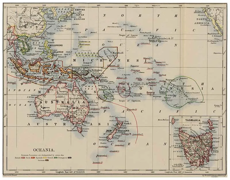
1. 1870 Johnson Map of Australia, the East Indies, and Southeast Asia
This is A. J. Johnson’s 1870 map of Australia, the East Indies, and Southeast Asia. Covers from Modern-day Thailand and Vietnam south to include all of the East Indies, the Philippines, New Guinea, and the continent of Australia. The map offers superb detail, with numerous islands, states, cities, and geographical areas labeled and color-coded.
The map shows an advanced state of Australian exploration, noting the explorations of Burke, Wills, Stuart, and Gregory. An inset in the lower-left quadrant details New Zealand. Text in the lower quadrants notes counties in each province of Australia.

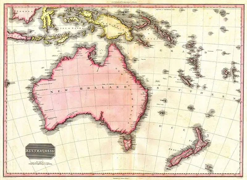
2. 1818 Pinkerton Map of Australasia
This fascinating hand-colored 1818 map by Edinburgh cartographer John Pinkerton depicts Australia (as New Holland with Van Diemen’s land no longer attached), New Zealand (depicts only two islands), and parts of Micronesia and Polynesia (nothing is in quite the right place). Without a doubt, one of the finest and most important maps of Australia to appear in the 19th century.
New Holland is a historical European name for mainland Australia. The name was first applied to Australia in 1644 by the Dutch seafarer Abel Tasman.

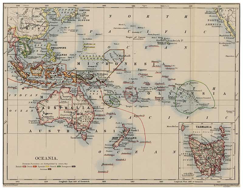
3. 1897 Map of Oceania
This map of Oceania is from the book “Australia in 1897” by Petherick, Edward Augustus.
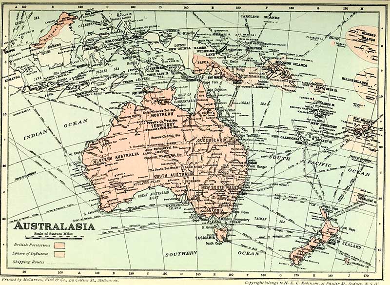
4. 1914 Map Of Australasia
Map from the book “The commonwealth of Australia; federal handbook“, 1914.

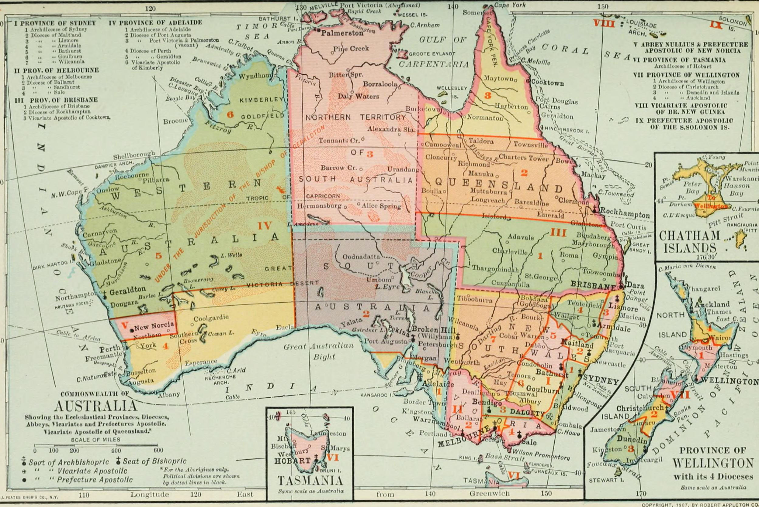
1907 Map of Australia and New Zealand
A lovely colorful map from the 1907 edition of “The Catholic Encyclopedia“.


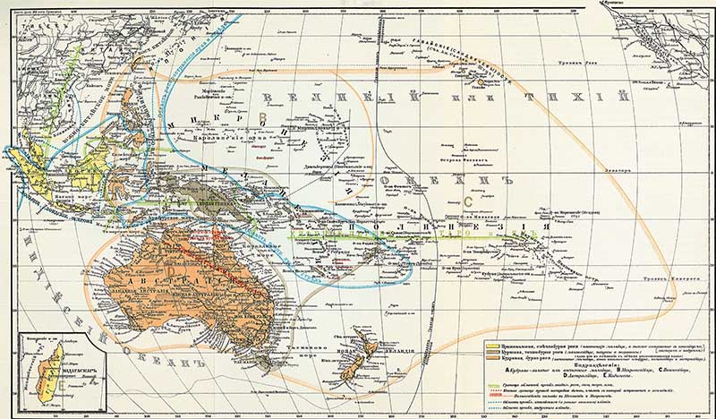
6. 1904 Russian Map of Australasia

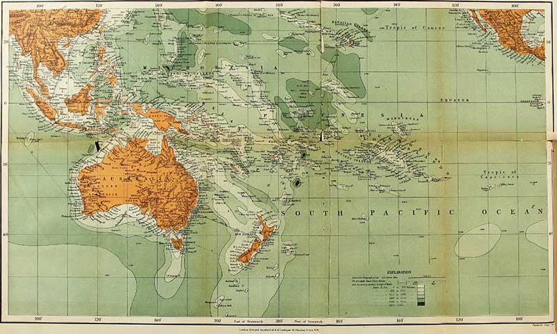
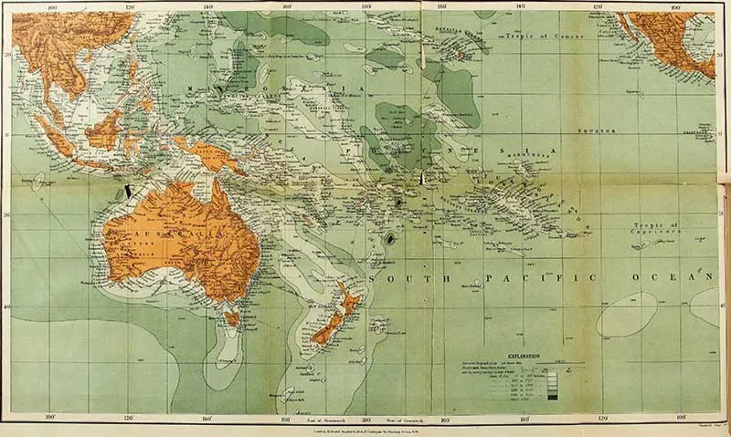
7. 1893 Map of Australasia
A chart of Australasia showing the depth of the sea.
8. The Port of Hobart
The Port of Hobart the finest deep-water port in Australasia – a map of sea lanes into the harbor and statistical information. With local advertising around the border.


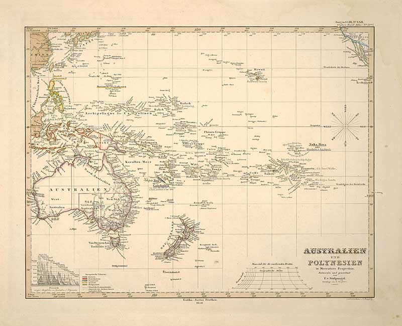
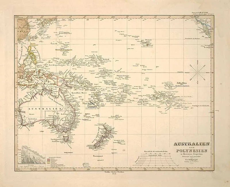
9. 1858 Australia and Polynesia in Mercators Projection
The Mercator projection is a cylindrical map projection presented by the Flemish geographer and cartographer Gerardus Mercator in 1569. It became the standard map projection for navigation because it is unique in representing north as up and south as down everywhere while preserving local directions and shapes.
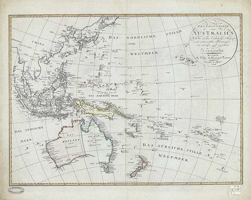
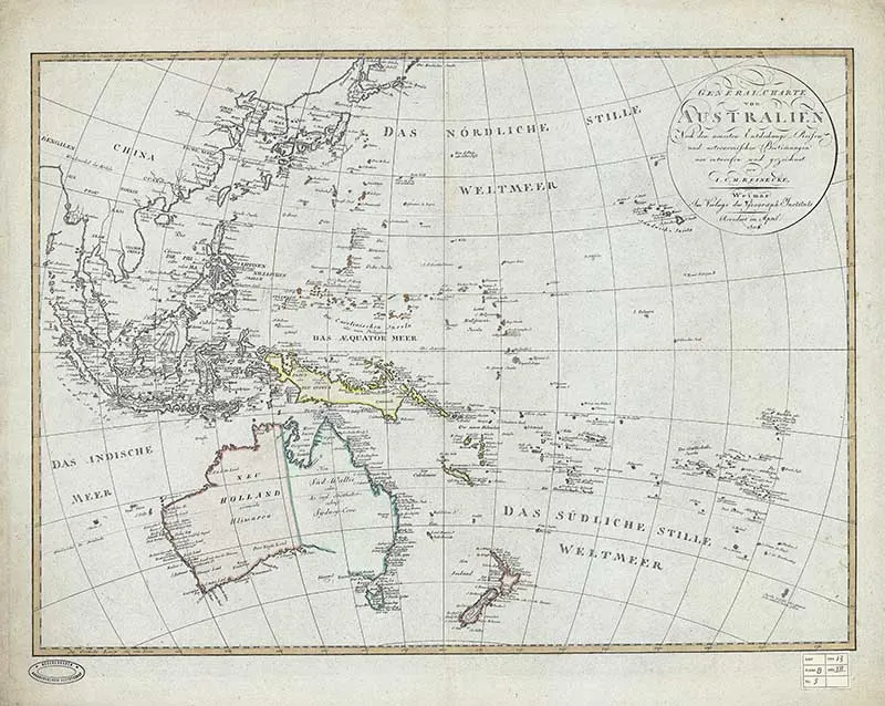
10. Reinecke’s General Charte von Australien
Johann Matthias Christoph Reinecke’s map of the Western Pacific Ocean, Australia, Southeast Asia, etc.
I hope you enjoyed these vintage maps of Australasia. You should also check out the maps of its neighboring contents Asia and Antarctica on Pictureboxblue.
Australasia has some colorful unique wildlife, flora and fauna. And on this site, there are some stunning illustrations of the coral reef of the Great Barrier reef and the amazing parrot paintings of Edward Lear.
jenny rodgers
Monday 12th of December 2022
Thankyou for including my home country. As I have only just discovered your fantastic site , I wonder if you have pictures of Australian animals, very unique. I am still going through everything. Also I love cockatoos. I live in a little country town in Victoria, its called Cockatoo. thankyou. Jenny
claire
Tuesday 13th of December 2022
Glad you are enjoying the site. You might want to check out a collection of vintage cockatoo prints here. https://www.pictureboxblue.com/vintage-cockatoo-prints/
Patricia
Saturday 29th of May 2021
Thanks for putting all the posters, maps, ect in one place it makes things easy to find. Now I have enough for painting and junk jourals.
claire
Saturday 29th of May 2021
Thank you and good luck with your junk journaling.
Denise/My Home of All Seasons
Friday 16th of April 2021
These are great Claire. Thanks so much for sharing them. I follow your other blog and I know you've traveled extensively. I have not. Terribly afraid of flying and I will only do so when there is no other option. Through my own blog, I have met so many amazing people from down under and so I have been learning a lot about the area. I would love to visit but it's very unlikely that I ever will. I appreciate all the facts you've shared along with the beautiful maps. Thanks again and good luck with Picture Box Blue!
claire
Saturday 17th of April 2021
Aww, thank you so much. Yes, I have also met many people through the blog which is definitely one of the biggest pluses of blogging.