
I have curated a collection of lovely old maps of Canada. They are all copyright free for you to download, print and use as you want.
Even though I’ve visited Canada five times, I have not seen that much of it. The country is vast, it is the second biggest in the world.
Having good friends in Alberta, I’ve visited them and the Canadian rookies three times. Twice in the summer and once in the winter. They were amazing trips full of stunning scenery and wonderful wildlife sightings.
The last visit we made was to Vancouver and the Gulf Islands in British Columbia. Another amazing holiday.
The only time I have ventured to the East coast of Canada was for an unscheduled stay in Toronto.
We were actually en route to New York from London but due to the chaos caused by the Northern Seaboard Blackout of 2003, we ended up in Toronto for the night.
I will definitely return to Canada at some point and hope to see some more of the beautiful country. In the meantime, I will share some wonderful old maps of Canada I have found.

Some Facts About Canada
- Along with the Japanese passport, the Canadian passport is the best one to have. That is because it gets you into most countries without the need for a visa or a visa is readily given on arrival.
Maybe its because Canadia is so beautiful other countries aren’t worried about Canadians outstaying their welcome. They know they will want to return home.
- Canada may only be the second-largest country in the world (after Russia), but it has the largest coastline.
- With over half the population having a degree, Canada is the most educated country in the world.
- There are more lakes in Canada then in the rest of the world combined.
- There are more than 250,000 lakes in Ontario. All that freshwater combined is about a fifth of the world’s total.
- 37 million people live in Canada and life expectancy is 81 years.
- Canada has the most doughnut shops per head and thus consumes the most doughnuts.
- The beaver is the national animal of Canada
- Canada has six time zones.
- Hockey and lacrosse are Canada’s national sports.
- 60 percent of the world’s polar bears live in Canada.
For more fun facts visit hikebiketravel.com
To download a higher resolution of the old map of Canada just click on the title above the one you want.
We participate in the Amazon Services LLC Associates Program, an affiliate advertising program designed to provide a means for us to earn fees by linking to Amazon.com and affiliated sites. As an Amazon Associate, I earn from qualifying purchases.
The Wonderful Old Maps of Canada
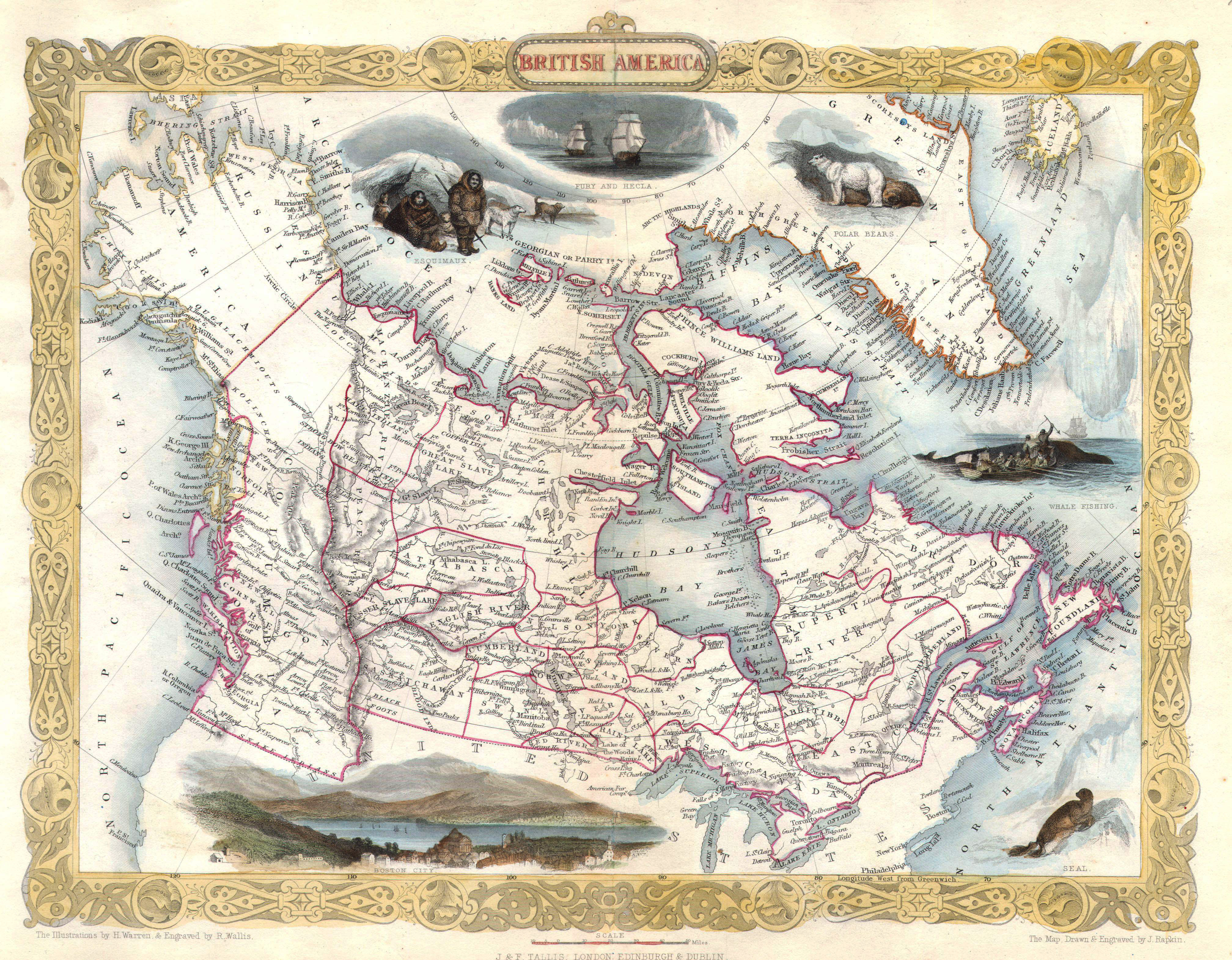
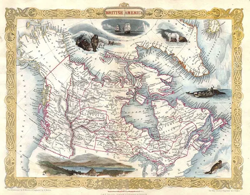
1. Tallis’s 1849 Map of British America
I first came across this beautiful map of Canada when looking for polar bear pictures. The illustrations on the map really make it interesting.
The description that comes with the map is as follows:
This is a rare and curious first state first edition of Tallis’s 1849 map of British America or what is today Canada. Extends from Russian America ( Alaska ) east as far as Greenland and Iceland. Inexplicably, this map recognizes the British claim to Oregon as far south as the Columbia River. This dispute was supposedly resolved three years previously in 1846 by the “Oregon Treaty” which officially set the U.S – British America border at the 49th parallel. Features numerous decorative vignettes typical of Rapkin / Tallis work including a seal, whale fishing, the exploring ships Fury and Recla, a polar bear, some Esquimaux (Eskimos) and a view of Boston.

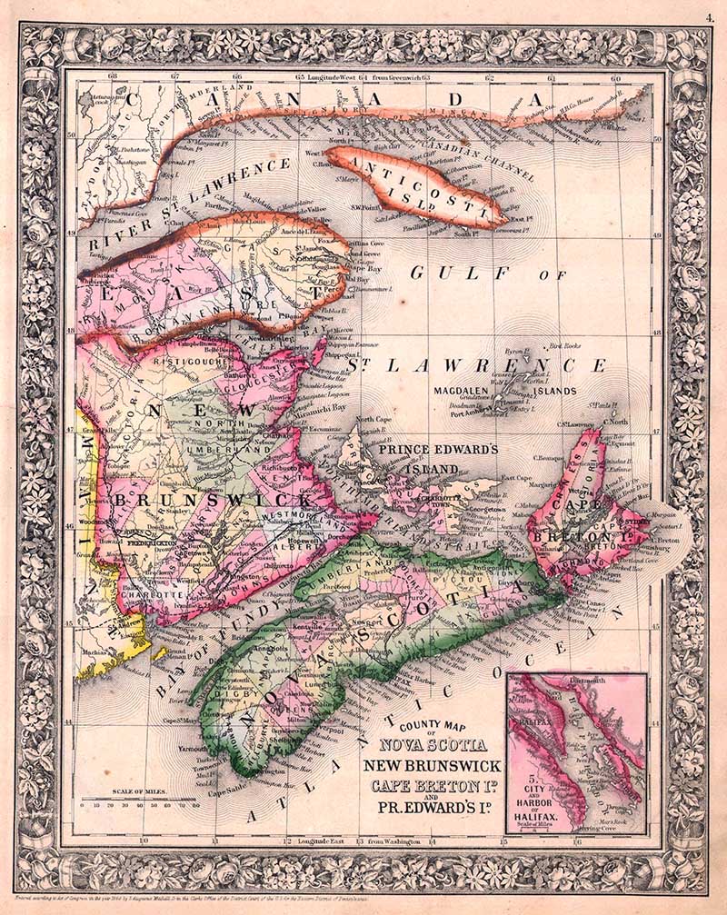
S. A. Mitchell Jr.’s 1864 Map of Canadian Provinces
The next three old Canada maps are more detailed maps of 3 areas of Eastern Canada. They were published in 1864 by the cartographer Samuel A Mitchell.
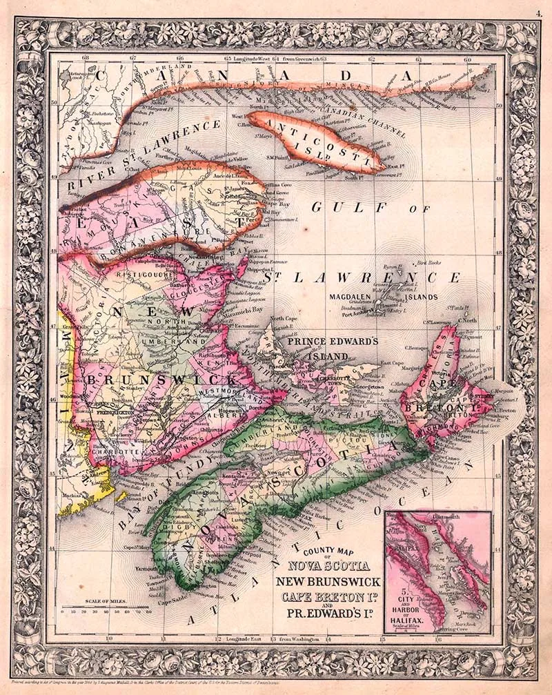
2. Map of Nova Scotia and New Brunswick
A beautiful map of Canadian Maritime Provinces of Nova Scotia, New Brunswick, Prince Edward’s Island, and Cape Breton Island. Detailed to the county level with special attention both political and geographic elements. Notes important river systems, railways, canals, and cities. An inset map in the lower right quadrant depicts the city and harbor of Halifax.
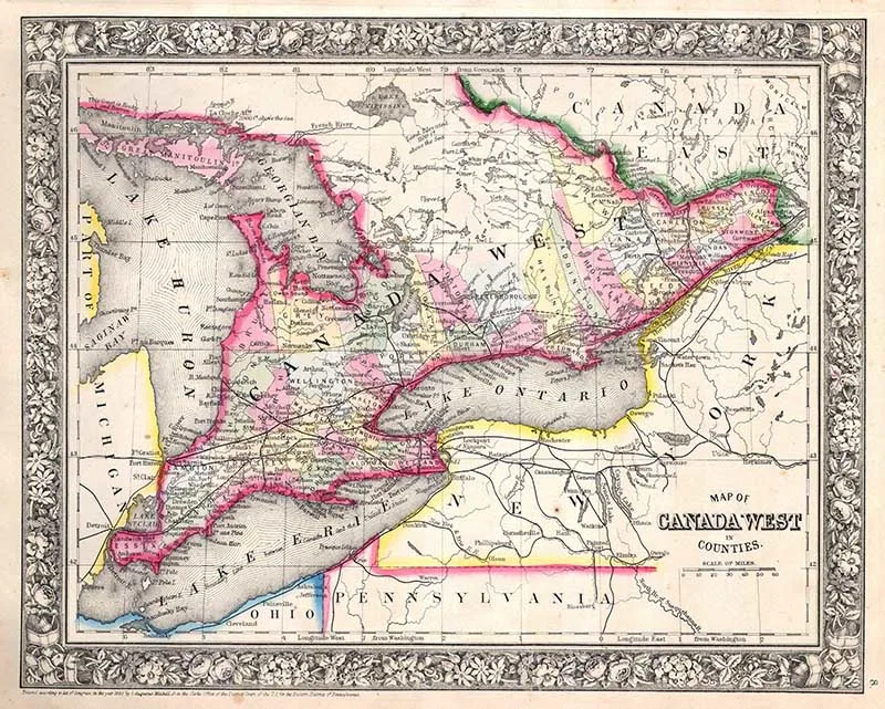
3. Map of Ontario, Canada
Another beautiful Mitchell map of Canada West, or as it is now known, Ontario. Detailed to the county level with special attention both political and geographic elements. Notes important river systems, railways, canals, and cities.

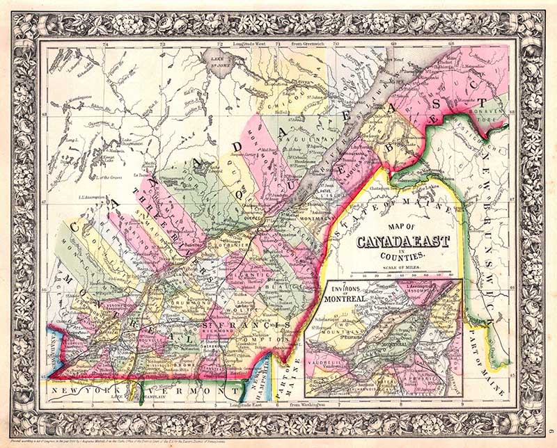
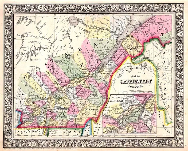
4. Map of Quebec, Canada
Another wonderful Mitchell map of Canada East, or as it is now known, Quebec. Detailed to the county level with special attention both political and geographic elements. Notes important river systems, railways, canals, and cities. An inset map in the lower right quadrant depicts Montreal and environs.
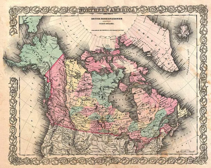
5. 1855 Old Map of Canada
Colton’s rare old map of Canada, or more specifically, British, Russian, and Danish holdings in North America. Covers the continent from modern-day Alaska (Russian America) to Greenland (Danish America), and from the U.S border north to the Arctic. Includes Iceland. Hand-colored in pink, green, yellow and blue pastels.

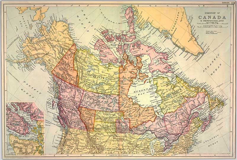
6. Vintage Map of Dominion of Canada
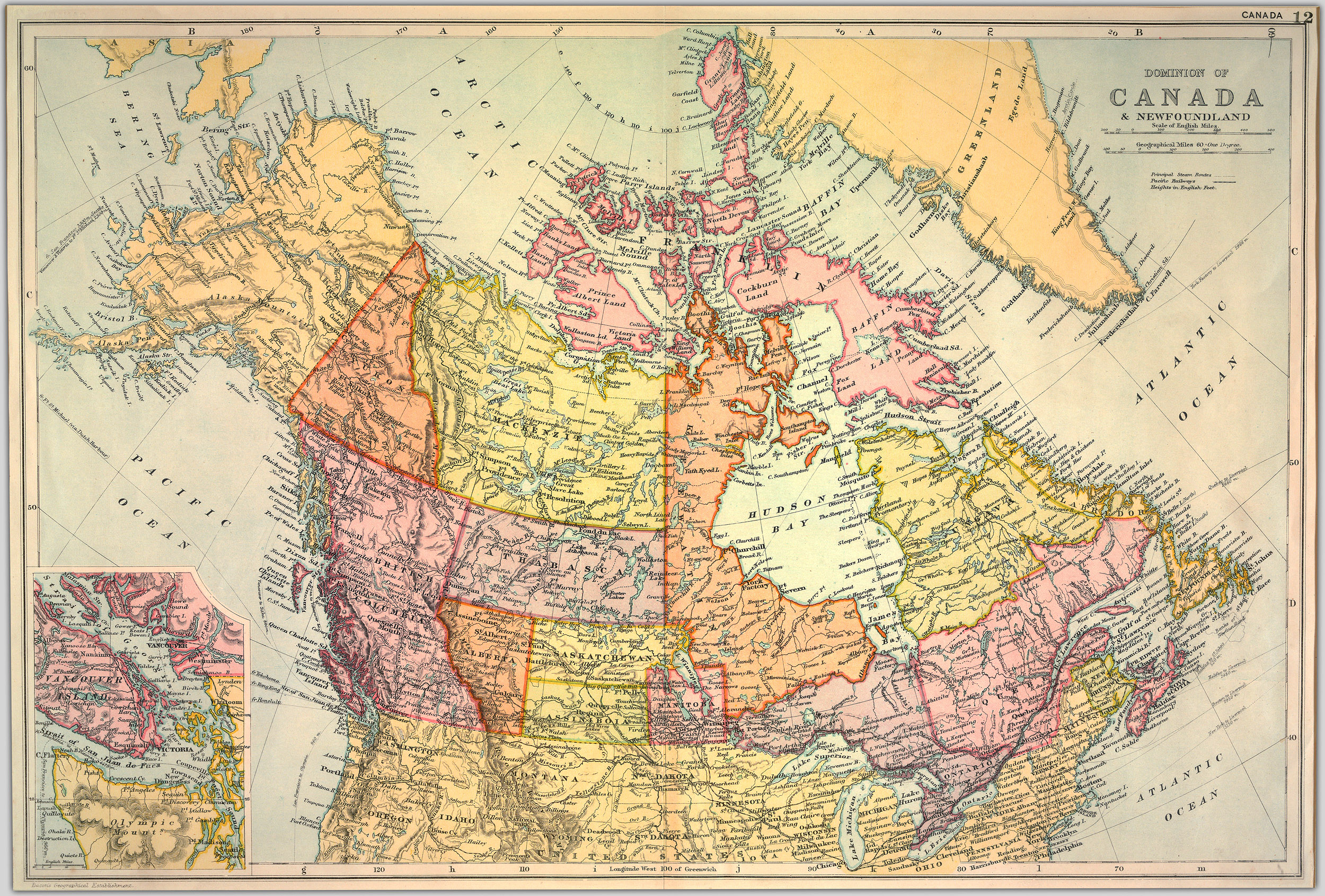
Unfortunately, I don’t know much about this lovely colourful vintage map of Canada. I believe it was published in the late 19th Century and the style suggests it could be by the publisher John Bartholomew.

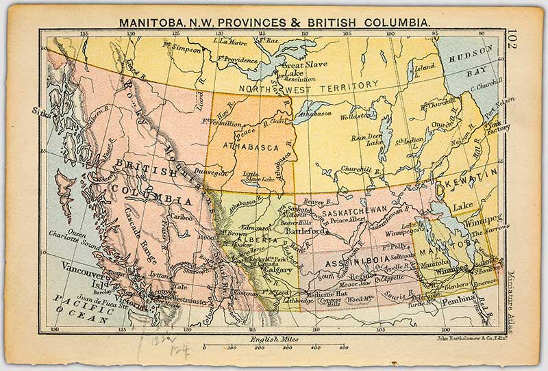
7. Manitoba, N.W. provinces and British Columbia
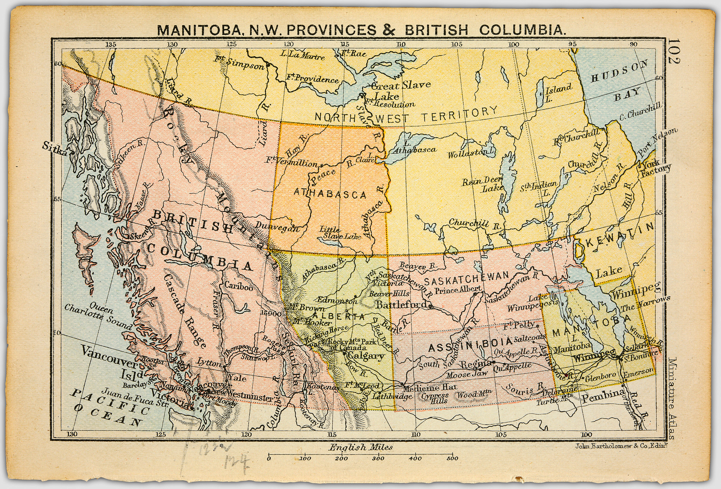
This vintage map of Canada is by the publisher John Bartholomew and shows the provinces of Western Canada.

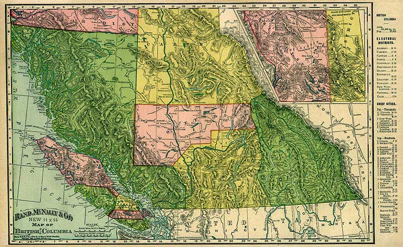
8. 1896 Map of British Columbia
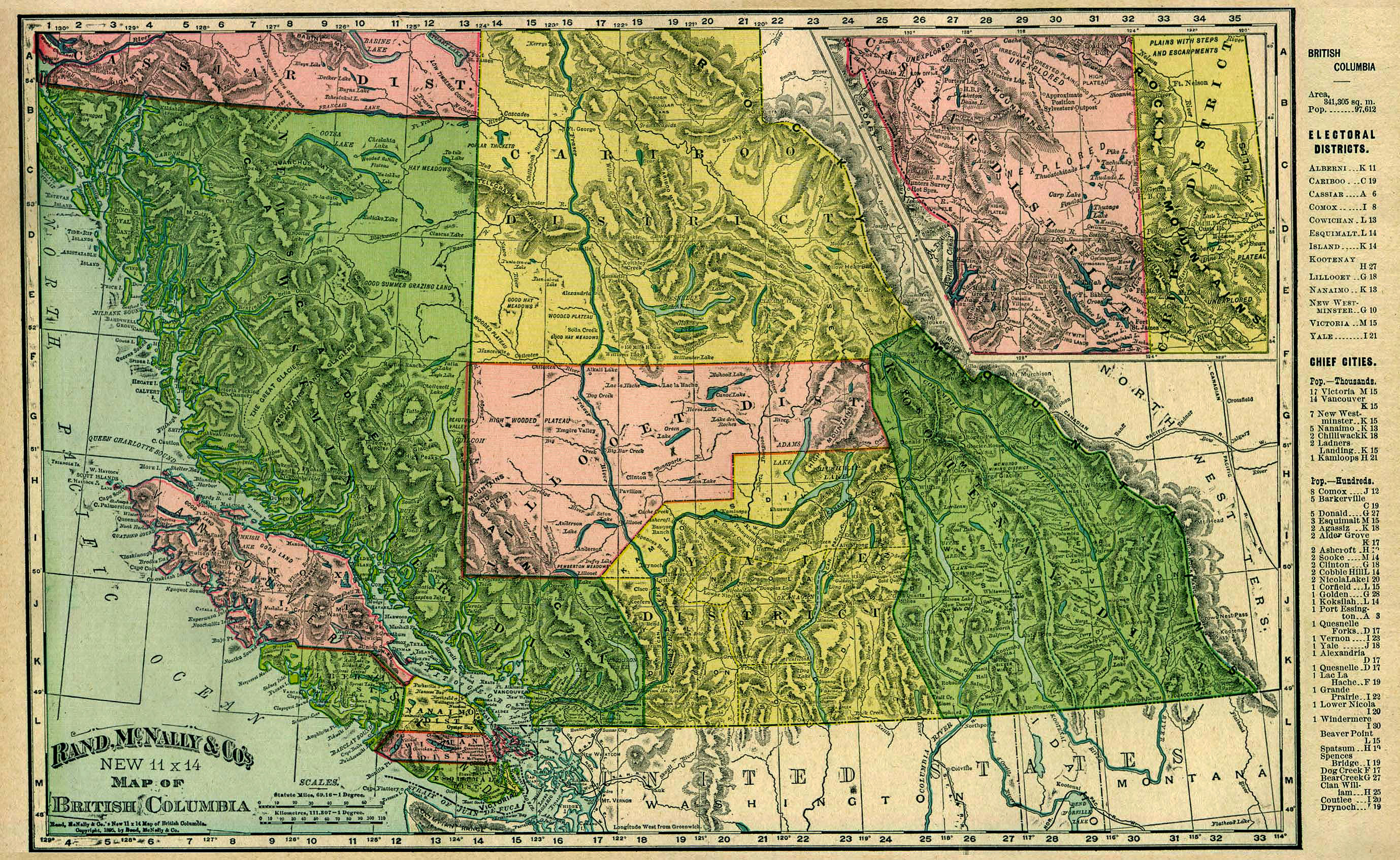
A Rand McNally & Co map of British Columbia Canada 1896.
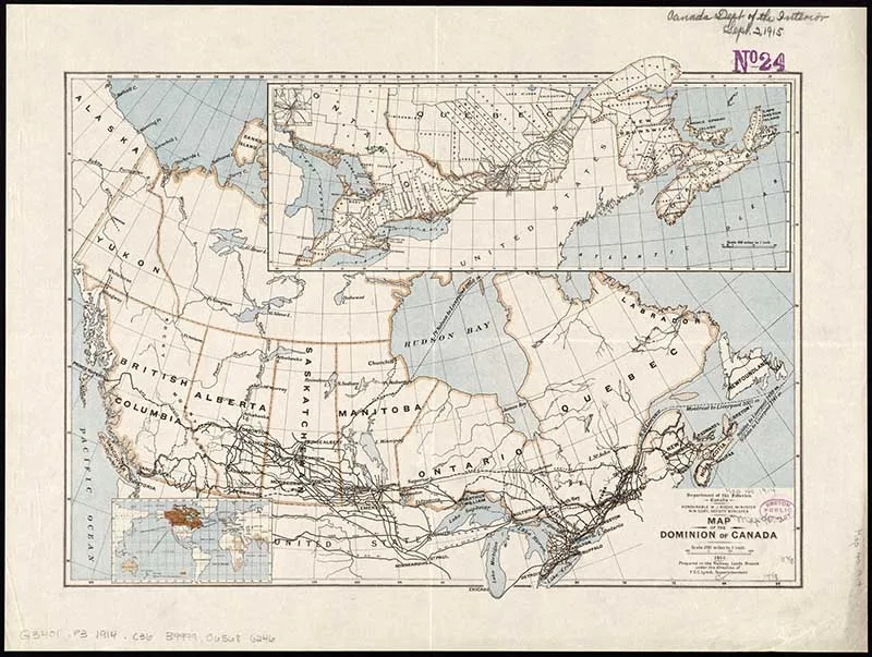
9. Old Map of Canada – Railways
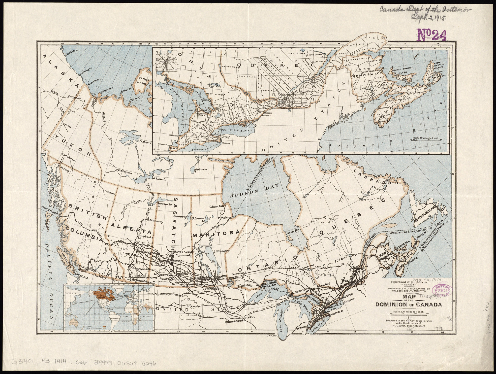
A 1914 antique map of Canada showing the railway lines.

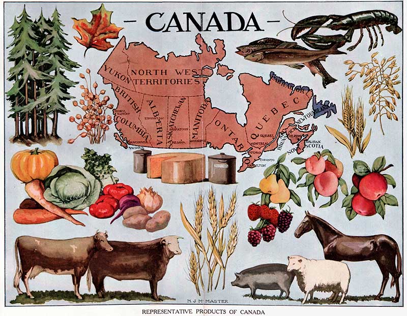
10. Products of Canada Map
A simple old map of Canada, illustrated with the main products of the country.

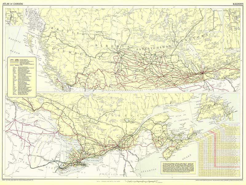
11. 1957 Map of Canada Railways
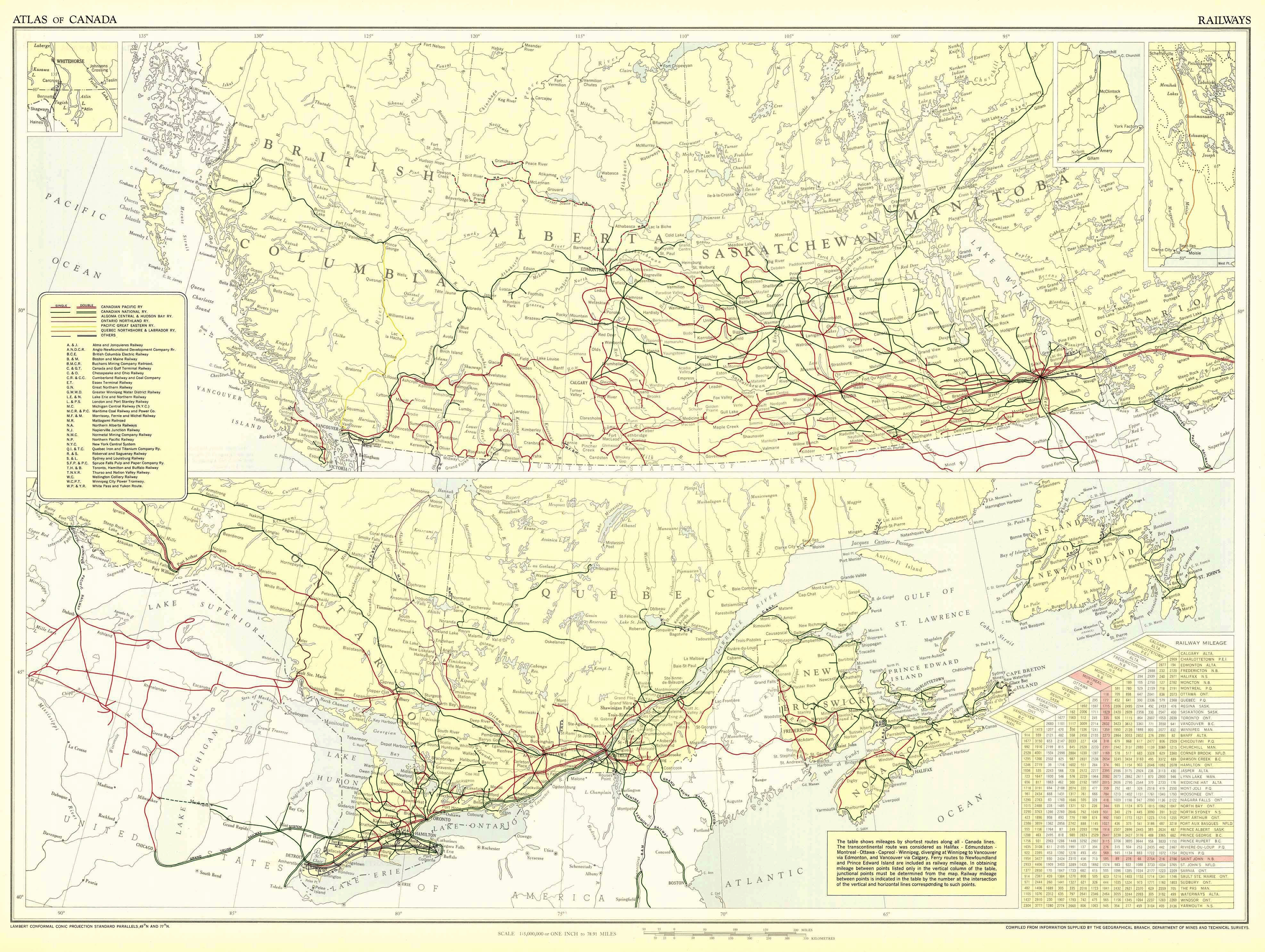
Considered to be one of the world’s greatest rail journeys, the 86 hour (4,446 Km) trans Canadian train from Toronto to Vancouver. The train stops in Winnipeg, Edmonton, and Jasper. The scenery is from the train is just breathtaking.

I hope you enjoyed this collection of free old maps of Canada. Before you go you might want to check out some of the other vintage map collections on Picture Box Blue.
Bill
Sunday 2nd of November 2025
These maps are amazing, thank you so much.
claire
Sunday 2nd of November 2025
Thank you, you're welcome.
Deena
Tuesday 1st of July 2025
Thank you for these wonderful images!
claire
Wednesday 2nd of July 2025
Thank you glad you enjoyed them
Eliza
Saturday 3rd of May 2025
Merci beaucoup !!!
claire
Sunday 4th of May 2025
Your welcome!
Teejaie
Friday 22nd of November 2019
Thanks for sharing these wonderful maps. I've printed most and am hoping to come up with a great project so I can share with family. I am from the East Coast of Canada also and have traveled this country extensively. It is my belief that I am truly blessed to have been born in the best and most beautiful country in the world. Hoping you get to see more of it yourself. Thanks again the maps are beautiful!
claire
Saturday 23rd of November 2019
Thank you, yes it certainly is a beautiful country and one of my favourites.
Thelma
Thursday 31st of October 2019
Thanks for sharing. I live in Eastern Canada, my son lives in Western Canada, I have visited a lot of this beautiful country. I hope you get to visit more of it. Greetings Thelma.
claire
Thursday 31st of October 2019
Thank you, I hope so too. It is beautiful.