
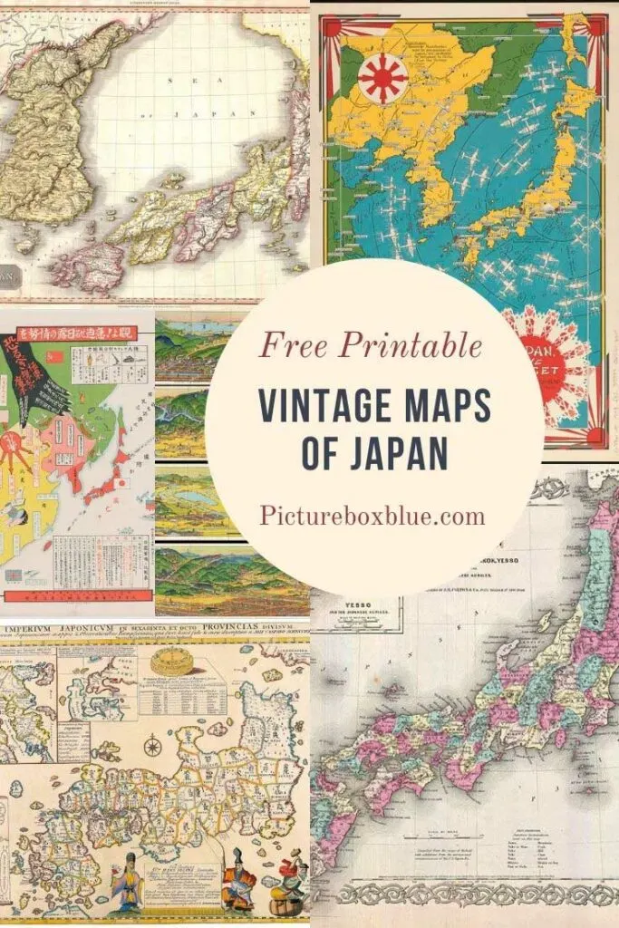
I have curated a collection of wonderful old maps of Japan to download for free.
Japan is probably on the top of my bucket list of countries to visit. I’m a big fan of Japanese food and culture, and I’d love to visit the country. I would have loved to have combined a visit to Japan with the Olympics, but it is still not certain that the postponed Tokyo Olympics will go ahead next summer.
My interest in Japan has already been reflected by some of the other vintage Japanese images that have been shared on Pictureboxblue. Such as the vintage Japanese design prints, Watanabe Seitei prints, and art woodblock prints of Utagawa Kuniyoshi.
There is also a wonderful collection of vintage Japanese travel posters on the site and vintage photos of Japanese people. I wanted to add old maps of Japan to this collection.

Geographical Facts About Japan
- Japan is actually called Nippon by the Japanese. Nippon translates as “Land of the Rising Sun.” This is because Nippon was believed to be the first country to see the sunrise in the East in the morning.
- Japan is an archipelago of over 6800 islands.
- The Japanese archipelago is about the size of Germany or California.
- The main five islands are Hokkaido, Honshu, Shikoku, Kyushu, and Okinawa.
- The capital city Tokoyo is to be found on Honshu and is the most populous city in the world.
- Honshu is the 7th largest island in the world and the 2nd most populous after the Indonesian island of Java.
- The population of Japan is approximately 126 million.
- Japan is a very mountainous country, over 70% of Japan is made up of forest and mountains that aren’t suitable for farming or living in.
- The largest mountain in Japan is Mt Fuji at 3,776 meters.
- Mt Fuji is considered a sacred mountain and over a million people climb it every summer.
- Mt Fuji is a dormant volcano that last erupted in 1707.
- Japan is in what is known as the “Pacific ring of fire” with 108 active volcanoes.
- Japan has the most number of earthquakes in the world each year, of any country.
The Old Maps Of Japan
To download the map you want, just click on the title above that map. A higher resolution map will open in a new window on your browser. If you right-click with your mouse whilst on the map, you can save it to your device.
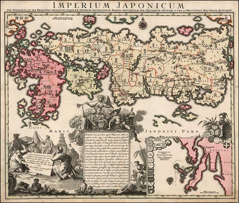
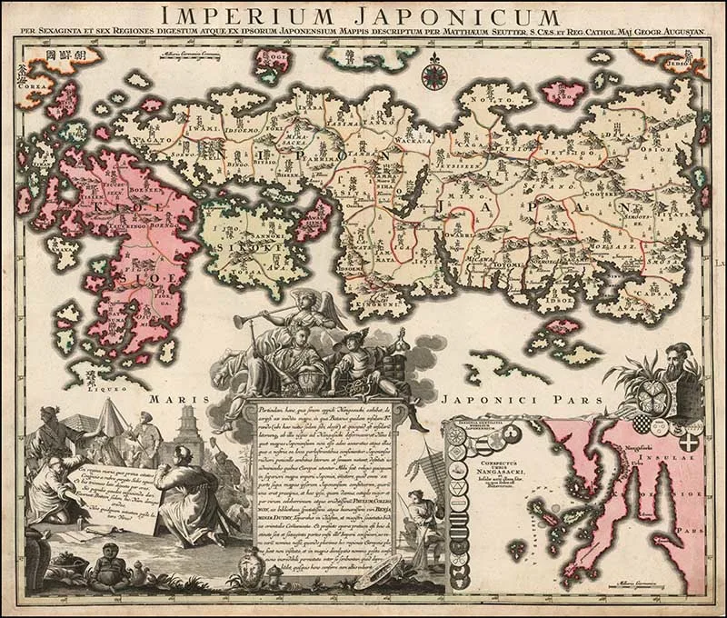
1. 1740 Map Of Japan by Matthaus Seutter
This map is by Adrien Reland, a Dutch cartographer who interestingly never left the Netherlands.
It was the first old map of Japan to use Sino-Japanese characters on a European printed map. At the time, this was one of the most important maps of Japan.
The map includes a large inset of the area around Nagasaki, the location of an island, which at the time was the only place where Westerners were allowed to trade with Japan.
(Warning this is a large map to download)
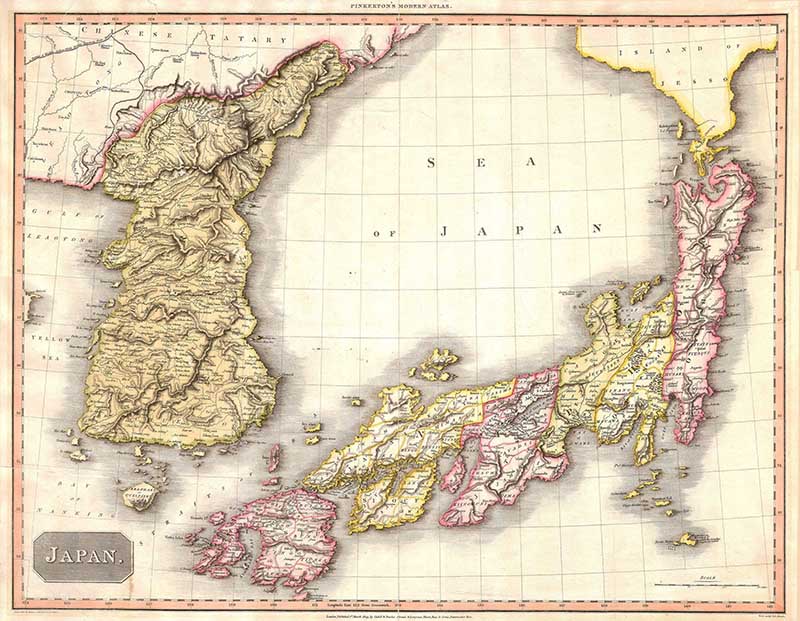
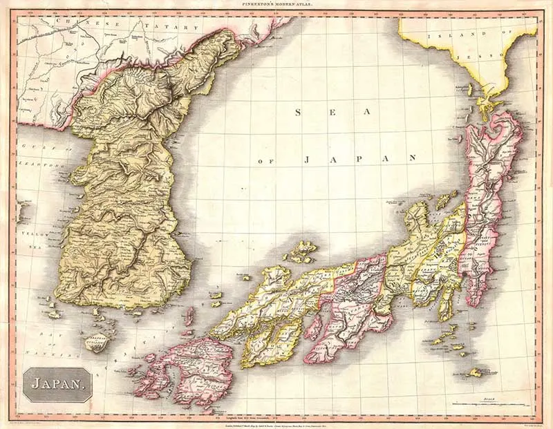
2. 1809 Pinkerton Map of Korea & Japan
A hand-colored map by the Scottish cartographer John Pinkerton. This is a highly detailed map of this region of Asia is considered to be one of the finest maps of Japan from the 19th century.
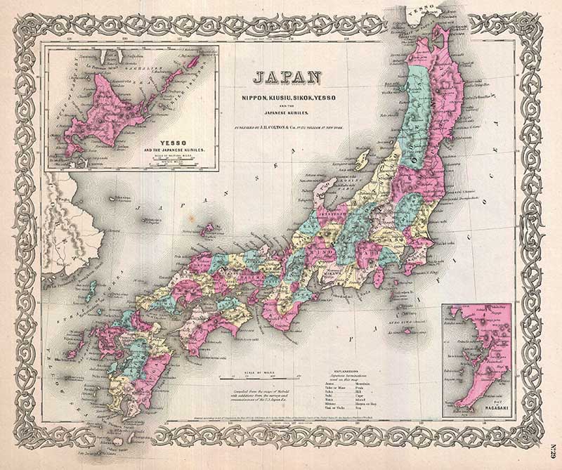
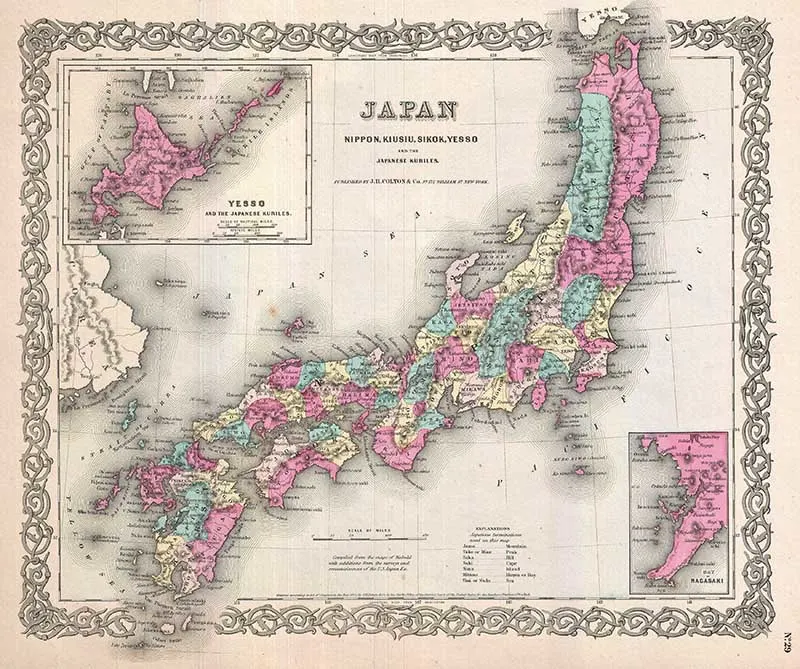
3. 1855 Colton Map of Japan
A beautiful 1855 first edition example of Colton’s map of Japan.
An inset map in the upper right focuses on Hokkaido or Yesso and the Japanese Kuriles. Another inset in the lower right quadrant details the Bay of Nagasaki.
Throughout, Colton identifies various cities, towns, rivers, and an assortment of additional topographical details. From the first edition of George Washington Colton’s 1855 Atlas of the World.
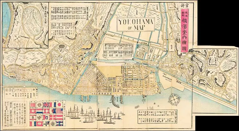
4 . 1870 Map of Yokohama
Yokohama is the second-largest city in Japan by population. It lies on Tokyo Bay, south of Tokyo, on the main island of Honshu.
Yokohama developed rapidly as Japan’s prominent port city following the end of Japan’s relative isolation in the mid-19th century and is today one of its major ports.
15 years before, Yokohama was just a fishing village. By the time this map was printed in 1870, it had become a vibrant international trading port. Hence, all the flags and ships on the map. It is still the largest seaport in Japan.

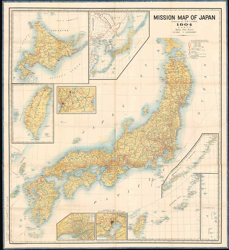
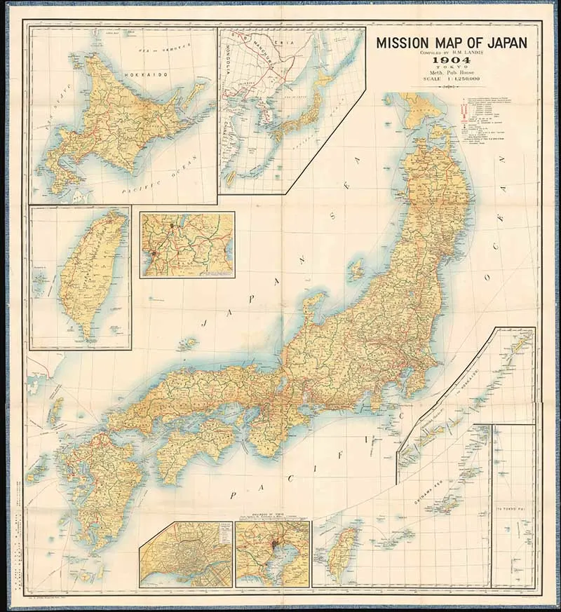
5. 1904 Landis Mission Map of Japan
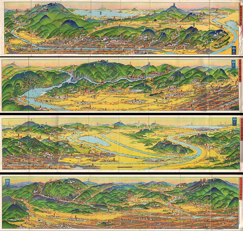
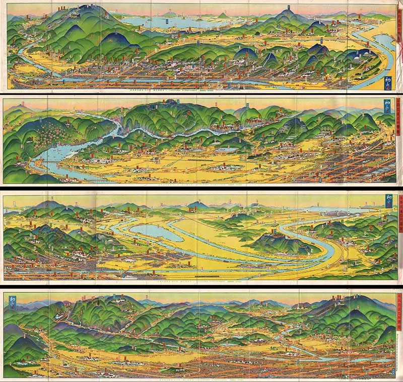
6. 1928 Hiroshi Yoshida Railroad Map of Kyoto
There are actually 4 old Japanese maps here and not just one. They were drawn by the famous Japanese illustrator and printmaker Hiroshi Yoshida.
These panoramic style maps were common in 19th century Japan for essential transport and rail maps. The maps here show different parts of Kyoto – North, South, East, and West.
Kyoto is considered the cultural capital of Japan and a major tourist destination. It is home to numerous Buddhist temples, Shinto shrines, palaces and gardens, some of which are listed collectively by UNESCO as a World Heritage Site.
If you like this colorful lithograph map, then check out these wonderful geographical posters on the site.
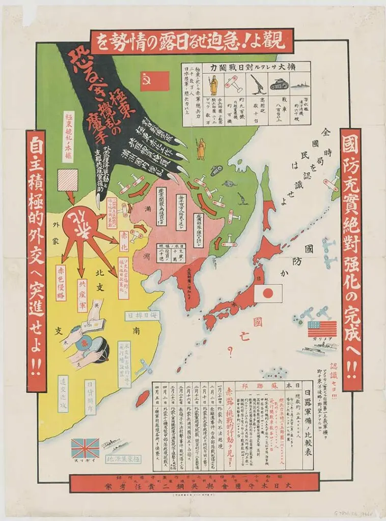
7. 1936 Japanese anti-Communist propaganda map of East Asia
A colorful cartoon old map of Japan and East Asia against the rise of communism.

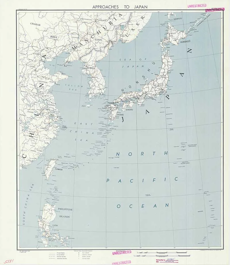
8. 1945 Map of Japan
1945 CIA map of Japan.

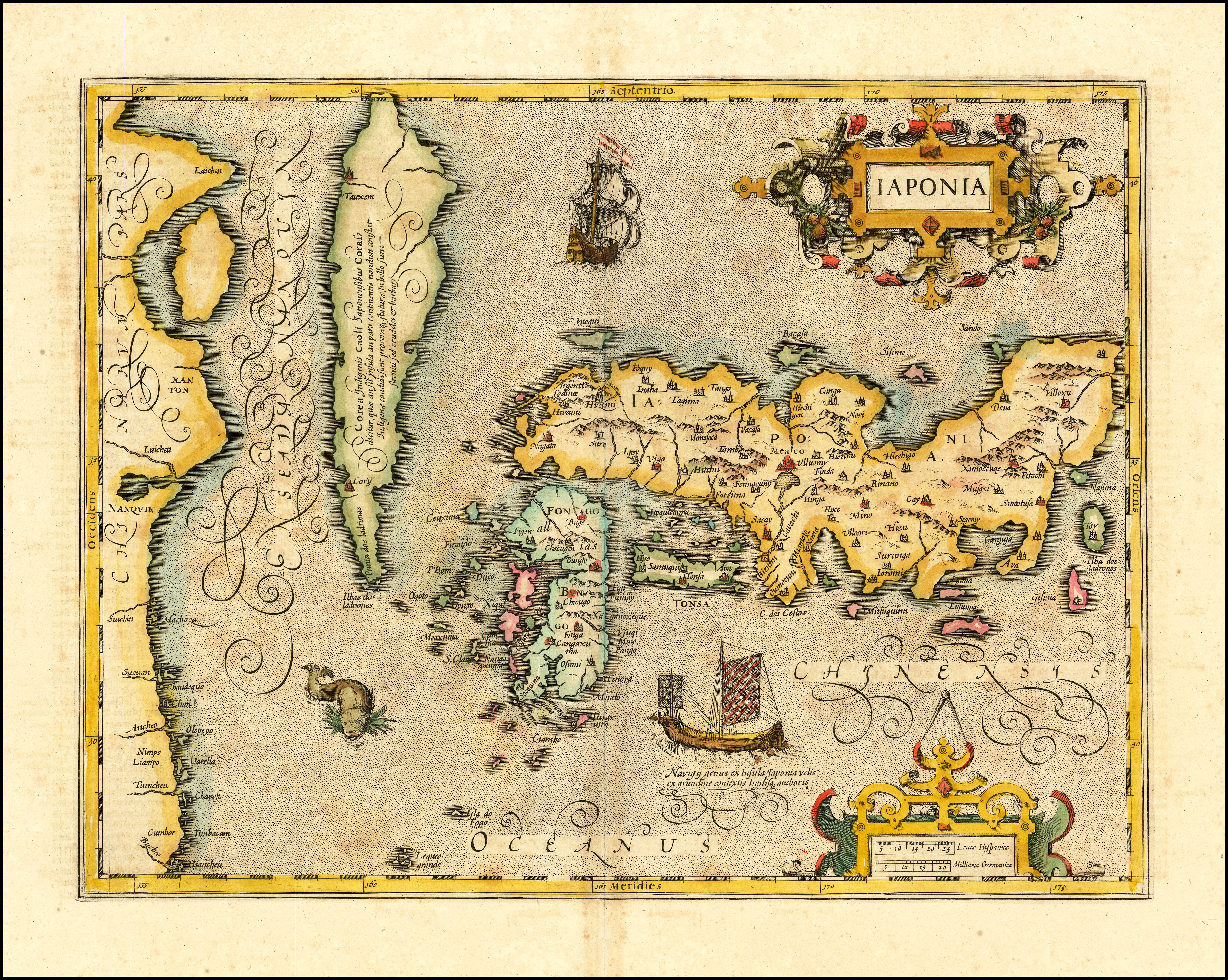
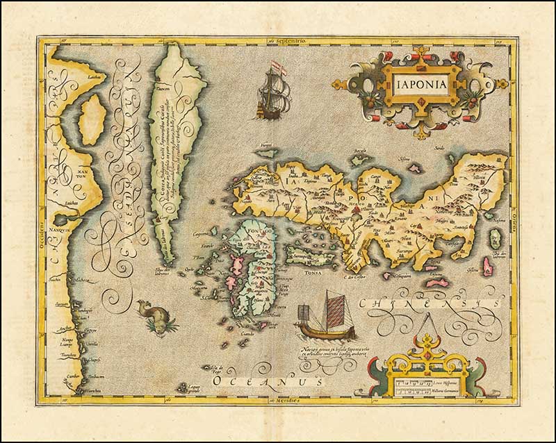
9. 1619 Iaponia
A very old map of Japan by the Dutch cartographer Jodocus Hondius. The map is in Latin. Iaponia is the Latin name for Japan.

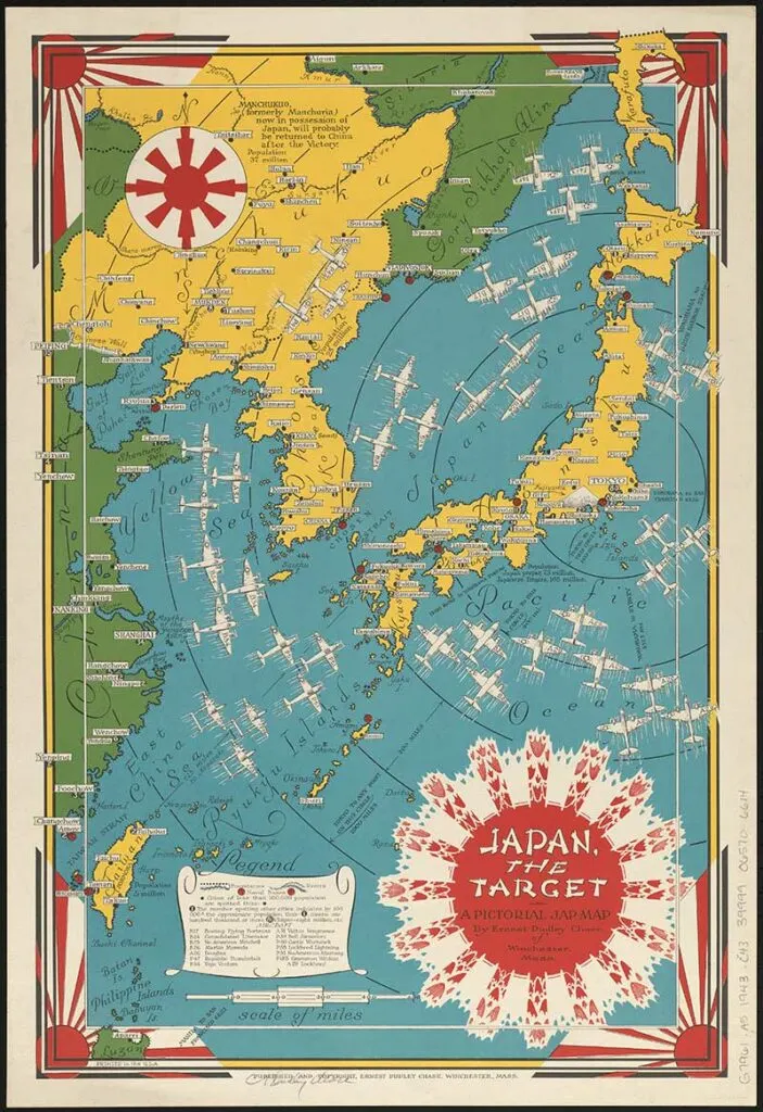
10. 1943 Japan The Target
Second World War propaganda map of Japan showing airplanes targeting the country.
This map is by Ernest Dudley Chase, who also created the pictorial map of Loveland.

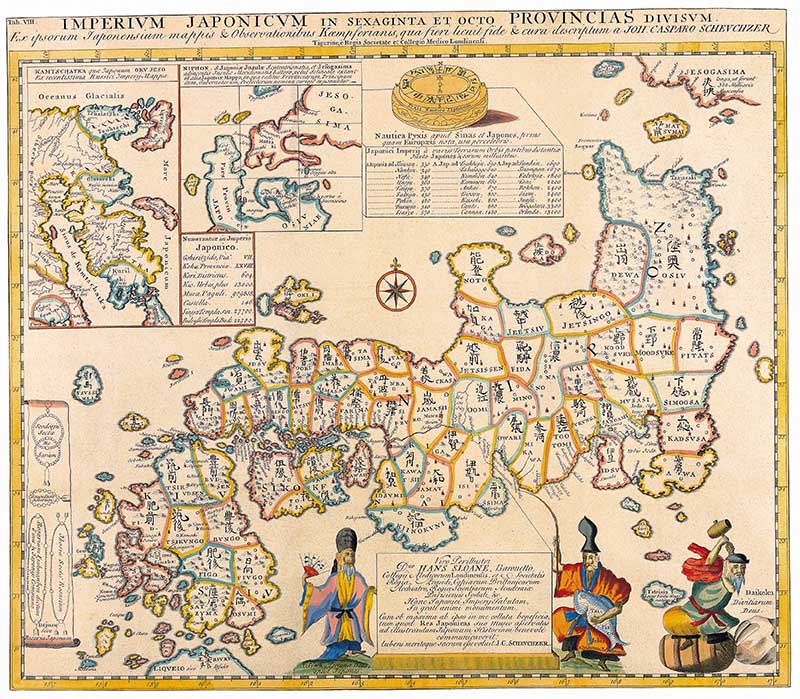
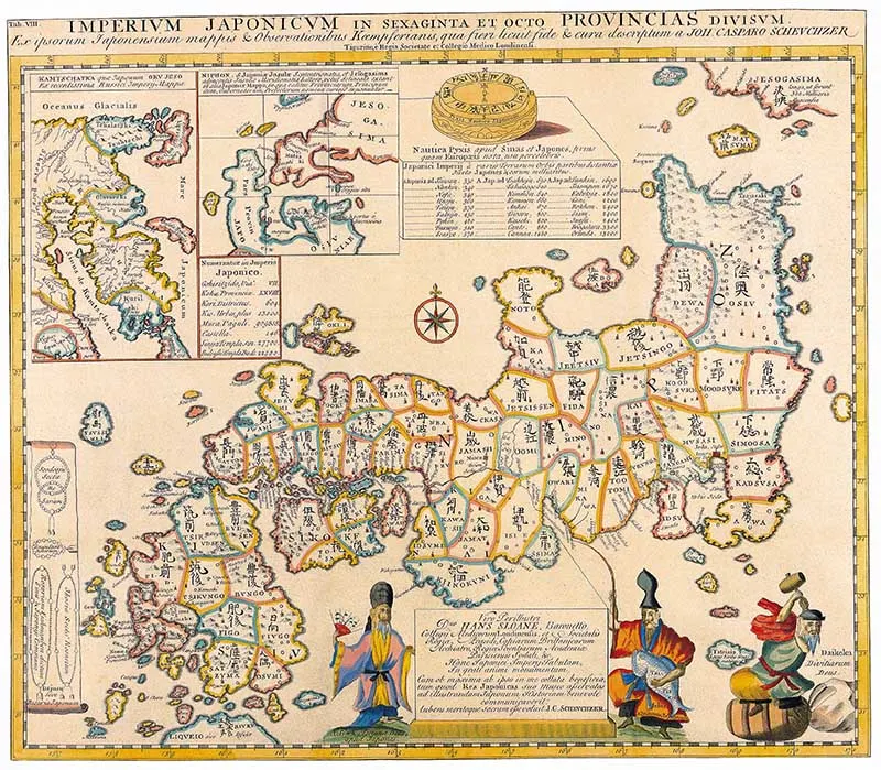
11. 1727 Old Map of Japan
Old map of Japan by the German explorer Engelbert Kaempfer. His History of Japan, published in 1727, was the chief source of Western knowledge about the country throughout the 18th and mid-19th centuries when it was closed to foreigners.
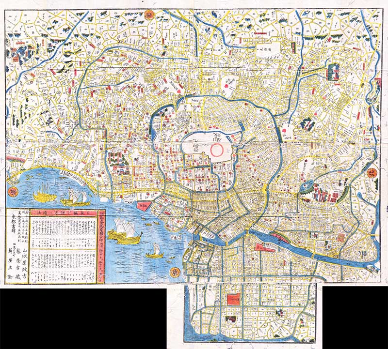
12. 1849 Old Woodcut Map of Tokyo (Edo)
Edo is the old name for Tokyo, the city changed names in 1868.
This is a hand colored Edo Period woodcut map of Edo, or Tokyo, Japan. This map is a combination of practical and decorative, ships and waves decorate the harbor and there is no specific directional orientation. All text seems to radiate from the center of the map.

I hope you have enjoyed this interesting and colorful collection of old maps of Japan. Don’t forget to check out some of the other wonderful vintage map collections on Picutreboxblue. Such as the antique maps of Asia, old maps of China and the hemisphere maps of the world.
You can find the complete collection of vintage Japanese posts on Pictureboxblue, including some beautiful Japanese patterns.
Jennifer Watson
Monday 8th of March 2021
Interesting thankyou!
claire
Tuesday 9th of March 2021
Thank you.