
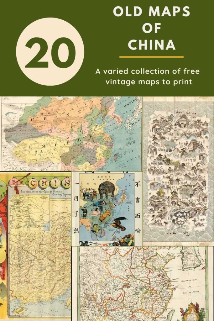
Here is a collection of old maps of China which are in the Public Domain and free to print.
I have included Hong Kong and Macau maps as they are part of China. Being born and brought up in Hong Kong, I am genuinely interested in this collection of vintage maps of China.
I now live in the UK but love to visit Asia whenever I can, especially Hong Kong. As soon as the borders open up again, I will be booking a vacation to the region.
All eyes will be focused on China next month, with the upcoming winter Olympics in Beijing. It’s also Chinese New Year soon.
There are some images of traditional Chinese patterns and vintage Chinoiserie prints on Pictureboxblue that you might want to check out.

Interesting Titbits About China
- China may not quite be the largest country in the world by landmass (it’s third after Russia and Canada), but it is the most populous.
- The country is officially known as the People’s Republic of China (PCR).
- China borders 14 different countries (just two less than Russia).
- Almost one in every five people in the world are Chinese.
- China has six of the world’s 33 megacities. The largest of which is Shanghai with a population of over 33 million.
- Despite its landmass, China operates in a single time zone. Everything runs on Beijing time. This means at Chinas most easterly border with Afghanistan, the time difference between the 2 countries is 4.5 hours.
- Table tennis is the national sport of China.
- Pandas are the national animal of China.
How to Download The Old Maps Of China
Click on the title above the vintage map of China you want to download. A higher-resolution map will open in a new window in your browser. If you then click on that map with your mouse, you can save it to your device.
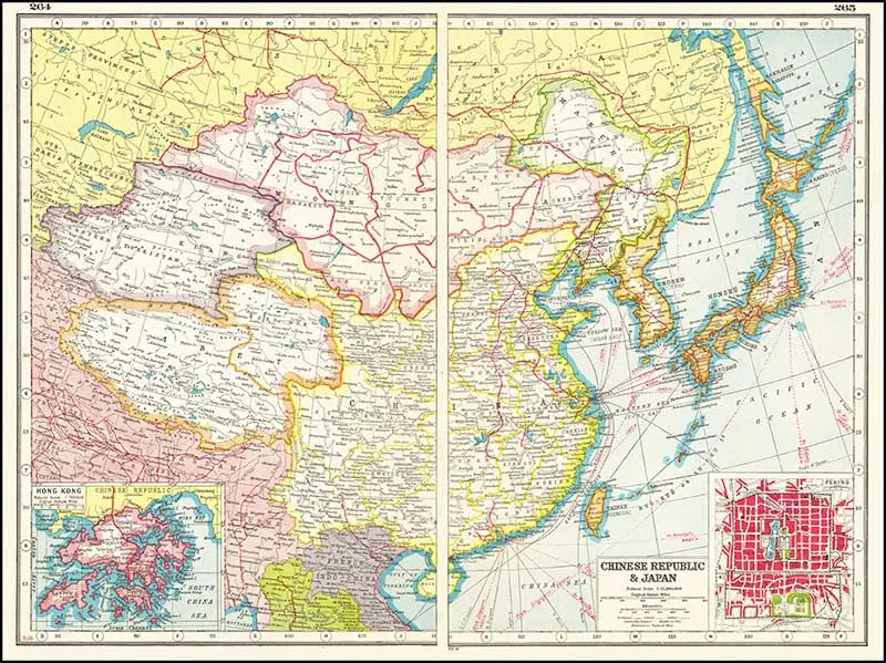
1. 1920 map of the Chinese Republic & Japan
I particularly like this map as it includes a detailed inset map of Hong Kong in the bottom left-hand corner. The bottom right corner consists of an inset map of Beijing.
(There are more old maps of Japan here).

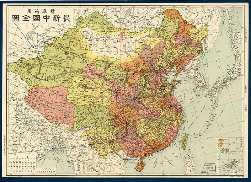
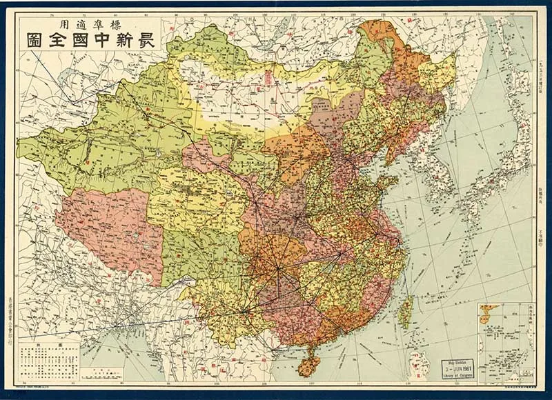
2. 1953 Old Map Of China In Chinese
A Chinese language map of China showing the administrative regions. From the collection at the Library of Congress.
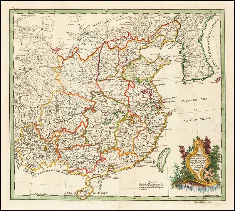
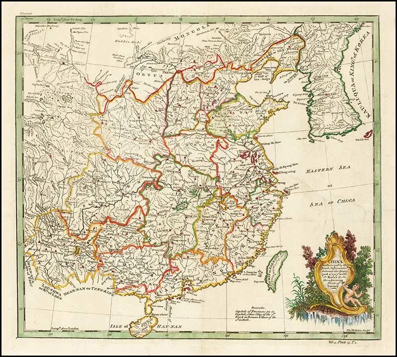
3. China as Surveyed by the Jesuit Missionaries
1770 Map of China as Surveyed by the Jesuit Missionaries between the Years 1708 & 1717, with Korea & the adjoining parts of Tartary.
Tartary was a blanket term used by Europeans for the areas of Central Asia, North Asia, and East Asia unknown to European geography.
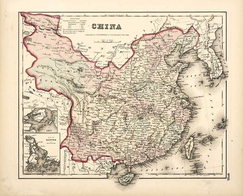
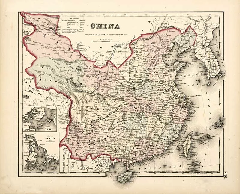
4. Colton’s Map of China
A vintage Map of China from the 1857 edition of Colton’s General Atlas.
There are inset maps of Canton and Amoy, these cities are now known as Guangzhou and Xiamen respectively.
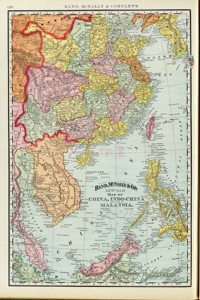
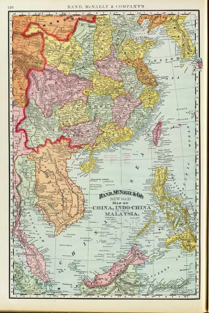
5. Old Map of China, Indo-China, Malaysia
Map from 1897 Rand McNally and Company Atlas.
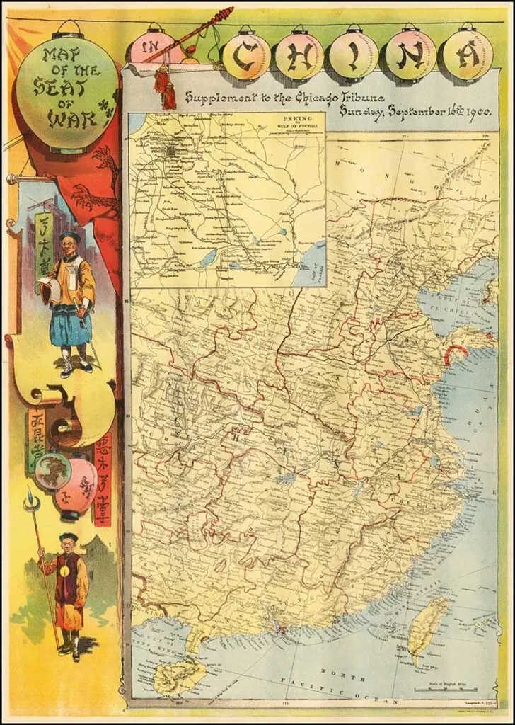
6. Map of the Seat of War in China
An old pictorial map of China as a supplement to the Chicago Tribune Sunday, September 16th 1900.

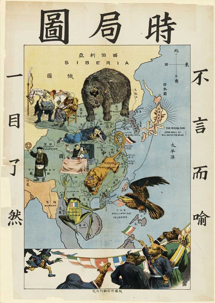
7. Political Cartoon Map of China 1900’s
A political cartoon map by Tse Tsan-tai, depicted the western powers encroaching on China at the end of the nineteenth century in symbolic form.
The bear representing Russia is intruding from the north, the bulldog head with a lion body representing the United Kingdom is in south China, with its tail around the Shantung peninsula. The Gallic frog is in southeast Asia. The bald eagle representing the United States is approaching from the Philippines. The symbolic Sun behind Japan spreads its rays across Korea onto China, while Japan fishes for Taiwan. Some other European countries, following Prussia, are waiting to invade China at the bottom of the map.

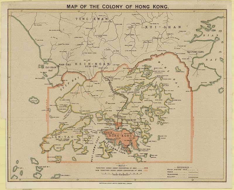
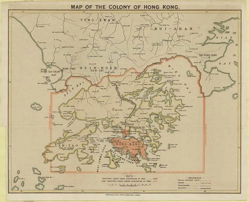
8. 1900 Map Of Hong Kong
A colonial map of Hong Kong. In 1997 the colony became a special administrative region of China.
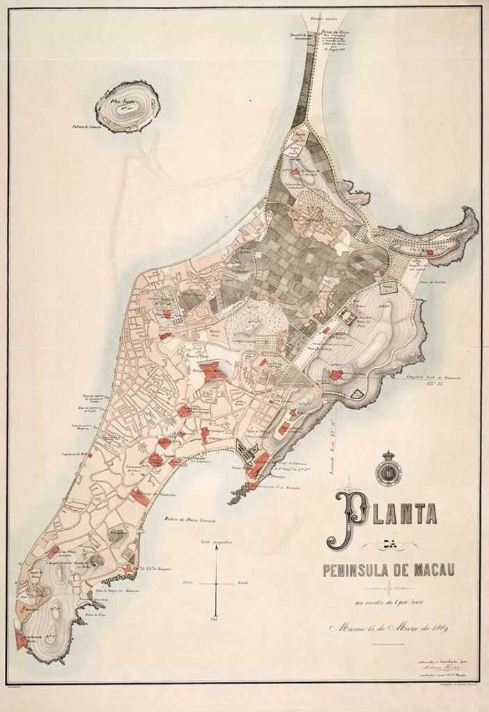
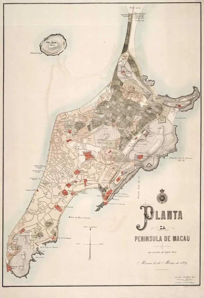
9. 1889 Map of Macau
Macau was a Portuguese colony off the coast of China from 1557 to 1999. Since then it has also become a Special Administrative Region of China.
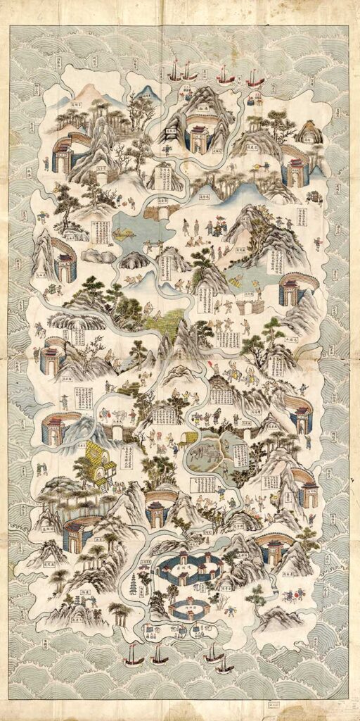
10. Pictorial Map of Hainan Island
This is a beautifully illustrative early 19th Century map of Hainan Island China.
Hainan is the largest and most populous island in China. It lies off the southernmost part of the country.
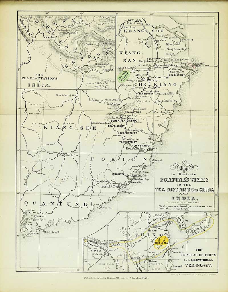
11. 1853 Map of the Tea Districts of China & India
A map to illustrate Robert Fortune’s visits to the Tea districts of China and India.
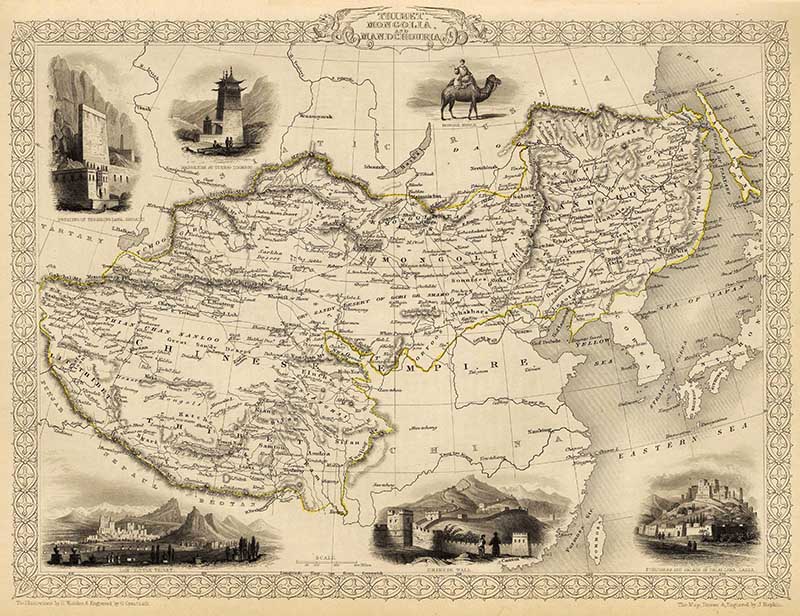
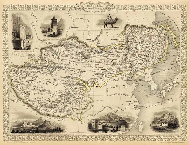
12. 1851 Map of Tibet, Mongolia and Manchuria
Old Map of China by John Tallis, illustrating the northern and western part of the Chinese Empire, “Tibet, Mongolia, and Manchuria”.
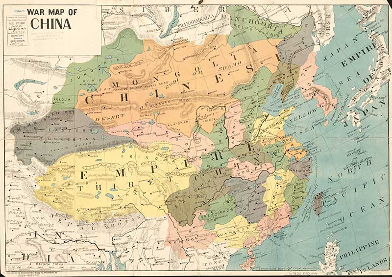
13. 1900 War Map of China
Another vintage map of China from the Library of Congress.

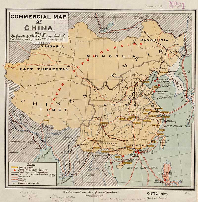
14. 1899 Commercial Map of China
United States Government Commercial map of China, showing treaty ports, ports of foreign control, railways, telegraphs, waterways.

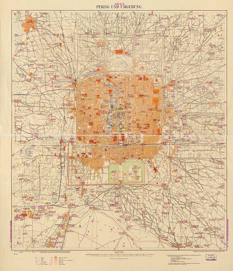
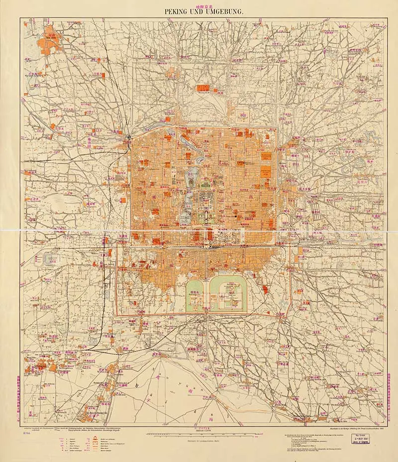
15. 1907 Map of Peking and Surrounds
A German map of the Chinese city of Peking and its surrounding suburbs. Peking is an old European name for the capital of China, now called Bejing.
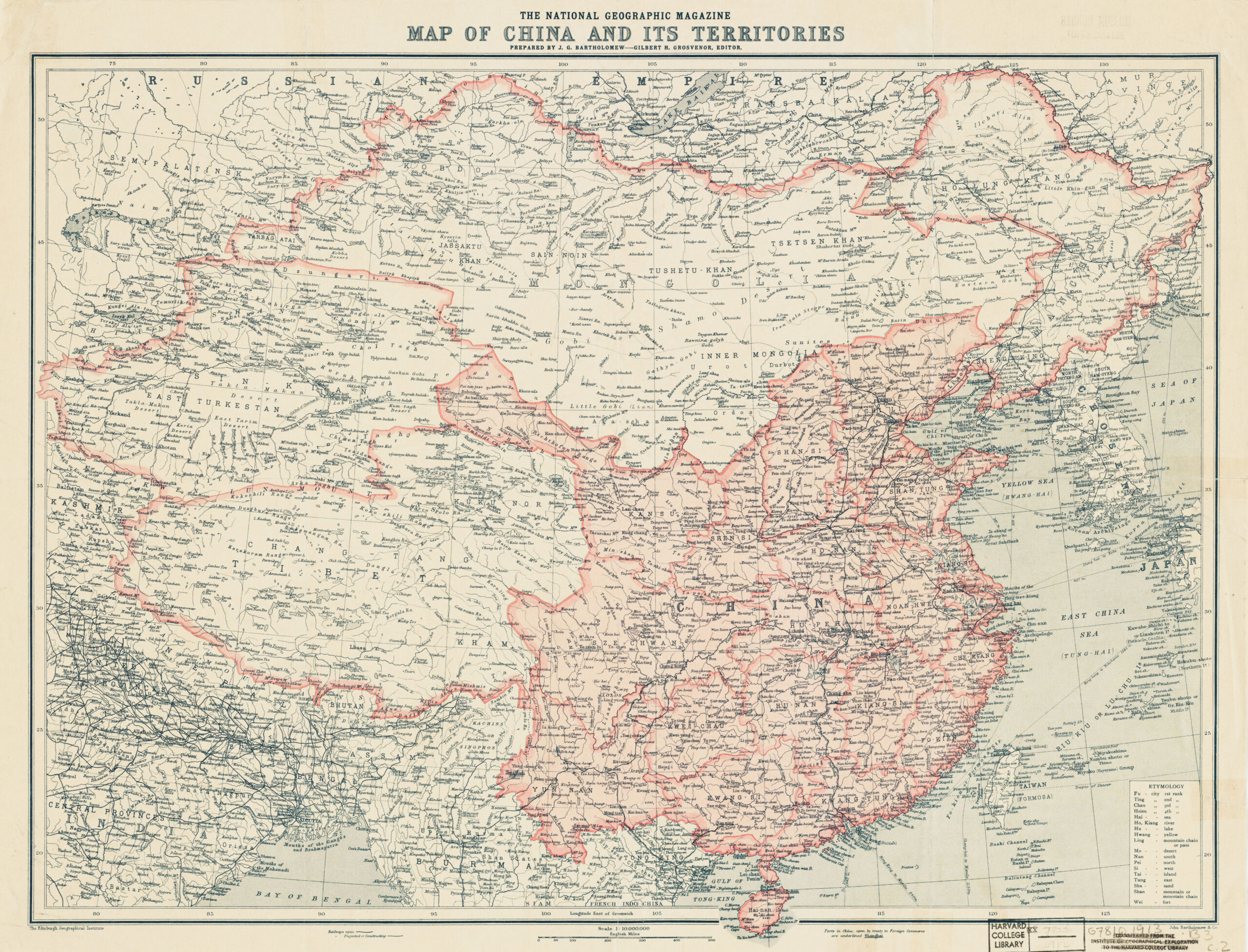
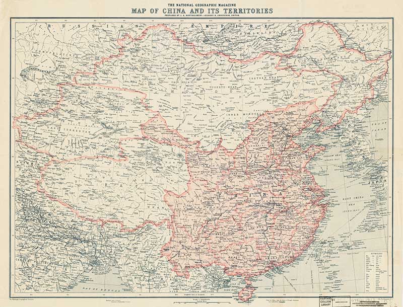
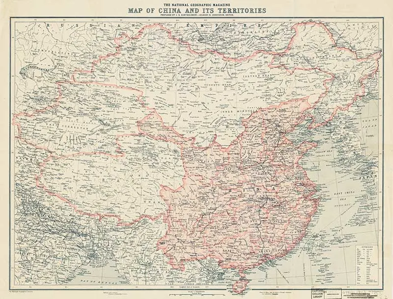
16. National Geographical Magazine Old Map of China
The 1912 National Geographic Magazine map of China and its territories.
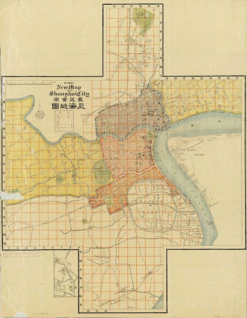
17. Map Of Shanghai City
Shanghai is the most populous city in China. This 1916 map of the city is from the collection at the Library of Congress.
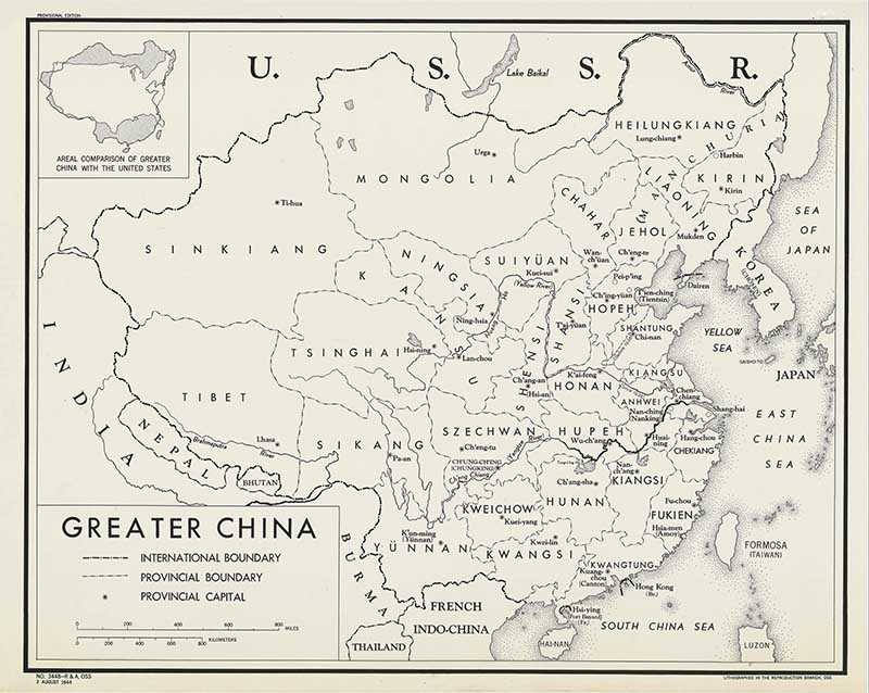
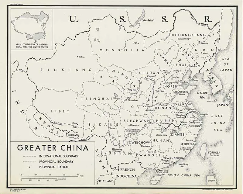
18. 1944 Map of Greater China
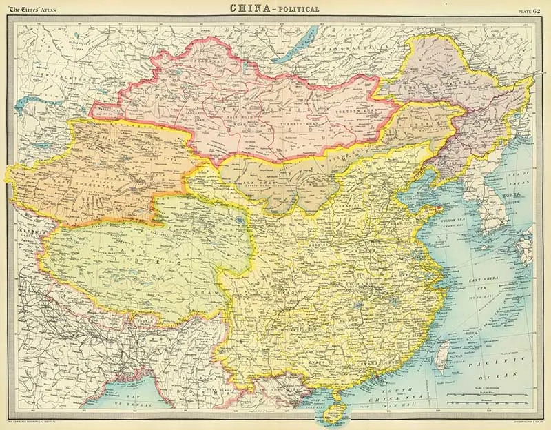
19. Political Map 1922
A political map of China from the 1922 edition of The Times Atlas.

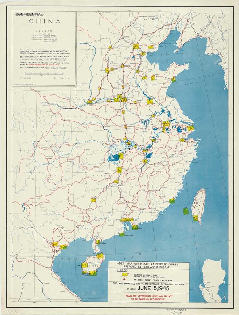
20. 1945 Map of China Railroads

I hope you enjoyed this varied collection of vintage Chinese maps. Don’t forget to check out the many other vintage maps on the site. There are antique maps of the world, country maps and old maps of famous cities.
The major celebration in China each year is their New Year celebrations. This year the Chinese zodiac animal will be the tiger, so you might want to check out the tiger drawings and illustrations on Pictureboxblue.
phan huy quynh
Tuesday 20th of June 2023
thanhks you so much. The maps are so usefully.
claire
Wednesday 21st of June 2023
Thank you, glad you like them.
Andrew
Thursday 27th of January 2022
Thanks Claire, Lovely stuff.
claire
Saturday 29th of January 2022
Thank you, you're welcome.
Donna @ Modern on Monticello
Wednesday 26th of January 2022
Old maps are just so interesting. Thanks for sharing them this week. #HomeMattersParty
claire
Thursday 27th of January 2022
Thank you, I just can't resist an old map, they are fascinating.
Cecilia
Sunday 23rd of January 2022
Lovely collection, Claire! Thanks for sharing at Vintage Charm!
claire
Tuesday 25th of January 2022
Thank you so much, I do love my vintage maps.