
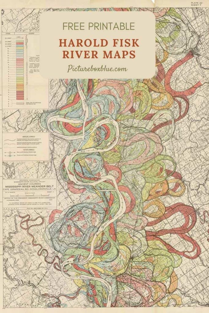
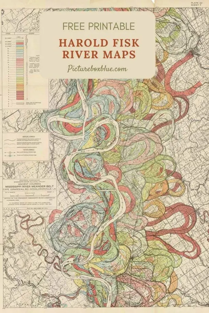
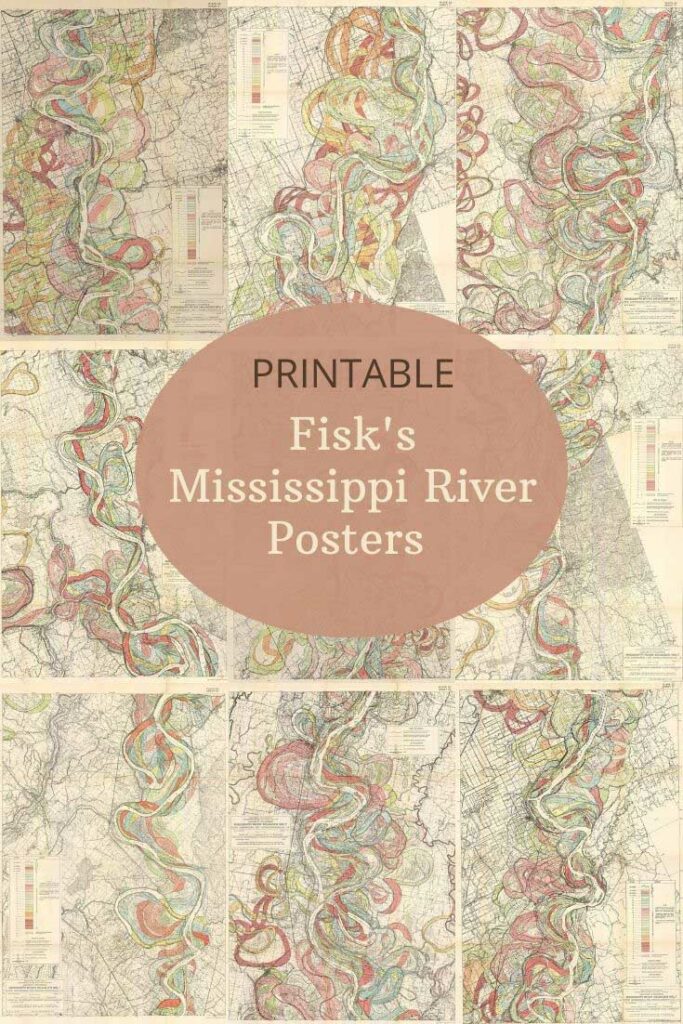
A stunning collection of vintage Mississippi River maps, including the beautiful meander charts by Harold Fisk. Created in 1944 to show how the river’s course shifted over centuries, these colourful historic maps look more like artwork than traditional cartography. Perfect for printable wall art, classrooms, junk journals, or creative projects, these free, public-domain river charts are a must for map lovers and vintage print fans alike.
I first came across these maps in the V&A Museum of London’s gift shop. And actually mistook them for a piece of artwork. The maps are full of colourful curves and swirls. I have since seen prints of the maps for sale for hundreds of dollars in fancy interior shops.
These maps of Harold Fisk are in the Public Domain. I have managed to find some good digital downloads of them. In my search, I also came across some other wonderful vintage Mississippi River maps. You can also download and print it for free.
If you like maps of rivers, you will probably enjoy the wonderful mountain sketches and charts on Pictureboxblue. Some of these illustrations feature the world’s longest rivers, too, or pictorial maps by Chase.
Harold Fisk’s Meandering Maps of the Mississippi River
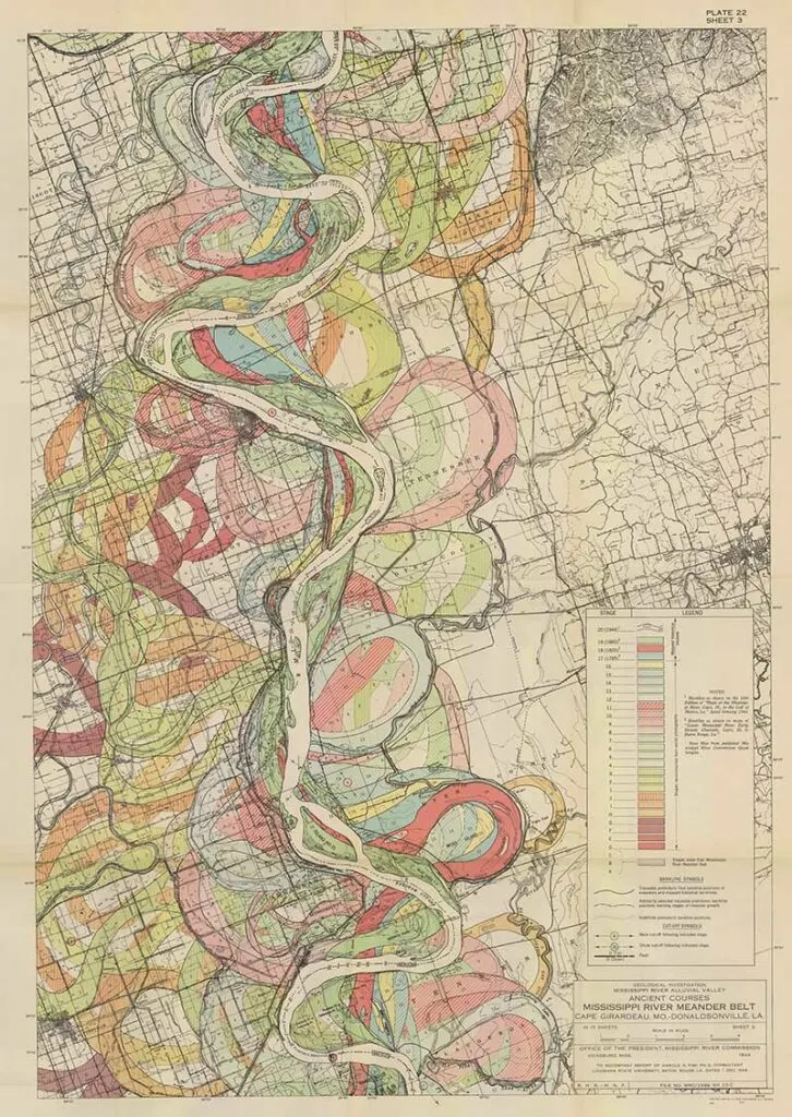
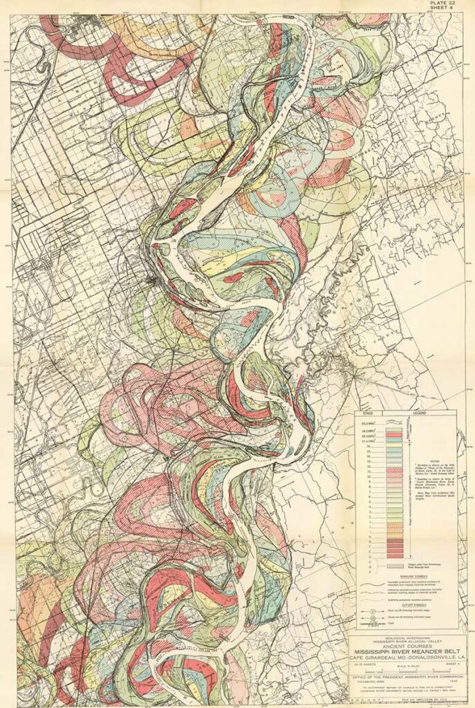
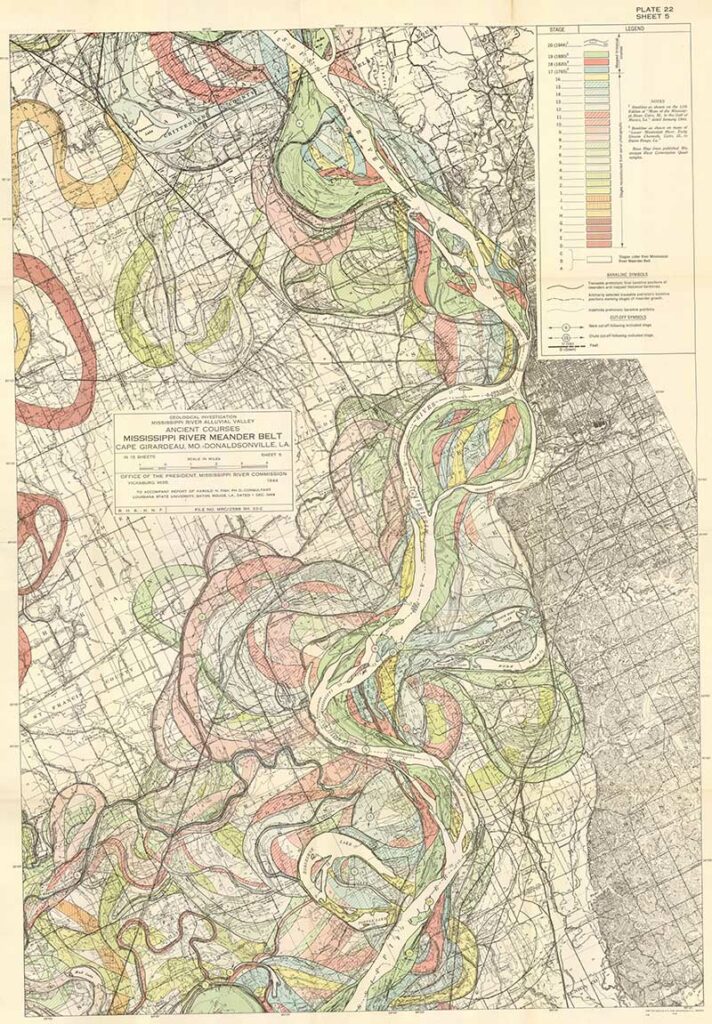
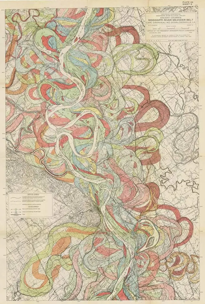
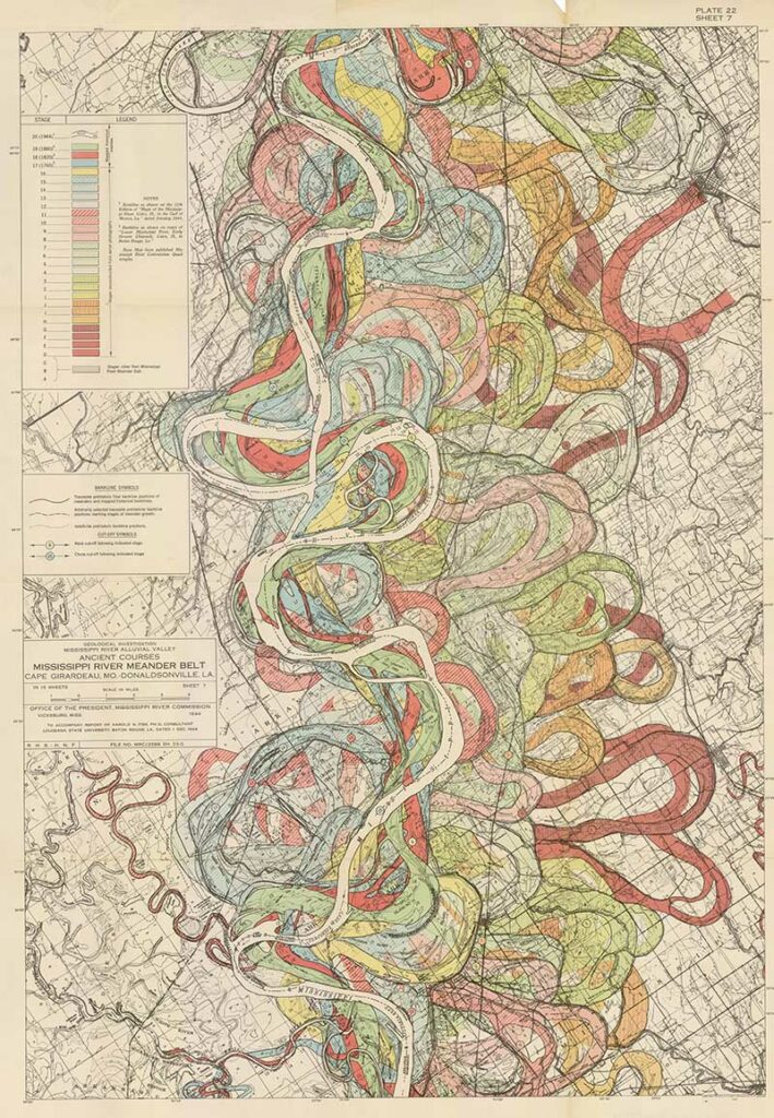
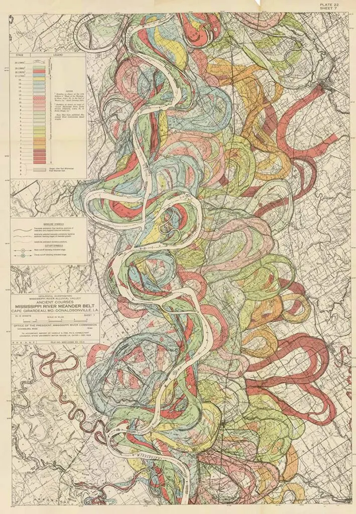
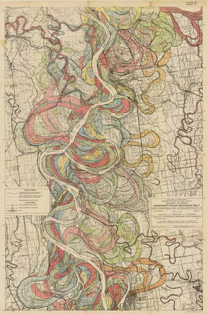
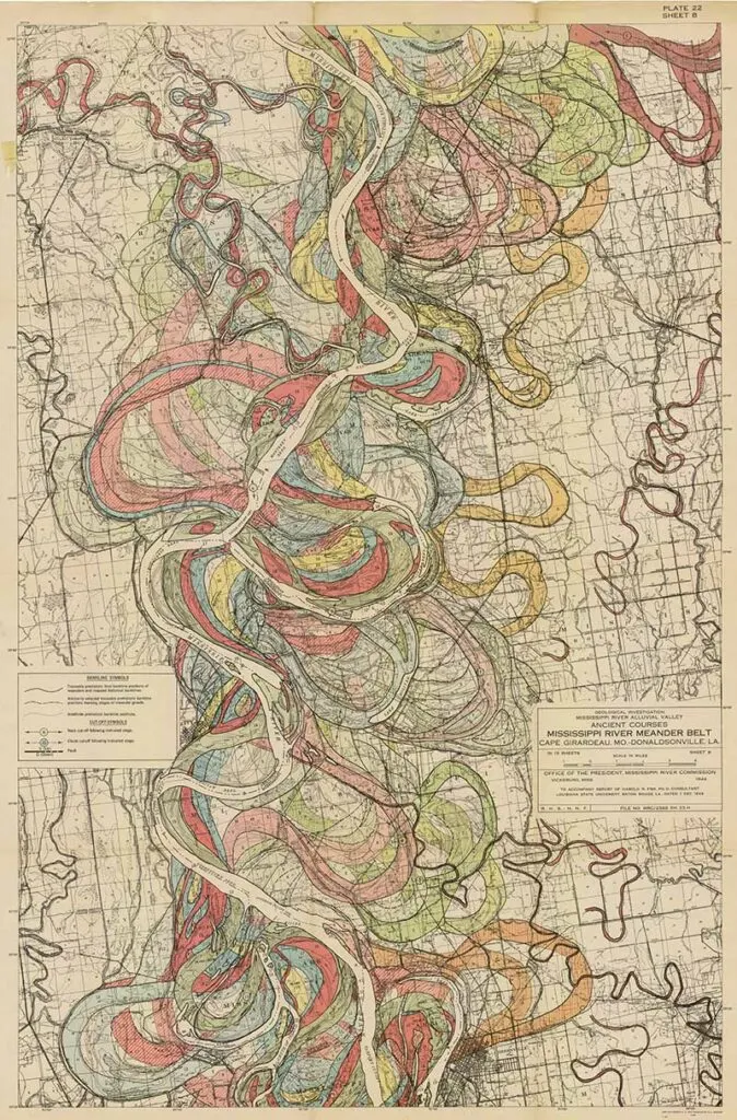
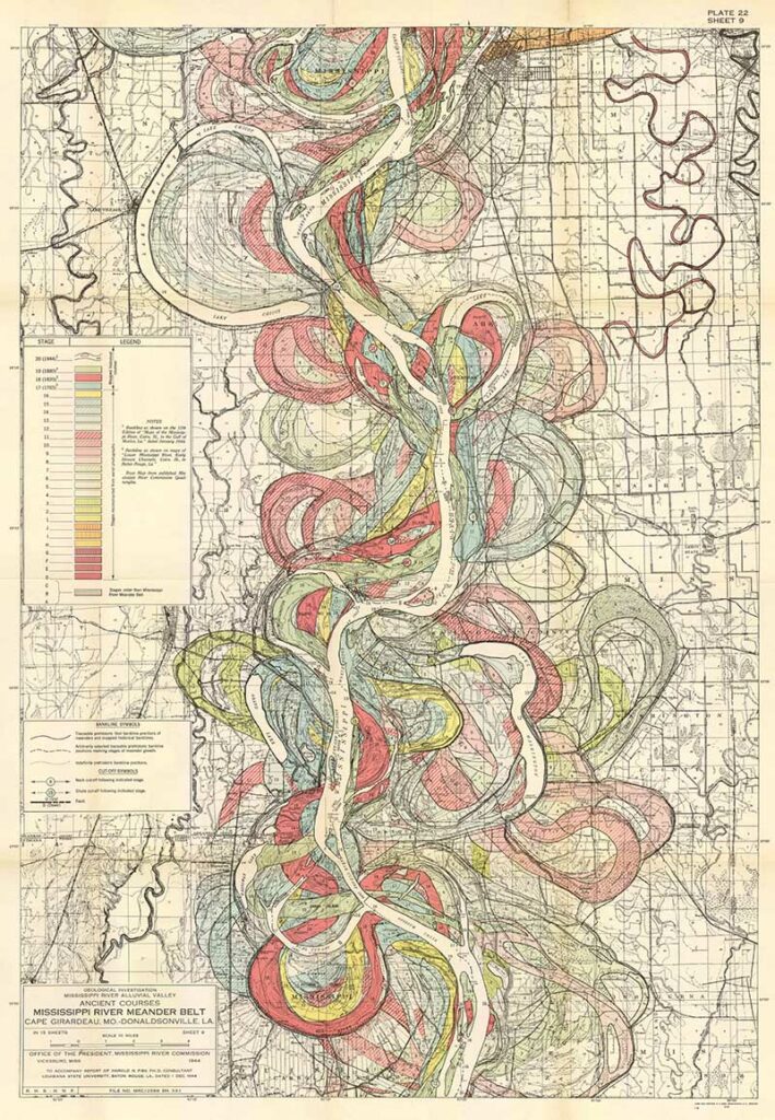
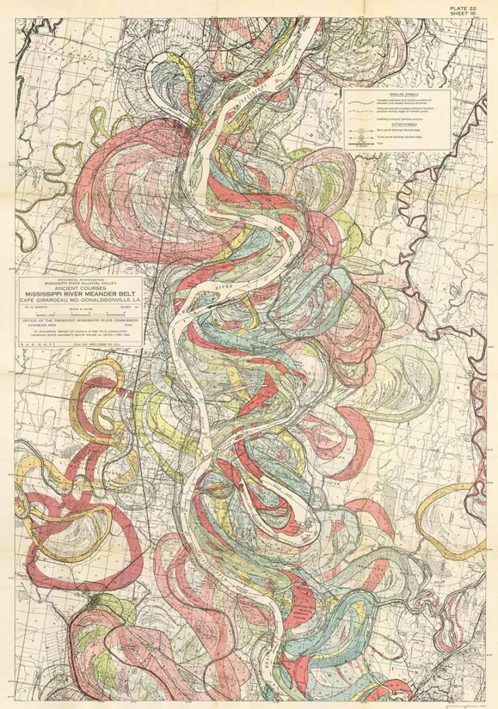
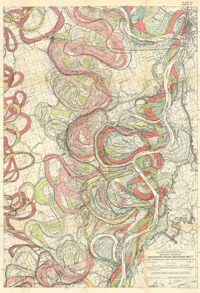
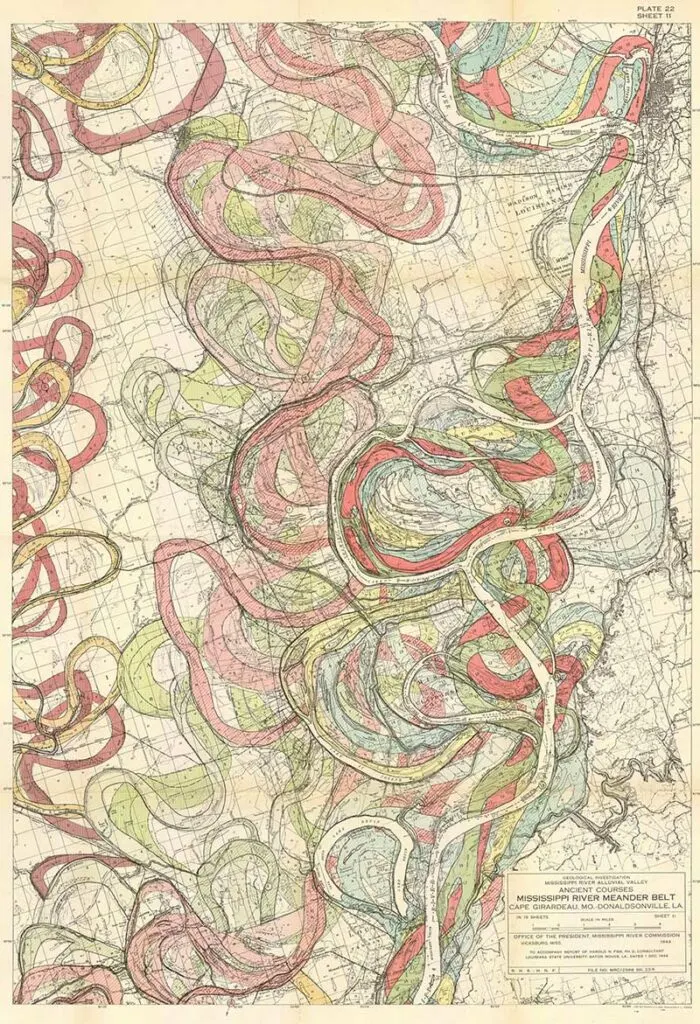
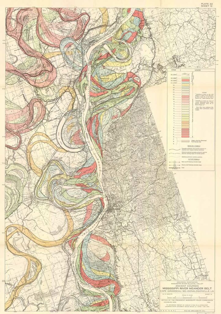
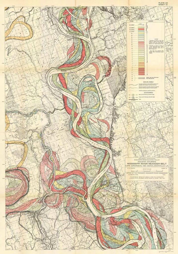
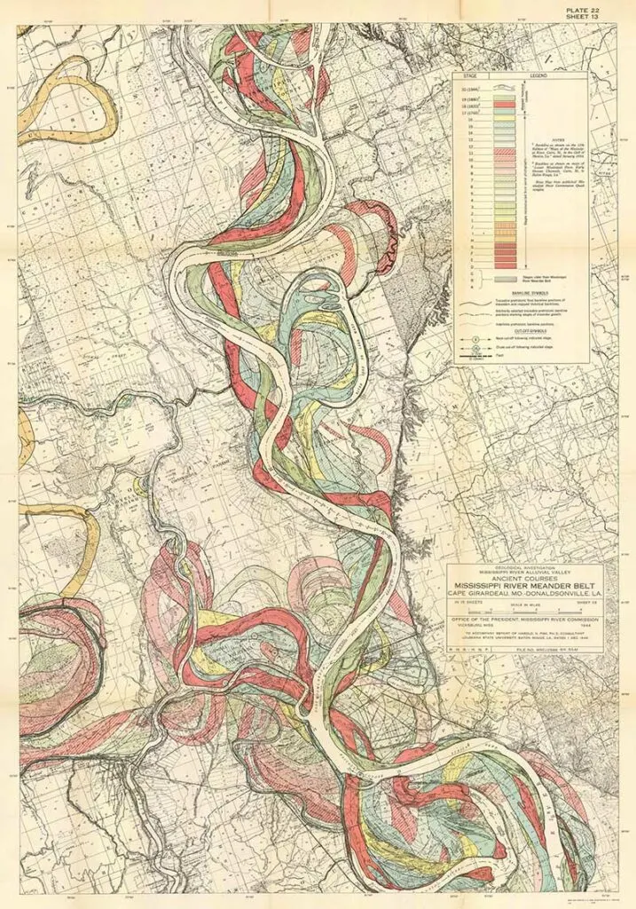
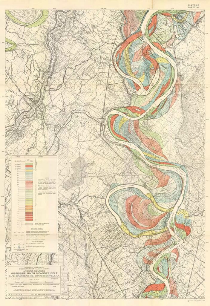
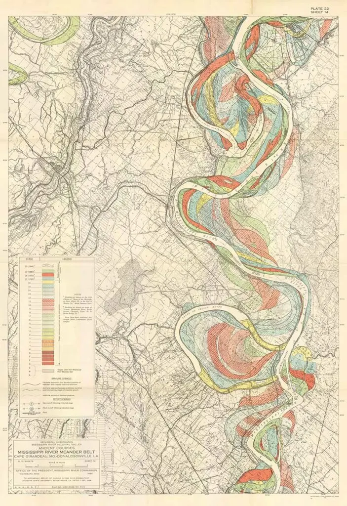
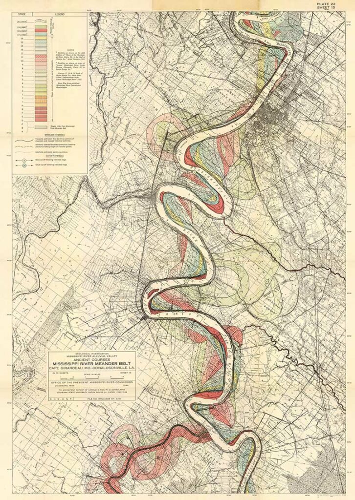
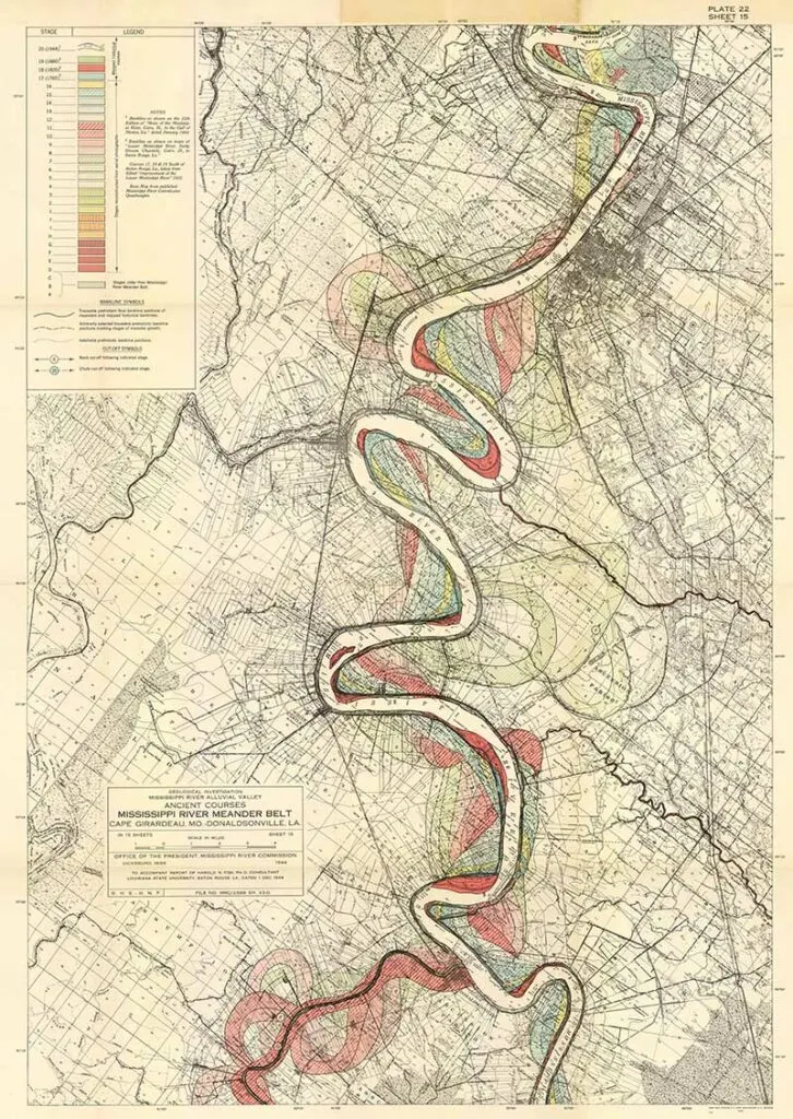
Harold Fisk was a geologist and cartographer employed by the US Army Corps of Engineers. In 1944, he published a rather bland government report, “The Nature and Origin of the Alluvial Valley of the Lower Mississippi River”. There was a visual gem within this report: 15 colourful maps of the Mississippi River.
The Mississippi Alluvial Valley represents the historic floodplain and valley of the lower Mississippi River.
Fisk had spent three years researching the river’s historical flow. By combining aerial photography and geographical study, Fisk plotted the Mississippi’s history in an artistic way.
The maps were designed to visually show how the meandering flow of the Mississippi River had changed over time. Fisk used greens, blues, reds, and oranges wandering across the maps. The colours represent the Mississippi’s fluctuations and flow over time.
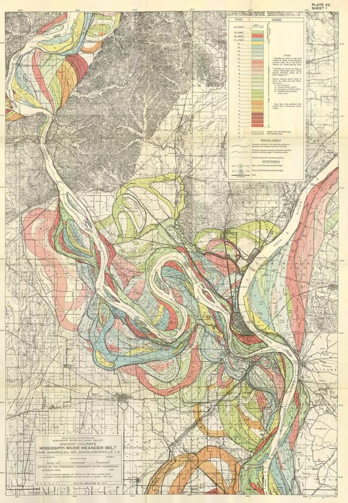
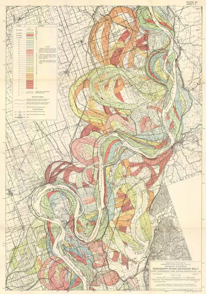
The river’s path on the 1944 map is in black. The green path is the course of the river in 1880, the salmon-pink 1820, and the light blue 1765. The maps also illustrate the colour-coded traces of the river’s earlier flow, stretching back to prehistoric times.
As well as cartographers and geographers,s the artistry of these river maps has been appreciated by creatives. Some have even used them as inspiration for their own creations, such as the stunning art quilts of Timma Tarr and Cathy Fussell.
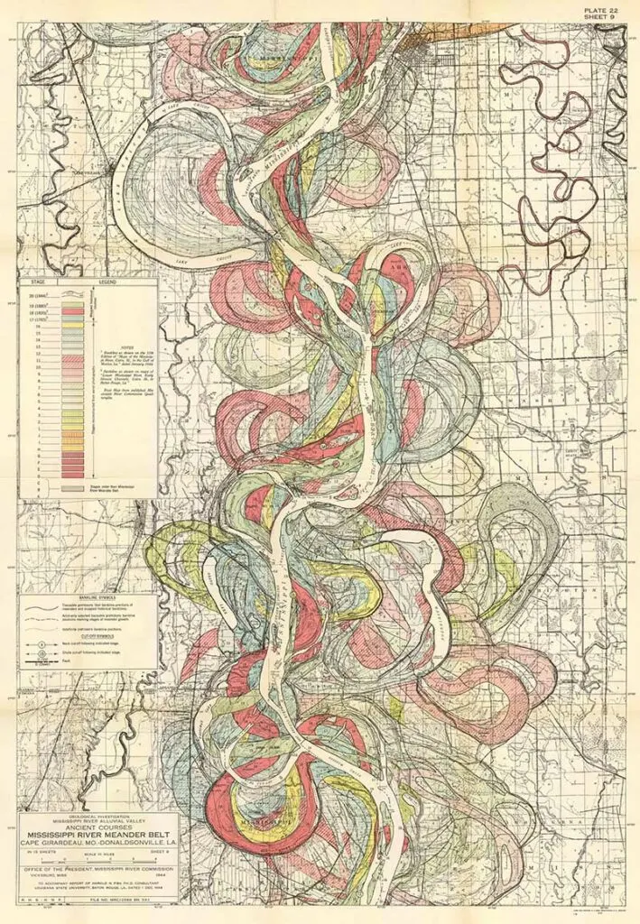
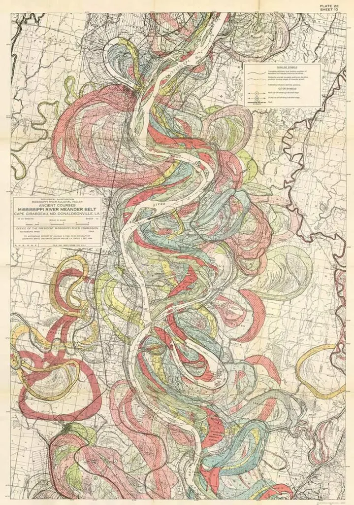
Ancient Courses Mississippi River Meander Belt
There are fifteen of these colourful maps. Click the title above the map you want to download, and the menu option to save it to your device will appear. These maps can then be either printed at home or sent to an online print service. Warning: these are large files.
All these maps are stunning, but if I had to pick just two to print and frame, I’d probably pick 3, 13 & 14.
1. Map 1 – Cape Girardeau, MO – Donaldsonville, LA.

2. Meandering Map 2

3. Meandering Mississippi Map 3

4. Harold Fisk Map 4

5. Meandering Map 5

6. Meanderings 6

7. Meandering Mississippi 7
8. Harold Fisk River Map 8
9. Harold Fisk 9
10. Harold Fisk 10
11. Mississippi River Map 11
12. Mississippi Map 12

13. Mississippi River Map 13
14. Meanderings 14
15. Map 15 Harold Fisk Mississippi Meanderings
(Some of these meandering maps were used for the DIY tea light lanterns craft)
Fun Facts About the Mississippi River
Whilst hunting for the wonderful Mississippi River maps of Harold Fisk, I came across some other wonderful vintage maps of the river. Before I share these below, I will share some fun facts about the river.
Even though I’m a Brit living in the UK, I have a romantic image of the Mississippi River from Mark Twain’s writings. Many of his famous stories centre around the river.
These books included the famous Adventures of Huckleberry Finn, which depicted the people and places along the river. The Adventures of Tom Sawyer is the story of a young boy growing up along the watershed. He also wrote Life on the Mississippi, a memoir of his life as a Mississippi steamboat pilot.
- The Mississippi River is 2,340 miles long, making it the third-longest river in the US. But it’s probably the most famous!
- It takes 90 days for a single drop of water to travel the Mississippi River’s entire length.
- The Mississippi River begins at its headwaters, fed by Lake Itasca in Northern Minnesota. It then flows all the way down into the Gulf of Mexico.
- The river flows through 10 states in the U.S. These include Louisiana, Mississippi, Arkansas, Tennessee, Kentucky, Missouri, Illinois, Iowa, Wisconsin, and Minnesota
- At its narrowest point at Lake Itasca, the river is 20 -30 ft wide.
- The widest point is at Lake Winnibigoshish near Bena, MN, where it is more than 11 miles wide.
- The Environmental Protection Agency says that over 50 cities rely on the Mississippi for their daily water supply.
- A quarter of all fish species in North America live in the Mississippi River. That’s over 260 different species.
- At least 145 species of amphibians and reptiles inhabit Mississippi
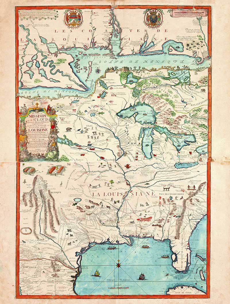
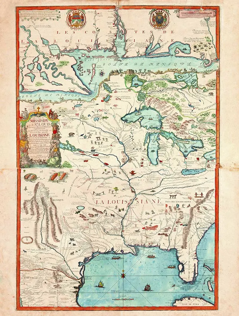
16. 1718 French Map of The Mississippi
The translation on this French map showing the Mississippi River flowing into the Gulf of Mexico is, “The course of the Mississippi, or of St. Louis, the famous river of North America around which is not called Louisiana.”
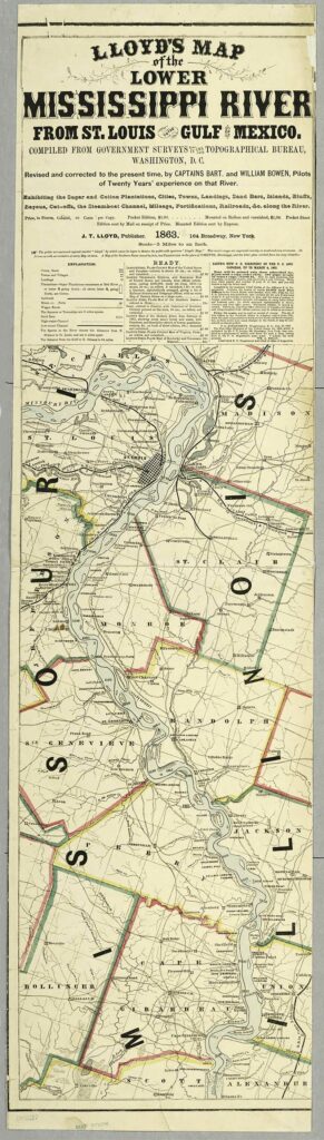
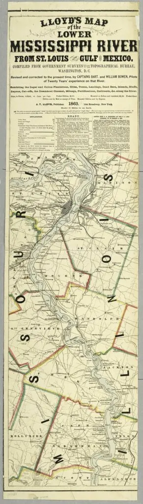
17. Lloyd’s Map 1863
Map of the Lower Mississippi River from St. Louis to the Gulf of Mexico. Exhibiting the sugar and cotton plantations, cities, towns, landings, sand bars, islands, bluffs, bayous, cut-offs, the steamboat channel, mileage, fortifications, railroads along the river.
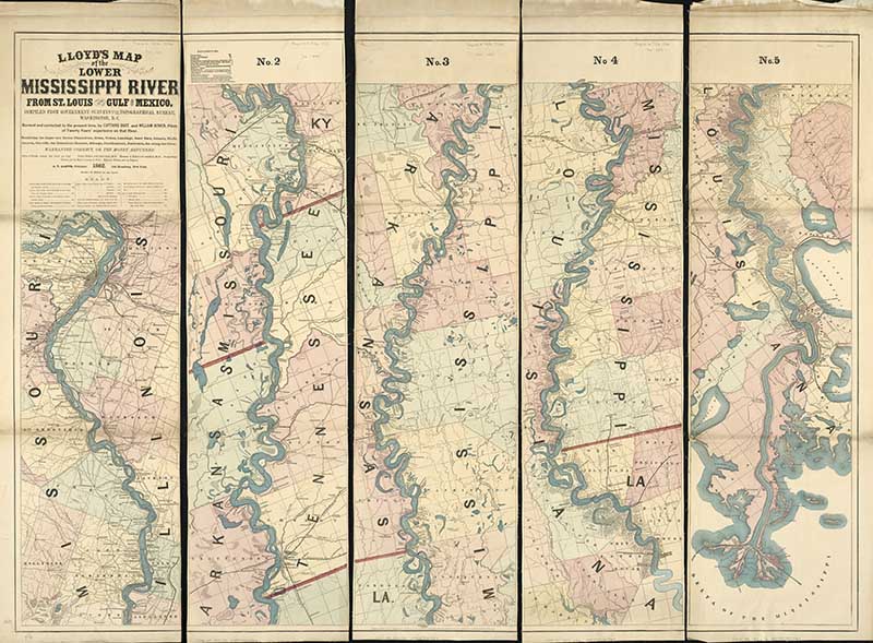
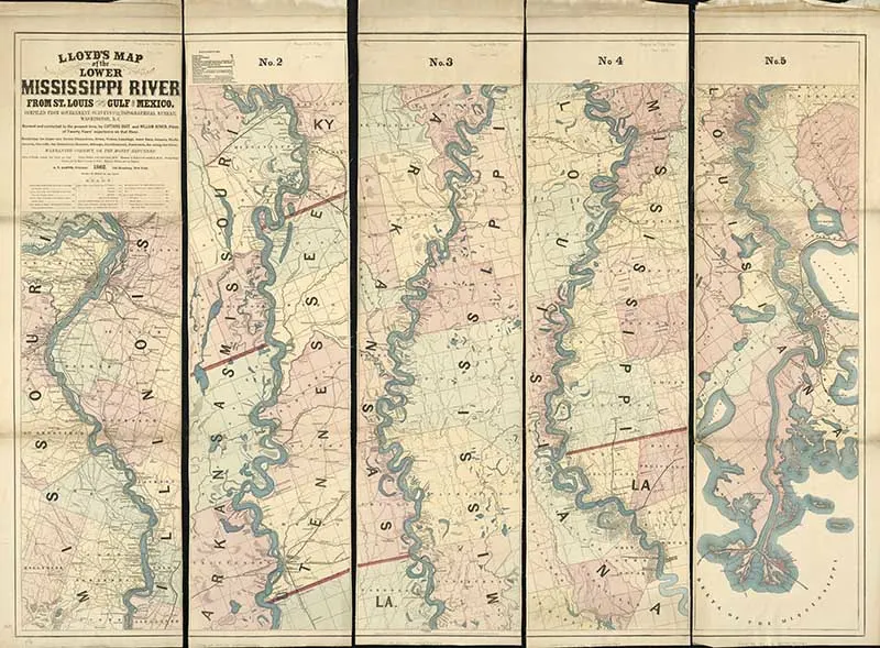
18. Lloyds Map 1862
Map of the lower Mississippi River from St. Louis to the Gulf of Mexico.
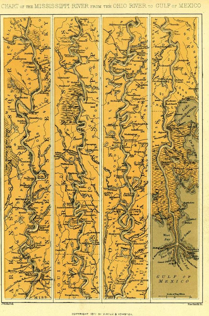
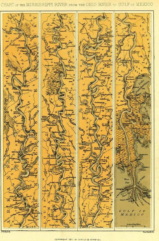
19. Chart of Mississippi 1877
Print of four maps, charting the Mississippi River from the Ohio River to the Gulf of Mexico. The map on the far left shows where the Ohio River flows into the Mississippi at Cairo.
From left to right, the river is mapped going from north to south. The map on the far right shows the Mississippi River delta and the Gulf of Mexico.
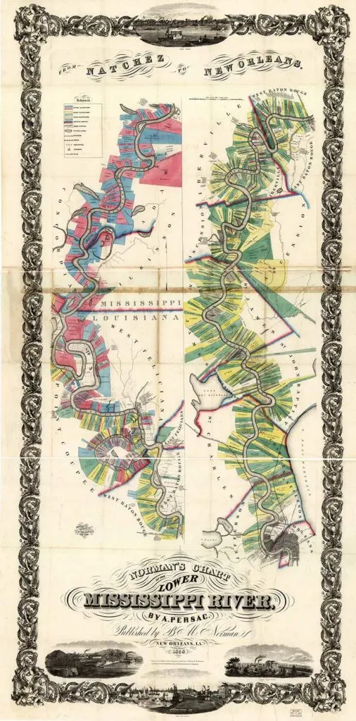
20. Norman’s Chart of Lower Mississippi 1858
A hand-coloured map showing landowners shows plantations with the names of owners.

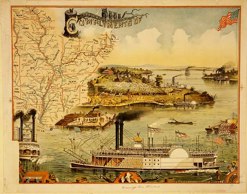
21. Mississippi River Steamboat
Mississippi River steamboat and tourist map from 1895.

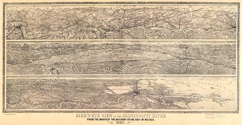
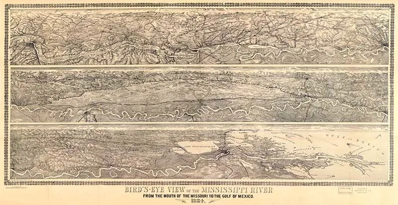
22. 1884 Birdseye View
Bird’s-eye view of the Mississippi River: from the mouth of Missouri to the Gulf of Mexico, 1884.
You can find more birds’ eye view maps here; these are of San Francisco Bay.
I hope you have enjoyed all these wonderful maps, especially those of Harold Fisk, which are stunning.
If you liked the maps for their geographical qualities, you should check out Yaggi’s amazing educational Geography posters.
There are many other maps of the United States on the blog, including many Southern US State maps. There are also maps of New York City.

Emily
Sunday 13th of October 2024
Dear claire I am writing to tell you how happy I am to have finally found these maps. I want to use them to make a gift for my dear person. He's a geologist. Thank you so much!
claire
Monday 14th of October 2024
Thank you, that's lovely to hear.
Audrey
Sunday 28th of March 2021
Thanks so much for making these incredible images available. I just recently found your website and I love it!
claire
Monday 29th of March 2021
Thank you, Audrey. There are many more wonderful images to come so make sure you come back soon.
Cecilia
Saturday 13th of March 2021
Before reading the comments, I was also going to say how much the maps resemble art! Thanks for sharing at Vintage Charm!
claire
Tuesday 16th of March 2021
Thank you, they are very artistic.
Julie
Friday 12th of March 2021
Wow, these are amazing, I've never heard of Harold Fisk but every day is a school day. They are interesting and really beautiful.
claire
Friday 12th of March 2021
They are amazing, Graham and Greene are selling them for £475 at the moment https://www.grahamandgreen.co.uk/extra-large-framed-mississippi-long-river-print, which seems a bit expensive. I'll be printing and framing my own for a fraction of the price.
NINA LEWIS
Wednesday 10th of March 2021
These are amazing maps. And I agree with you that those by Harold Fisk do look like works of art! And, I find it rather funny that I've learned facts about a river that is in my country from someone who lives in another country! (I was surprised that at its narrowest point that the Mississippi River is only 20-30 feet wide.)
Thanks so much for sharing this at our Party in Your PJs link party. I always love what you share.
claire
Wednesday 10th of March 2021
Thank you, Nina. As well as loving vintage images, I'm a bit of a fact nerd. I think it stems from a love of the old-fashioned illustrated encyclopedias that I used to read as a child.