
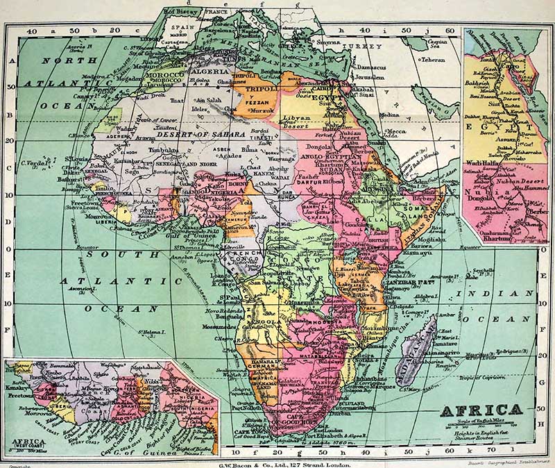
Dive into Africa’s cartographic history with our collection of old maps, all available for free download and print. These public domain maps are perfect for educators, historians, and enthusiasts eager to explore the continent’s changing landscapes and borders through vintage maps.
Africa is a continent I would love to explore more of one day. I have only visited three African countries: Morrocco, South Africa and Kenya. And they were as a child! Morocco and South Africa are both opposite ends of the vast continent.
The trip to Morroco was only a day trip from Spain. Did you know that Africa and Europe are less than 9 miles apart and separated by the Strait of Gibraltar? We took the ferry from Gibraltar to Tangiers, and it only took about 80 minutes.
Fun Facts About The African Continent
- After Asia, Africa is the second largest and most populous of the seven continents. It is a huge continent comprising 54 countries and over a billion people.
- The continent spans both hemispheres. Most of the continent and its countries are in the Northern Hemisphere, with a substantial portion and number of countries in the Southern Hemisphere.
- Africa has the youngest population of all the continents. The median age in 2012 was 19.7, compared to 30.4 worldwide.
- The largest country in Africa by area is Algeria. Whereas the largest country by population is Nigeria.
- Another interesting fact about Africa is that it is considered the birthplace of humanity. The continent is where the first hominids, human beings and their closest relatives, the gorillas and chimpanzees, evolved about 7 million years ago. Fossils found in Africa show that modern humans spread from this continent.
- Africa boasts perhaps the world’s largest and most diverse populations of wild animals.
- The continent is home to most wild populations of large mammals, such as lions, elephants, giraffes, hippos and camels. (There are some free printable vintage African animal prints download here).
Top Places To Visit in Africa
Hopefully, you can spot some of these places on the old maps of Africa. They are considered to be the most popular tourist destinations within the continent.
- Cape Town in South Africa
- Masai Mara National Park in Kenya
- Kruger National Park in South Africa
- Victoria Falls in Zambia/Zimbabwe
- Namibia: the Namib Desert and Etosha National Park
- Mauritius and the Indian Ocean Islands
- Mt Kilimanjaro in Tanzania
- Morocco – Markets, Deserts and Mountains
I would add a few more important African destinations to this list.
- Omo river region – Ethiopia
- Virunga Mountains (Gorilla trekking) – Democratic Republic of Congo
- The Pyramids and Sphinx – Egypt

The Copyright free Old Maps Of Africa
To download a higher resolution of the historical map of Africa you want just click on the title above the map. A higher resolution image should then open up in a new page in your browser. You can then just save that image to your hard drive as a jpg file.
The .jpg file can be printed directly from your computer or you can upload the file to an online printers/photo lab and order a professional print on the paper of your choice and size.
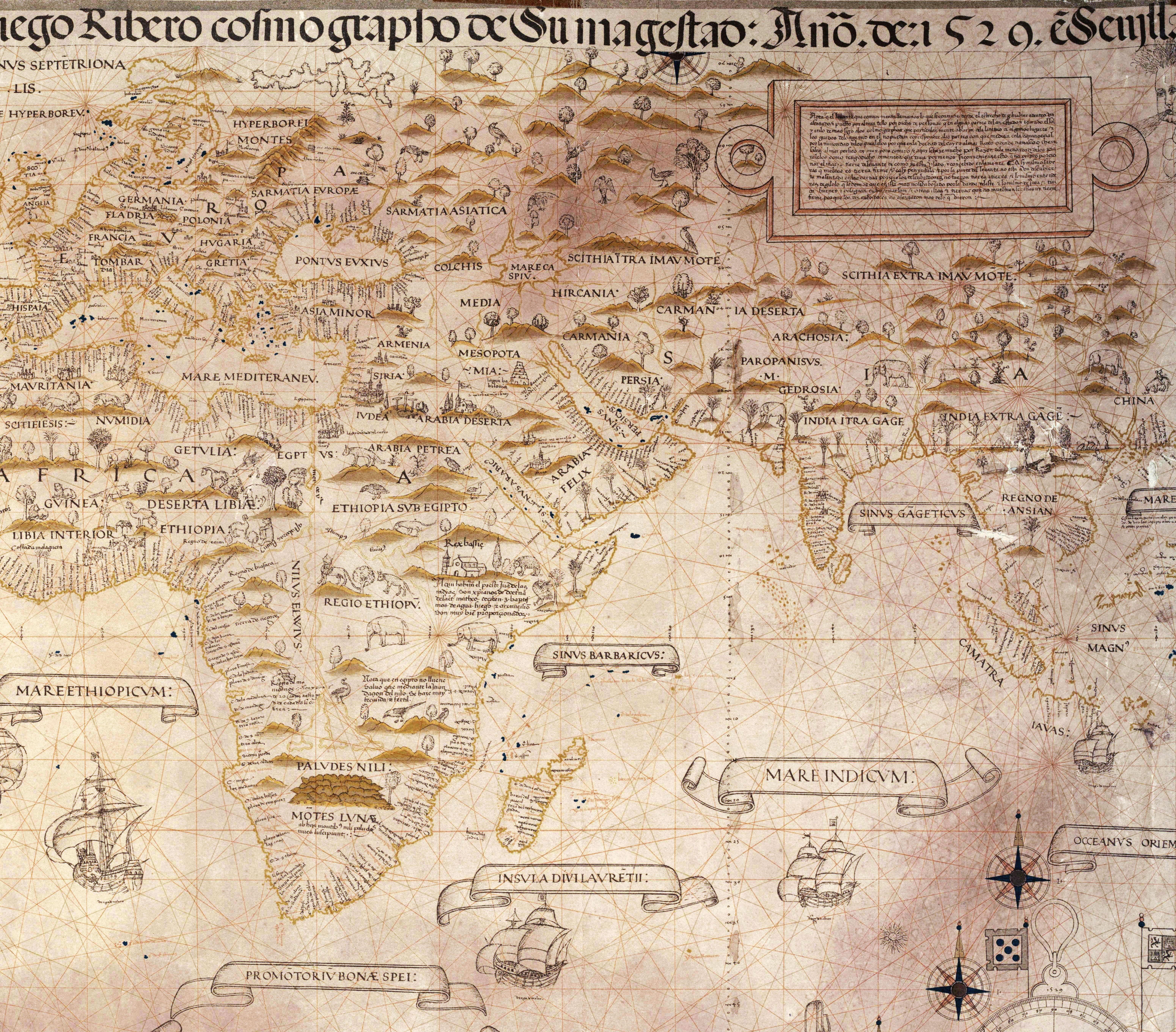
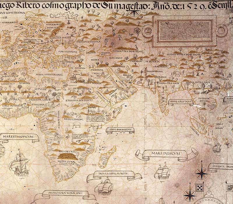
1.Diego Ribero 1529 Map
Diego Ribero was a Portuguese cartographer and explorer who worked most of his life in Spain. This antique map of Africa was part of the world map.
This is part of his most famous map The Padrón Real which was the official and secret Spanish master map used as a template for the maps on all Spanish ships during the 16th century.
The illustrations on this map are wonderful, small line drawings of animals and trees. He has also drawn some Spanish galleons along the coast. Considering its age, this map seems surprisingly accurate.

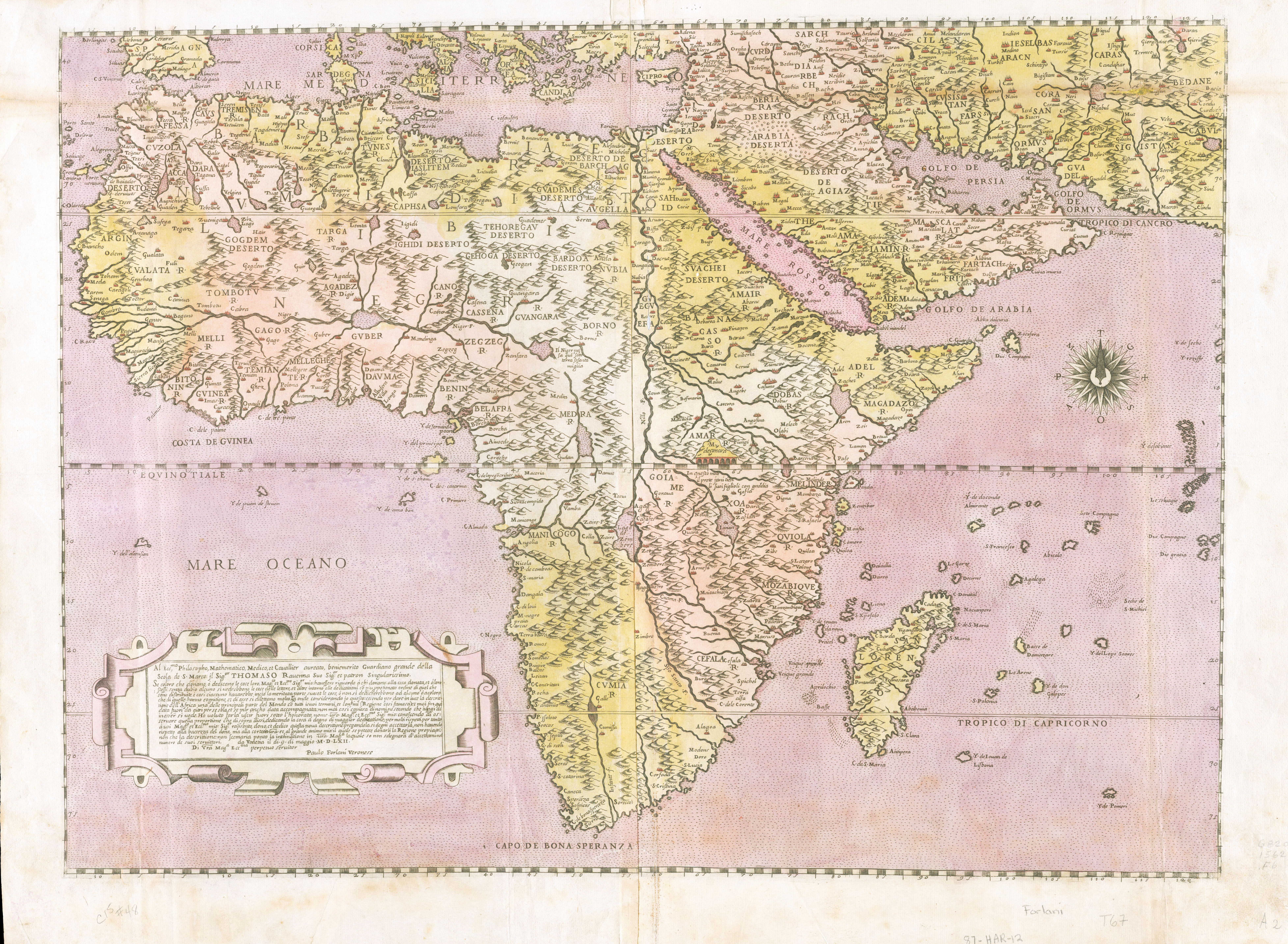
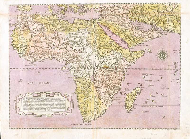
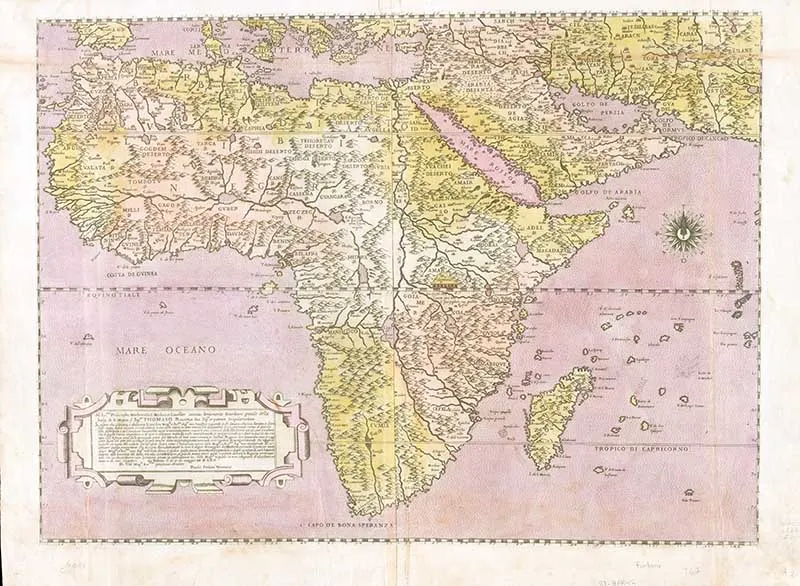
2. 1562 Map by Paolo Forlani
I don’t know much about this antique map of Africa except that it was published by Paolo Forlani. (This is a very large file)
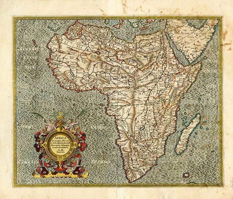
3. Gerardus Mercator – Old Map Of Africa
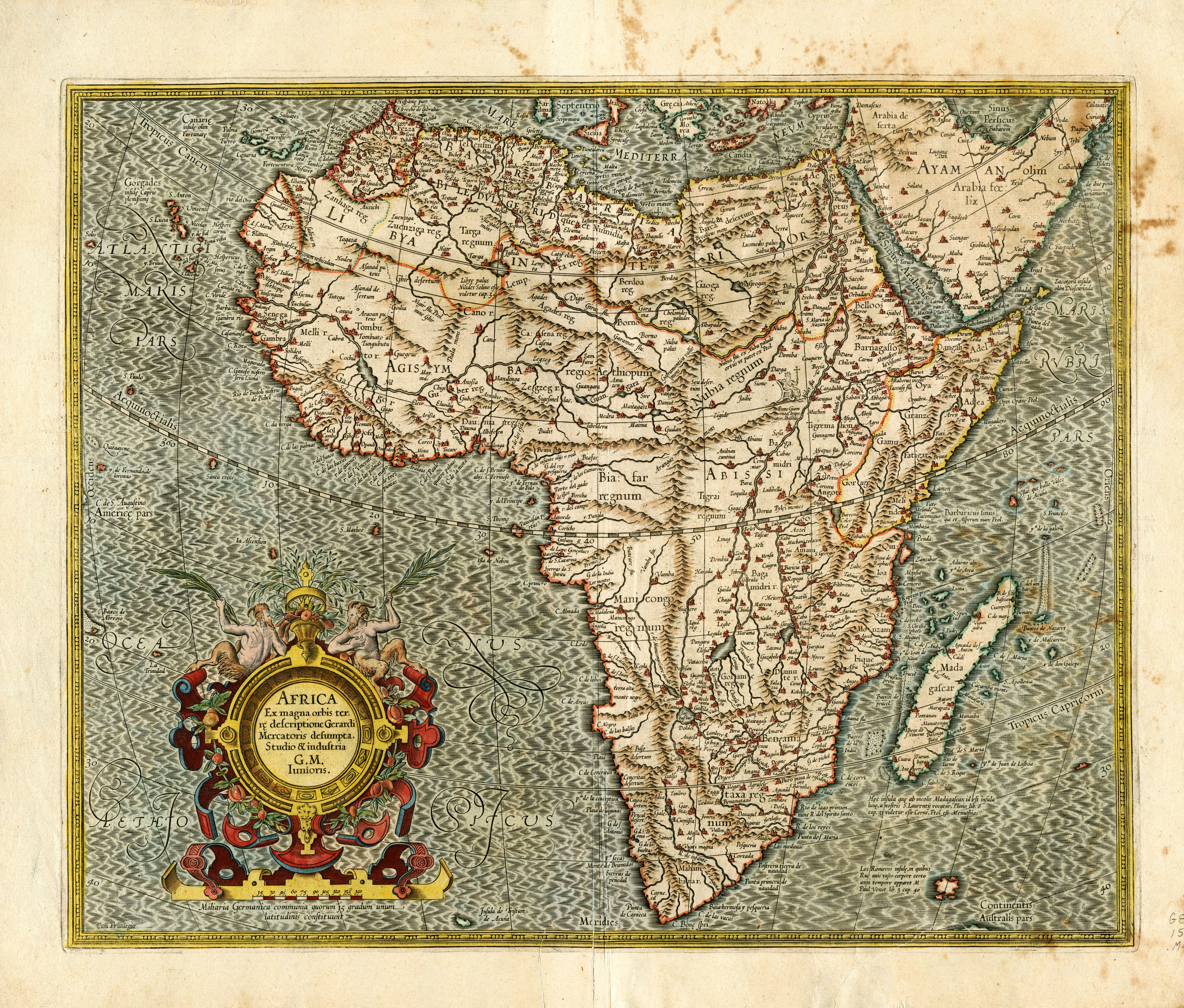
Mercator was a Belgian pioneer of cartography, and he was also known as a maker of globes and scientific instruments.

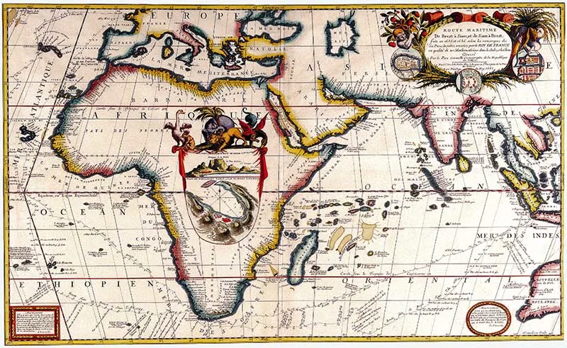
4. Route de Brest au royaume de Siam 1690
A beautiful antique map featuring Africa in the centre which is described as:
“Sea route: From Brest to Siam and from Siam to Brest made in 1865 by Father Coronelli cosmographer of the Republic of Venice.“

5. Historical Map of Africa with 9 City Illustrations
This next, beautifully illustrated (1635) map of Africa by the Dutch cartographer Willem Janszoon Blaeu is bordered by some lovely drawings.
Including illustrations of 9 African cities: Tanger, Ceuta, Alger, Tunis, Alexandria, Alcair, Mozambique, S. Georgius della Mina, Canaria. (This is a large map)
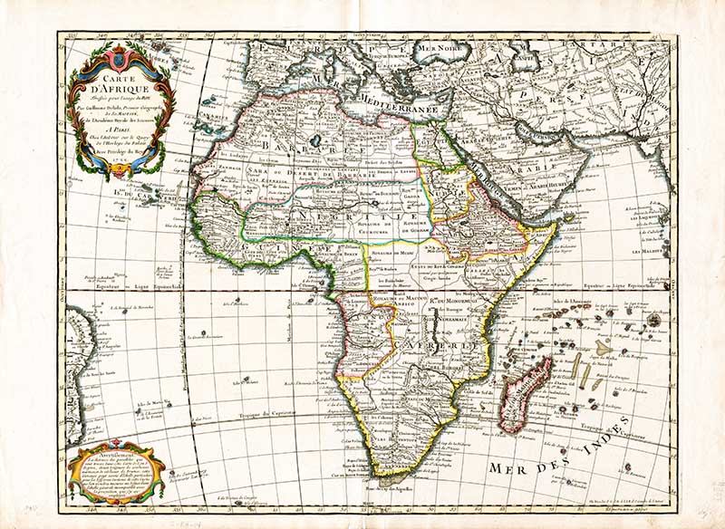
6. Guillaume Delisle 1745 Historical Africa
Guillaume Delisle was a well-known French cartographer. Like many cartographers of his day, Delisle did not travel with the explorers. He drew maps in his office, relying on various data.
The quality of his maps depended on his well-connected network of friends and family, who provided him with first-hand accounts of their travels. This gave him an advantage over his competitors.
Being a member of the Académie also kept him updated on recent discoveries, especially in astronomy and measurement.

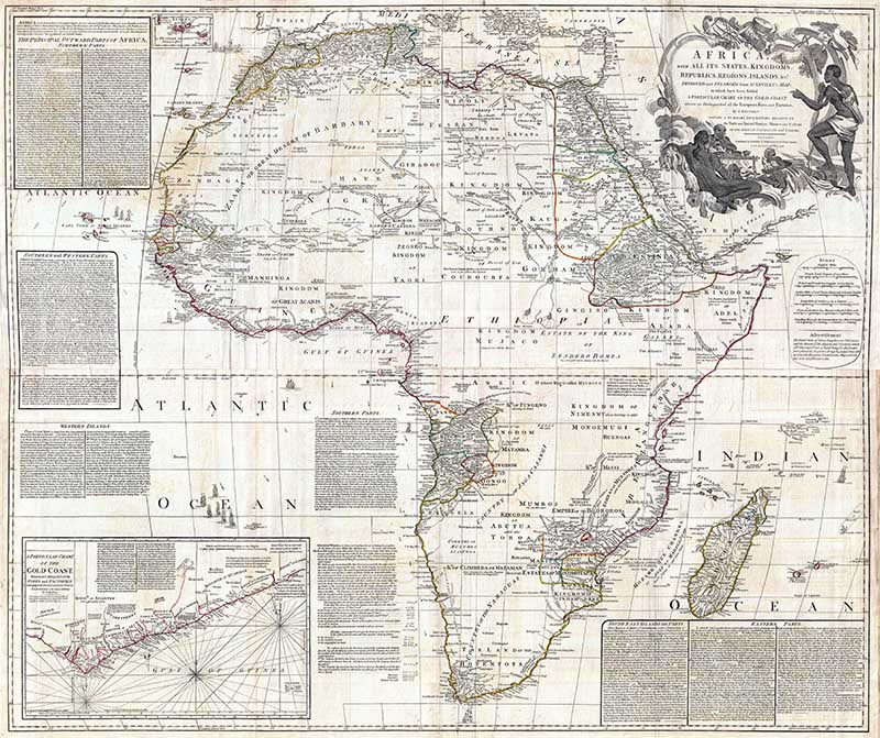
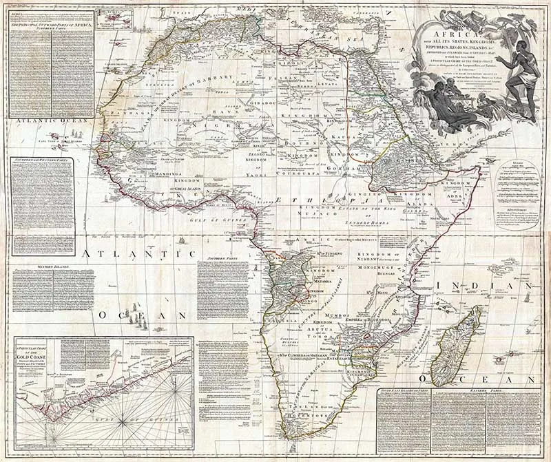
7. 1794 Boulton and Anville Wall Map of Africa
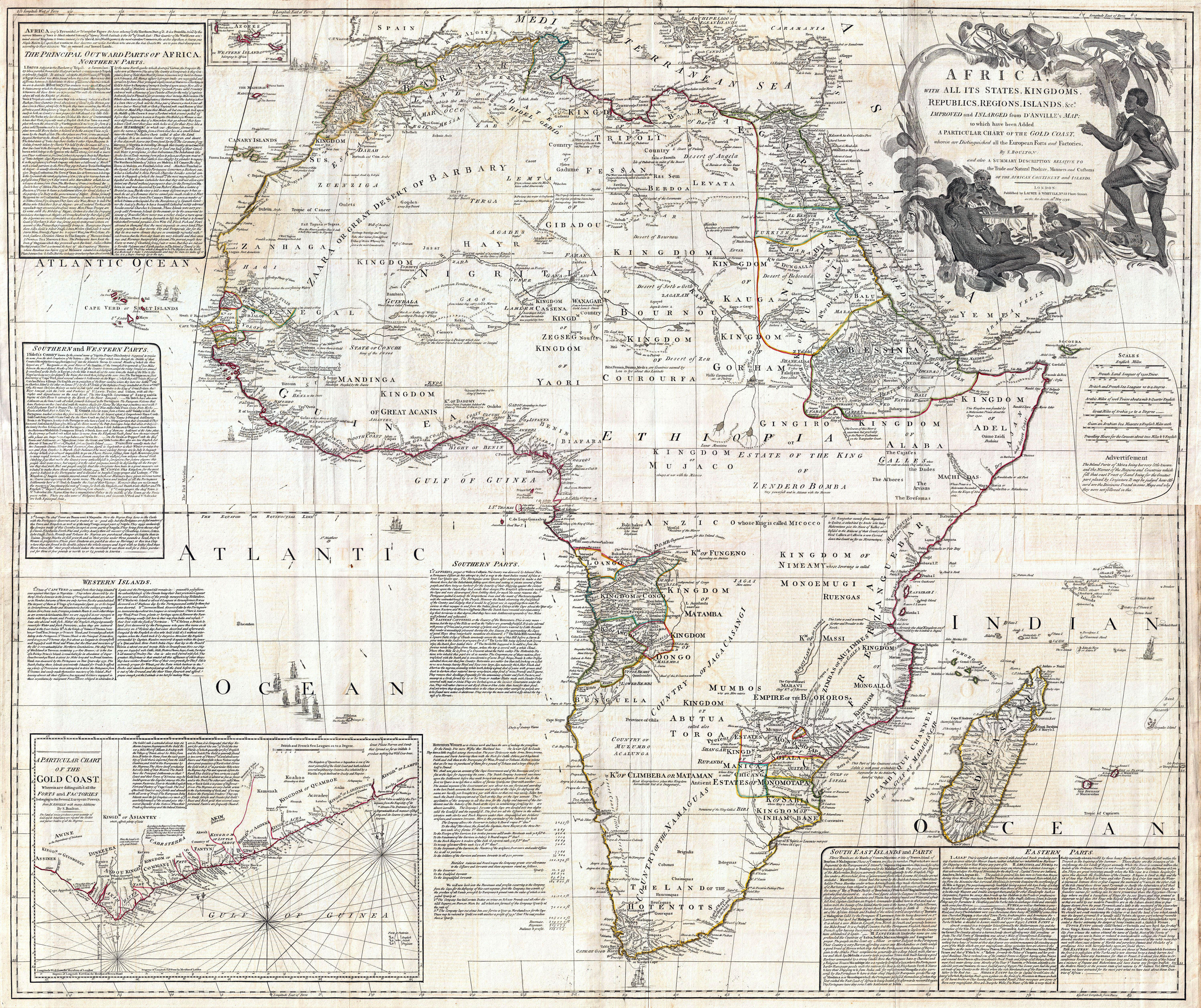
This is considered one of the most important 18th-century maps of the African continent.
The map is unique in that it attempts to compile all of the accurate scientific knowledge of the African continent at the time.
In contrast to many other cartographers of the period, there was almost no attempt to fill the “unknown” regions of the interior with fictitious beasts, kingdoms, and geological features.
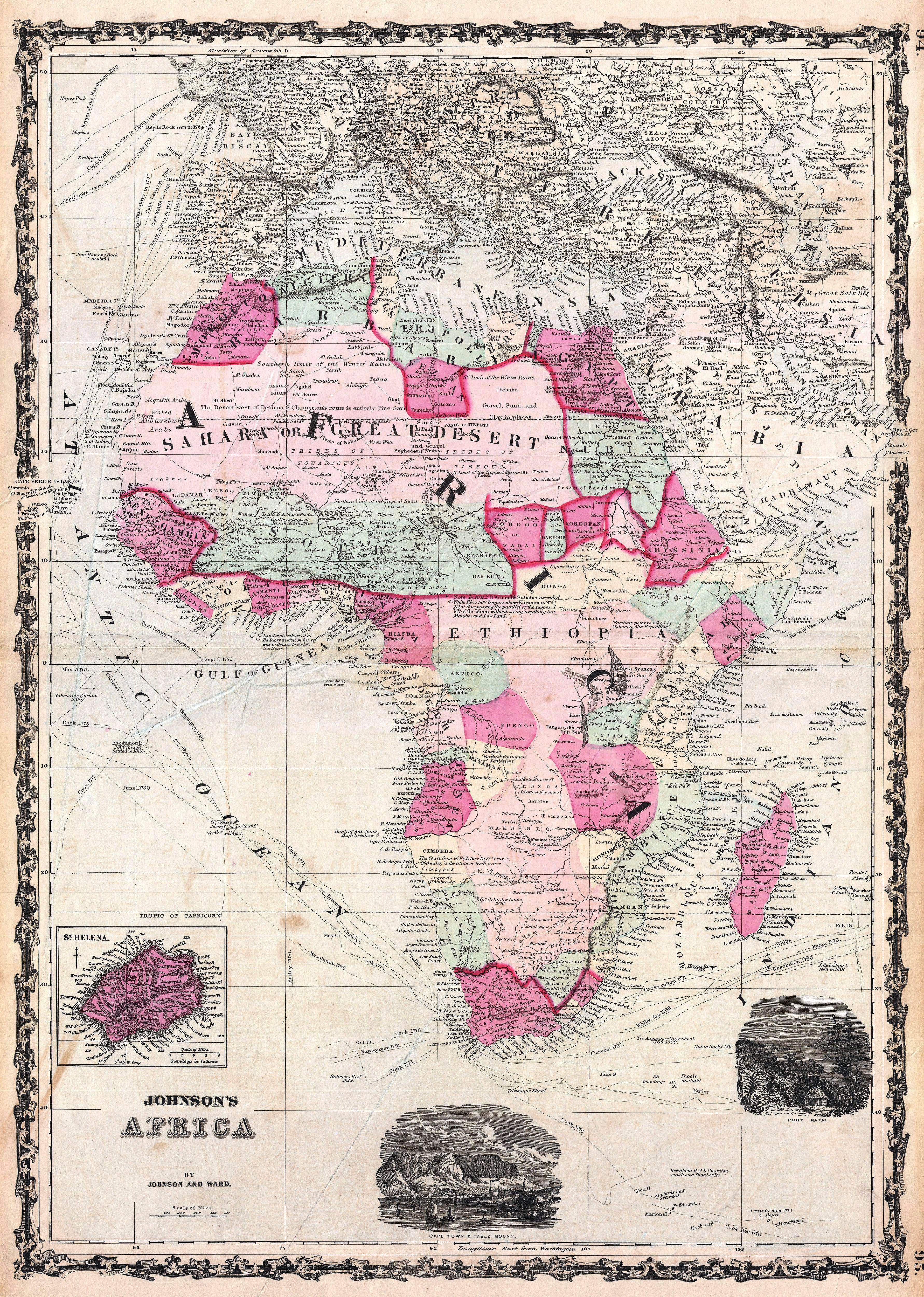
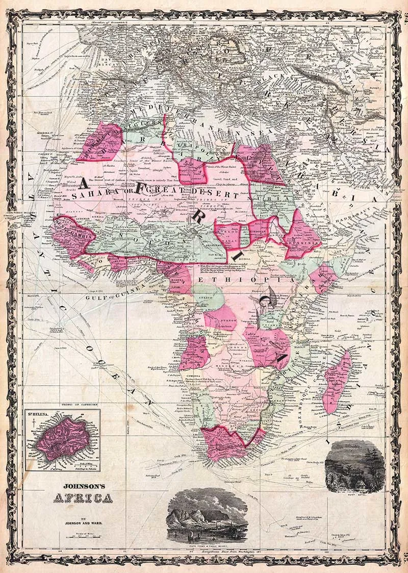
8. Johnson’s Africa 1862
This rare map appeared only in the earliest editions of Johnson’s Atlas. The map of the African continent also includes the adjacent parts of Europe and Asia.
The map is colour-coded according to African states. It shows Lake Victoria (alternately called Lake Nyanza or Ukerewe Sea) and marks Dr. Livingstone’s route along the Zambezi River.
The map also offers notations regarding other important explorations, such as Mahomet Ali, Denham & Clapperton, Barth, Lander, etc.
The surrounding watery areas show the routes of numerous sailing expeditions around the Cape, including Cook, Carteret, Wallis, the Resolution, Byron, Vasco de Gama, and Vancouver.
An inset details the remote island of St. Helena, famed as Napoleon’s place of exile and death. The lower right-hand quadrant features two attractive vignettes depicting Cape Town Table Mountain and Port Natal.

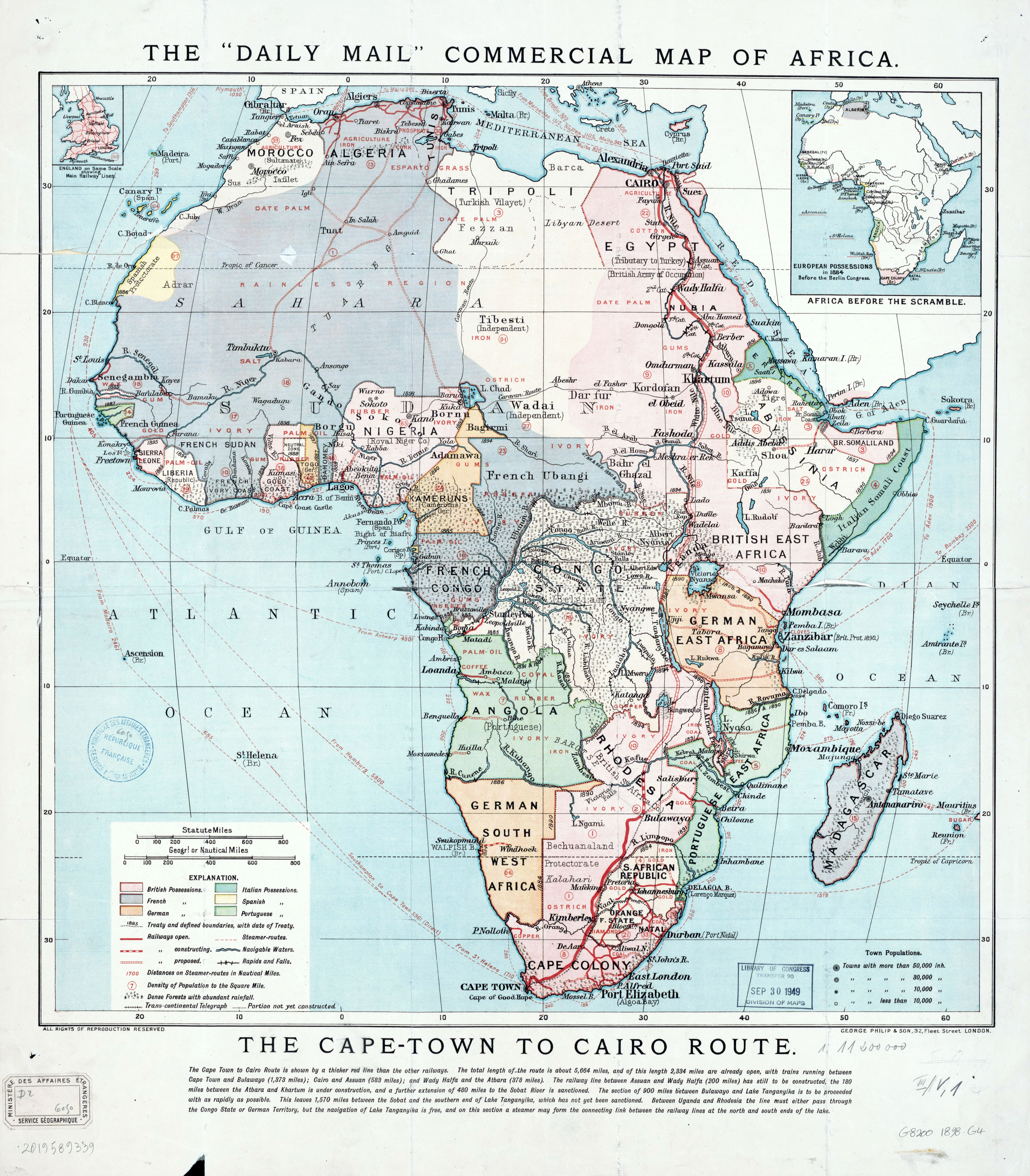
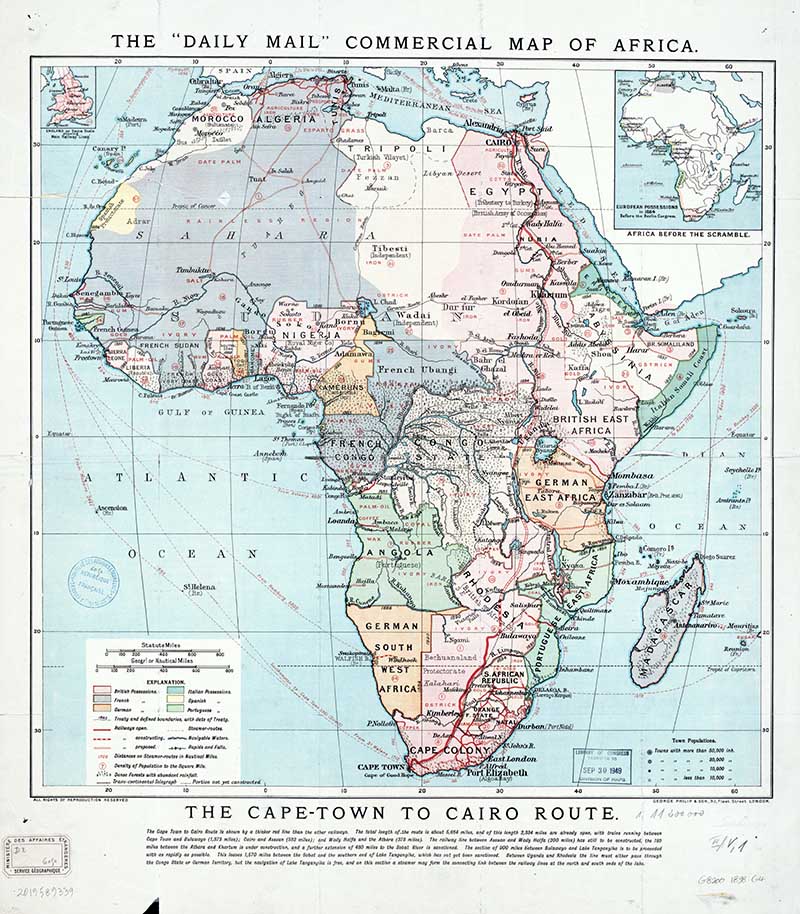
9. The “Daily Mail” commercial map of Africa
The British newspaper The Daily Mail published this old map of Africa in 1898.

10. Vintage Maps of Africa 1913
This vintage map of Africa is from Owen Letcher’s book The Bonds of Africa: impressions of Travel and Sport from Cape Town to Cairo, 1902-1912.
Other Map Posts
Don’t forget to check out all the other fabulous continental maps on Pictureboxblue. Such as those vintage maps of Europe and the old maps of Antarctica. I have some wonderful old maps of Asia.
I have split the continent of North America into two sets of maps, those maps of the United Stages and vintage maps of Canada.
However, if you want a more global view, there are the antique world maps.
A Crafty Mix | For the Love of Africa –Mixed Media Night Light - A Crafty Mix
Saturday 27th of November 2021
[…] are so many different ways to embellish the African continent or whatever shape you decide to use. Glue on fabric scraps or buttons, or give it a crazy cracked […]
Michelle Leslie
Wednesday 5th of February 2020
Thanks Claire. You're always my go-to place for beautiful maps and these African ones are extra special.
claire
Wednesday 5th of February 2020
Thank you, Michelle. I plan to dig out some South African ones someday soon.
angie
Thursday 30th of January 2020
love learning geography and helping kids learn as well thanks for sharing come see us at http://shopannies.blogspot.com
claire
Thursday 30th of January 2020
Thank you.