
These antique maps of the Greek islands and eastern Mediterranean created by Jean-Baptiste Bourguignon d’Anville, one of the most respected cartographers of the eighteenth century.
Most of the maps focus on the islands of the Aegean and Ionian Seas, but the collection also includes islands and coastal regions of present-day Turkey, the Levant and parts of North Africa. Together, they provide an intriguing snapshot of the eastern Mediterranean as it was mapped more than 250 years ago.
The maps come from the collections of the National Library of France’s Maps and Plans Department, home to one of Europe’s most significant archives of historic maps and charts.
Today, they are appreciated not only for their geographical detail but also for their decorative appeal, with beautifully engraved coastlines, settlements and mountain ranges.
The Origins of the Maps
These maps were created by d’Anville using earlier geographical works by the French explorer and writer André Thevet. During the sixteenth century, Thevet travelled extensively and published descriptions of many Mediterranean islands, helping to shape European understanding of the region.
Nearly two centuries later, d’Anville revisited these sources and combined them with more recent geographical knowledge to produce a remarkable series of maps. The result is a fascinating blend of Renaissance exploration and Enlightenment cartography.
Jean-Baptiste Bourguignon d’Anville
Born in Paris in 1697, d’Anville became one of Europe’s most influential mapmakers. Unli e many cartographers of his time, he was known for carefully checking historical records, travellers’ accounts and survey data rather than simply copying earlier maps.
His commitment to accuracy helped raise the standards of eighteenth-century cartography and earned him the title of Geographer to the King of France. Over the course of his career, he produced hundreds of maps covering Europe, Asia, Africa and the ancient world.
Mapping the Eastern Mediterranean
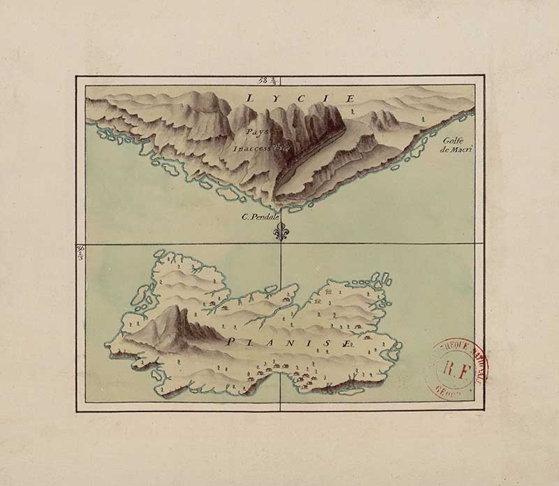
The maps in this collection record the islands and coastlines of the eastern Mediterranean as they were understood during the eighteenth century. Harb urs, settlements, mountains, and coastal features are carefully engraved, offering valuable insight into the region’s geography before the age of modern mapping.
If you enjoy these historic maps, you may also like my collections of vintage maps of Europe and antique nautical illustrations. Toge her they show how cartographers, explorers and sailors documented the world in earlier centuries.
How To Download The Maps
All the vintage maps featured in this collection are in the public domain and available for free, high-resolution download. To download a map, simply click on the title above it to open the full-size version. Once the larger image appears, right-click and choose “Save Image As” on a computer, or press and hold the image on a mobile device to save it to your photo library.
These historic maps are ideal for printing, framing, decoupage projects, junk journals, home décor, genealogy research, educational projects and other creative uses.
If you’re looking for more printable cartography, be sure to check out my collections of vintage maps.
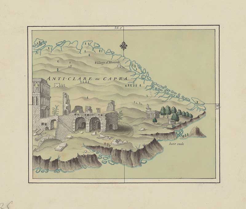
Island Maps -8
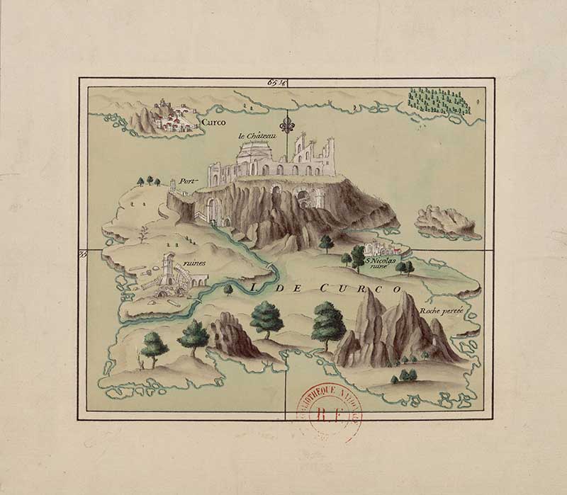
The ruins of Gortyne on the Islan of Crete. The ruins are the remains of an ancient city in sout ern Crete. Founded thousands of years ago, Gortyne became an important city during both the Greek and Roman periods and later served as the Roman capita of Crete. The site contains the remains of public buildings, temples, baths and a theatre, as well as the famous Gortyn Code, an ancient set of laws carved nto stone. Today, the ruins are one of Crete’s most significant archaeological sites.
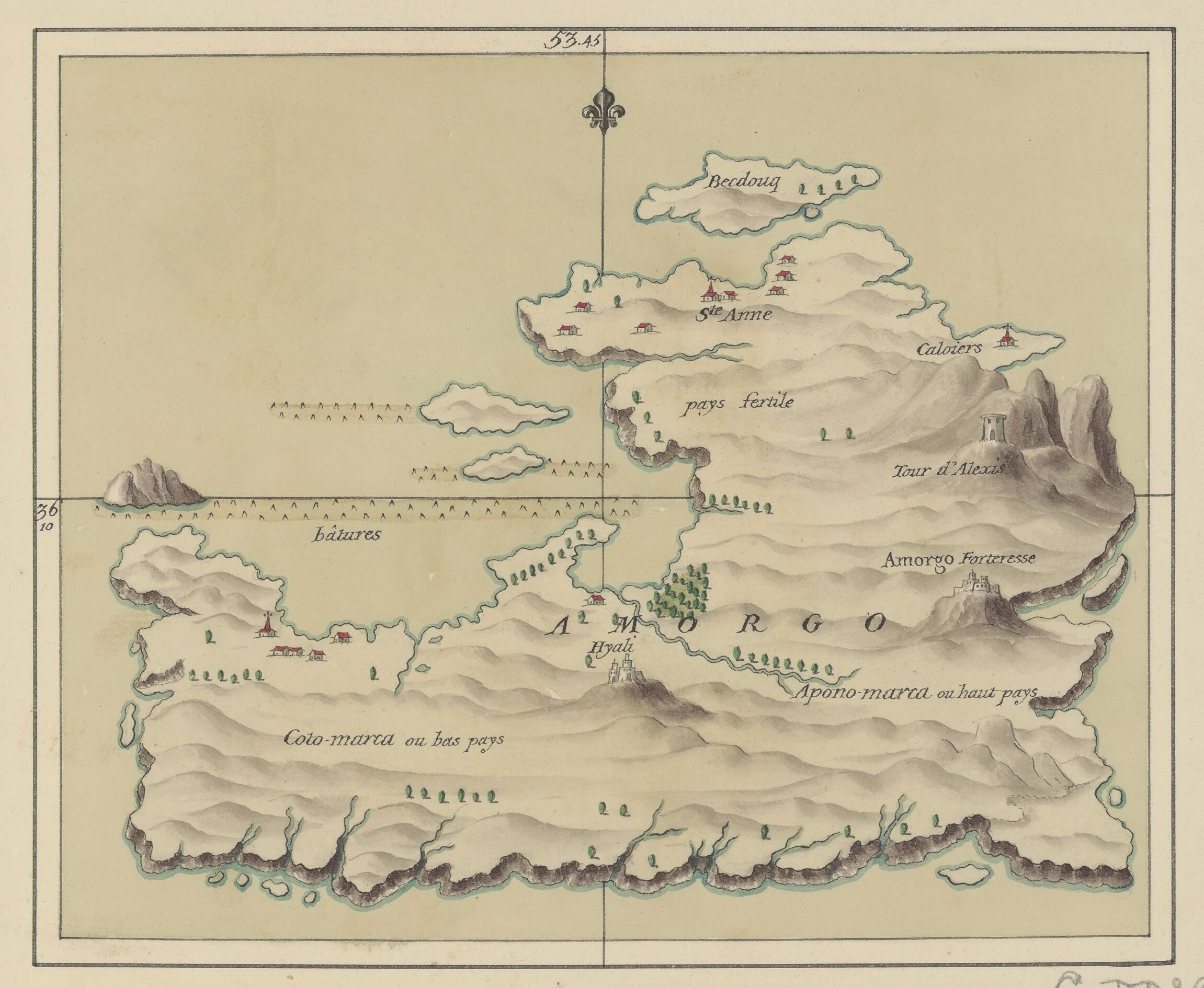
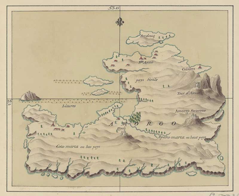
Amorgos is a Greek island in the Cyclades group of the Aegean Sea. Known for its rugged mountains, dramatic cliffs and crystal-clear waters, it has been inhabited since ancient times and was an important stop on Mediterranean trade routes. The island gained international fame as the filming location for the 1988 movie The Big Blue.
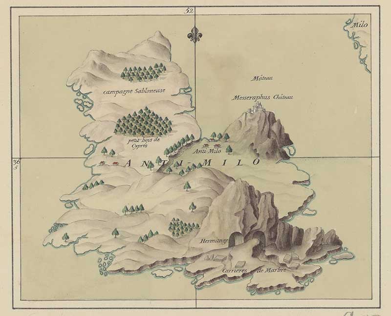
Milos is a volcanic Greek island in the Cyclades, known for its dramatic coastline and rich mineral resources. The island has been inhabited since prehistoric times and was an important source of obsidian, a volcanic glass used for tools and weapons. Milos is perhaps best known as the discovery site of the Venus de Milo, the famous ancient Greek statue now housed in the Louvre Museum in Paris.
Kalymnos, a Greek island in the Dodecanese near the coast of Turkey. The island has a long maritime history and was once famous for its sponge-diving industry, with generations of local divers harvesting natural sea sponges from the Aegean Sea.
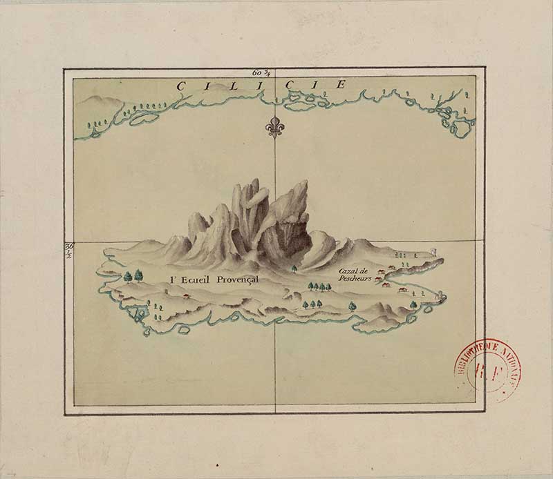
A small island located off the coast of Cilicia in modern-day Turkey.
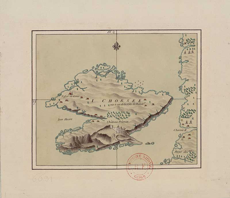
The small island of Atlit off the coast of present-day Israel. The central landmark is Château Pèlerin (Pilgrim’s Castle), one of the largest and best-preserved Crusader fortresses ever built. Constructed by the Knights Templar in 1218, the castle stood on a rocky promontory south of Haifa and served as an important stronghold during the Crusades.
Corycus (modern Kızkalesi) was an important port city on the Mediterranean coast of ancient Cilicia, in present-day Turkey. The town is best known for its impressive medieval castles, which protected the harbour and local trade routes.
Island Maps 9 – 18

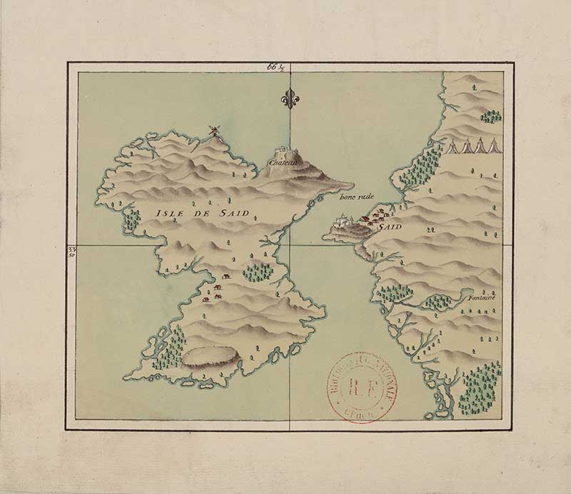
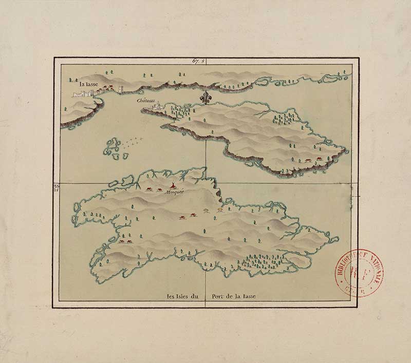
Saïda Island is located off the coast of Sidon in modern-day Lebanon.
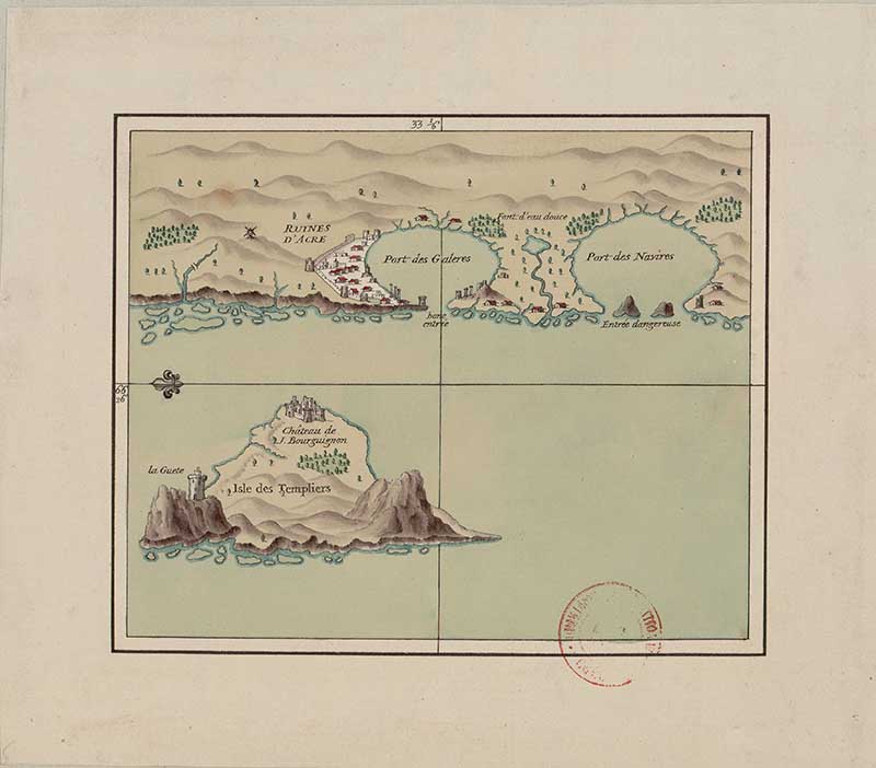
Map 12. Knights Templer Island
This map depicts Acre (modern-day Akko in Israel) and the nearby Templars’ Island, a small fortified island that guarded the harbour. Acre was one of the most important ports in the eastern Mediterranean and served as the last major stronghold of the Crusader Kingdom of Jerusalem.
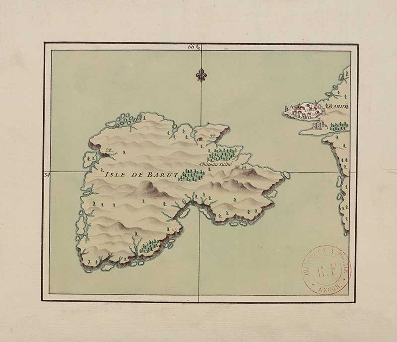
The map shows the island situated off the coast of the city of Beirut.
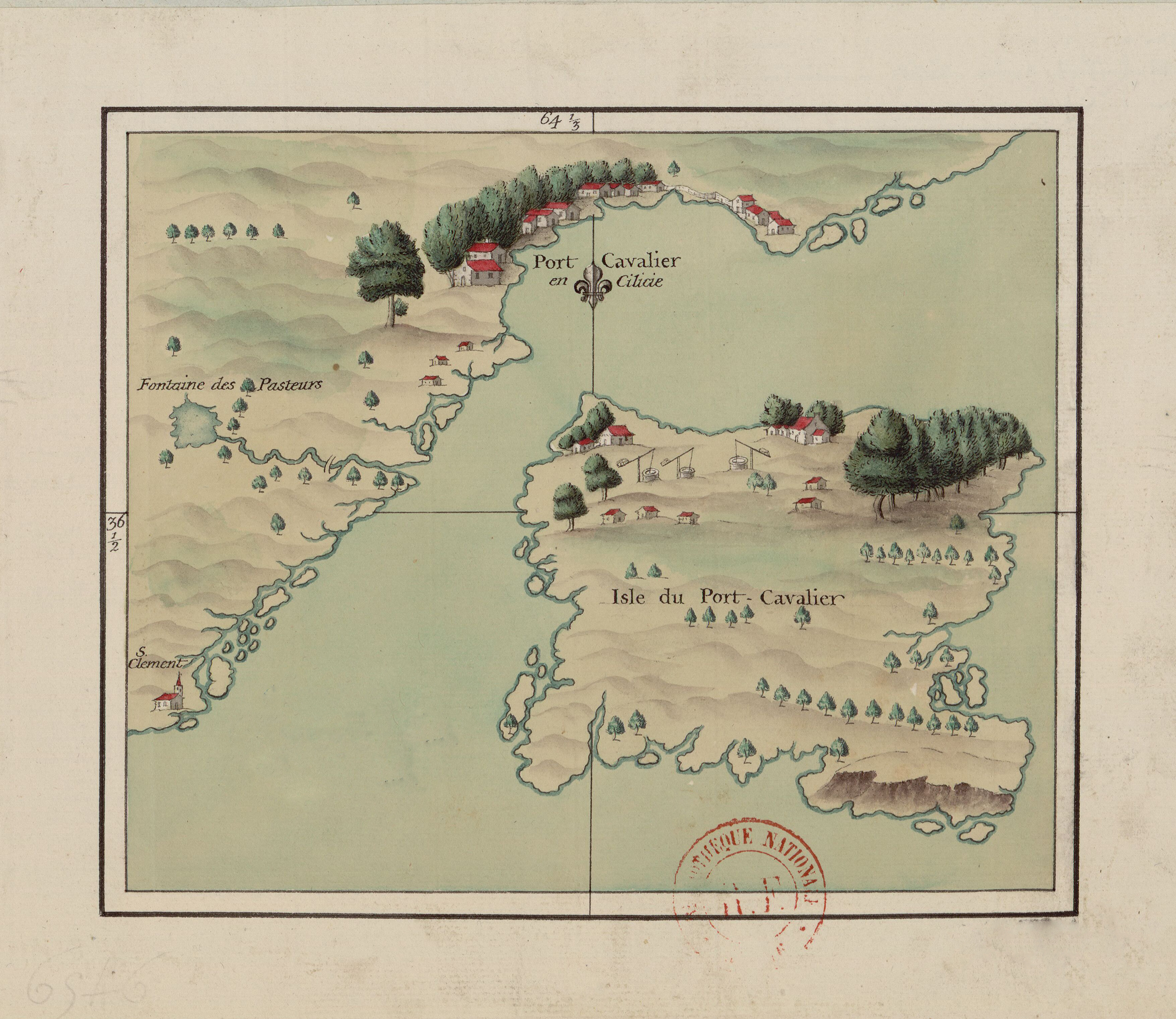
Cilicia is an ancient region located on the south-coastal area of Asia Minor (modern-day Turkey).
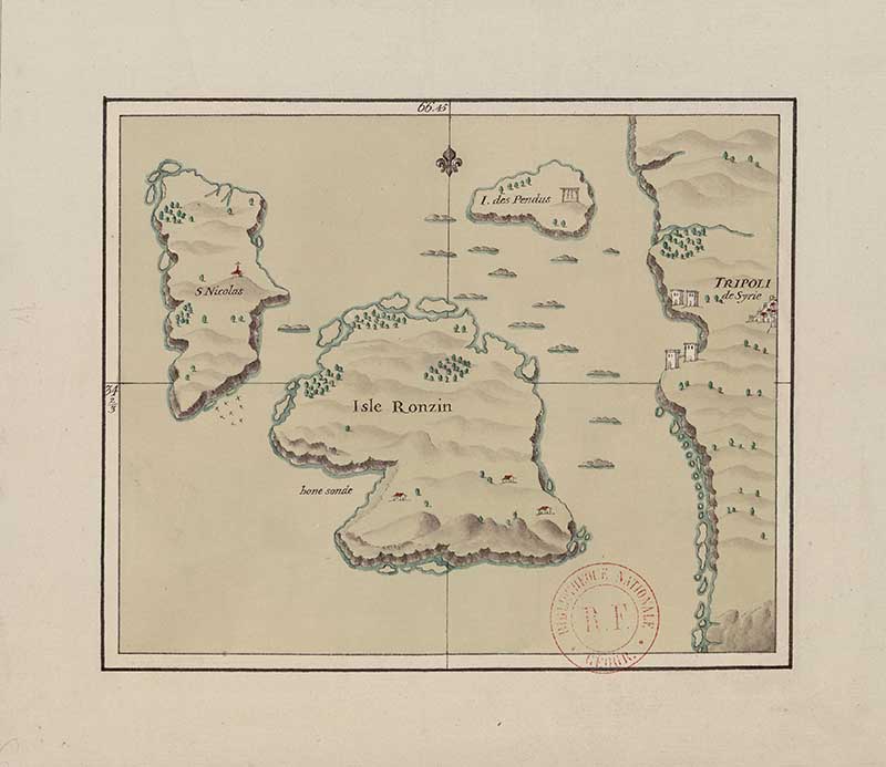
The map depicts the islands situated off the coast of Tripoli (Libya).
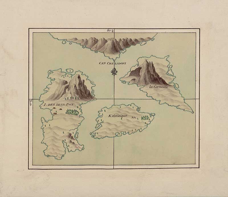
Map 17. Islands off Cape Chelidoni
Off the coast of Turkey. The area is famous for the nearby Cape Gelidonya shipwreck, one of the most significant Bronze Age shipwrecks ever discovered.
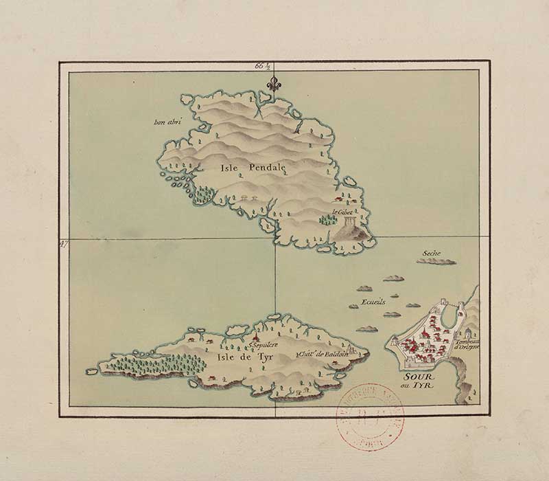
Off the Lebanon coast.
If you fancy, you can Buy Me A Coffee Here.