
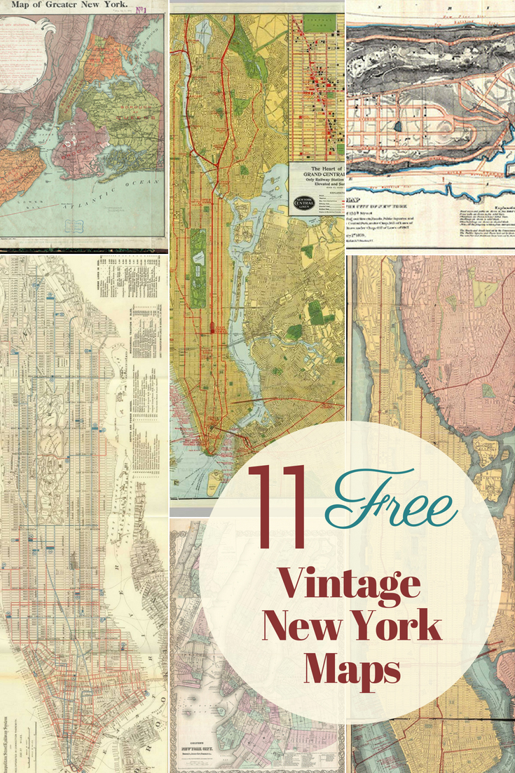
Glorious Copyright Free Vintage New York Maps
I’ve only been to New York once. It was for a wedding on top of the Empire State building of all places.
The wedding was actually on 2 days after the infamous Northeastern Seaboard blackout. It was actually amazing that all the guests made it to the wedding. Everyone had their own tale of how they made it to New York even though practically everything shut down during the blackout and took about a week to get back to normal. The bride and groom ended up driving from Toronto to New York as they were no flights.
Blackout or no blackout New York is a fabulous city. Even if you haven’t been there, you probably know it really well from TV and films. When I visited I had to remind myself that I was really in the city and not just on a movie set. It was so familiar. I plan to take the kids one day.
For all you New York lovers, I have curated a wonderful collection of vintage New York maps that are free to download. These would look fabulous printed out and framed or would be great for crafting and DIY.

The PDF downloaded maps will be of a higher resolution then the images below.
To download the maps just click on the Map Title link link and a PDF of the map will automatically download to your device.
Vintage New York Maps
-
-
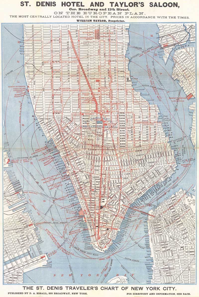
1879 Tourist Map of Lower Manhattan.
This is a tourist map of lower Manhattan from the St Denis Hotel, showing it’s location in the center of Manhattan.
-

-
-
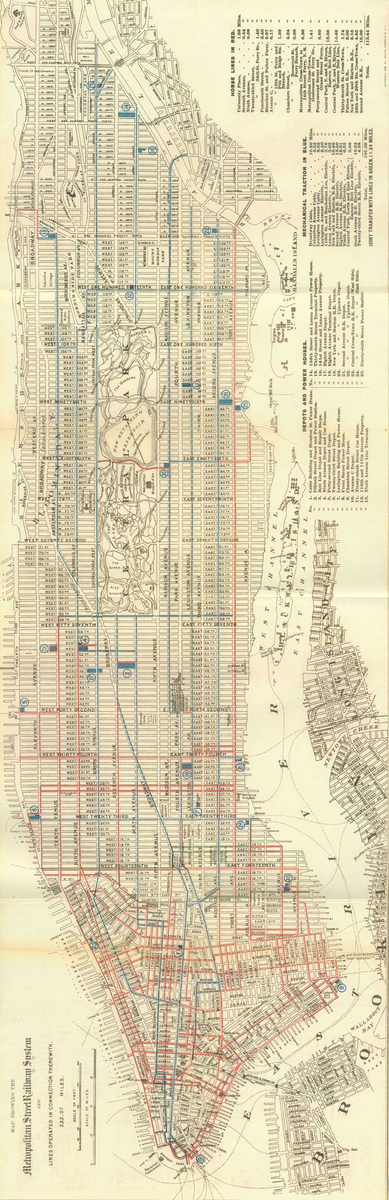
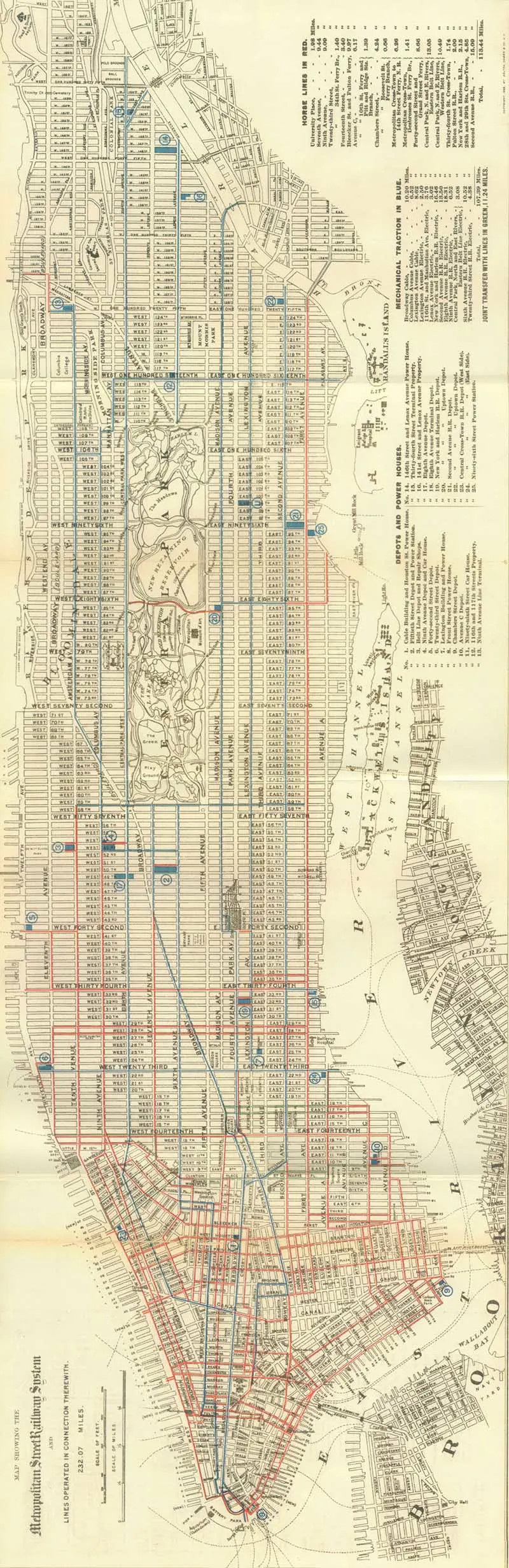
1899 Map of Manhattan Railways
Another great vintage tourist map of Manhattan this one from 1899 shows the streetcar lines.
-
-
-
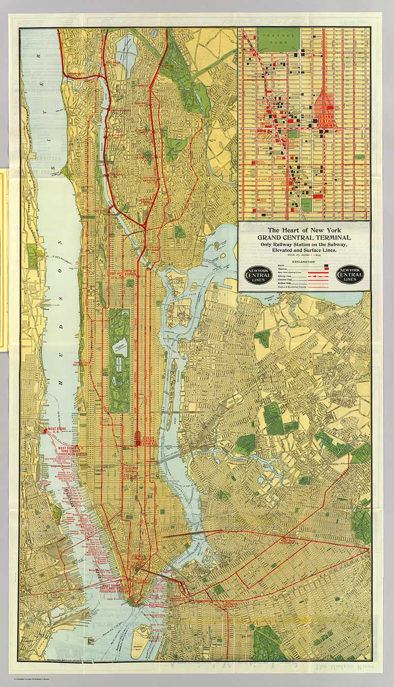
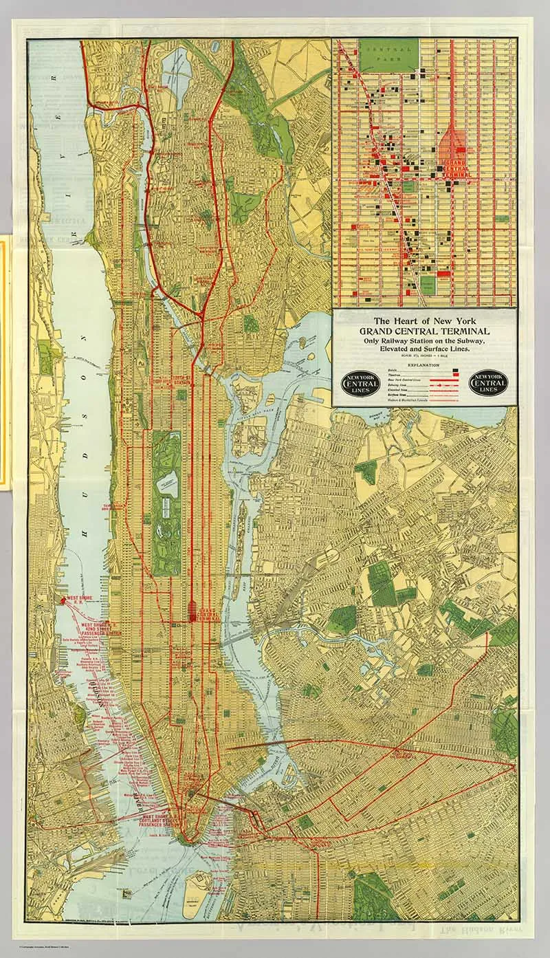
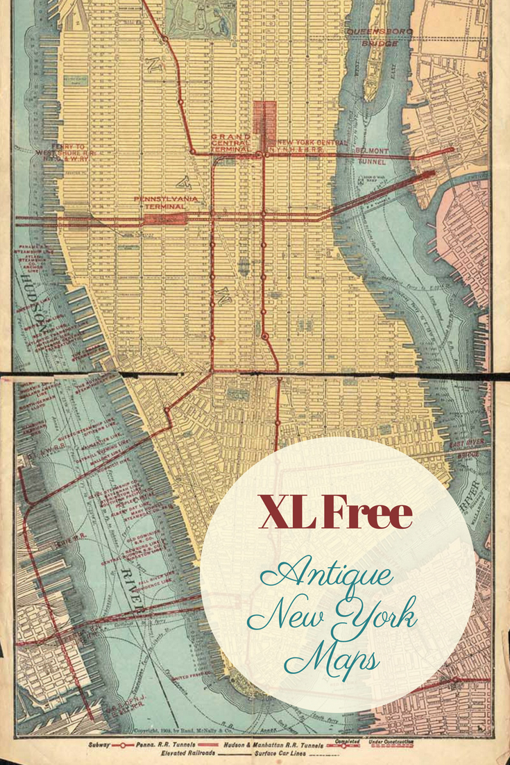
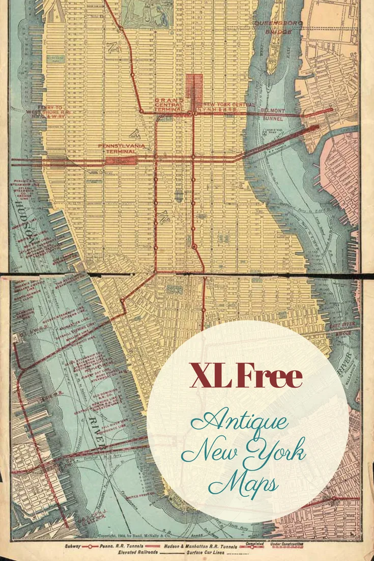
1918 New York City Rail Road Map
This is a very big map showing the railroad of New York City including a close up of Grand Central Station. The original map download is huge about 6ft by 9ft so it could be printed off as a massive wall poster. It’s a fabulous looking map too.
You can off course resize the map into something more manageable but I thought I’d leave it in its original size as its unusual to be able to download and print such a large map.
-
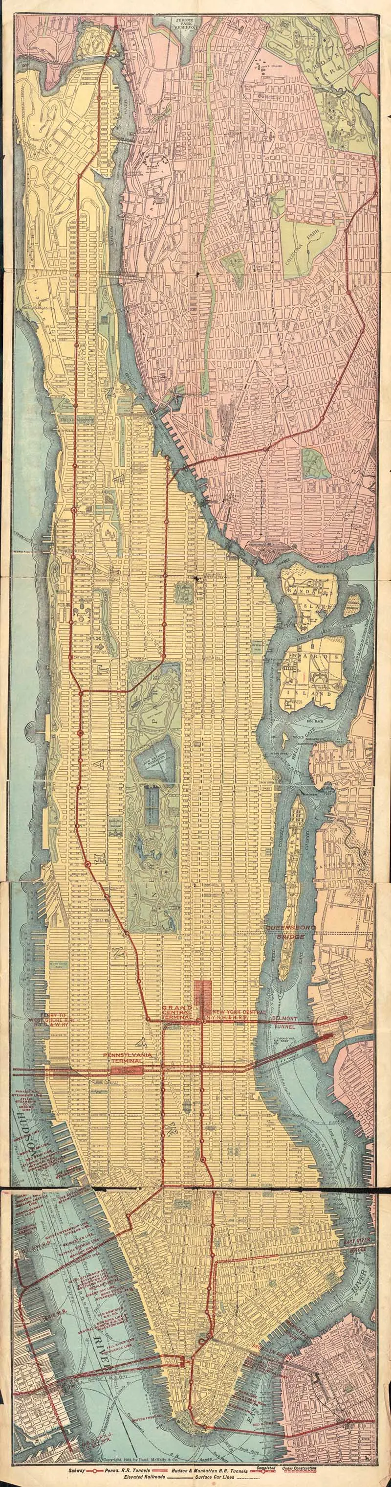
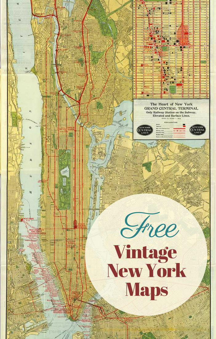
1908 – Rapid Transit Map of New York City
Like the railroad map above this is another massive map of New York City.

-
-
-
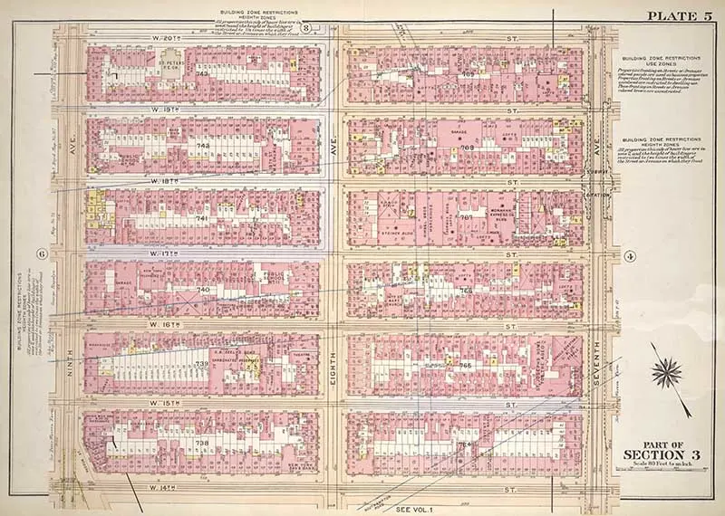
Building Zone Map 14th -20th Street New York City 1920
Not strictly a map, or just a very detailed section. Showing the buliding layouts, 14th Street to 20th Street. I decided to include it as I thought it was a very interesting detailed close up of a section of Manhattan Island.

-
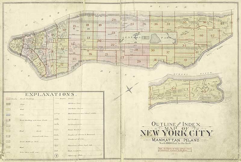
1891 Outline Map of New York Manhattan Island
This is a fabulous outline vintage map of Manhattan Island.
-
-
-
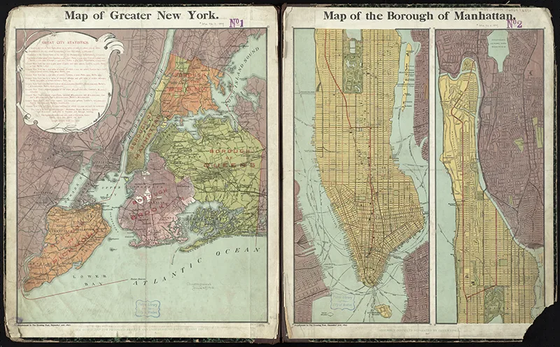
1897 Map of Greater New York and Manhattan Island.
This map is a bit beaten up but I think that just ads to the charm. Plus the fact it covers the area of greater New York.

-
-
-
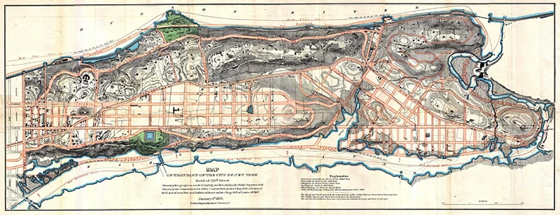
1870 Map of Upper Manhattan – Harlem, Washington Heights, Inwood
A fabulous old map showing a close up of Upper Manhattan. That’s North of 155th Street and includes the district of Harlem, Inwood and Washington Heights.

-
-
-
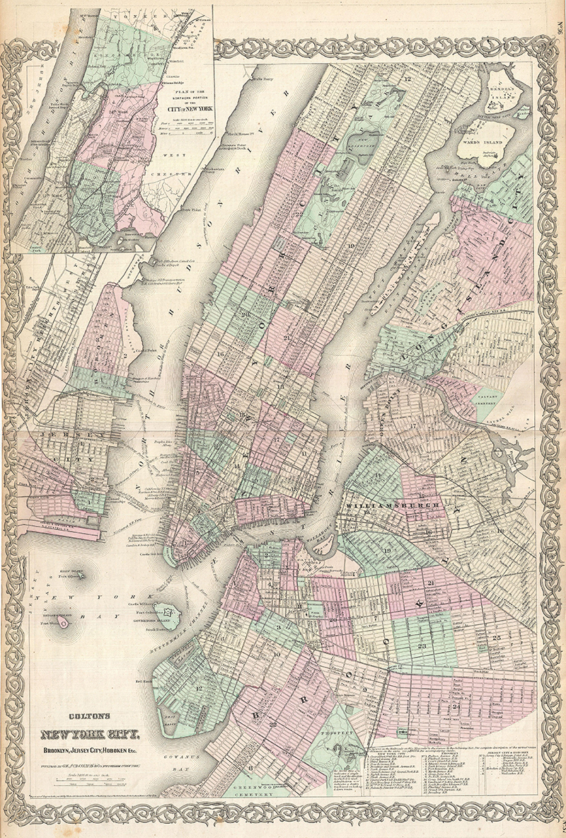
1865 Map of New York City including Brooklyn and Long Island City
An extremely rare example of G. Woolworth Colton’s 1865 vertical map of New York. Most maps upto this date of New York teneded to be horizontal maps of Manhattan Island only.
-
-
-
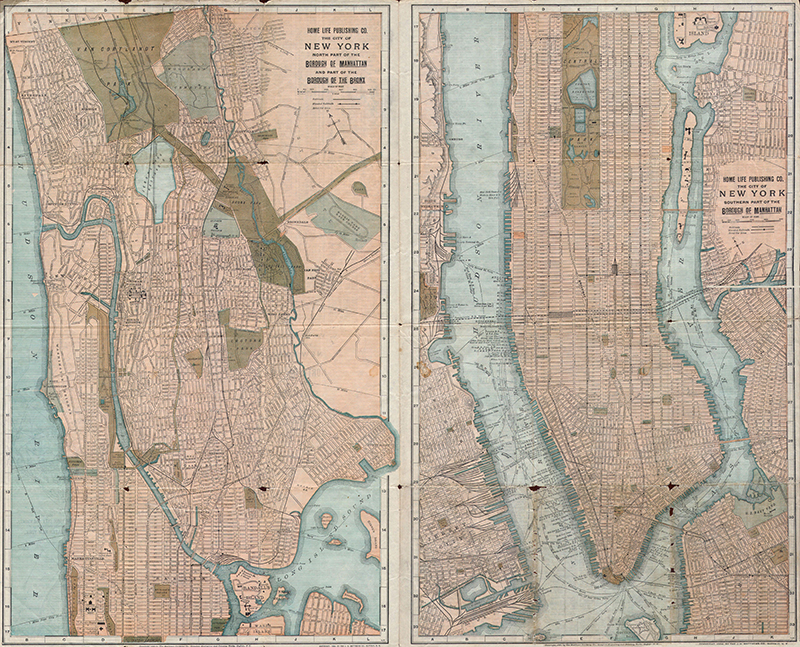
1899 Map of New York City – Manhattan and the Bronx
Fabulous detailed map of the city.
-
-
-
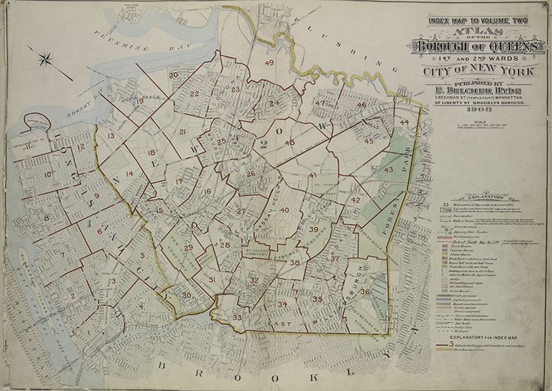
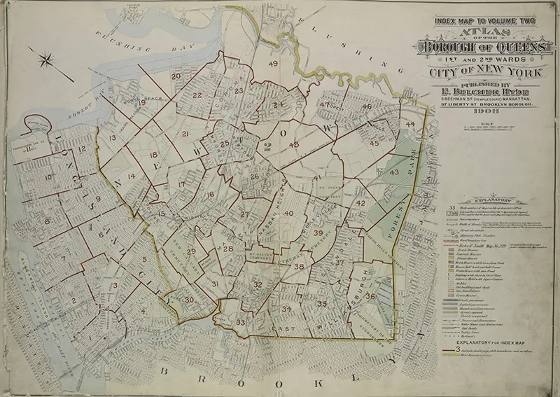
1908 Map of the New York Borough of Queens
A wonderful index vintage New York Map from an atlas of the Borough of Queens
-
Any of these maps would look fabulous as a wall decoration. Some of the larger maps you may want to send to a printer to get printed in a large format. A few of the maps are large enough for you to be able to print custom wallpaper. If you look on the web there are lots of sites which offer this service.
There are some wonderful New York posters in this vintage airline poster collection.
I also have a wonderful collection of vintage birds-eye-view maps of San Francisco.
I make map table maps out of the cities I have visited. This collection of vintage New York maps would make a lovely set of placemats, like these city map table mats.
Don’t forget to check out these free old maps of Texas and other US states . Also, there are some fantastic maps of the Mississippi river available.

Naomi Noeldner
Friday 1st of March 2019
Wow. Incredible, Thank you so much for compiling and sharing this treasure trove!
claire
Saturday 2nd of March 2019
You’re welcome their will be more to come.
Lovely Old Maps of Paris To Download - Picture Box Blue
Friday 11th of January 2019
[…] Vintage New York Maps […]
Shirley Wood
Thursday 9th of August 2018
Claire, congrats on the new blog! At first I thought someone was copying you when I saw the name, Picture Box Blue. I had to check around to be sure it was you! So glad you share with us at Merry Monday! Can't wait to see all of the great ideas you will be sharing with map projects!
claire
Saturday 11th of August 2018
Thank you, Shirley. This new blog will focus more on lovely vintage images, I will still be crafting at Pillarboxblue.
LINDA BOUFFARD
Wednesday 8th of August 2018
These are very cool, Claire. Thank you for the vintage maps. I like that. Coming from Thursday Favorite Things - cohostess, Linda @Crafts a la mode
claire
Saturday 11th of August 2018
Thank you, Linda glad you liked the images.
Cecilia MyThriftStoreAddiction
Monday 6th of August 2018
Thanks for sharing these great maps at Vintage Charm!
claire
Tuesday 7th of August 2018
Thank you, for hosting.