
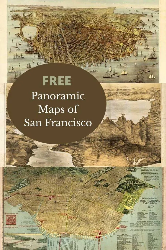
I was inspired to curate this panoramic map collection, after spotting cool old birds-eye view maps San Francisco Bay area on TV.
That TV series was “Halt and Catch Fire“. The latter two seasons were set in San Francisco. One of the main characters “Joe“, had a huge antique birds-eye view map of the city on his apartment wall. The map kept on catching my eye and I was determined to find it.
Not only did I find this antique San Francisco map but I also find a few more maps of the area. Here I share all the vintage birds-eye view maps I found with my research.
San Francisco has the highest proportion of the LGBTQ population of any city in the US if not the world. With it being pride month I thought it was also quite apt to share old maps of the city.

Facts About San Francisco
The city of San Francisco almost grew overnight from a fishing village into the internationally-famous city, as a consequence of the California Gold Rush.
Today, San Francisco’s 49 square miles are home to more than 800,000 people.
Three-quarters of the city was destroyed by an earthquake and subsequent fire in 1906. It was however quickly rebuilt and amazingly hosted the Panama-Pacific International Exposition world fair in 1915.
San Francisco has the highest population of gay and lesbian individuals in any city at 15%. It also has the highest percentage of same-sex households of any American county.
The city is renowned for being at the forefront of innovation from the gold rush in the 19th century. To banking industries at the end of the 19th Century. At the end of the 20th Century, San Francisco became the center of internet start-up companies and social media boom. The last two seasons of “Halt and Catch Fire” was about internet startups. Hence the program was set in San Francisco.
Silicon Valley, which is the center of computer innovation is in the San Franciso Bay area. It is home to many of the world’s largest high-tech corporations.
The Birds Eye View Maps Of San Francisco Bay Area
To download the old map of San Francisco you want, click on the title above the map. A higher resolution large map will open as a new tab in your browser. These are large files so may take a little while to open.
Right-click on the large map and select the “save as” option on the drop-down menu. This should save the map to your hard drive.
The maps can be printed at home. For a good quality large map print, I recommend using a print shop.
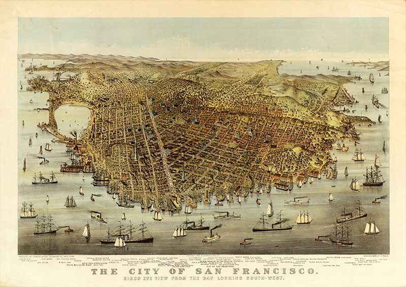
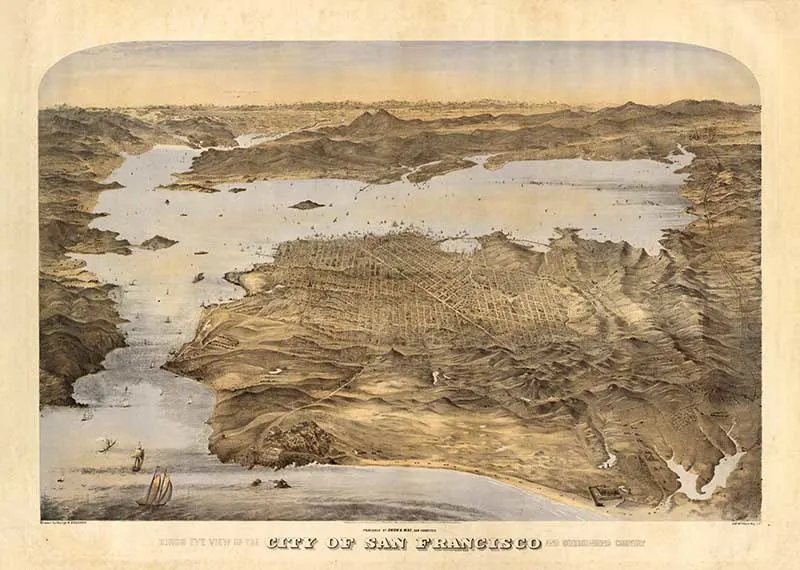
1. 1878 Birds Eye View of San Francisco Bay
This beautiful map of San Francisco shows a birds-eye view from the bay looking South West. It was made in 1878 long before the devastating earthquake in 1906.
The map is illustrated with skewed docks and surrounding steam and sailing ships, hills, and ocean beyond. It was sketched and drawn by C. R. Parsons.

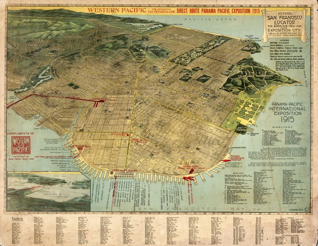
2. Peter’s 1914 Panama–Pacific International Exposition Map
The Panama–Pacific International Exposition was a world’s fair held in San Francisco, in 1915. Its main purpose was to celebrate the completion of the Panama Canal. But it was widely viewed in the city as a chance to showcase its recovery from the 1906 earthquake and fire.

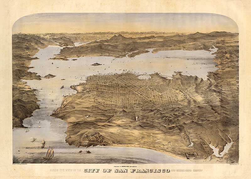
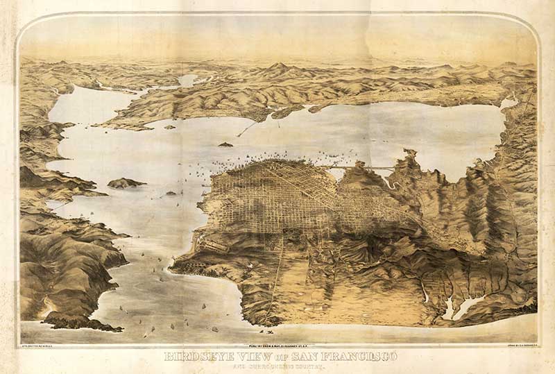
3. 1868 Map Of San Francisco Bay Area
This panoramic birds eye view of the city of San Francisco and surrounding country was drawn by George H. Goddard.
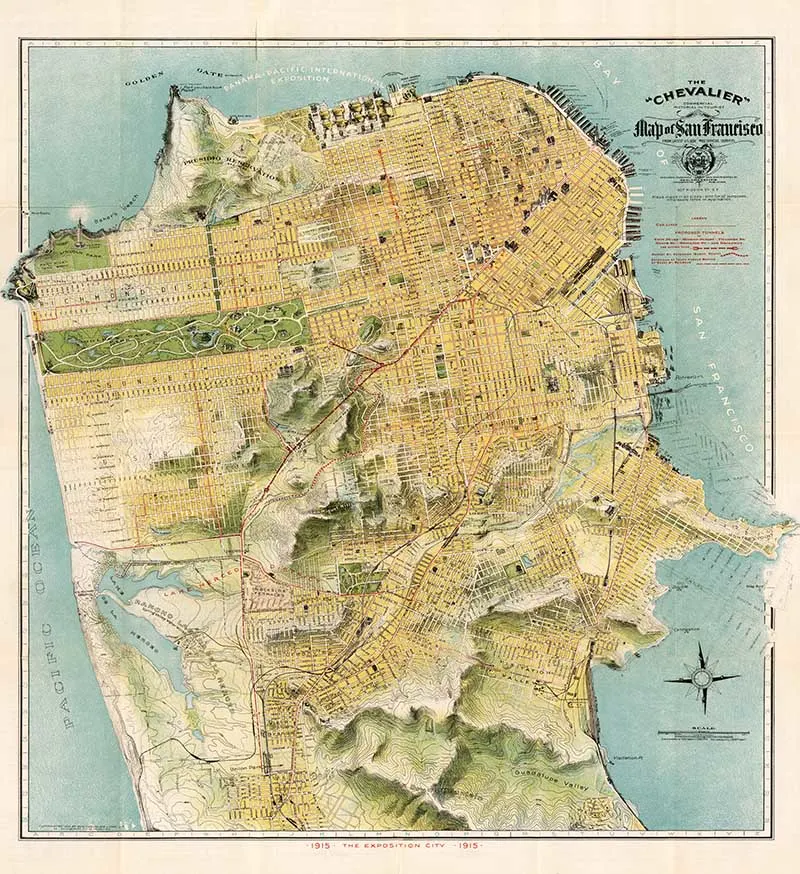
4. 1915 Map Of San Francisco
Another exhibition map of the city this one by Chevalier.

5. 1876 Map of San Francisco Bay
A perspective map not drawn to scale. Accompanied by: Key to Snow & May’s view of San Francisco and the surrounding country.

If you enjoyed these birds-eye-view maps of San Francisco then don’t forget some of the other large city maps on Pictureboxblue. There are large vintage maps of New York and antique maps of both London and lovely old maps of Paris.
I also have other vintage maps of the United States including maps of the Southern US States. I even have a bird’s eye view map of the Mississippi River.
If you are looking for a more global view don’t forget to check out my collections of antique world maps and hemispherical world maps. The pictorial world maps of Ernest Chase are worth checking out too.
Garry Coventry
Tuesday 1st of November 2022
and The Ducks were victims of the Committee of Vigilance 1851. They mainly inhabited the slopes of Telegraph Hill but ran groggeries and other places throughout the town. From Committee records I have street locations of the Duck's activities and their 'establishments'. I would love to be able to provide a pictorial street map of these locations, around 1850. Are you able to procure such a map or tell me who might have one? I have had no luck trying the internet to get a suitable map. Thanks for any assistance you can provide. Also, I lived on the corner of California and Leavenworth Streets. Any contemporary picture of that neighbourhood? Thanks for any help you can give, Dr Garry Coventry
claire
Tuesday 1st of November 2022
Sorry, I can't help you with those maps, good luck with your hunt.
Rachelle
Saturday 1st of August 2020
Hi Clair, I'm a 5th generation California gal from the bay area, so these maps are extra special to me. It's fun to see the city without any of the bridges that connect it to Marin, Oakland or San Mateo.
claire
Sunday 2nd of August 2020
Thank you, I'm glad you enjoyed them.
Tuesday Turn About Link Party 59 - Thistle Key Lane
Tuesday 28th of July 2020
[…] of Picture Box Blue shares Free Old Maps Of The San Francisco Bay Area.Sometimes it’s fun to get lost in […]
Michelle | Thistle Key Lane
Monday 27th of July 2020
Claire, these old maps are really fantastic. I could study them all day and never get bored. I'm happy to share your post this week on the Tuesday Turn About Link Party. Hope to see you there!
claire
Monday 27th of July 2020
Thank you so much Michelle, I look forward to seeing them.
Donna @ Modern on Monticello
Wednesday 22nd of July 2020
Old maps are just so interesting to look at and enjoy. Thanks for sharing these with us this week. #HomeMattersParty
claire
Sunday 26th of July 2020
I agree with you, there is something fascinating about old maps. Thank you.